|
|
|
|
|
 |
| View along Buxton's Rd (C135) at Wilmot, with Mt Roland at sunset. Image © Peter Renshaw. |
You've arrived at the road photos and information section that covers Tasmania.
Tasmania is an island state that covers an area of 68 401 square kilometres on the south-easternmost part of Australia. 1
The State-owned road network consists of 3650 km of road. The State road network primarily consists of roads that provide connectivity between cities, major towns, rural catchments and key port and air transport hubs. The Tasmanian Department of Infrastructure, Energy and Resources has adopted a five-tier hierarchy. 2
The Hierarchy identifies five categories of roads: 2
Tasmania route numbering system is alphanumeric. Tasmania was the first state to introduce alphanumeric routes, with the exception of one route – National Highway 1. This is because of a Federal Government requirement, when the system was introduced, that the National Highway route be signposted with the traditional National Highway shield. Before the introduction of alphanumeric route numbering in the late 1970s, a small collection of State Routes existed, similar to those used in other states prior to the introduction of alphanumeric route numbers.
Below are the various roads that this site has photos of. The numbered routes are sorted by their route number. To view each gallery, click on the thumbnail or route number.
| Route Number: | Description: | Preview: |
 |
National Highway 1 (Burnie to Hobart): Brooker Highway, Midland Highway & Bass Highway |
 |
| A2 | A2 (Burnie to Marrawah): Bass Highway |
 |
| A3 | A3 (Launceston to Hobart): Tasman Highway |
 |
| A4 | A4 (Conara to Falmouth): Esk Main Road & Elephant Pass Road |
 |
| A5 | A5 (Deloraine to Melton Mowbray): Lake Highway, Meander Valley Road & Highland Lakes Road |
 |
| A6 | A6 (Hobart to Southport): Huon Highway & Southern Outlet |
 |
| A7 | A7 (Launceston to Greens Beach): West Tamar Highway |
 |
| A8 | A8 (Launceston to Low Head): East Tamar Highway |
 |
| A9 | A9 (Sorell to Port Arthur): Arthur Highway |
 |
| A10 | A10 (Burnie to Hobart): Murchison Highway, Zeehan Highway & Lyell Highway |
 |
| B11 | B11 (Miena to Bronte): Marlborough Road |
 |
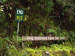
| B12 | B12 (Deloraine to King Solomons Cave): Mole Creek Road & Liena Road |
 |
| B13 | B13 (Elizabeth Town to Latrobe): Kimberley Road & Railton Road |
 |
| B14 | B14 (Railton to Spreyton): Foster Street, Sheffield Main Road, Sheffield Road & High Street |
 |
| B15 | B15 (Ulverstone to Nietta): Castra Road |
 |
| B16 | B16 (Forth to Sprent): Kindred Road |
 |
| B18 | B18 (Burnie To Guildford): Mount Street & Ridgley Highway |
 |
| B24 | B24 (Queenstown to Strahan): Lyell Highway |
 |
| B27 | B27 (Zeehan to Strahan): Zeehan Highway, Henty Road, Andrew Street & The Esplanade |
 |
| B31 | B31 (Cambridge to Jericho): Cambridge Road, Richmond Road, Bridge Street, Franklin Street & Colebrook Road |
 |
| B32 | B32 (Bridgewater to Rose Bay): East Derwent Highway |
 |
| B33 | B33 (Mornington To O'Possum Bay): South Arm Highway, Rokeby Road & South Arm Road |
 |
| B35 | B35 (Otago to Goodwood): Goodwood Road |
 |
| B36 | B36 (New Town To Queens Domain): Domain Highway |
 |
| B41 | B41 (Breadalbane to Leighlands): Evandale Road & Leighlands Road |
 |
| B54 | B54 (Deloraine to Travellers Rest): Meander Valley Way |
 |
| B64 | B64 (South Hobart to Sandfly): Davey Street, Huon Road & Sandfly Road |
 |
| B68 | B68 (Hobart to Huonville): Sandy Bay Road, Channel Highway & Southern Outlet |
 |
| B73 | B73 (Hillwood to Sidmouth): Batman Highway |
 |
| C132 | C132 (Forth to Guildford): Wilmot Road, Cradle Mountain Road & Cradle Mountain Development Road |
 |
| C136 | C136 (Moina To Sheffield): Spring Street, Claude Road & Cethana Road |
 |
| C140 | C140 (Roland to Mt Roland): Staverton Road |
 |
| C142 | C142 (Ulverstone To West Ulverstone): Eastland Drive, Main Street, Crescent Street, Kings Parade, Hobbs Parade, South Road & Knights Road |
 |
| C240 | C240 (Wynyard To Doctors Rocks): Inglis Street, Goldie Street & Old Bass Highway |
 |
| C305 | C305 (Ross to Tooms Lake): Chiswick Road, Church Street, Roseneath Road, Bridge Street, Bond Street & Tooms Lake Road |
 |
| C312 | C312 (Oatlands To Runnymede): High Street, Dudley Street, Tunnack Road, New Country Marsh Road & Woodsdale Road |
 |
| C351 | C351 (Richmond To Penna): Bridge Street, Wellington Street & Brinktop Road |
 |
| C402 | C402 (Breadalbane to Kings Meadows): Hobart Road |
 |
| C403 | C403 (Kings Meadows to St Leonards): Kings Meadows Link, Quarantine Road, Johnston Road, St Leonards Road & Abels Hill Road |
 |
| C623 | C623 (Kingston to Margate): Beach Road, Roslyn Avenue, Brightwater Road & Howden Road |
 |
| C643 | C643 (Tolmans Hill to Mount Nelson): Olinda Grove & Nelson Road |
 |
1 Geoscience Australia
2 Tasmanian Department of Infrstructure, Energy and Resources
Last updated: 01 Sep 2019 19:27
This site © Paul Rands. All rights reserved. Some portions © (copyright) by their respective and credited owners. Permission must be obtained before using any images from this site. For details, please email by clicking here.