|
|
|
|
|
| A5 | Lake Highway, Meander Valley Road & Highland Lakes Road (A5) |
Statistics:
Route Numbering:

General Information:
A5 is a sealed and an unsealed road in Tasmania (unsealed between south and to the west of Great Lake). The Lake Highway's highest elevation along its length is 1220m and the lowest point is at 191m above sea level.
A5 connects with the Bass Highway (NH1), the Emu Bay Road, the Marlborough Highway (B11), the Meander Valley Highway (B54), the Midland Highway (NH1), and Poatina Road (B51).

| Melton Mowbray to Deloraine | Deloraine to Melton Mowbray | |||
| Preview: | Description: | Preview: | Description: | |
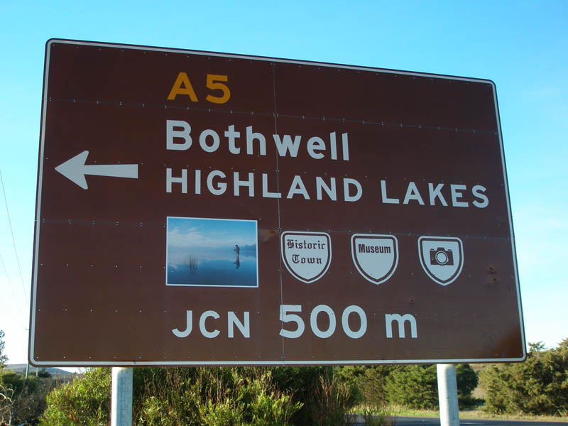 |
Advance Directional Sign: Northbound tourist orientated AD sign on Midland Hwy (NH1) approaching the junction with Lake Highway at Melton Mowbray (A5 southern terminus). May 2007. Image © Peter Renshaw |
 |
Advance Directional Sign: AD sign at Miena approaching Malborough Rd (B11), November 2007. Image © Peter Renshaw |
|
 |
Advance Directional Sign: Westbound AD sign approaching the northern terminus for the A5. Sign located on the Bass Hwy (NH1) at Deloraine. June 2007. Image © Peter Renshaw |
 |
Intersection Directional Sign: ID sign at the corner of Highland Lakes Rd (A5) and Malborough Rd (B11) at Miena, May 2008. Image © Peter Renshaw |
|
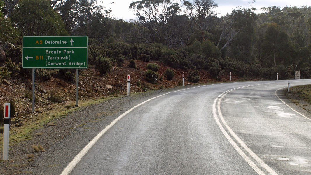 |
Advance Directional Sign: AD sign at Miena approaching Malborough Rd (B11), May 2008. Image © Peter Renshaw |
|||
 |
Intersection Directional Sign: ID sign at the corner of Highland Lakes Rd (A5) and Malborough Rd (B11) at Miena, May 2008. Image © Peter Renshaw |
|||
 |
Reassurance Directional Sign: Distance sign at Miena, September 2007. Image © Peter Renshaw |
|||
Last updated: 10-Feb-2019 14:06
This site © Paul Rands. All rights reserved. Some portions © (copyright) by their respective and credited owners. Permission must be obtained before using any images from this site. For details, please email by clicking here.