|
|
|
|
|
| A8 | East Tamar Highway (A8) |
Statistics:
Route Numbering:
General Information:
The East Tamar Highway is a highway in Tasmania, Australia. It traverses the eastern side of the Tamar River, from Launceston to the lighthouse at Low Head.
The East Tamar Highway connects with the Batman Highway, the Bridport Road, the Lilydale Road, the Main Road, the Midland Highway, the Tasman Highway and the West Tamar Highway.
The highest point above sea level of the East Tamar Highway along its length is 154 m above sea level and the lowest point above sea level of the East Tamar Highway along its length is -1.8 m.
History:

Click here for the former alignment between Launceston and Low Head
| Launceston to Low Head | Low Head to Launceston | |||
| Preview: | Description: | Preview: | Description: | |
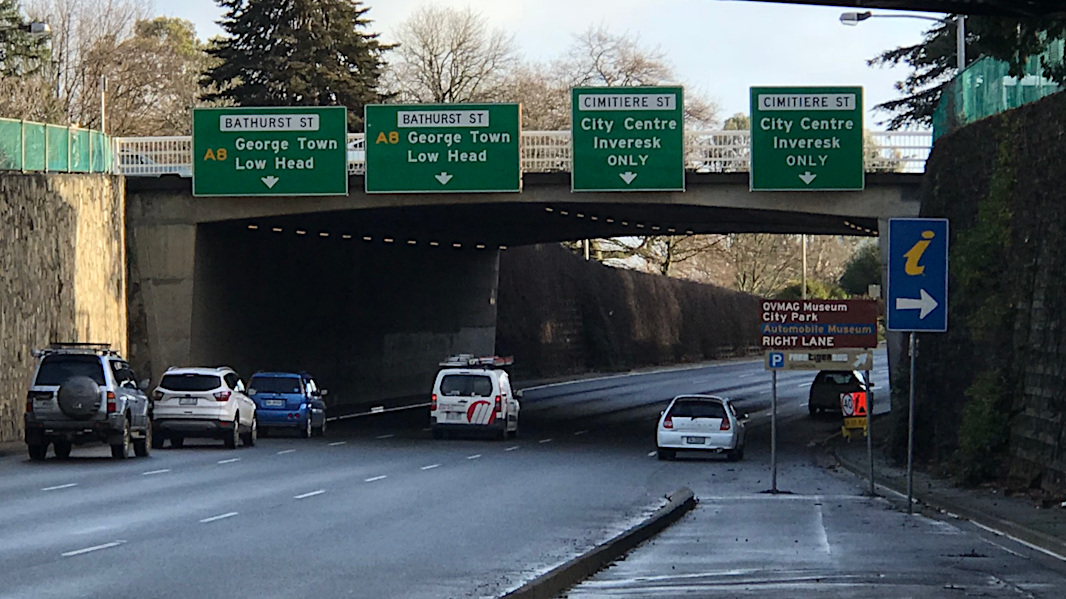 |
Paterson St Overpass: Looking northbound near the southern terminus of A8 in Launceston, as you approach the Cimitiere St interchange. July 2018. Click here for a photo of this location by Peter Renshaw from April 2007. Image © Paul Rands |
 |
Cimitiere Street: Unusual signal gantry set up where Cimitiere St joins East Tamar Hwy (Bathurst St) (A8) in Launceston, August 2006. Image © Tim Cole |
|
 |
Black Advance Directional Sign: Eastbound on Batman Hwy (B73) approaching the intersection with East Tamar Hwy (A8) at Hillwood, May 2007. Image © Peter Renshaw |
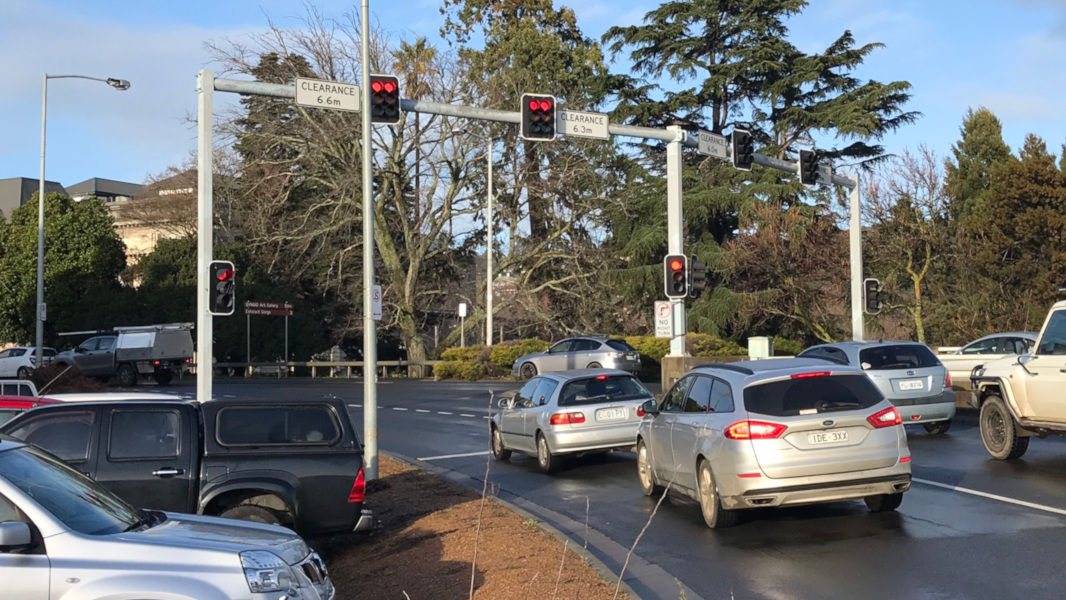 |
Cimitiere Street: Unusual signal gantry set up where Cimitiere St joins East Tamar Hwy (Bathurst St) (A8) in Launceston, July 2018. Image © Paul Rands |
|
1 Examiner, Plans for New High Speed East Tamar Highway Outlined, 4 Nov 1953
2 Ozroads, East Tamar Highway
Last updated: 10-Feb-2019 16:58
This site © Paul Rands. All rights reserved. Some portions © (copyright) by their respective and credited owners. Permission must be obtained before using any images from this site. For details, please email by clicking here.