|
|
|
|
|
| A2 | Bass Highway (A2) |
Statistics:
Route Numbering:
General Information:
A2 is more less an east-west route connecting Burnie with Tasmania's west coast, and like Bass Strait, the Bass Highway is named after explorer George Bass.
History:

| Marrawah to Burnie | |
Burnie to Marrawah | ||
| Preview: | Description: | |
Preview: | Description: |
 |
Advance Directional Sign: AD sign at Rocky Cape approaching Pollards Rd, 2008. Image © Jamie Scuglia |
|
 |
Eastern Terminus: Looking westbound from Mount Street Burnie. October 2007. Image © Peter Renshaw |
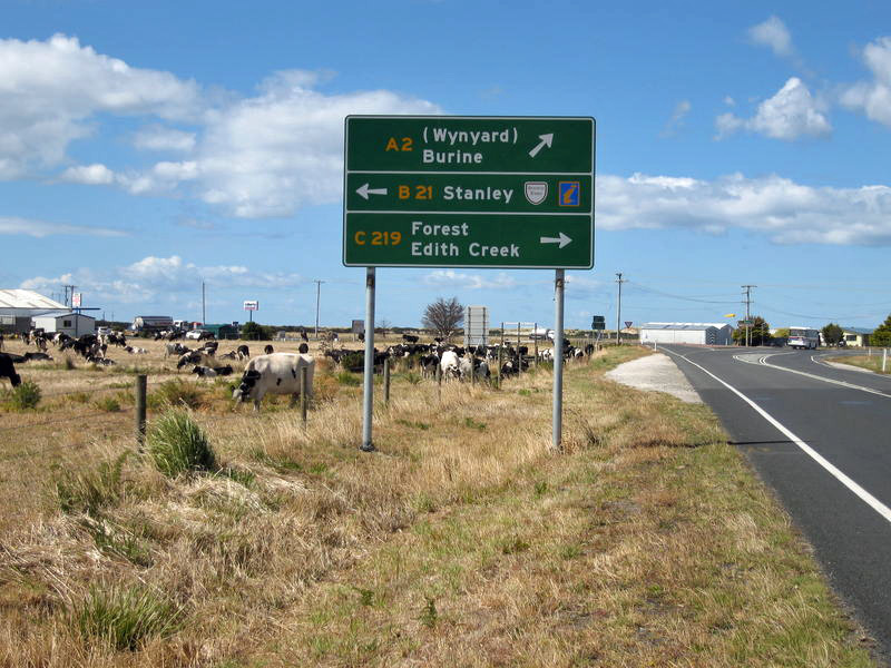 |
Advance Directional Sign: AD sign at Stanley approaching Stanley Hwy (B21) and Mengha Rd (C219), 2008. Image © Jamie Scuglia |
|
 |
Eastern Terminus: Looking northbound on Mount Street in Burnie. October 2007. Image © Peter Renshaw |
 |
Reassurance Directional Sign: Distance sign at Stanley, 2008. Image © Jamie Scuglia |
|
 |
Intersection Directional Sign Assembly: ID signs facing traffic of West Park Grove in Parklands. October 2007. Image © Peter Renshaw |
1 Department of Infrastructure, Transport, Regional Development and Local Government
Last updated: 28 Aug 2019 23:27
This site © Paul Rands. All rights reserved. Some portions © (copyright) by their respective and credited owners. Permission must be obtained before using any images from this site. For details, please email by clicking here.