|
|
|
|
|
| C305 | Chiswick Road, Church Street, Roseneath Road, Bridge Street, Bond Street & Tooms Lake Road (C305) |
Statistics:
Route Numbering:

General Information:
C305 is a rural road in Eastern Tasmania. It connects the small town of Tooms Lake to the Midland Highway via the small and historic town of Ross. The Chiswick Road section, and the nearby Bridge Road and Ross Bridge are former alignments of the Midland Highway.
In the Tasmanian State Road Hierarchy brochure, the route comes under Category 5 - Other Road, which suggests its a minor route. A section of the route is unsealed.
Ross Bridge:
The Ross Bridge is a major feature in the town of Ross, and was constructed by convict labour and opened in 1836, and is the third oldest bridge still in use in Australia. The bridge crosses the Macquarie River. 1
History:

Click here for the former alignment through Ross
Ross Bridge:
| Ross Town Centre to Midland Highway | Midland Highway to Ross Town Centre | |||
| Preview: | Description: | Preview: | Description: | |
 |
Plaque 1: One of the plaques commemorating the history of The Ross Bridge over the Macquarie River at Ross, March 2016. Image © Garry Coxhead |
 |
Stone Embankment : Old hand laid convict stone embankment, approaching the Ross Bridge at Ross, July 2018. Image © Paul Rands |
|
 |
Plaque 1: One of the plaques commemorating the history of The Ross Bridge over the Macquarie River at Ross, March 2016. Image © Garry Coxhead |
 |
The Ross Bridge: The Ross Bridge spanning the Macquarie River at Ross, July 2018. Image © Paul Rands |
|
 |
Approaching The Ross Bridge: Bridge St (C305) approaching The Ross Bridge at Ross, March 2016. Image © Garry Coxhead |
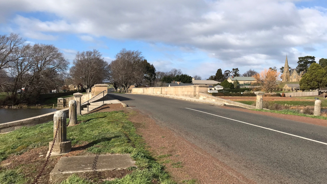 |
Approaching The Ross Bridge: Bridge St (C305) approaching The Ross Bridge at Ross, July 2018. Image © Paul Rands |
|
 |
The Ross Bridge: The Ross Bridge spanning the Macquarie River at Ross, March 2016. Image © Garry Coxhead |
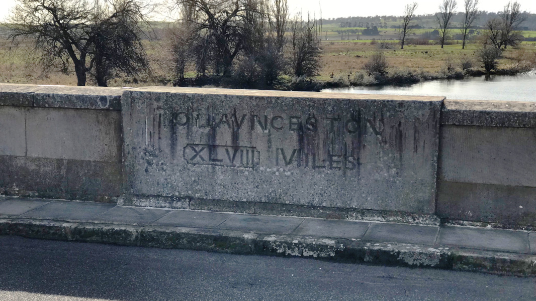 |
Distance Marking: Distance in miles to Launceston on Ross Bridge, July 2018. Image © Paul Rands |
|
 |
Construction Date Marking: Construction date marking on Ross Bridge, September 2007. Image © Peter Renshaw |
|||
 |
Distance Marking: Distance in miles to Hobart on Ross Bridge, July 2018. Image © Paul Rands |
|||
Ross to Tooms Lake:
| Ross To Tooms Lake | Tooms Lake To Ross | |||
| Preview: | Description: | Preview: | Description: | |
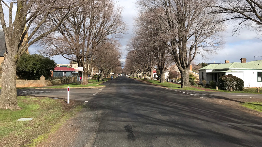 |
Ross Town Centre : Church St (C305) through the Ross town centre, July 2018. Image © Paul Rands |
 |
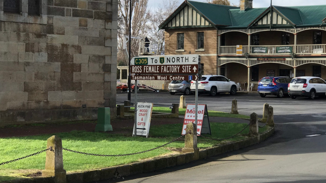
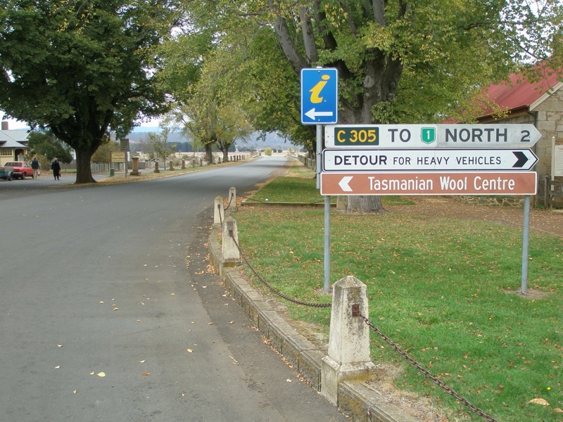
Intersection Directional Sign: ID sign at the junction of Church St (C305) and Bridge St (C305) in Ross, July 2018. Click here for a photo of this location by Peter Renshaw from April 2007. Image © Paul Rands |
|
 |
Mile Post : Mile post on Church St in Ross, July 2018. 'H' is for Hobart, and the numeral is 75 miles. Image © Paul Rands |
 |
Ross Town Centre : Church St (C305) through the Ross town centre, July 2018. Image © Paul Rands |
|
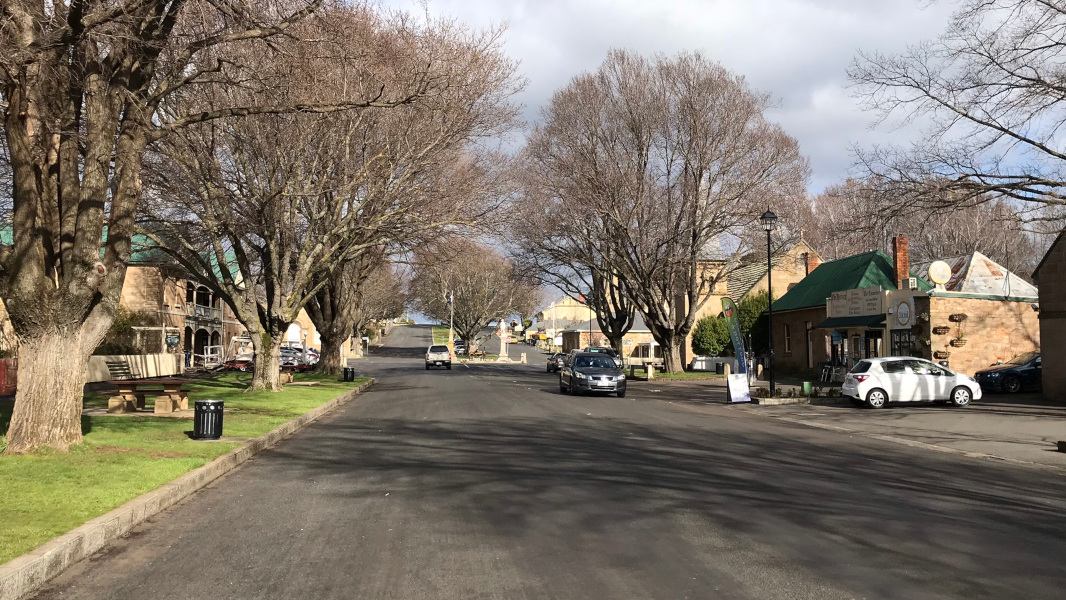 |
Ross Town Centre : Church St (C305) through the Ross town centre, July 2018. Image © Paul Rands |
 |
Ross Town Centre : Church St (C305) through the Ross town centre, July 2018. Image © Paul Rands |
|
 |
Intersection Directional Sign : ID sign at the junction with Bridge St (C305) and Church St in Ross, July 2018. Image © Paul Rands |
 |
Mile Post : Mile post on Church St in Ross, July 2018. 'L' is for Launceston, and the numeral is 48 miles. Image © Paul Rands |
|
 |
Intersection Directional Sign: ID sign at the junction with the unnumbered section of Bridge St at Ross, July 2018. C305 continues as Bond St at this point. |
|||
1 And Sometimes I Just Sits (Ferraby Ling), Ross Bridge, 07 October 2009
Last updated: 10-Feb-2019 12:53
This site © Paul Rands. All rights reserved. Some portions © (copyright) by their respective and credited owners. Permission must be obtained before using any images from this site. For details, please email by clicking here.