|
|
|
|
|
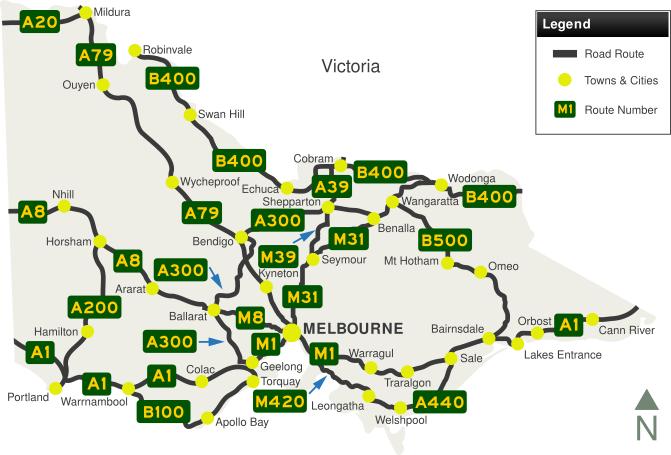
Welcome to the Victoria area of the Australian Towns and Cities section. Please choose a region of Victoria to explore by choosing from a list of towns and cities from further down the page.
Victoria is a state located in southeastern Australia. Victoria is Australia's most densely populated state and its second-most populous state overall. Victoria is bordered by New South Wales to the north, South Australia to the west and Tasmania to the south, separated by Bass Straight.
Victoria once formed part of the wider colony of New South Wales. The first European settlement in the area occurred in 1803 at Sullivan Bay. Named after Queen Victoria, who signed the division's separation from New South Wales, the colony was officially established in 1851 and achieved self government in 1855. The capital of Victoria, Melbourne, served as federal capital of Australia until the construction of Canberra in 1927, with the Federal Parliament meeting in Melbourne's Parliament House and all principal offices of the federal government being based in Melbourne.
 |
|
 |
 |
| Photos: (Left) Victoria border sign along the Sturt Highway crossing from South Australia, (Right) Elizabeth Street, Melbourne (Images © Jamie Scuglia) | |
Capital City: Melbourne
Regional Towns & Cities :
|
|
|
1 Australian Bureau of Statistics, Australian Demographic Statistics, Jun 2018
Last updated: 19-Dec-2020 8:07
This site © Paul Rands. All rights reserved. Some portions © (copyright) by their respective and credited owners. Permission must be obtained before using any images from this site. For details, please email by clicking here.