|
|
|
|
|
 |
Northam-Toodyay Road, Newcastle Road, Fitzgerald Street, Peel Terrace, York Road, Panmure Road, Balladong Street & Great Southern Highway (State Route 120) - Toodyay to Pingelly |
Statistics:
Route Numbering:


General Information:
The Great Southern Highway name begins at York and connects several Wheatbelt towns with towns in the Great Southern region on Western Australia. It consists of two way, single carriageway rural highway, which passes through several somewhat important country towns. The Great Southern Hwy runs almost parallel to the Albany Hwy (SR30), and lies east of the Albany Hwy. It also runs parallel with the Perth-Albany railway corridor for its entire length.
Multiplexes along the route include:
History:
| Toodyay to Pingelly | Pingelly to Toodyay | |||
| Preview: | Description: | Preview: | Description: | |
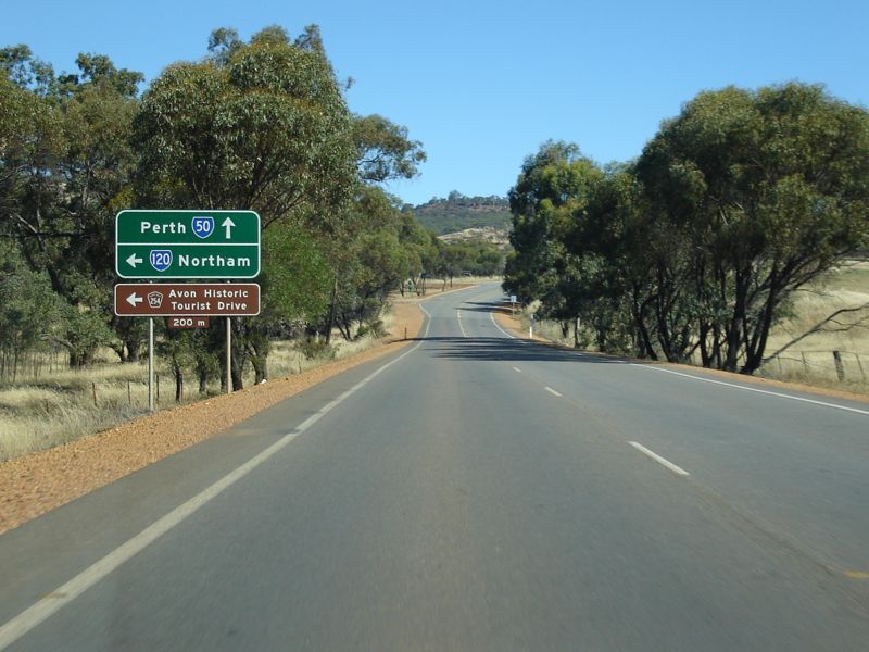 |
Advance Directional Sign: AD sign on Toodyay Road (TD254) at Toodyay, approaching the junction with Northam-Toodyay Road. November 2008. Image © Paul Rands |
 |
Entering Brookton: Great Southern Hwy as you enter the town of Brookton. November 2008. Image © Paul Rands |
|
 |
Advance Directional Sign: AD sign on Northam-Toodyay Road at Katrine, approaching the junction with Katrine Road. TD254 turns left at this intersection. November 2008. Image © Paul Rands |
 |
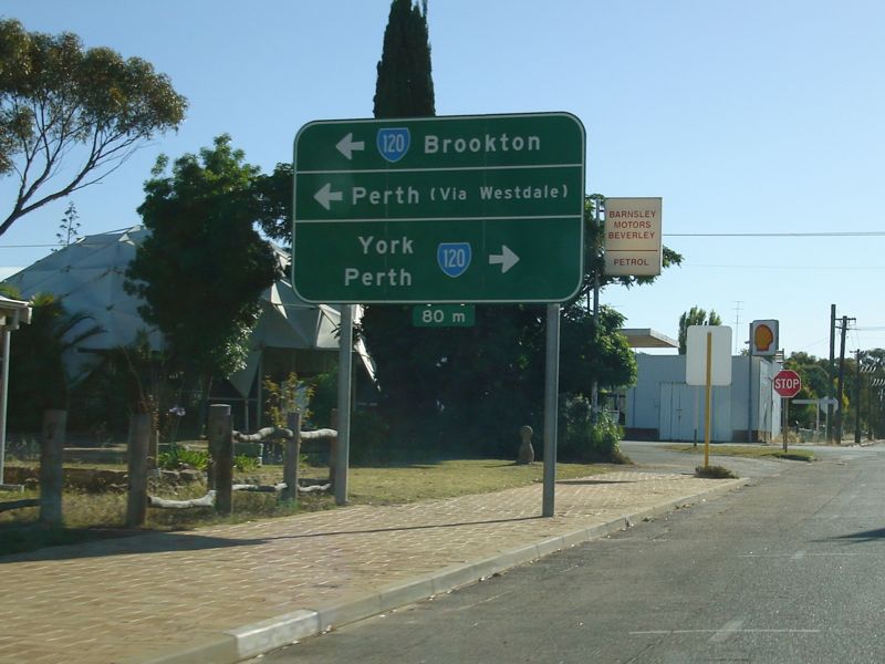
Advance
Directional Sign: AD sign approaching Brookton Hwy at Brookton. November 2008. SR120 turns right and follows SR40 for about 2 km. Image © Paul Rands |
|
 |
Katrine Road Intersection: Southbound through the intersection with Katrine Road (TD254) in Katrine. November 2008. Image © Paul Rands |
 |
Intersection
Directional Sign: ID sign on the junction with Brookton Hwy at Brookton. November 2008. SR120 turns right here and follows SR40 for about 2 km. Image © Paul Rands |
|
 |
Trailblazer: SR120 trailblazer after the Katrine Road intersection at Katrine, November 2008. Image © Paul Rands |
 |
Advance Directional Sign: AD sign approaching Brookton-Corrigin Rd (SR40) and Moorumbine Rd at Brookton, July 2014. Image © Terry Siva |
|
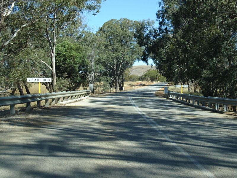 |
Crossing Mistake Creek: Southbound as you cross Mistake Creek near Northam, November 2008. Image © Paul Rands |
 |
Distance Sign: Reassurance directional sign as SR120 leaves Brookton, July 2014. Image © Terry Siva |
|
 |
Road Trains Sign: Road trains warning sign on Northam-Toodyay Road as you approach the grain rail terminal just outside Northam. November 2008. Image © Paul Rands |
 |
Advance Directional Sign: AD sign at Northam approaching Yilgarn Av, April 2018. Image © Paul Rands |
|
 |
Advance Directional Sign: Southbound signage approaching the interchange with Great Eastern Hwy (NH94) at Northam, November 2008. Note the incorrect SR50 shield. Image © Paul Rands |
 |
Intersection Directional Sign: ID sign assembly at the junction with Yilgarn Av, Northam, April 2018. Image © Paul Rands |
|
 |
Great Eastern Highway Interchange: Ramp to the Great Eastern Highway (NH94) at Northam, November 2008. Image © Paul Rands |
 |
Avon River: Newcastle St (SR120) as it crosses Avon River at Northam, April 2018. Image © Paul Rands |
|
 |
Distance Sign: Southbound RD sign with incorrect SR50 shield at Northam, after the interchange with Great Eastern Highway (NH94), November 2008. Image © Paul Rands |
 |
Advance Directional Sign: AD sign on Newcastle Rd (SR120) approaching Mitchell Av in Northam, which should have 'To' prefixed to the NH94 shield, April 2018. Click here for a photo of this location by Terry Siva from July 2014. Image © Paul Rands |
|
 |
Entering Northam: Southbound as you cross the railway line into the Northam town centre, November 2008. Image © Paul Rands |
 |
Fingerboard Assembly: Fingerboards facing Mitchell Av at Northam, April 2018. Image © Paul Rands |
|
 |
Avon River: Southbound on Newcastle Road in Northam as you cross the Avon River, November 2008. Newcastle is the old name for the town of Toodyay. Image © Paul Rands |
|||
 |
Approaching Fitzgerald & Gairdner Streets: Southbound advance directional sign on Newcastle Road in Northam as you approach the intersection with Fitzgerald and Gairdner Streets, November 2008. Image © Paul Rands |
|||
 |
Intersection
Directional Sign: ID sign facing Newcastle Road traffic at the intersection with Fitzgerald Street and Gairdner Street in Northam. TD254 makes a run through the town centre along Fitzgerald Street, November 2008. Image © Paul Rands |
|||
 |
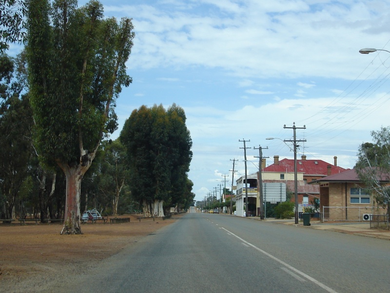
Northam
CBD: Looking northeast on Fitzgerald Street (former NH94), through the Northam town centre. November 2008. Image © Paul Rands |
|||
 |
Black
Advance Directional Sign: Old black AD sign dating back to when NH94 passed through the Northam CBD (via Fitzgerald St, Newcastle Rd & Mitchell Av). This is on Fitzgerald St approaching the signalised junction with Peel Tce & Taylor St, November 2008. SR120 turns right at this junction. Image © Paul Rands |
|||
 |
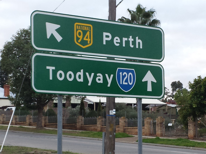
Advance
Directional Sign: Advance directional sign approaching Yilgarn Avenue in Northam, April 2018. Yilgarn Avenue used to be NH94 when the Great Eastern Highway passed through the Northam town centre. Click here for a photo of this location by Paul Rands from November 2008. Image © Paul Rands |
|||
 |
Yilgarn
Avenue Intersection: Corner of Peel Tce & York Rd (SR120) and Yilgarn Av (former NH94) in Northam, April 2018. Image © Paul Rands |
|||
 |
Advance
Directional Sign: Advance directional sign on Yilgarn Avenue approaching Great Eastern Highway (NH94) in Northam, April 2020 Image © Paul Rands |
|||
 |
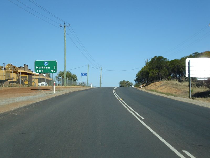
Distance
Sign: RD sign as you head southeast on York Road out of Northam, November 2008. Image © Paul Rands |
|||
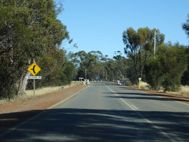 |
Approaching
Muluckine Road: Approaching the intersection of York Rd (SR120) and Muluckine Rd in Northam, November 2008. Image © Paul Rands |
|||
 |
Muluckine
Road Intersection: The intersection of York Rd (SR120) and Muluckine Rd in Northam, November 2008. Image © Paul Rands |
|||
 |
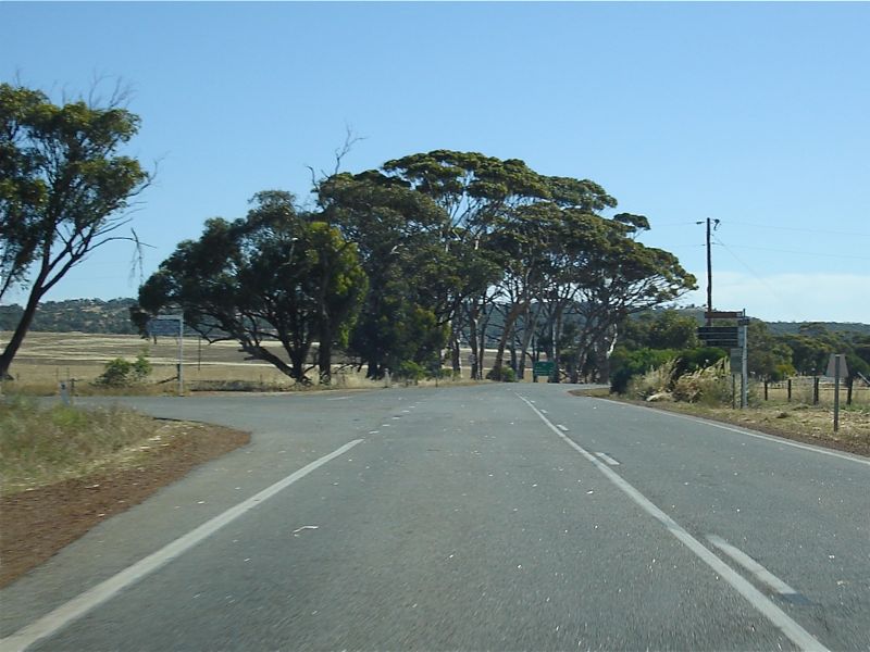
Entering
Shire of York: Southbound as you enter the Shire of York near Throssell, November 2008. Image © Paul Rands |
|||
 |
Advance
Directional Sign: AD sign for the Goldfields Road intersection, southbound at York. November 2008. Image © Paul Rands |
|||
 |
Goldfields
Road Intersection: Corner of York Road and Goldfields Road in York. Southbound, November 2008. Image © Paul Rands |
|||
 |
RD Sign: Distance sign after the junction with Goldfields Road at York. November 2008. Image © Paul Rands |
|||
 |
Entering
York: Sign showing you are entering the town of York, the first inland settlement in Western Australia, November 2008. Image © Paul Rands |
|||
 |
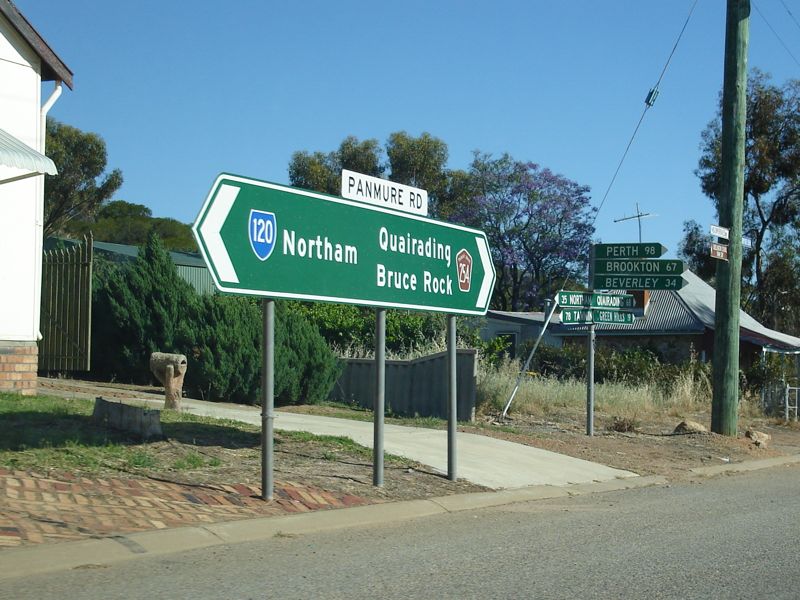
Advance
Directional Sign: Southbound on Panmure Road as you approach the intersection with Balladong Street in York. November 2008. Image © Paul Rands |
|||
 |
Intersection
Directional Sign: ID sign facing Balladong St on the junction with Panmure Rd in York, November 2008. Image © Paul Rands |
|||
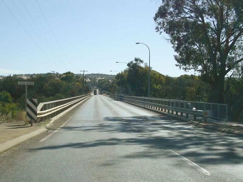 |
Avon
River: Balladong Street as it crosses the Avon River, November 2008. Image © Paul Rands |
|||
 |
Advance
Directional Sign: AD sign as you travel southwest on Balladong Street in York, approaching the unnumbered section of Great Southern Highway, the SR120 segment of Great Southern Highway and York Terrace (TD254), November 2008. Image © Paul Rands |
|||
 |
Black
Advance Directional Sign: Very faded non-reflective black AD sign as you travel south on York Terrace (TD254) in York, approaching the unnumbered section of Great Southern Highway, the SR120 segment of Great Southern Highway and Balladong Terrace (also SR120), November 2008. Image © Paul Rands |
|||
 |
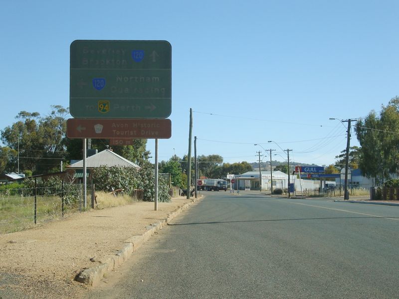
Distance
Sign: Southbound RD sign as you leave York, November 2008. Image © Paul Rands |
|||
 |
Level
Crossing: One of several railway level crossings on SR120, this one as you leave the town of York on the Great Southern Hwy, November 2008. Image © Paul Rands |
|||
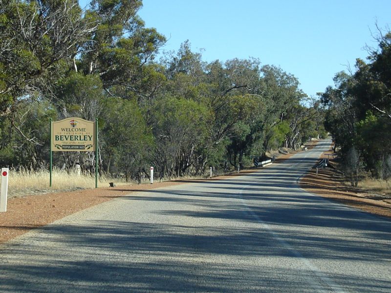 |
Entering
the Shire of Beverley: Southbound at Gilgering as you enter the Shire of Beverley, November 2008. Image © Paul Rands |
|||
 |
Trailblazer: Southbound trailblazer in the Gilgering area, November 2008. Image © Paul Rands |
|||
 |
Dale
River: Looking southeast as the Great Southern Hwy crosses Dale River. November 2008. Image © Paul Rands |
|||
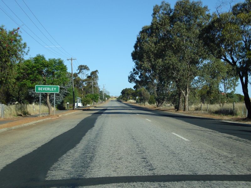 |
Entering
Beverley: Great Southern Hwy as it enters the town of Beverley, November 2008. Image © Paul Rands |
|||
 |
Advance
Directional Sign: AD sign as you travel southeast on Great Eastern Hwy approaching Vincent St and Waterhatch Rd in Beverley, November 2008. Image © Paul Rands |
|||
 |
Intersection
Directional Sign: ID sign on the corner of Great Eastern Hwy, Vincent St and Waterhatch Rd in Beverley, November 2008. Image © Paul Rands |
|||
 |
Advance
Directional Sign: AD sign as you travel southwest on Vincent St in Beverley, as you approach Waterhatch Rd and Great Southern Hwy (SR120), November 2008. Image © Paul Rands |
|||
 |
Distance
Sign: Southbound RD sign as you leave Beverley, November 2008. Image © Paul Rands |
|||
 |
Advance
Directional Sign: Southbound AD sign approaching Westdale Road. A route that bypasses Brookton and acts as a shortcut to Perth, November 2008. Image © Paul Rands |
|||
 |
Westdale
Road Intersection: Corner of Great Southern Hwy and Westdale Rd at Beverley, November 2008. Image © Paul Rands |
|||
 |
Black
Distance Sign: Black RD sign with SR120 topknot heading southeast on Great Southern Hwy after the Westdale Rd intersection at Beverley. November 2008. Image © Paul Rands |
|||
 |
Trailblazer: SR120 trailblazer between Beverley and Kokeby, November 2008. Image © Paul Rands |
|||
 |
Avon
River South Branch: Great Southern Hwy as it crosses the Avon River, South Branch at Kokeby. November 2008. Image © Paul Rands |
|||
 |
Services
Sign: Services sign at Brookton as the Great Southern Highway travels southeast, November 2008. Image © Paul Rands |
|||
 |
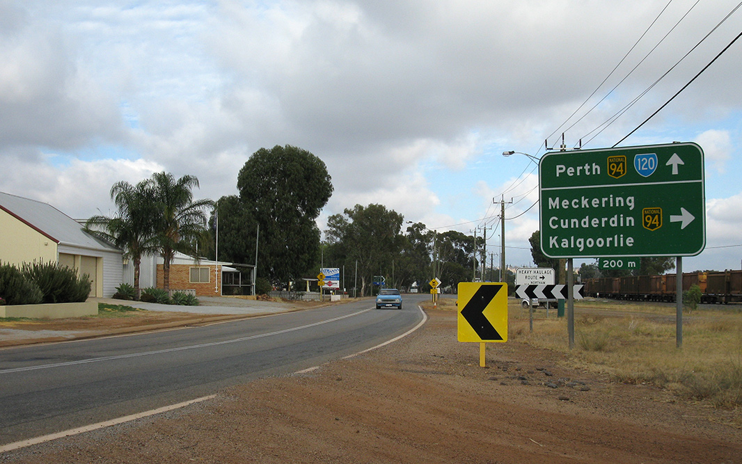
Advance
Directional Sign: AD sign approaching the intersection with Brookton Hwy (SR40) at Brookton, November 2008. Image © Paul Rands |
|||
 |
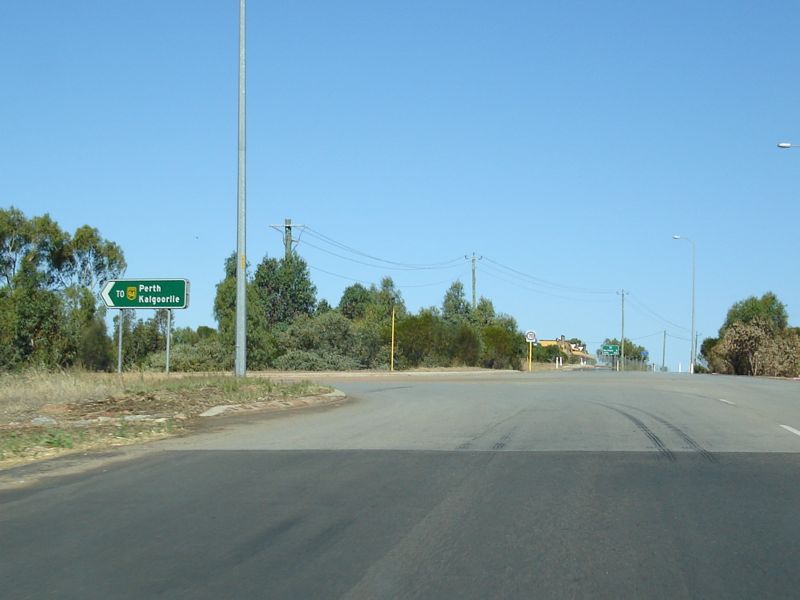
Intersection
Directional Sign: ID sign on the corner of Brookton Hwy (SR40) and Great Southern Hwy (SR120) on the eastern side of Brookton, November 2008. SR120 duplexes with SR40 by turning right and entering Brookton's town centre. Image © Paul Rands |
|||
 |
Brookton: The Great Southern Highway (William Street) as it bypasses the shopping precinct in Brookton, April 2009. Image © Paul Rands |
|||
 |
Brookton: The Great Southern Highway (William Street) as it bypasses the shopping precinct in Brookton, November 2008. Image © Paul Rands |
|||
 |
Tourist Drive Trailblazer: TD356 trailblazer as you leave Brookton, April 2009. Image © Paul Rands |
|||
 |
Distance Sign: Southbound RD sign as you leave the town of Brookton, November 2008. Image © Paul Rands |
|||
| Click here for the continuation of SR120 between Pingelly & Wagin | ||||
1 Main Roads Western Australia
2 The Town of Narrogin
Last updated: 28-Jul-2020 12:49
This site © Paul Rands. All rights reserved. Some portions © (copyright) by their respective and credited owners. Permission must be obtained before using any images from this site. For details, please email by clicking here.