|
|
|
|
|
 |
Picton Road, South Western Highway, Coalfields Highway, Arthur Road, Wagin-Dumbleyung Road, Dumbleyung-Lake Grace Road & Newdegate-Ravensthorpe Road (State Route 107) - Bunbury to Collie |
Statistics:
Route Numbering:


General Information:
SR107 connects the coast of Western Australia, with the state's coalfields and wheat belt. The road is generally rural road / rural highway standard and runs in a generally east to west fashion from end to end. SR107 forms the route 5 part of the official heavy haulage route system in Southwestern Western Australia.1
Multiplexes along the route include:
Click here for photos of the former alignment between Bunbury and Collie
| Bunbury to Collie | Collie to Bunbury | |||
| Preview: | Description: | Preview: | Description: | |
 |
Distance Sign: Looking northeast at Glen Iris near the Preston River. December 2007. Image © Paul Rands |
 |
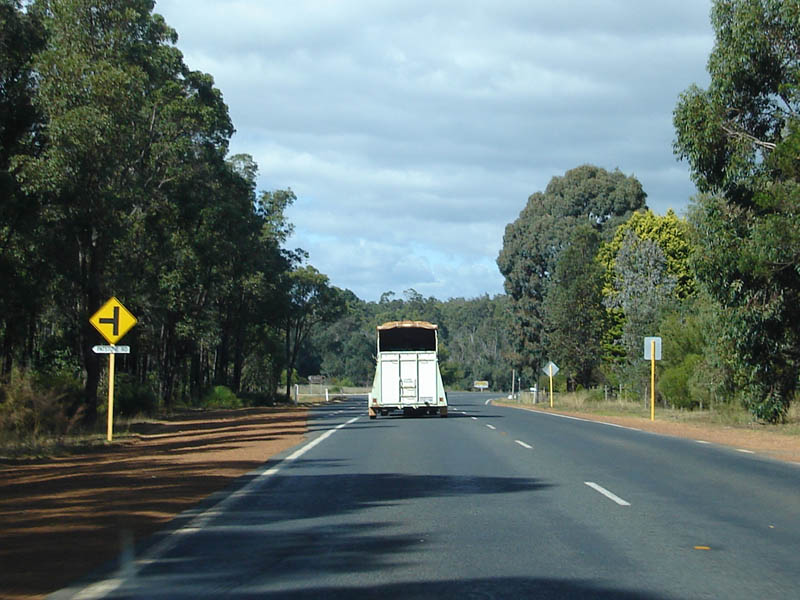
Advance Directional Sign: AD sign at Darkan approaching Darkan South Rd and Williams-Darkan Rd, April 2014. Image © Terry Siva |
|
 |
Advance Directional Sign: AD sign at Picton approaching Picton-Boyanup Rd. December 2007. Image © Paul Rands |
|||
 |
Picton-Boyanup Road Intersection: Looking northeast at the Picton-Boyanup Rd intersection. December 2007. Image © Paul Rands |
|||
 |
Distance Sign: RD sign as you head northeast at Picton, December 2007. Image © Paul Rands |
|||
 |
Distance Sign: RD sign as you head northeast at Waterloo, December 2007. Image © Paul Rands |
|||
 |
Collie River: Crossing the Collie River at Burekup. December 2007. Image © Paul Rands |
|||
 |
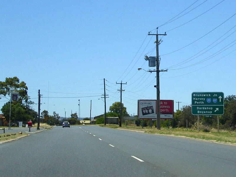
Approaching Raymond Road / Coalfields Hwy Junction: Heading northeast at Burekup approaching Raymond Rd (left turn) and Coalfields Hwy (right turn), which is where the SR20 duplex ends, December 2007. Image © Paul Rands |
|||
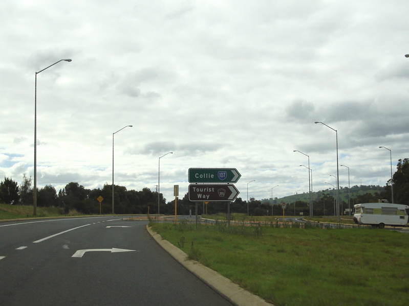 |
Coalfields Hwy Intersection: Looking at the right turn of SR107 onto Coalfields Hwy at Roelands, May 2008. Image © Paul Rands |
|||
 |
Coalfields Hwy & Government Road Intersection: Looking at the level crossing and junction with Government Road as the Coalfields Hwy at Roelands, May 2008. Image © Paul Rands |
|||
 |
Distance Sign: Eastbound RD sign at Roelands, May 2008. Image © Paul Rands |
|||
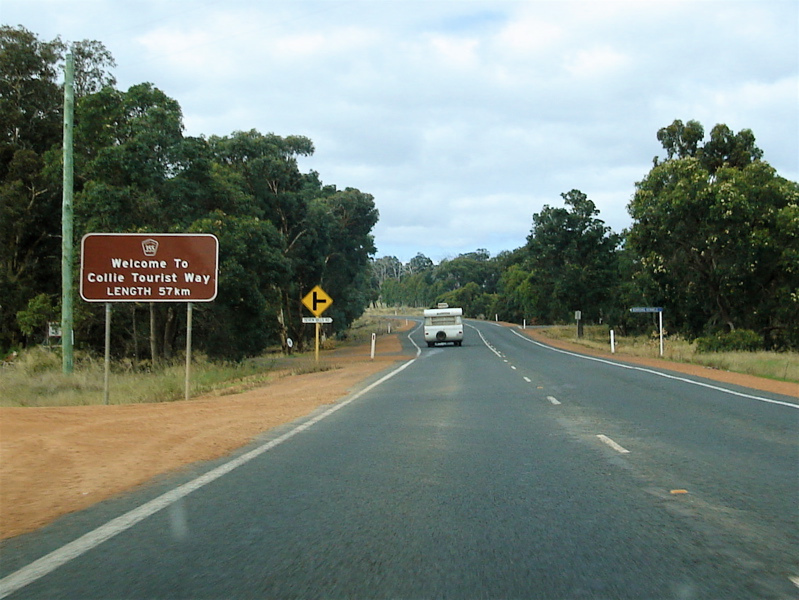 |
Tourist Drive Sign: Sign announcing the start of the Collie Tourist Way at Roelands, May 2008. Image © Paul Rands |
|||
 |
Typical Conditions: Eastbound between Roelands and Worsley, May 2008. Image © Paul Rands |
|||
 |
Typical Conditions: Eastbound between Roelands and Worsley, May 2008. Image © Paul Rands |
|||
 |
Beela Road Intersection: Looking at the intersection with Beela Road at Worsley, May 2008. Image © Paul Rands |
|||
 |
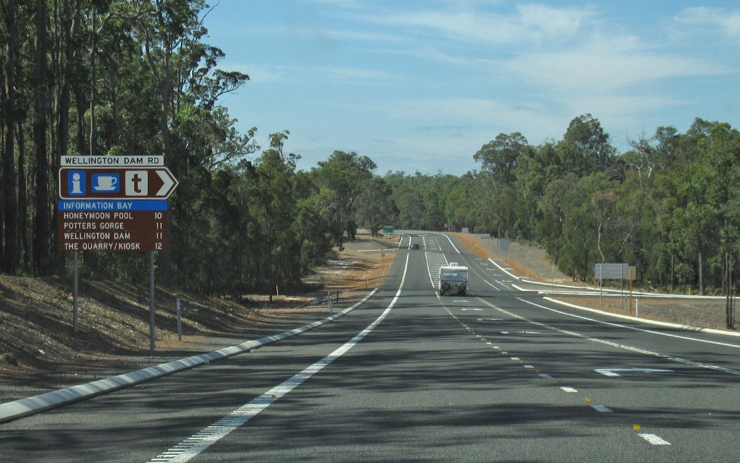
Advance Directional Sign: AD sign as you approach Wellington Dam Road at Worsley, April 2018. Image © Paul Rands |
|||
 |
Intersection Directional Signs: Looking at the intersection with Wellington Dam Road at Worsley, April 2018. Image © Paul Rands |
|||
 |
Distance Sign: RD sign located after Wellington Dam Road at Worsley, April 2018. Image © Paul Rands |
|||
 |
Advance directional Sign: AD sign as you approach the intersection with Gastaldo Road at Worsley, April 2018. Image © Paul Rands |
|||
 |
Trailblazer: Trailblazer sign located after the junction with Gastaldo Rd at Worsley, May 2008. Image © Paul Rands |
|||
 |
Entering Allanson: Coalfields Hwy as it enters the small town of Allanson, May 2008. Image © Paul Rands |
|||
 |
Allanson: Typical road conditions through Allanson, approaching Patstone Road, May 2008. Image © Paul Rands |
|||
 |
Welcome to Collie: Large council sign welcoming you to the town of Collie, May 2008. Image © Paul Rands |
|||
 |
Collie: Coalfields Hwy (SR107) as it enters the town of Collie, April 2018. Click here for a photo of this location by Paul Rands from May 2008. Image © Paul Rands |
|||
 |
Throssell Street: Looking eastbound through Collie on Coalfields Hwy (Throssell St), April 2018. Click here for a photo of this location by Paul Rands from May 2008. Image © Paul Rands |
|||
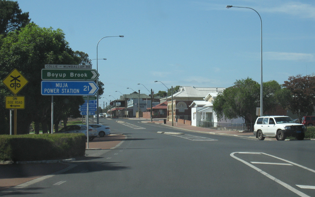 |
Collie-Mumballup Road Intersection: Southbound in Collie's town centre, April 2018. Click here for a photo of this location by Paul Rands from May 2008. Image © Paul Rands |
|||
 |
Lefroy Street: Corner of Coalfields Hwy (Throssell St) (SR107) and Lefroy St, Collie, April 2018. Image © Paul Rands |
|||
 |
Level Crossing: One of several railway lines in Collie as it crosses Coalfields Hwy right beside the Collie River bridge, May 2008. Image © Paul Rands |
|||
 |
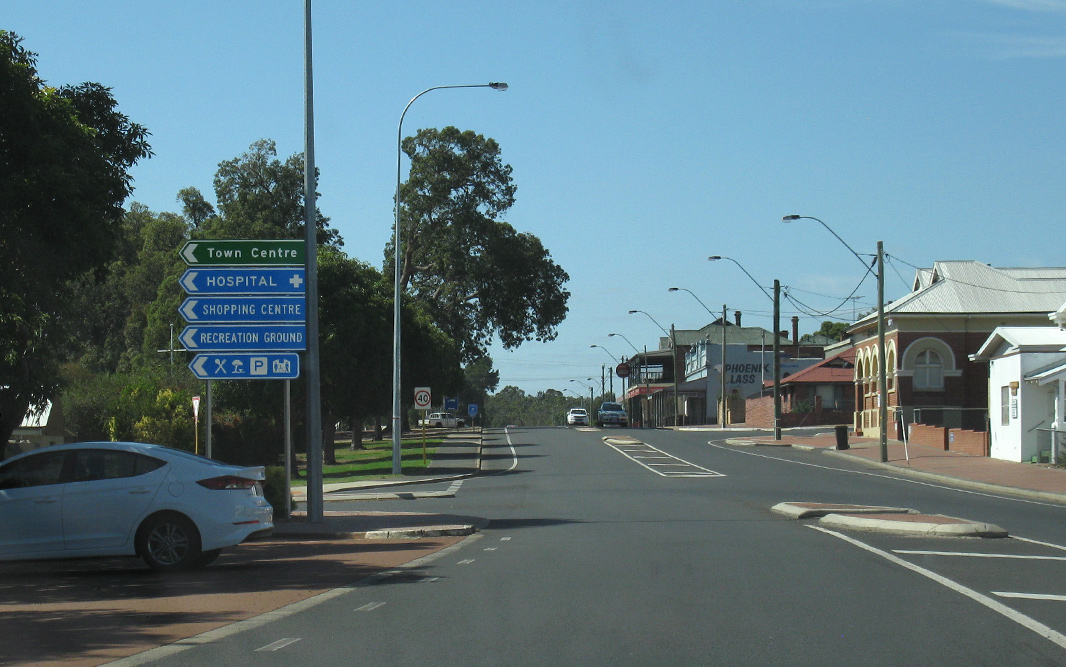
AD Sign: Advance directional sign approaching the intersection with Collie-Willians Rd (Paull Street) in Collie, April 2018. Click here for a photo of this location by Paul Rands from May 2008. Image © Paul Rands |
|||
 |
Paull Street Intersection: Looking at the Collie-Willians Rd (Paull Street) junction in Collie, May 2008. Image © Paul Rands |
|||
 |
Distance Sign: RD sign as you leave Collie, eastbound, May 2008. Image © Paul Rands |
|||
| Click here for the continuation of SR107 between Collie and Arthur River | ||||
1 Main Roads Western Australia, Roads Controlled By Main Roads Western Australia, retrieved 23/07/2008
Last updated: 28-Jul-2020 11:55
This site © Paul Rands. All rights reserved. Some portions © (copyright) by their respective and credited owners. Permission must be obtained before using any images from this site. For details, please email by clicking here.