|
|
|
|
|
| Road Photos & Information: Queensland |
 |
New England Highway & Cunningham Highway (National Highway 15) - Stanthorpe to Glengallan |
Statistics:
Route Numbering:

General Information:
The New England and Cunningham Highways link South East Queensland to southern freight markets including Sydney, and is a major freight route to and from regional communities in north-west New South Wales and southwest Queensland. The National Highway 15 segments of the Cunningham Highway and New England Highway form part of the National Highway system for which the Commonwealth Government has full funding responsibility. 2
The route features a mix of rural highway standards (southwest of Ipswich to NSW border) and freeway standards (through the eastern suburbs of Ipswich).
History:
| Stanthorpe to Glengallan | Glengallan to Stanthorpe | |||
| Preview: | Description: | Preview: | Description: | |
 |
Applethorpe: Arterial road conditions through the orchard and wine town of Applethorpe. March 2006. Image © Paul Rands |
 |
Great Dividing Range: Cunningham Hwy (NH15) at Taroom approaching the Great Dividing Range, May 2012. Image © Michael Greenslade |
|
 |
Wind
Gusts Sign: Unusual wind gusts sign as you head through Applethorpe, March 2006. Image © Paul Rands |
|||
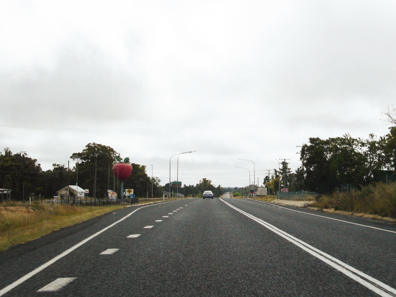 |
Approaching
Amiens Road: Northbound at Applethorpe, note the big apple! March 2006. Image © Paul Rands |
|||
 |
Black Kilometre Plate Old black kilometre plate, northbound on the New England Highway at The Glen, 20 km south of the Warwick CBD, March 2006. Image © Paul Rands |
|||
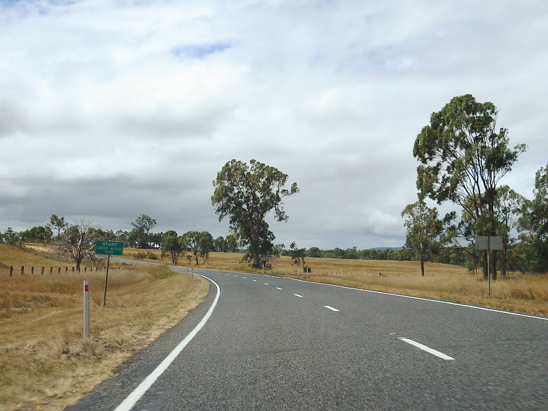 |
Start
Limited Access Road: Sign announcing access restrictions as you enter Warwick, March 2006, northbound. Image © Paul Rands |
|||
 |
Approaching
Bracker Road: Northbound as you approach the Bracker Road intersection in the area known as Rosenthal Heights at Warwick. March 2006. Image © Paul Rands |
|||
 |
End
Limited Access Road: Sign announcing the end access restrictions at Warwick, March 2006, northbound. Image © Paul Rands |
|||
 |
Level
Crossing: Northbound near Glen Road at Warwick as you travel along Wallace Street (New England Highway), March 2006. Image © Paul Rands |
|||
 |
Approaching
the NR42 / NH15 junction: Northbound at Warwick as you approach the Wallace Street and Wood Street (Cunningham Hwy) junction. March 2006. Image © Paul Rands |
|||
 |
NR42
/ NH15 junction: At Warwick at the Wallace Street and Wood Street (Cunningham Hwy) junction. March 2006. Note the older style traffic signal masts. Image © Paul Rands |
|||
 |
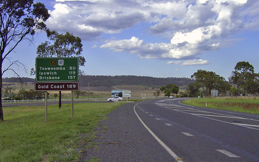
Distance
Sign: RD sign as you head east along Wood Street at Warwick, March 2006. Note the additional sign for the Gold Coast - access to the Gold Coast is via the turn off to Beaudesert at Fassifern, near Aratula. Image © Paul Rands |
|||
 |
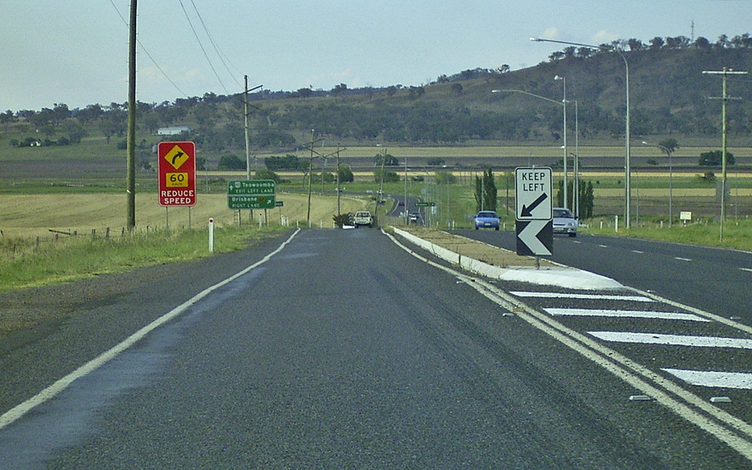
Advance
Directional Sign for Albion Street: Eastbound on Wood Street as you approach the hard left turn to continue along the highway, March 2006 at Warwick. Image © Paul Rands |
|||
 |
Corner
of Albion & Wood Streets: Turn lane for the continuation of the highway at Warwick, eastbound, March 2006. Image © Paul Rands |
|||
 |
Distance
Sign: RD sign as you drive north along Albion Street at Warwick, March 2006. Image © Paul Rands |
|||
 |
Black
Distance Sign: Black RD Sign as you start to leave the central area of Warwick, heading northeast at the Alice Street intersection, before you cross the Condamine River. March 2006. Image © Paul Rands |
|||
 |
Distance
Sign: RD sign Womina, at the Glengallan Rd intersection. December 2002. Image © Michael Greenslade |
|||
 |
Road
Train Sign: Sign prohibiting road trains beyond this point. Taken eastbound outside the road train assembly area at Womina near Warwick, March 2006. Image © Paul Rands |
|||
 |
Cunningham
& New England Highways Split: Advance directional sign for the junction of the New England Highway (becomes A3) and the Cunningham Highway (the continuation of NH15). March 2006, northbound at Glengallan. Image © Paul Rands |
|||
 |
Advance Directional Sign: AD sign at Glengallan approaching New England Hwy (then NR42, now A3), December 2002. Image © Michael Greenslade |
|||
 |
New England Highway & Cunningham Highway: New England Hwy (NH15 / NR42) at the junction with New England Hwy (then NR42, now A3) and Cunningham Hwy (NH15) at Glengallan, December 2002. Image © Michael Greenslade |
|||
| Click here for the
continuation of National Highway 15 between Glengallan and Aratula Click here for the continuation of National Highway 15 between Stanthorpe and NSW Border |
||||
1 Main Roads State Road Network of Queensland Map, 30 June 2008
2 Queensland Department of Main Roads
Last updated: 21-Oct-2021 14:28
This site © Paul Rands. All rights reserved. Some portions © (copyright) by their respective and credited owners. Permission must be obtained before using any images from this site. For details, please email by clicking here.