|
|
|
|
|

|
Castlereagh Highway, Carnarvon Highway, Gregory Highway, Carnarvon Developmental Road & Gregory Developmental Road (National Route 55) (Decommissioned) |
Statistics:
Route Numbering:


General Information:
National Route 55 was a rural highway that linked the NSW Central West with North Queensland. The route was a mostly single carriageway route, linking a number of key towns and highways in the rural heartland of NSW and QLD.
The Queensland portion serviced a number of farming communities, most of which produce cattle or cotton.
Multiplexes along the route include:
History:

| NSW Border to Charters Towers | Charters Towers to NSW Border | |||
| Preview: | Description: | Preview: | Description: | |
 |
NSW / QLD Border: Castlereagh Hwy (NR55) as it crosses from New South Wales into Queensland at Hebel, December 2003. Image © Michael Greenslade |
 |
Advance Directional
Sign: AD sign on Carnarvon Hwy (NR55) at Euthulla approaching Roma-Taroom Rd, April 2004. Image © Michael Greenslade |
|
 |
Black Advance Directional Sign: Black AD sign that likely predates the introduction of NR55 approaching Bollon-Dirranbandi Rd at Dirranbandi, December 2003. NR55 turns right at this location. Image © Michael Greenslade |
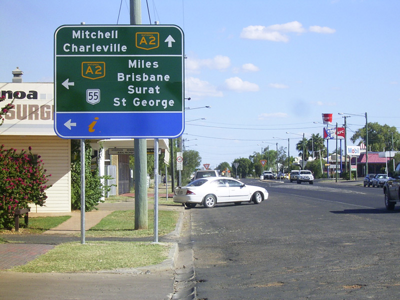 |
Advance Directional
Sign: AD sign on Carnarvon Hwy (Quintin St) (NR55) at Roma approaching Warrego Hwy (NH-A2) and Bowen St, April 2004. Image © Michael Greenslade |
|
 |
Black Reassurance Directional Sign: Black distance sign that likely predates the introduction of NR55 at Dirranbandi, December 2003. Image © Michael Greenslade |
 |
Black Reassurance
Directional Sign: Black distance sign at Roma, April 2004. Image © Michael Greenslade |
|
 |
Reassurance Directional Sign: Distance sign at Noondoo, December 2003. Image © Michael Greenslade |
 |
Advance Directional Sign: ID sign on Moonie Hwy (SR49) approaching Carnarvon Hwy (NR55 / SR49), December 2003. The SR49 duplex along NR55 begins at this location. Image © Michael Greenslade |
|
 |
Black Advance Directional Sign: Black AD sign at St George approaching Balonne Hwy (SR49), December 2003. The SR49 duplex starts at this junction. Image © Michael Greenslade |
 |
Reassurance Directional Sign: Distance sign at St George, December 2003. Note the incorrect shield type and missing SR49 shield. Image © Michael Greenslade |
|
 |
Reassurance Directional Sign: Distance sign at St George, December 2003. Note the incorrect shield for SR49. Image © Michael Greenslade |
 |
Advance Directional Sign: AD sign at St George approaching Balonne Hwy (SR49), December 2003. The SR49 duplex ends at this junction. Image © Michael Greenslade |
|
 |
Reassurance Directional Sign: Distance sign at St George, December 2003. Image © Michael Greenslade |
 |
Advance Directional Sign: AD sign at St George approaching Carnarvon Hwy (NR46), December 2003. NR46 is straight ahead and NR55 turns right at this junction and becomes Castlereagh Hwy, contrary to the sign. Image © Michael Greenslade |
|
 |
Reassurance
Directional Sign: Distance sign on Carnarvon Hwy (NR55) at Roma, April 2004. Image © Michael Greenslade |
 |
Trailblazer: NR55 trailblazer on Castlereagh Hwy (NR55) at St George, December 2003. Image © Michael Greenslade |
|
 |
Trailblazer &
Kilometre Plate: NR55 trailblazer and kilometre plate at Euthulla, April 2004. Image © Michael Greenslade |
 |
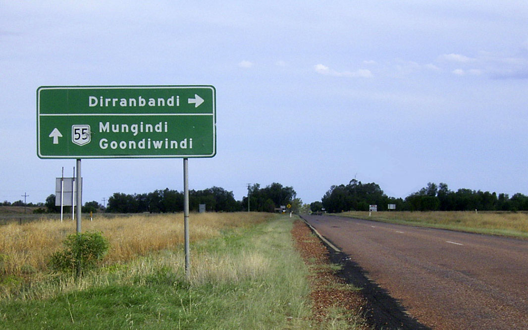
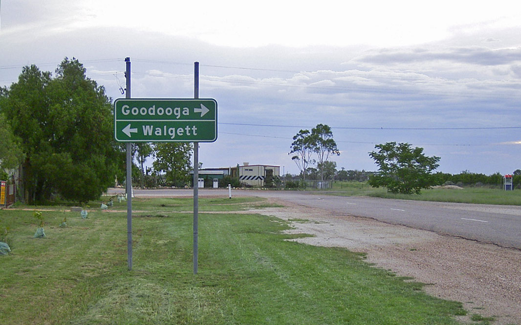
Advance Directional Sign: AD sign at Noondoo approaching Mungindi Rd, December 2003. NR55 turns right at this location. Image © Michael Greenslade |
|
 |
Dirranbandi: Castlereagh Hwy (NR55) as it passes through Dirranbandi, December 2003. Image © Michael Greenslade |
|||
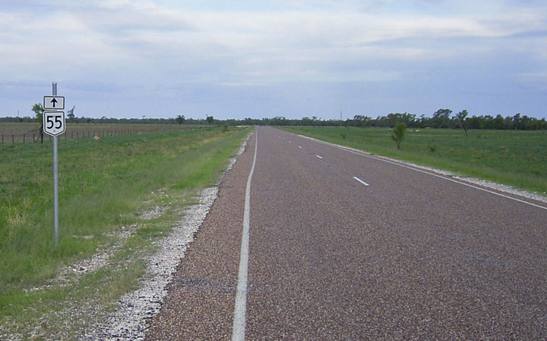 |
Trailblazer: NR55 trailblazer on Castlereagh Hwy (NR55) at Dirranbandi, December 2003. Image © Michael Greenslade |
|||
 |
Entering Hebel: Castlereagh Hwy (NR55) as it enters the town of Hebel, December 2003. Image © Michael Greenslade |
|||
 |
Advance Directional Sign: AD sign on Castlereagh Hwy (NR55) approaching Hebel-Goodooga Rd, December 2003. NR55 turns left at this location. Note the missing NR55 shield. Image © Michael Greenslade |
|||
| Click here for the continuation of National Route 55 in New South Wales | ||||
1 Map of the
State Road Network of Queensland, 30 June 2008
2 Balonne Shire Annual Report 2003-2004
3 Sam Laybutt (Ozroads)
4 Balonne Shire Annual Report 2004-2005
Last updated: 17-Sep-2020 23:08
This site © Paul Rands. All rights reserved. Some portions © (copyright) by their respective and credited owners. Permission must be obtained before using any images from this site. For details, please email by clicking here.