|
|
|
|
|
 |
Castlereagh Highway (National Route 55) (Decommissioned) |
Statistics:
Route Numbering:

General Information:
National Route 55 is a rural highway linking the New South Wales western plains with southern Queensland. The road is undivided along its entire length.
The highway named after the Castlereagh River, which runs parallel with the highway.
Multiplexes along the route include:
History:

| Gilgandra to QLD Border | Qld Border to Gilgandra | |||
| Preview: | Description: | Preview: | Description: | |
 |
Advance Directional Sign: AD sign on Oxley Hwy (NR34) approaching Castlereagh Hwy (NR55) at Gilgandra, November 2010. Image © Rob Tilley |
 |
NSW-QLD Border: Castlereagh Hwy (NR55) as it crosses from Queensland into New South Wales at Angledool, December 2003. Image © Michael Greenslade |
|
 |
Black Intersection Directional Sign: Black ID sign on the corner of Oxley Hwy (NR34) and Castlereagh Hwy (NR55) at Gilgandra, May 2005. Image © Rob Tilley |
 |
Intersection Directional Sign: ID signs facing Bill O'Brien Way at Lightning Ridge, October 2005. Note the wrong SR shield on the top sign and the alphanumeric route number on the bottom sign. Image © Paul Rands |
|
 |
Gilgandra CBD: Castlereagh Hwy (NR55) as it passes through the Gilgandra CBD, July 2006. Image © Paul Rands |
 |
110km/h Zone: The 110 km/h zone along Castlereagh Hwy (NR55) at Lightning Ridge, October 2005. Image © Paul Rands |
|
 |
Black Distance Sign: Black reassurance directional sign as the Castlereagh Hwy (NR55) leaves Gilgandra, December 2002. Image © Michael Greenslade |
 |
Advance Directional Sign: AD sign at Walgett approaching Gwydir Hwy (NR83), December 2003. Image © Michael Greenslade |
|
 |
Black Intersection Directional Sign: Black ID sign at the corner of Castlereagh Hwy (NR55) and King St, Coonamble, December 2003. Image © Michael Greenslade |
 |
Dust Sign: Sign requesting truck drivers to stop at the bay beyond the sign to drop dust from their vehicles before entering the town centre, Walgett, October 2010. Image © Paul Rands |
|
 |
Advance Directional Sign: AD sign at Coonamble approaching Aberford St and Castlereagh St, December 2003. Image © Michael Greenslade |
 |
Reassurance Directional Sign: Distance sign at Walgett, December 2003. Image © Michael Greenslade |
|
 |
Black Intersection Directional Sign: Black ID sign at the corner of Castlereagh Hwy (NR55) Kamilaroi Hwy (NR37) and Wee Waa St, December 2003. This sign pre-dates the introduction of NR37. Image © Michael Greenslade |
 |
Advance Directional Sign: AD sign at Coonamble approaching Aberford St and Castlereagh St, December 2003. Image © Michael Greenslade |
|
 |
Horses Sign: Sign that is common to the more isolated areas of the state asking motorists to stop and wait for horses if on the bridge, Namoi River at Walgett, October 2010. Image © Paul Rands |
 |
Black Advance Directional Sign: Black AD sign on Oxley Hwy (NR34) approaching Castlereagh Hwy (Miller St) at Gilgandra. May 2005. Image © Rob Tilley |
|
 |
Intersection Directional Sign: ID sign assembly at the end of the NR37 duplex in Walgett, October 2010. NR55 continues straight ahead at this junction. Note the missing NR37 shield. Image © Paul Rands |
 |
Black Intersection Directional Sign: Signage on the junction with the Castlereagh & Oxley Highways at Gilgandra. May 2005. Image © Rob Tilley |
|
 |
Distance Sign: RD sign as Castlereagh Hwy (NR55) leaves Walgett, December 2003. |
 |
Gilgandra: Castlereagh Hwy (NR55) as it passes through the town of Gilgandra, April 2012 . Image © Paul Rands |
|
 |
Barwon River: Castlereagh Hwy (NR55) as it crosses the Barwon River near Walgett, October 2005. Image © Paul Rands |
 |
Black Advance Directional Sign: Black AD sign on Castlereagh Hwy (Miller St) (NR55) approaching the Oxley Highway (Warren Rd) (NR34) at Gilgandra. May 2005. Image © Rob Tilley |
|
 |
Black Advance Directional Sign: Black AD sign on Castlereagh Hwy (NR55) approaching Gwydir Hwy (NR38), October 2005. Image © Paul Rands |
 |
Advance Directional Sign: AD sign on Castlereagh Hwy (Miller St) (NR55) approaching the Oxley Highway (Warren Rd) (NR34) at Gilgandra. April 2012. Click here for a photo by Rob Tilley from May 2005. Image © Paul Rands |
|
 |
Reassurance Directional Sign: Distance sign at Walgett, December 2003. Note the missing route number. Image © Michael Greenslade |
 |
Intersection Directional Sign: Signage on the junction with the Castlereagh & Oxley Highways at Gilgandra. April 2012. Click here for a photo by Rob Tilley from May 2005. Image © Paul Rands |
|
 |
Black Intersection Directional Sign: Black ID sign at the corner of Castlereagh Hwy (NR55) and Llanillo Rd at Lightning Ridge, December 2003. Image © Michael Greenslade |
|||
 |
Reassurance Directional Sign: Distance sign at Lightning Ridge, December 2003. Note the missing route number. Image © Michael Greenslade |
|||
 |
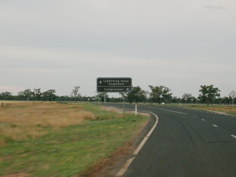
Supplemental Advance Directional Sign: Supplemental AD sign on Castlereagh Hwy (NR55) approaching Bill O'Brien Way at Lightning Ridge, October 2005. Image © Paul Rands |
|||
 |
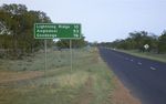
Black Advance Directional Sign: Black AD sign at Lightning Ridge approaching Bill O'Brien Way, December 2003. This sign pre-dates the extension of NR55 to the NSW / QLD Border. Image © Michael Greenslade |
|||
 |
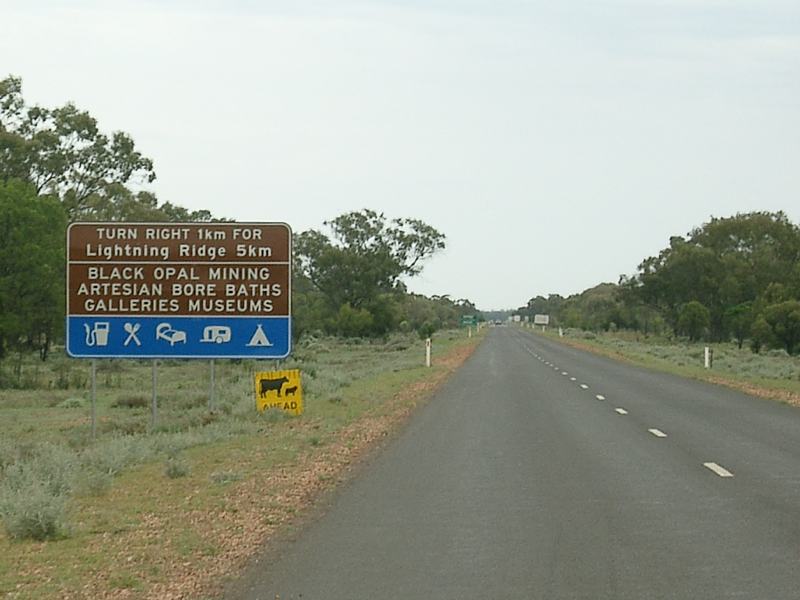
No Fuel next 63km: Sign on Castlereagh Hwy (NR55) at Lightning Ridge indicating distance to the next available fuel, October 2005. Image © Paul Rands |
|||
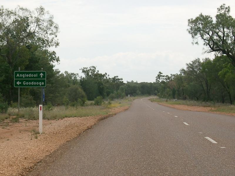 |
Advance Directional Sign: AD sign at Angledool approaching Goodooga Rd, October 2005. Image © Paul Rands |
|||
 |
Black Kilometre Plate: Black kilometre plate near the NSW / QLD Border at Angledool, December 2003. Image © Michael Greenslade |
|||
 |
NSW-QLD Border: Castlereagh Hwy (NR55) at the border with Queensland, October 2005. NR55 ends here and becomes A55. Image © Paul Rands |
|||
| Click here for the continuation of Castlereagh Highway as NR55 in Queensland Click here for the continuation of Castlereagh Highway as SR86 in New South Wales |
||||
1 Roads and Traffic Authority, Schedule of Classified Roads and State & Regional Roads, 31 January 2011
2 Department of Main Roads, Historical Roads of New South Wales brochure, Castlereagh Highway
3 Department of Main Roads, The Roadmakers, A History of Main Roads in New South Wales, ISBN 0 7240 0439 4
Last updated: 19-Oct-2021 1:21
This site © Paul Rands. All rights reserved. Some portions © (copyright) by their respective and credited owners. Permission must be obtained before using any images from this site. For details, please email by clicking here.