|
|
|
|
|
 |
Pacific Motorway, Riverside Expressway, Coronation Drive, Hale Street, Inner City Bypass, Bowen Bridge Road, Lutwyche Road, Gympie Road & Gympie Arterial Road (Metroad 3) (Decommissioned) - Eight Mile Plains to Brisbane |
Statistics:
Route Numbering:


General Information:
The Pacific Motorway once had 2 names, the bridges and interchanges in the Brisbane CBD was called the Riverside Expressway and the freeway south of the CBD was known as the South East Freeway. The South East Freeway and Riverside Expressway were two of the early projects to be completed from the Wilbur Smith "Brisbane Transportation Study", which was published in 1965 and made recommendations covering sixteen years to 1981. 2The Captain Cook Bridge is the third crossing of the Brisbane River. It crosses at the South Brisbane Reach of the river, and links Gardens Point to Woolloongabba. It carries four lanes of traffic in either direction.
History:
| Eight Mile Plains to Brisbane | Brisbane to Eight Mile Plains | |||
| Preview: | Description: | Preview: | Description: | |
 |
Riverside Expressway
& Captain Cook Bridge: End of South Eastern Fwy (Metroad 3) and start of Riverside Expwy (Metroad 3) at South Brisbane, March 2004. Also shown here is Captain Cook Bridge over Brisbane River Image © Michael Greenslade |
 |
Hale Street,
Southbound: Hale St as it makes its way southbound through Brisbane after the Musgrave Rd (SR31) interchange, March 2006. Image © Paul Rands |
|
 |
Advance Directional
Sign: Coronation Dr (Metroad 3) at Milton approaching Coronation Dr (SR33) ad Hale St (Metroad 3), October 2004. Image © Michael Greenslade |
 |
Advance Directional
Signs: AD signs for Milton Rd (SR32) and Coronation Dr (SR33 / Metroad 3) on the Caxton St overpass as Hale Street passes through Brisbane, March 2006. Image © Paul Rands |
|
 |
Intersection
Directional Sign: ID sign at the exit to Boomerang St from Hale St (Metroad 3) at Milton, October 2004. Image © Michael Greenslade |
 |
Advance Directional
Sign: AD signs on the Milton Rd (SR32) overpass for Coronation Dr (SR33 / Metroad 3) as Hale Street passes through Brisbane, March 2006. Image © Paul Rands |
|
 |
Advance Directional
Signs: AD signs on gantry over Coronation Dr in Brisbane, March 2006. Image © Paul Rands |
|||
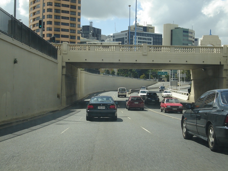 |
William Jolly Bridge: Metroad 3 changes from Coronation Drive to Pacific Motorway (former Riverside Expressway) under the William Jolly Bridge in brisbane, March 2006. Image © Paul Rands |
|||
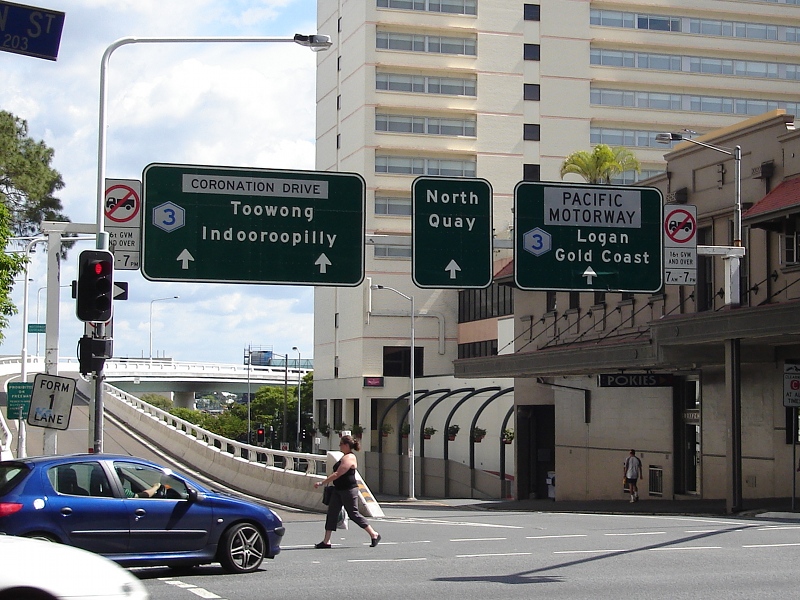
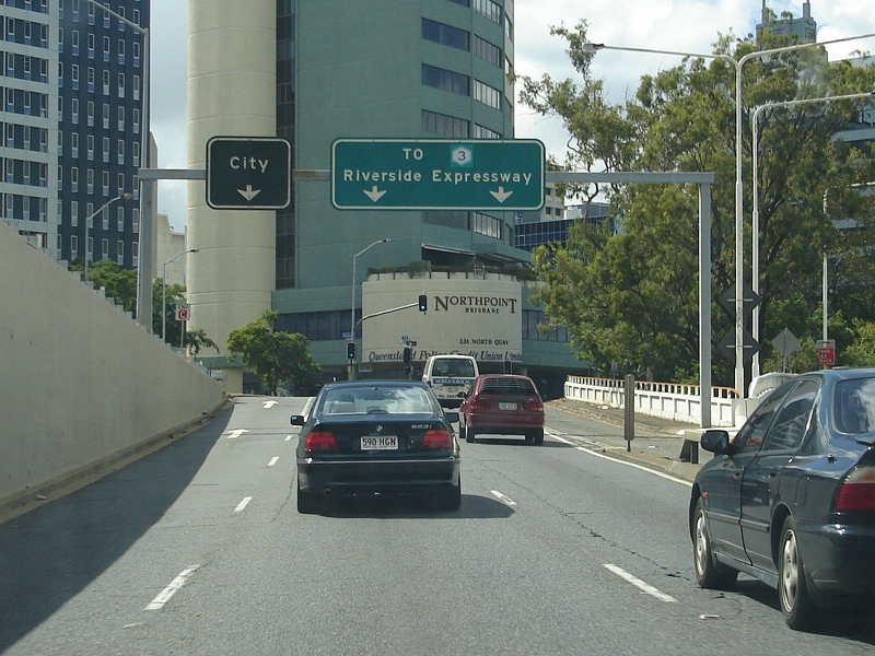 |
Black and Freeway Green
Signs: Signs over the lanes for North Quay and Pacific Motorway (former Riverside Expressway) in Brisbane, March 2006. Click here for a photo of this location by Michael Greenslade from May 2005. Image © Paul Rands |
|||
 |
North Quay and Pacific
Motorway Access: Southbound through the Brisbane CBD, with North Quay on the left of the traffic island, and access to the Pacific Motorway on the right hand side, as you approach Herschel Street. March 2006. Image © Paul Rands |
|||
 |
Intersection
Directional Signs: Signs over the lanes for Pacific Motorway and North Quay facing Ann Street traffic in the Brisbane CBD. March 2006. Image © Paul Rands |
|||
 |
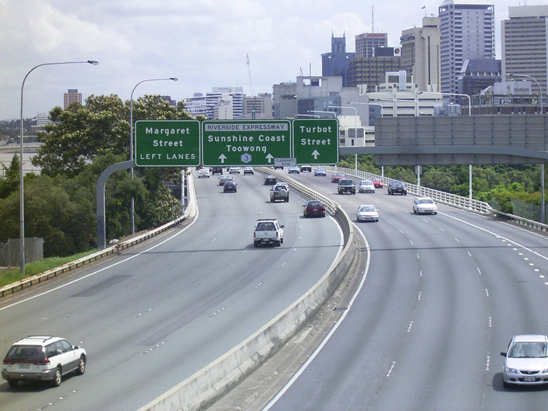
Advance Directional
Sign: Older style AD sign for the Elizabeth St off ramp on the Pacific Mwy (former Riverside Expwy), Brisbane, March 2006. Image © Paul Rands |
|||
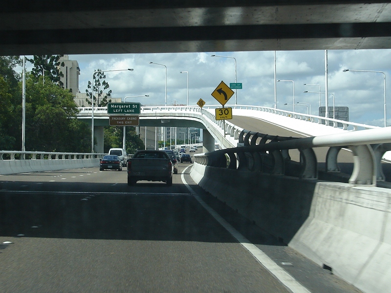 |
Advance Directional
Sign: The ramp to Elizabeth Street with Melbourne Street overpass overhead, with the AD sign for the Margaret St exit in the distance, March 2006. Image © Paul Rands |
|||
 |
Alice Street
Interchange: Pacific Mwy (former Riverside Expwy) as you pass through the Alice Street Interchange in Brisbane, March 2006. Image © Paul Rands |
|||
 |
Intersection
Directional Signs: ID signs over the lanes facing Alice St traffic in the Brisbane CBD, March 2006. Image © Paul Rands |
|||
 |
Captain Cook Bridge and
Advance Directional Sign: Pacific Mwy southbound over the Captain Cook Bridge, over the Brisbane River and AD sign for Vulture St / Stanley St (SR41) interchange in the distance, March 2006. Image © Paul Rands |
|||
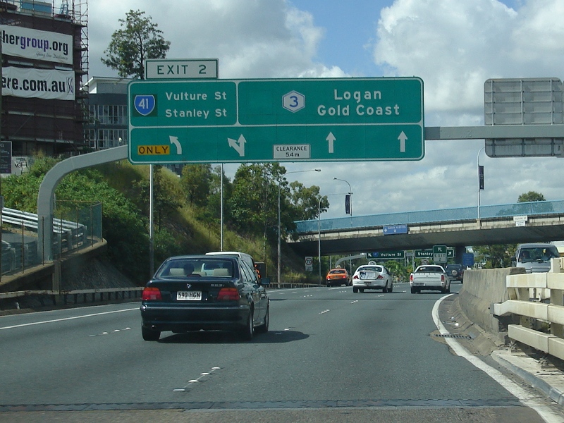 |
Vulture
St / Stanley St Interchange: Freeway green ID sign over the lanes of the Pacific Mwy in Kangaroo Point at the Vulture St & Stanley St (SR41) interchange. March 2006. Image © Paul Rands |
|||
 |
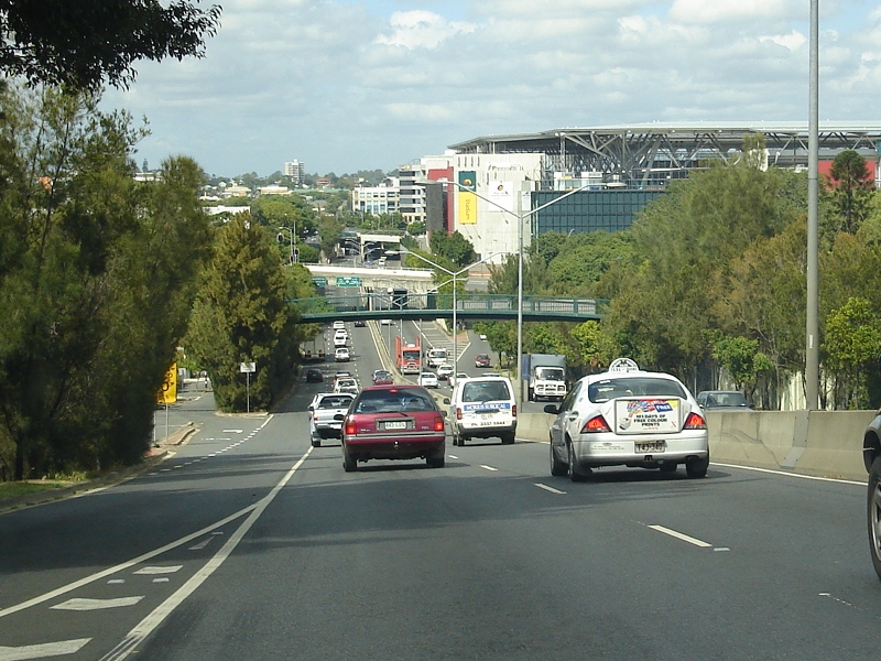
Pacific Motorway: View of Pacific Mwy (Metroad 3) at Woolloongabba, from Hawthorne St overpass, March 2004. Image © Michael Greenslade |
|||
 |
Freeway Green RD Sign: Freeway green distance sign at Woolloongabba, near Hawthorne St overpass, March 2004. |
|||
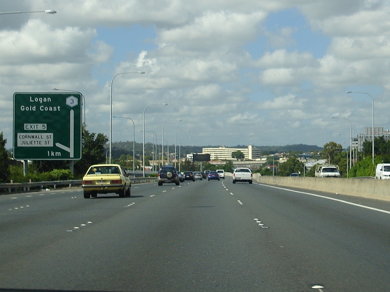 |
Advance Directional
Sign: Southbound AD sign at Woolloongabba approaching Cornwall and Juliette Streets, March 2006. Image © Paul Rands |
|||
 |
Intersection
Directional Sign: ID sign at the corner of Cornwall and Marquis Street in Greenslopes, October 2005. Image © Paul Rands |
|||
 |
Advance Directional
Sign: Diagrammatic AD sign on Marquis St approaching Juliette St and Pacific Mwy in Greenslopes, October 2005. Image © Paul Rands |
|||
 |
Distance Sign: Distance sign after the Cornwall St / Juliette St interchange in Greenslopes, October 2005. Image © Paul Rands |
|||
 |
Advance Directional
Sign: AD sign approaching the Marshall Rd (SR10/11) interchange at Holland Park West, March 2006. Image © Paul Rands |
|||
 |
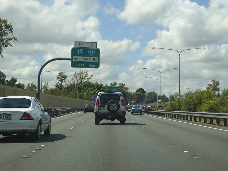
Marshall Road
Interchange: Southbound through the Marshall Rd (SR10/11) interchange at Holland Park West, March 2006. Image © Paul Rands |
|||
 |
Klumpp Road & Mains
Road AD sign: Advance diredctional sign approaching the Klumpp Rd and Mains Rd (SR36) interchange at Mt Gravatt, March 2006. Image © Paul Rands |
|||
 |
Klumpp Road & Mains
Road Interchange: Southbound ID sign at the Klumpp Road and Mains Road (SR36) interchange in Mt Gravatt, March 2006. Image © Paul Rands |
|||
 |
Southbound Distance
Sign: RD sign near the Mains Rd / Klumpp Rd interchange in Mt Gravatt, May 2005. Image © Michael Greenslade |
|||
 |
Distance Sign: RD sign at Upper Mt Gravatt, southbound near the beginning of the transit lane, March 2006. Image © Paul Rands |
|||
 |
Advance Directional
Sign: AD sign at Upper Mt Gravatt for Logan Rd (SR95, former NR1), March 2006. Kessells Rd (Metroad 2) overpass behind the sign. Image © Paul Rands |
|||
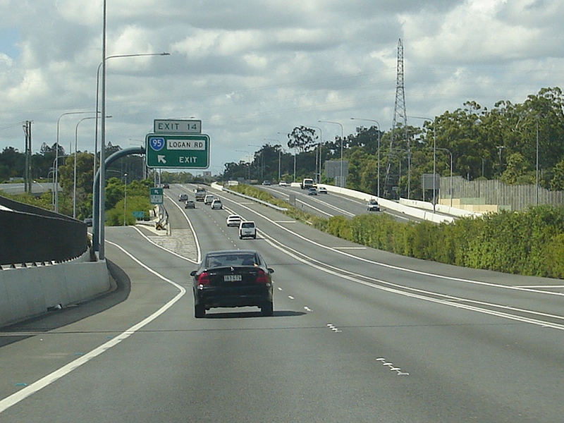 |
Logan Road Interchange: Looking southbound through the Logan Rd (SR95) interchange at Eight Mile Plains, March 2006. Image © Paul Rands |
|||
 |
Distance Sign: RD sign, southbound after the Logan Rd (SR95) interchange at Eight Mile Plains, March 2006. Image © Paul Rands |
|||
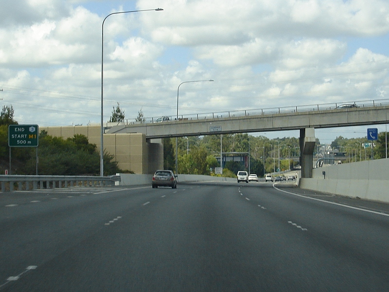 |
End Metroad 3 500m: Sign beside the Miles Platting Rd (SR56) overpass at Eight Mile Plains indicating 500 metres to the end of Metroad 3. March 2006. Image © Paul Rands |
|||
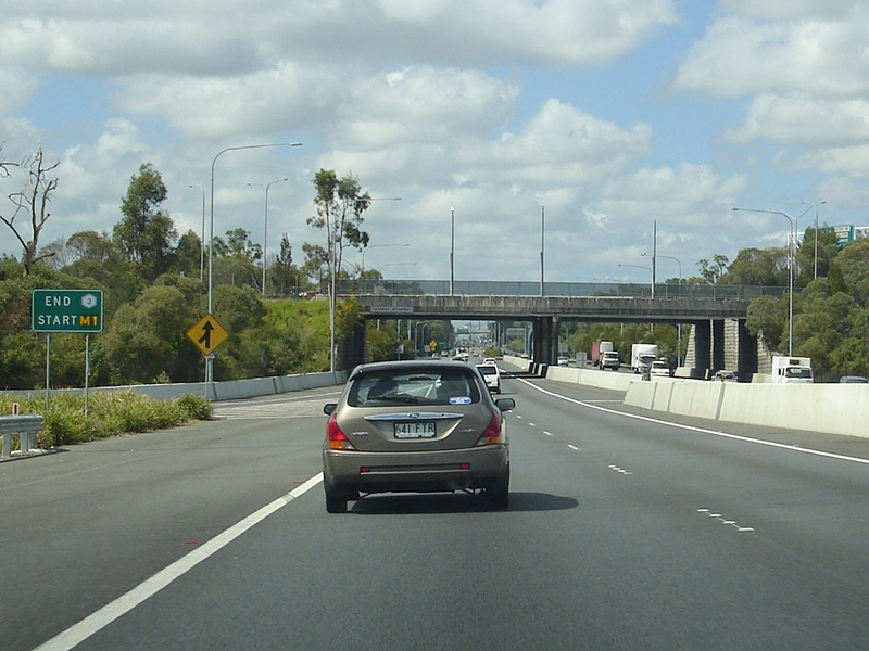 |
End Metroad 3: Sign at the interchange with Gateway Mwy (M1 and former Metroad 4, now M2) and Pacific Mwy (M1) at Eight Mile Plains, indicating the end of Metroad 3. March 2006. Image © Paul Rands |
|||
| Click here for the continuation of Metroad 3 between Brisbane and Bald Hills | ||||
1 State Road
Network of Queensland Map, 30 June 2008
2 Queensland Roads, March 2009
3 The 200 km City Web Site
4 Queensland Roads, Edition No. 4, Sept
07
5 Redcliffe City Library
6 Queensland State Archives, 1972
Cabinet Minutes
7 Queensland State Archives, 1975
Cabinet Minutes Historian's Report
8 Queensland State Archives, 1976
Cabinet Minutes
9 Brisbane City Council Annual Report
06-07
10 Busway Website History Web Page
11 Michael Greenslade
Last updated: 26-Oct-2021 1:15
This site © Paul Rands. All rights reserved. Some portions © (copyright) by their respective and credited owners. Permission must be obtained before using any images from this site. For details, please email by clicking here.