|
|
|
|
|
 |
New England Highway (National Highway 15) - Guyra to Deepwater (Decommissioned) |
Statistics:
Route Numbering:


General Information:
National Highway 15 is one the major routes in New South Wales and Queensland. It links the farming regions of NSW to the ports at Newcastle and also to other major roads to Sydney and it's also a link to Brisbane's metropolitan area.
The route consists of single carriageway 2-lane rural highway, through to multi-lane divided sections, and includes two multiplexes: National Route 34, the Oxley Highway, between Tamworth and Bendemeer, and also National Route 38, the Gwydir Highway at Glen Innes.
History:
The New England Highway originally formed part of the Great Northern Road from Sydney via Wiseman's Ferry to the Queensland border (near Mt Lindesay), taking shape as settlement spread northward from the lower Hunter Valley. By 1851 the Great Northern Road had reached the Gap, two miles beyond Murrurundi. In 1858 it was classified as one of three Main Roads in the colony (Great Western and Great Southern) and extended from Morpeth via Maitland, Singleton, Muswellbrook, Scone, Murrurundi and Tamworth, to Armidale, a distance of about 236 miles. Captain Martindale, Chief Railway Commissioner, who was also responsible for roads, stressed the need for bridges as in many cases long circuits had to be made to find a crossing over a stream. In 1860 arrangements were in progress for building 90 culverts and minor bridges and for forming new sections of road, including a new ascent to Murrurundi Gap, which was previously steep with sharp dangerous turns. In 1865 the section of road between Muswellbrook and Murrurundi was metalled and a deviation suggested between Blandford and Murrurundi to skirt the Page River, obviating two bridges, however, such a deviation was never constructed. With the construction of the Northern Railway line from Newcastle, commenced in the 1850s and reaching Murrurundi in 1872, attention was diverted away from roads and sections of the Great Northern Road were in poor condition. Despite the impact of the railway, roads developed steadily and considerable progress was made in the bridging of rivers and creeks. 2
Click here for the former alignment in the Ben Lomond area.
| Guyra to Deepwater | Deepwater to Guyra | |||
| Preview: | Description: | Preview: | Description: | |
 |
Northbound at Llangothlin: Entering the small town of Llangothlin, January 2006. Image © Paul Rands |
 |
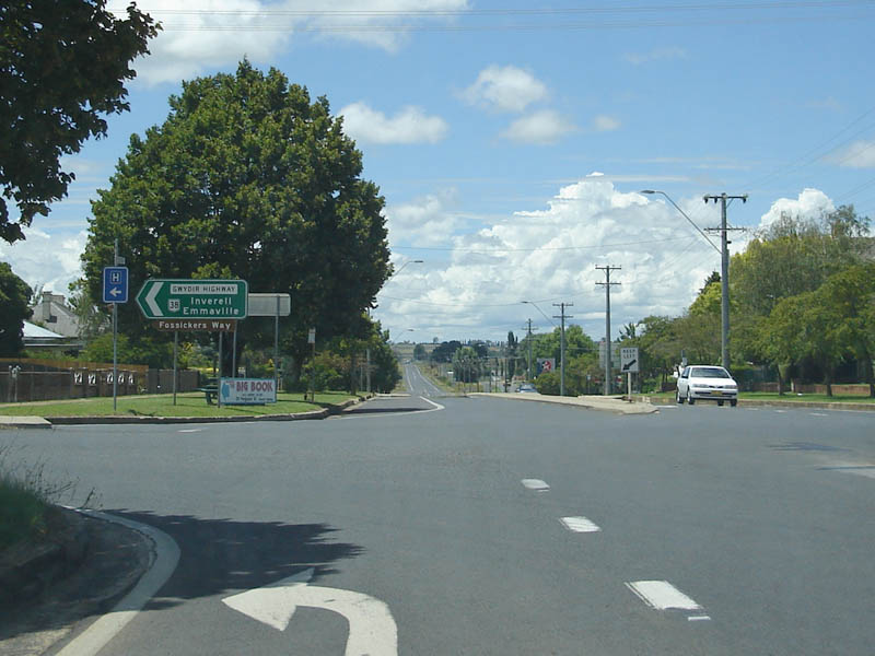
Advance Directional Sign: Eastbound on the Gwydir Hwy (Ferguson Street) as you approach the New England Hwy in Glen Innes, January 2006. Image © Paul Rands |
|
 |
Northbound at Llangothlin: The small town of Llangothlin, January 2006. Image © Paul Rands |
 |
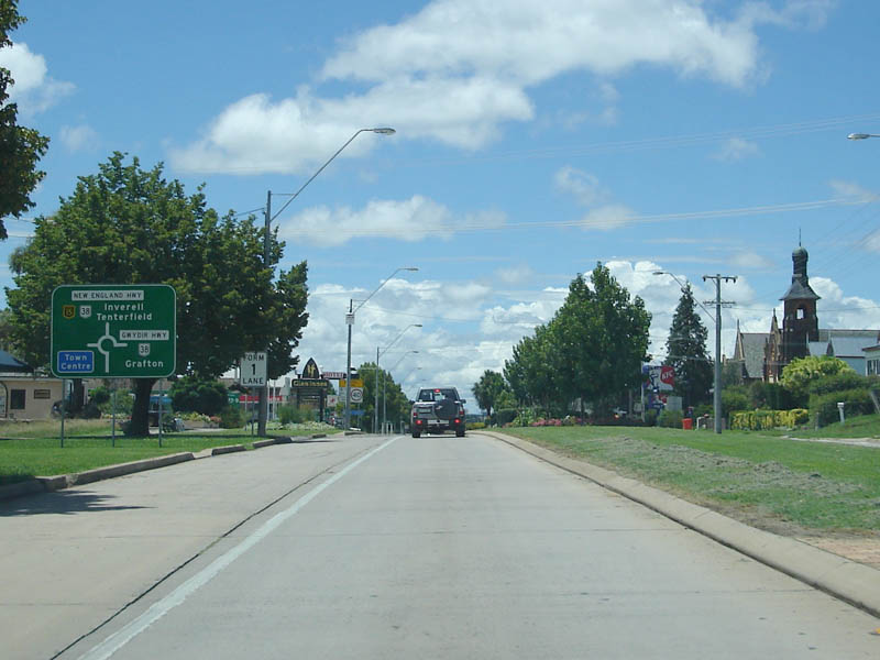
Intersection Directional Sign: Eastbound on the Gwydir Hwy (Ferguson Street) at the junction with the New England Hwy in Glen Innes, January 2006. The NR38 duplex begins here. Image © Paul Rands |
|
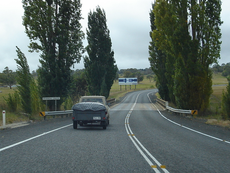 |
Crossing Ryanda Creek: Northbound at Llangothlin. March 2006. Image © Paul Rands |
 |
Advance Directional Sign: Southbound advance directional sign for the Gwydir Hwy (Meade St) roundabout at Glen Innes, July 2007. The NR38 duplex ends at this intersection. Image © Paul Rands |
|
 |
Northbound at Ben Lomond: Junction with Tubbumurra Road. March 2006. Image © Paul Rands |
 |
Distance Sign: RD sign as you leave the town of Glen Innes, May 2005. Image © Rob Tilley |
|
 |
Streeter Road Junction: Approaching the intersection with Streeters Road at Ben Lomond. March 2006. Image © Rob Tilley |
|||
 |
Typical scenery through Ben Lomond: Northbound, March 2006. Image © Rob Tilley |
|||
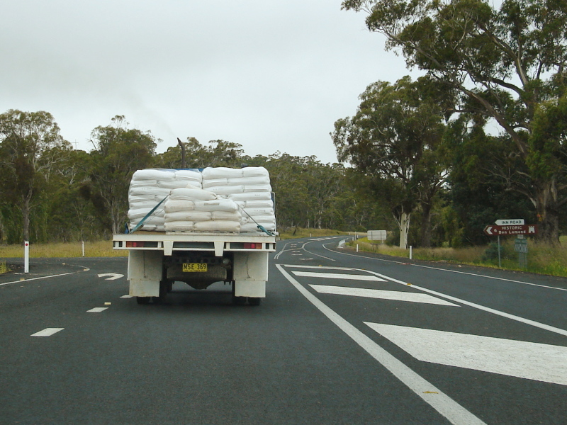 |
Inn Road intersection: Junction with Inn Road at Ben Lomond, March 2006.. Image © Rob Tilley |
|||
 |
Northbound Over Ben Lomond Hill: Scenery as you pass over the Ben Lomond Hill, January 2006. Image © Paul Rands |
|||
 |
Ben Lomond Hill: Scenery as you clib Ben Lomond Hill, January 2006. Image © Paul Rands |
|||
 |
Ben Lomond Range: Scenery as you pass over the Ben Lomond Range, July 2007. Image © Rob Tilley |
|||
 |
Ben Lomond Hill: Scenery as you pass over the Ben Lomond Hill, January 2006. This section is quite windy but has spectacular scenery and a couple of very steep safety ramps. Image © Paul Rands |
|||
 |
Ben Lomond Hill: Image © Paul Rands |
|||
 |
Ben Lomond Hill: Scenery as you pass over the Ben Lomond Hill, January 2006. This section is quite windy but has spectacular scenery and a couple of very steep safety ramps - note the one in the centre of the photo. Image © Paul Rands |
|||
 |
End Truck & Bus Speed Limit: Image © Paul Rands |
|||
 |
Beardy Waters: Crossing Beardy Waters at Stonehenge, January 2006 Image © Paul Rands |
|||
 |
Redbank Creek: Northbound as you cross Redbank Creek near Glen Innes, January 2006. Image © Paul Rands |
|||
 |
Glen Innes: Southern entry to the town of Glen Innes, January 2006. Image © Paul Rands |
|||
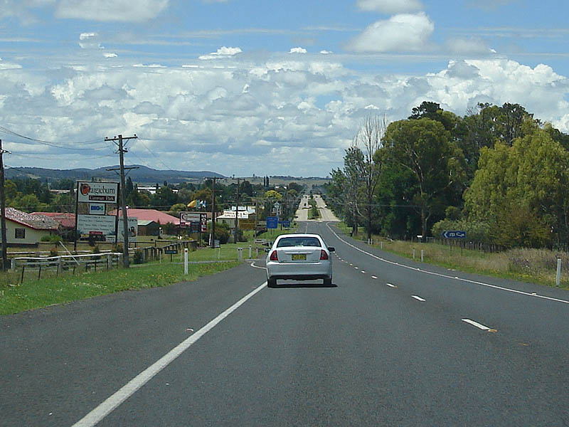 |
Entering Glen Innes: Northbound outside the Craigieburn Caravan Park at Glen Innes. Note the divided highway ahead, it's quite an old section of concrete roadway. January 2006. Image © Paul Rands |
|||
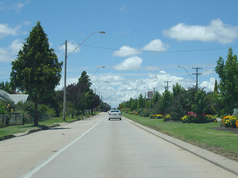 |
New England Highway (Church Street) Glen Innes: Typical roadway qualities and scenery as you drive through Glen Innes. January 2006. Image © Paul Rands |
|||
 |
Old Directional Signs: One of a few old directional fingerboards located in Glen Innes facing side streets on the highway. These are metal signs, unlike older ones of the same style which are wooden. Corner of Lang and Church Streets (NH15), January 2006. Image © Paul Rands |
|||
 |
Advance Directional Signage: Advance directional signage as you approach the NR38 duplex and the Meade Street roundabout, January 2006. Image © Paul Rands |
|||
 |
Intersection Directional Sign: ID sign on the Meade Street roundabout, and the start of the NR38 duplex which lasts 150 metres through Glen Innes. January 2006. Image © Paul Rands |
|||
 |
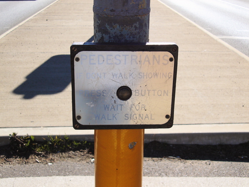
Advance Directional Signage: AD signage at the pedestrian signals outside the Catholic church and school on Church Street Glen Innes. These signals are a very old installation with yellow paint showing through the 1970s green colour. They have been refitted sometime this decade with Aldrige Traffic Systems halogen lanterns, and Bob Panich / AWA call buttons, except the call button on the centre island, it has retained the original brass and cast iron call button box, click here for a photo of the call button. January 2006. Click here for a close up of this sign taken July 2007. Image © Paul Rands |
|||
 |
NR38 Split: National Route 38 (Gwydir Hwy) leaves the New England Highway here at Ferguson Street, Glen Innes, January 2006. Image © Paul Rands |
|||
 |
Distance Sign: RD signage as you leave Glen Innes towards Tenterfield and Queensland, January 2006. Image © Paul Rands |
|||
 |
AD Sign: Advance directional sign for the Dundee - Bald Nob Road intersection at Dundee. Northbound, January 2006. Image © Paul Rands |
|||
 |
Dundee - Bald Nob Road: Dundee - Bald Nob Road intersection at Dundee. Northbound, January 2006. Image © Paul Rands |
|||
 |
Entering Dundee: Northbound as you enter the town of Dundee, January 2006. Image © Paul Rands |
|||
 |
Safe-T-Cam: Image © Paul Rands |
|||
 |
Directional Signage: This sign faces northbound traffic at the southern end of Rangers Valley Road at Dundee. January 2006. Image © Paul Rands |
|||
 |
AD Sign: Northbound at Deepwater as you approach the Emmaville turn off. January 2006. Image © Paul Rands |
|||
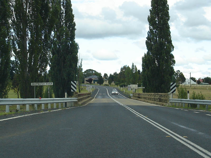 |
Deepwater River: Crossing the Deepwater River at Deepwater. January 2006, northbound. Image © Paul Rands |
|||
 |
Deepwater Town Centre: Looking north through Deepwater, January 2006. Image © Paul Rands |
|||
 |
Distance Signage: Northbound on the New England Highway at Greenfly near Deepwater. Wallangarra & Jenkins are at the NSW - QLD border but don't rate a mention here. January 2006. Image © Paul Rands |
|||
| Click here for the continuation of National Highway 15 between Deepwater and the QLD Border Click here for the continuation of National Highway 15 between Guyra and Armidale |
||||
1 National Library of Australia
2 Roads and Traffic Authority
3 Department of Infrastructure, Transport, Regional Development and Local Government
Last updated: 17-Dec-2019 0:55
This site © Paul Rands. All rights reserved. Some portions © (copyright) by their respective and credited owners. Permission must be obtained before using any images from this site. For details, please email by clicking here.