|
|
|
|
|
 |
New England Highway (National Highway 15) - Tamworth to Bendemeer (Decommissioned) |
Statistics:
Route Numbering:

General Information:
National Highway 15 is one the major routes in New South Wales and Queensland. It links the farming regions of NSW to the ports at Newcastle and also to other major roads to Sydney and it's also a link to Brisbane's metropolitan area.
The route consists of single carriageway 2-lane rural highway, through to multi-lane divided sections, and includes two multiplexes: National Route 34, the Oxley Highway, between Tamworth and Bendemeer, and also National Route 38, the Gwydir Highway at Glen Innes.
History:
The New England Highway originally formed part of the Great Northern Road from Sydney via Wiseman's Ferry to the Queensland border (near Mt Lindesay), taking shape as settlement spread northward from the lower Hunter Valley. By 1851 the Great Northern Road had reached the Gap, two miles beyond Murrurundi. In 1858 it was classified as one of three Main Roads in the colony (Great Western and Great Southern) and extended from Morpeth via Maitland, Singleton, Muswellbrook, Scone, Murrurundi and Tamworth, to Armidale, a distance of about 236 miles. Captain Martindale, Chief Railway Commissioner, who was also responsible for roads, stressed the need for bridges as in many cases long circuits had to be made to find a crossing over a stream. In 1860 arrangements were in progress for building 90 culverts and minor bridges and for forming new sections of road, including a new ascent to Murrurundi Gap, which was previously steep with sharp dangerous turns. In 1865 the section of road between Muswellbrook and Murrurundi was metalled and a deviation suggested between Blandford and Murrurundi to skirt the Page River, obviating two bridges, however, such a deviation was never constructed. With the construction of the Northern Railway line from Newcastle, commenced in the 1850s and reaching Murrurundi in 1872, attention was diverted away from roads and sections of the Great Northern Road were in poor condition. Despite the impact of the railway, roads developed steadily and considerable progress was made in the bridging of rivers and creeks. 2
Click here for the former alignment in the Tintinhull area.
Click here for the former alignment in the Kootingal area.
Click here for the former alignment in the Moonbi area.
Click here for the former alignment in the Bendemeer area.
| Tamworth to Bendemeer | Bendemeer to Tamworth | |||
| Preview: | Description: | Preview: | Description: | |
 |
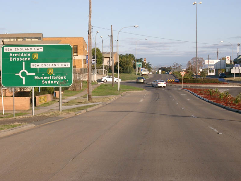
Intersection Directional Sign: Image © Paul Rands |
 |
Advance Directional Sign: AD sign approaching Oxley Hwy (NR34) at Bendemeer. May 2005. There should be an NR34 shield next to the NH15, as NR34 duplexes the route from this intersection to Tamworth's town centre. Image © Rob Tilley |
|
 |
Supplemental Advance Directional Sign: Image © Paul Rands |
 |
Oxley Hwy ID Sign Assembly: Sign assembly on the corner of New England Hwy and Oxley Hwy in Bendemeer. May 2005. Image © Rob Tilley |
|
 |
Advance Directional Sign: Image © Paul Rands |
 |
Advance Directional Sign: Southbound AD sign approaching Havana Street in Bendemeer, May 2005. This sign should have an NR34 shield alongside the NH15 shield. Image © Rob Tilley |
|
 |
Advance Directional Sign: Northbound on New England Hwy (Goonoo Goonoo Rd) in South Tamworth, approaching Wilburtree St. August 2011. Click here for a photo of this location by Paul Rands from July 2007. Image © Paul Rands |
 |
Intersection Directional Sign: Southbound intersection directional sign at the intersection with Havana Street in Bendemeer, May 2005. Image © Rob Tilley |
|
 |
Advance Directional Sign: AD sign approaching the intersection with Vera St and Scott Rd. New England Hwy (NH15), turns right at this roundabout, after being rerouted along Scott Rd during the 1990s. August 2011. Click here for a photo of this location by Paul Rands from July 2007. Image © Paul Rands |
 |
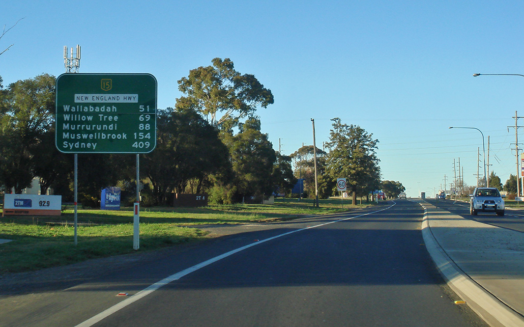
Distance Sign: Southbound RD sign as you leave the town of Bendemeer. May 2005. This sign should have an NR34 shield alongside the NH15 shield. Image © Rob Tilley |
|
 |
Vera St / Scott Rd / Goonoo Goonoo Rd Intersection: The intersection with Vera St and Scott Rd in Sth Tamworth. New England Hwy (NH15), turns right at this roundabout, after being rerouted along Scott Rd during the 1990s. July 2007. Image © Paul Rands |
 |
Safe-T-Cam: Approaching the Safe-T-Cam in Bendemeer, March 2004. Image © Paul Rands |
|
 |
Intersection Directional Sign: ID sign on the intersection with Vera St and Scott Rd in South Tamworth. New England Hwy (NH15), turns right at this roundabout, after being rerouted along Scott Rd during the 1990s. July 2007. Image © Paul Rands |
 |
Second Moonbi Hill: The New England Hwy as it makes its way down Second Moonbi Hill, September 2005. Image © Paul Rands |
|
 |
Supplemental AD Sign: Supplemental advance directional sign on Scott Rd (New England Hwy) in Tamworth. July 2007. Image © Paul Rands |
 |
Second Moonbi Hill: The New England Hwy as it makes its way down Second Moonbi Hill, September 2005. Image © Paul Rands |
|
 |
Advance Directional Sign: AD signage as you approach Peel Street in Tamworth on the New England Highway (Scott Road), July 2007. Image © Paul Rands |
 |
Moonbi Town Centre: Southbound as the New England Hwy makes its way through Moonbi near Thomas St, September 2005. Image © Paul Rands |
|
 |
Advance Directional Sign: AD sign on Peel Street in Tamworth approaching New England Highway (NH15), August 2011. Image © Paul Rands |
 |
Chelmsford Street: Corner of New England Hwy (NH15) and Chelmsford St, Kootingal, August 2011. Image © Paul Rands |
|
 |
Intersection Directional Sign: ID sign on the roundabout on the corner of Peel Street, Murray Street (NH15) and Scott Road (NH15) in Tamworth, September 2004. Image © Paul Rands |
 |
Sandy Road & Porcupine Lane: Corner of New England Hwy (NH15), Sandy Rd and Porcupine Ln, Kootingal, August 2011. Image © Paul Rands |
|
 |
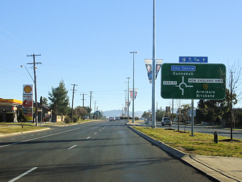
Advance Directional Signs: AD signs on Murray Street (New England Highway) in Tamworth as you approach the Marius St (Oxley Highway) roundabout, September 2004. New England Highway turns right at this roundabout and takes up the NR34 duplex from here to Bendemeer, even though it is not shown on the sign. Image © Paul Rands |
 |
Chaffey Lane & Tintinhull Road: Corner of New England Hwy (NH15), Chaffey Ln and Tintinhull Rd at Tintinhull, August 2011. Image © Paul Rands |
|
 |
Intersection Directional Sign: ID sign on Marius St (Oxley Hwy (NR34)), approaching the roundabout with Murray St (New England Hwy (NH15)) in Tamworth, August 2008. This section of NR34, was once a part of NH15. The straight ahead leg on the sign should show both NH15 and NR34 shields. Image © Paul Rands |
 |
Nemingha: New England Hwy (NH15) as it enters the village of Nemingha, August 2011. Image © Paul Rands |
|
 |
Intersection Directional Sign: ID sign on the Murray Street roundabout in Tamworth, August 2008. This sign is missing an NR34 shield, as the duplex with the Oxley Hwy (NR34) starts here. Image © Paul Rands |
 |
Advance Directional Sign: AD sign approaching Nundle Rd (TD23) and Railway St, Nemingha, August 2011. Image © Paul Rands |
|
 |
Distance Sign: RD sign after the Murray Street roundabout in Tamworth, August 2008. This sign is missing an NR34 shield, as the duplex with the Oxley Hwy runs along here, July 2007. Image © Paul Rands |
 |
Nundle Road & Railway Street: Corner of New England Hwy (NH15), Nundle Rd (TD23) and Railway St, Nemingha, August 2011. Image © Paul Rands |
|
 |
Services Sign: AD sign for the Tamworth Rest Area in East Tamworth. July 2007. Image © Paul Rands |
 |
Distance Sign: Southbound RD sign after the Nundle Road junction at Nemingha, May 2005. Note the missing NR34 shield. Image © Rob Tilley |
|
 |
AD Sign: Advance directional sign for Nundle Road (TD23) in Nemingha, September 2004. This sign should also show NR34, as it is duplexed along this section of the New England Hwy. Image © Paul Rands |
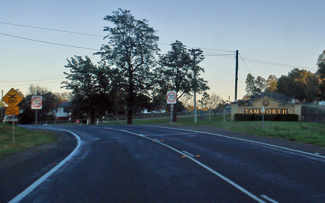 |
Tamworth: New England Hwy (NH15) entering the town of Tamworth, August 2011. Image © Paul Rands |
|
 |
Nundle Road Intersection: Travelling through the intersection with Nundle Road in Nemingha. July 2007. Image © Paul Rands |
 |
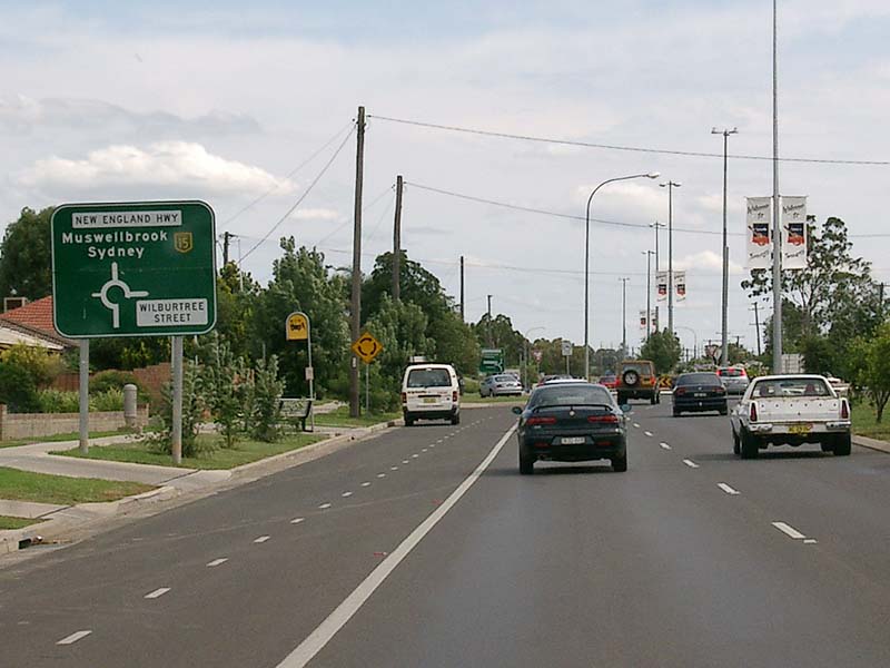
Advance Directional Sign: AD sign approaching the intersection with Murray Street in Tamworth. NR34 splits off here and goes straight (also former New England Highway). NH15 turns left at this junction. August 2011. Click here for a photo of this location by Paul Rands from October 2005. Image © Paul Rands |
|
 |
State Highway 9 Administration Post: Image © Paul Rands |
 |
Oxley Highway & Murray Street: Corner of New England Hwy (NH15), Oxley Hwy (NR34) and Murray St, Tamworth, August 2011. Image © Paul Rands |
|
 |
Distance Sign: RD sign as you leave the town of Nemingha, September 2004. This sign should also show NR34, as it is duplexed along this section of the New England Hwy. Image © Paul Rands |
 |
Advance Directional Sign: AD sign on Murray Street (New England Highway) for the Peel Street intersection, looking southwest at Tamworth. August 2011. Click here for a photo of this location by Paul Rands from November 2005. Image © Paul Rands |
|
 |
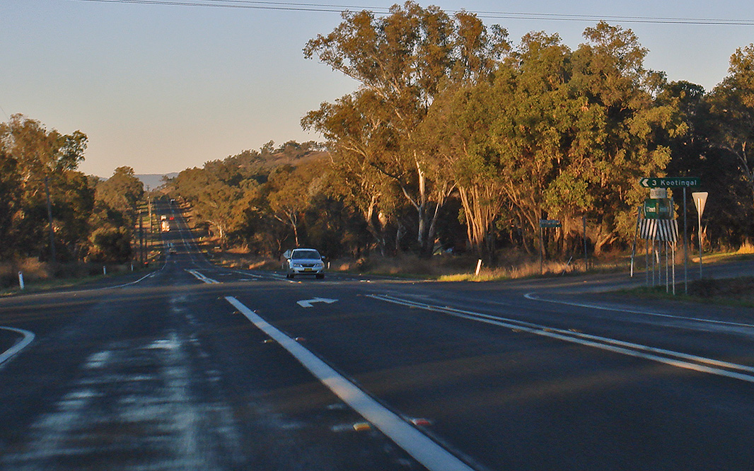
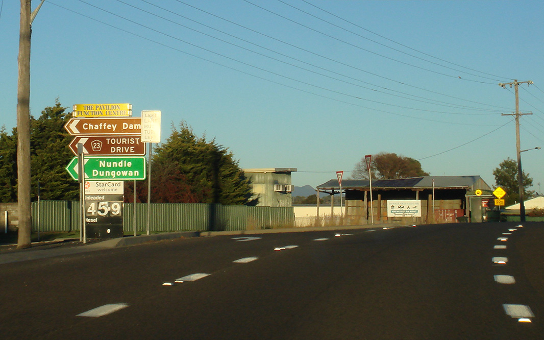
Services Sign: Services sign as you approach the town of Kootingal. July 2007. Click here for a photo of the sign this one replaced, taken in October 2004. Image © Paul Rands |
 |
Peel Street Intersection: Looking southwest at the intersection with Peel Street in Tamworth. Murray Street turns into Scott Road from this roundabout. November 2005. Image © Paul Rands |
|
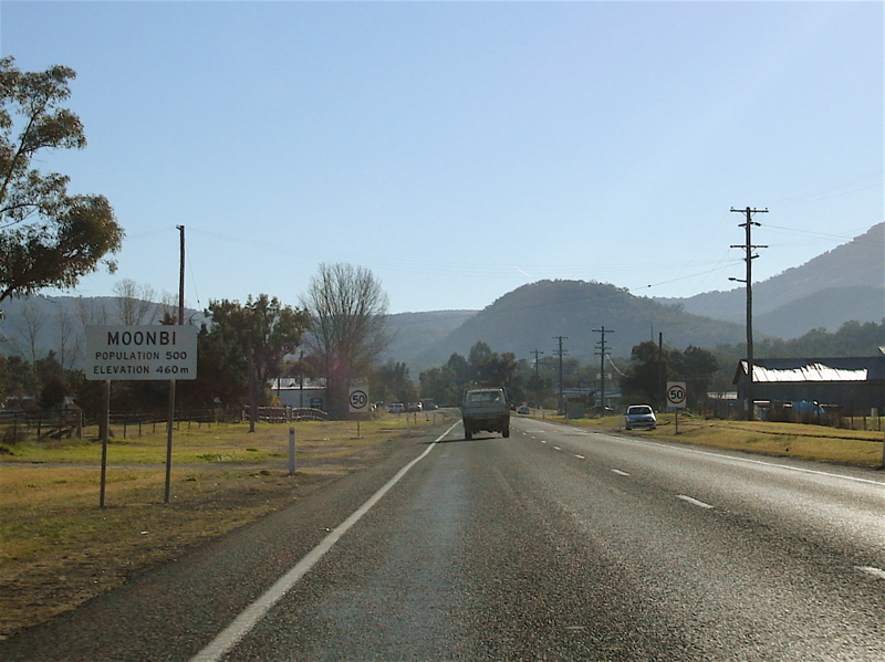 |
Entering Moonbi: New England Hwy as it enters the town of Moonbi, July 2007. Image © Paul Rands |
 |
Peel Street Intersection: Looking northwest at the intersection with Peel Street in Tamworth. October 2004. Image © Paul Rands |
|
 |
Divided Road Ahead Sign: Divided Road Ahead 1 km sign as you leave the town of Moonbi. The sign indicates the dual carriageway over First Moonbi Hill, which opened to traffic during the 1970s, July 2007. Image © Paul Rands |
 |
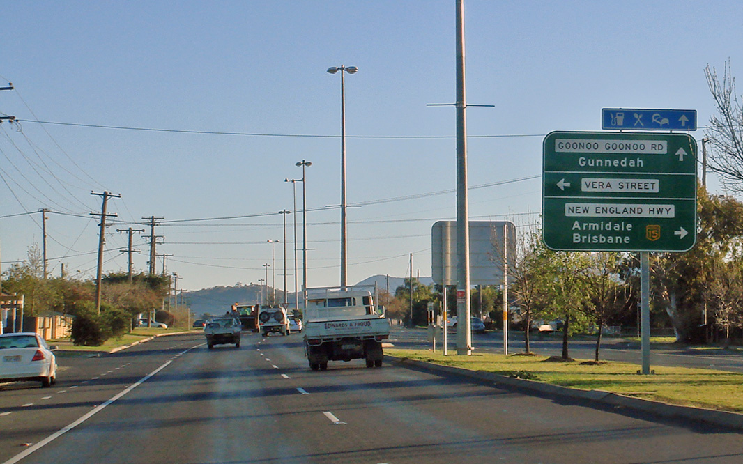
Advance Directional Sign: AD sign approaching the intersection with Goonoo Goonoo Road and Vera Street in South Tamworth, August 2011. Click here for a photo of this location by Paul Rands from September 2004. Image © Paul Rands |
|
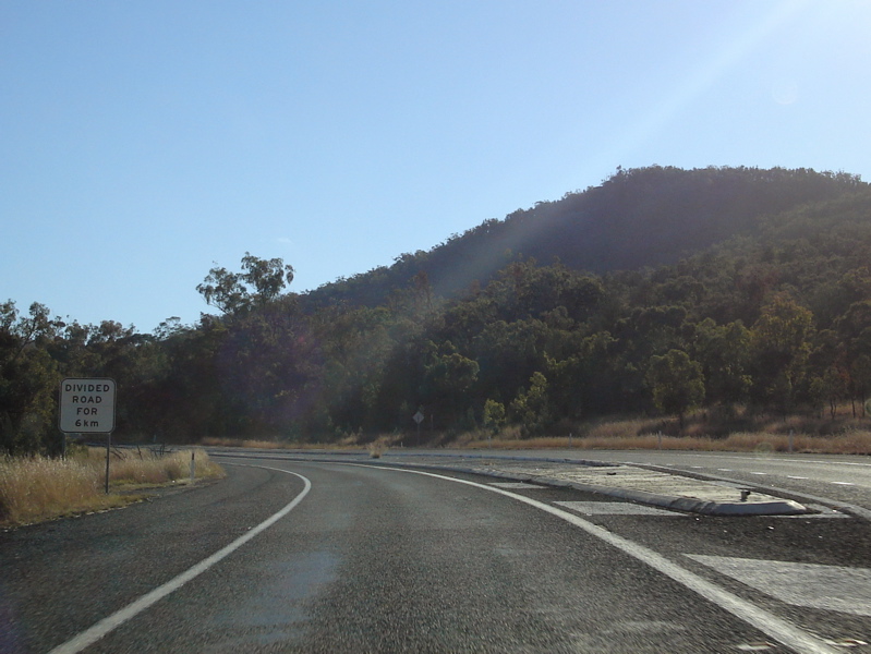 |
Divided Road Ahead Sign: Divided Road Ahead sign as you approach the dual carriageway over First Moonbi Hill, which opened to traffic during the 1970s, July 2007. Image © Paul Rands |
 |
Vera Street & Goonoo Goonoo Road: Corner of New England Hwy (NH15), Vera St and Goonoo Goonoo Rd at South Tamworth, August 2011. Image © Paul Rands |
|
 |
First Moonbi Hill: New England Hwy as it makes its way up First Moonbi Hill, July 2007. Image © Paul Rands |
 |
Advance Directional Sign: Southbound on New England Hwy (Goonoo Goonoo Rd) in South Tamworth, approaching Wilburtree St. August 2011. Click here for a photo of this location by Paul Rands from December 2004. Image © Paul Rands |
|
 |
First Moonbi Hill: New England Hwy as it makes its way up First Moonbi Hill, July 2007. Image © Paul Rands |
 |
Reassurance Directional Sign: Distance sign at South Tamworth, August 2011. Image © Paul Rands |
|
 |
First Moonbi Hill: New England Hwy as it makes its way up First Moonbi Hill, July 2007. Image © Paul Rands |
 |
Advance Directional Sign: AD sign at South Tamworth approaching Calala Ln roundabout, August 2011. Image © Paul Rands |
|
 |
Advance Directional Sign: AD sign for the Moonbi Lookout intersection, which utilises part of a former highway alignment, at Moonbi. July 2007. Image © Paul Rands |
 |
Advance Directional Sign: AD sign at South Tamworth approaching the entrance to the Big Golden Guitar, August 2011. Image © Paul Rands |
|
 |
End Divided Road: Approaching the end of the dual carriageways over Moonbi Hill, as you get closer to Second Moonbi Hill, September 2004. Image © Paul Rands |
 |
Advance Directional Sign: AD sign at South Tamworth approaching Ringers Rd and Greg Norman Dr, August 2011. Image © Paul Rands |
|
 |
Second Moonbi Hill: Heading up Second Moonbi Hill. July 2007. Image © Paul Rands |
 |
Reassurance Directional Sign: Distance sign at South Tamworth, August 2011. Image © Paul Rands |
|
 |
Services Sign: Services sign indicating travel times to the next 2 rest areas, Bendemeer. July 2007. Image © Paul Rands |
 |
Greg Norman Drive: Image © Paul Rands |
|
 |
Bendemeer: New England Hwy as it enters into the Bendemeer area, September 2004. Image © Paul Rands |
|||
 |
McDonald River: The New England Hwy as it passes over the McDonald River at Bendemeer, via the TA Perry Bridge, July 2007. Image © Paul Rands |
|||
 |
Lily Creek: The New England Hwy as it approaches Lily Ck near Bendemeer. July 2007. Image © Paul Rands |
|||
| Click here for the continuation of National Highway 15 between Bendemeer and Armidale Click here for the continuation of National Highway between Tamworth and Murrurundi |
||||
1 National Library of Australia
2 Roads and Traffic Authority
3 Department of Infrastructure, Transport, Regional Development and Local Government
Last updated: 12-Sep-2020 18:16
This site © Paul Rands. All rights reserved. Some portions © (copyright) by their respective and credited owners. Permission must be obtained before using any images from this site. For details, please email by clicking here.