|
|
|
|
|
 |
New England Highway (National Highway 15) - Scone to Murrurundi (Decommissioned) |
Statistics:
Route Numbering:

General Information:
National Highway 15 is one the major routes in New South Wales and Queensland. It links the farming regions of NSW to the ports at Newcastle and also to other major roads to Sydney and it's also a link to Brisbane's metropolitan area.
The route consists of single carriageway 2-lane rural highway, through to multi-lane divided sections, and includes two multiplexes: National Route 34, the Oxley Highway, between Tamworth and Bendemeer, and also National Route 38, the Gwydir Highway at Glen Innes.
History:
The New England Highway originally formed part of the Great Northern Road from Sydney via Wiseman's Ferry to the Queensland border (near Mt Lindesay), taking shape as settlement spread northward from the lower Hunter Valley. By 1851 the Great Northern Road had reached the Gap, two miles beyond Murrurundi. In 1858 it was classified as one of three Main Roads in the colony (Great Western and Great Southern) and extended from Morpeth via Maitland, Singleton, Muswellbrook, Scone, Murrurundi and Tamworth, to Armidale, a distance of about 236 miles. Captain Martindale, Chief Railway Commissioner, who was also responsible for roads, stressed the need for bridges as in many cases long circuits had to be made to find a crossing over a stream. In 1860 arrangements were in progress for building 90 culverts and minor bridges and for forming new sections of road, including a new ascent to Murrurundi Gap, which was previously steep with sharp dangerous turns. In 1865 the section of road between Muswellbrook and Murrurundi was metalled and a deviation suggested between Blandford and Murrurundi to skirt the Page River, obviating two bridges, however, such a deviation was never constructed. With the construction of the Northern Railway line from Newcastle, commenced in the 1850s and reaching Murrurundi in 1872, attention was diverted away from roads and sections of the Great Northern Road were in poor condition. Despite the impact of the railway, roads developed steadily and considerable progress was made in the bridging of rivers and creeks. 2
| Scone to Murrurundi | Murrurundi to Scone | |||
| Preview: | Description: | Preview: | Description: | |
 |
Entering Scone: New England Hwy (NH15) as it enters the town of Scone, December 2008. Image © Paul Rands |
 |
Descending the Murrurundi Range: View of the town of Murrurundi, as the New England Hwy makes its way down the Murrurundi Range into the town centre. December 2004. Image © Paul Rands |
|
 |
Gundy Road: Corner of New England Hwy (NH15) and Gundy Rd (TD29) in Scone, December 2008. Image © Paul Rands |
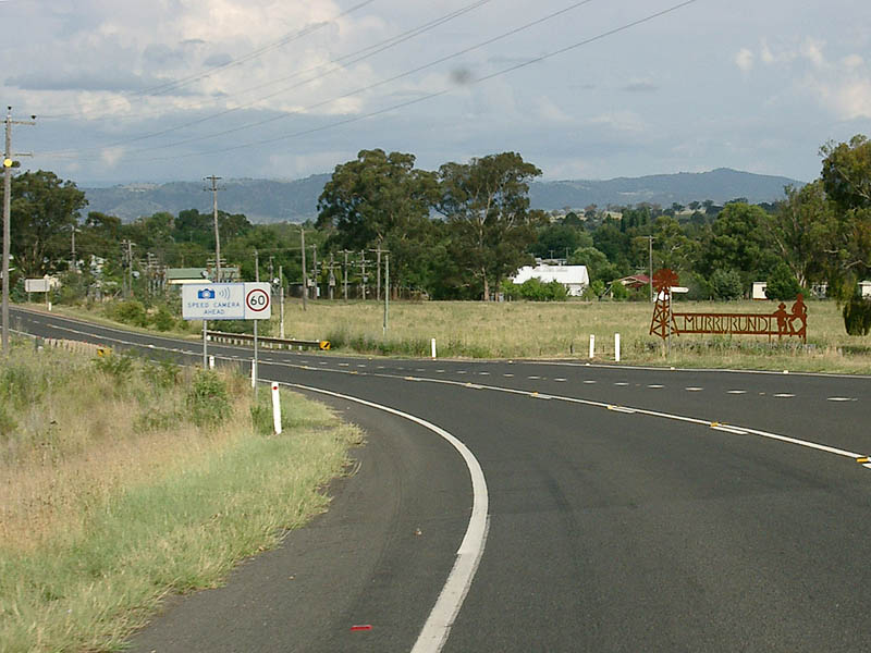 |
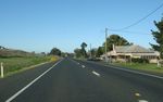
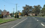
Entering Murrurundi: Southbound as you enter the town of Murrurundi. December 2004. Image © Paul Rands |
|
 |
Supplemental Advance Directional Sign: New England Hwy (NH15) in Scone approaching Liverpool St (TD27), December 2008. Image © Paul Rands |
 |
Murrurundi Town Centre: Looking southeast through Murrurundi on the New England Hwy (Mayne St), December 2004. Image © Paul Rands |
|
 |
Advance Directional Sign: New England Hwy (NH15) in Scone approaching Liverpool St (TD27), December 2008. Image © Paul Rands |
 |
Pages River: New England Hwy (NH15) as it crosses Pages River via Arnolds Bridge in Murrurundi, August 2011. Image © Paul Rands |
|
 |
Liverpool Street: New England Hwy (NH15) at the roundabout with Liverpool St in Scone, December 2008. Image © Paul Rands |
 |
Murrurundi Town Centre: New England Hwy (NH15) passing through Murrurundi, August 2011. Image © Paul Rands |
|
 |
Intersection Directional Sign: ID sign on the roundabout with Liverpool St in Scone, December 2008. Image © Paul Rands |
 |
Reassurance Directional Sign: Distance sign at Murrurundi, August 2011. Image © Paul Rands |
|
 |
Distance Sign: RD sign as you leave Scone, December 2008. Image © Paul Rands |
 |
Pages River: New England Hwy (NH15) as it crosses Pages River via Benhams Bridge in Murrurundi, August 2011. Image © Paul Rands |
|
 |
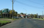
Entering Parkville: New England Hwy (NH15) as it enters the small town of Parkville, December 2008. Image © Paul Rands |
 |
Pages River: Blandford Bridge over the Pages River at Blandford. The left (northbound) carriageway is the newer bridge which was built during 2004, and the right (southbound) carriageway is an upgraded, former 2-way bridge built in 1953. December 2008. Image © Paul Rands |
|
 |
Entering Wingen: New England Hwy (NH15) as it enters the village of Wingen, December 2008. Image © Paul Rands |
 |
Entering Parkville: New England Hwy (NH15) as it enters the small town of Parkville, August 2011. Image © Paul Rands |
|
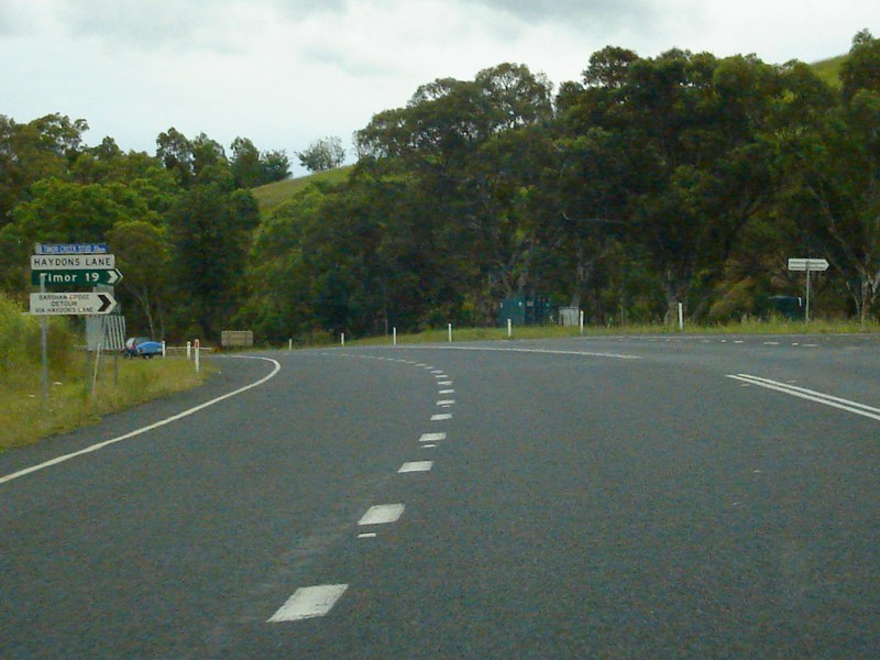 |
Haydons Lane: New England Hwy (NH15) at Blandford at the junction with Haydons Ln, December 2008. Image © Paul Rands |
 |
Timor Road: Corner of New England Hwy (NH15) and Timor Rd at Blandford, August 2011. Image © Paul Rands |
|
 |
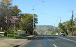
Entering Blandford: New England Hwy (NH15) as it enters the town of Blandford, December 2008. Image © Paul Rands |
 |
Entering Wingen: New England Hwy (NH15) as it enters the village of Wingen, August 2011. Image © Paul Rands |
|
 |
Pages River: Blandford Bridge over the Pages River at Blandford. The left (northbound) carriageway is the newer bridge which was built during 2004, and the right (southbound) carriageway is an upgraded, former 2-way bridge built in 1953. December 2008. Image © Paul Rands |
 |
Wingen: New England Hwy (NH15) as it passes through the village of Wingen, August 2011. Image © Paul Rands |
|
 |
Blandford: Passing through the town of Blandford. November 2004. Image © Paul Rands |
 |
Wingen: New England Hwy (NH15) as it passes through the village of Wingen, August 2011. Image © Paul Rands |
|
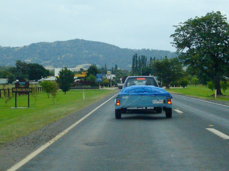 |
Entering Murrurundi: New England Hwy (NH15) as it enters the town of Murrurundi, December 2008. Image © Paul Rands |
 |
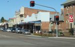
Scone: New England Hwy (NH15) entering the town of Scone, August 2011. Image © Paul Rands |
|
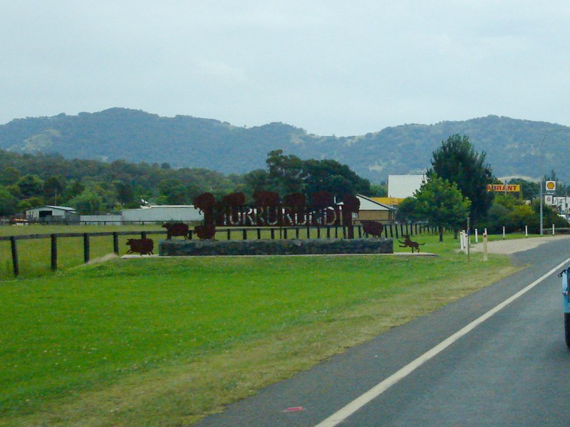 |
Entering Murrurundi: New England Hwy (NH15) as it enters the town of Murrurundi, December 2008. Image © Paul Rands |
 |
Entering Scone: New England Hwy (NH15) as it enters the town of Scone, August 2011. Image © Paul Rands |
|
 |
Murrurundi Town Centre: Looking northwest through Murrurundi on the New England Hwy (Mayne St), November 2004. Image © Paul Rands |
 |
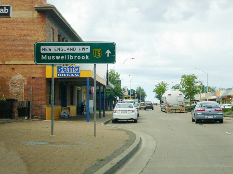
Muffett Street: Corner of New England Hwy (NH15) and Muffett St, Scone, August 2011. Image © Paul Rands |
|
 |
Pages River: New England Hwy (NH15) as it crosses Pages River via Arnolds Bridge in Murrurundi, December 2008. Image © Paul Rands |
 |
Staubins Street: New England Hwy (NH15) at the junction with Staubins St in Scone, August 2011. Image © Paul Rands |
|
 |
Murrurundi Town Centre: Looking northwest through Murrurundi on the New England Hwy (Mayne St), November 2004. Image © Paul Rands |
 |
Advance Directional Sign: New England Hwy (NH15) in Scone approaching Liverpool St (TD27), August 2011. Click here for a photo of this location by Paul Rands from December 2008. Image © Paul Rands |
|
 |
Nowlands Gap: New England Hwy (NH15) as it crosses Nowlands Gap on the Murrurundi Range, December 2008. Image © Paul Rands |
 |
Liverpool Street: Corner of New England Hwy (NH15) and Liverpool St, Scone, August 2011. Image © Paul Rands |
|
 |
Intersection Directional Sign: ID sign on the roundabout with Liverpool St in Scone, December 2008. This sign has since been removed due to the intersection being converted to traffic signals. Image © Paul Rands |
|||
 |
Supplemental AD sign: Supplemental advance directional sign approaching Gundy Rd (TD29) in Scone, August 2011. Image © Paul Rands |
|||
 |
AD sign: Advance directional sign approaching Gundy Rd (TD29) in Scone, August 2011. Image © Paul Rands |
|||
 |
Gundy Road: Corner of New England Hwy (NH15) and Gundy Rd (TD29) in Scone, August 2011. Click here for a photo of this location by Paul Rands from December 2008. Image © Paul Rands |
|||
 |
Gundy Road: Corner of New England Hwy (NH15) and Gundy Rd (TD29) in Scone, August 2011. Image © Paul Rands |
|||
 |
Distance Sign: RD sign as you leave Scone, August 2011. Click here for a photo of this location by Paul Rands from December 2008. Image © Paul Rands |
|||
 |
Turanville Road: Corner of New England Hwy (NH15) and Turanville Rd and Scone, August 2011. Image © Paul Rands |
|||
| Click here for the continuation of National Highway 15 between Murrurundi and Tamworth Click here for the continuation of National Highway 15 between Scone and Muswellbrook |
||||
1 National Library of Australia
2 Roads and Traffic Authority
3 Department of Infrastructure, Transport, Regional Development and Local Government
Last updated: 14-Sep-2020 20:53
This site © Paul Rands. All rights reserved. Some portions © (copyright) by their respective and credited owners. Permission must be obtained before using any images from this site. For details, please email by clicking here.