|
|
|
|
|
 |
New England Highway (National Highway 15) - Beresfield to Maitland (Decommissioned) |
Statistics:
Route Numbering:

General Information:
National Highway 15 is one the major routes in New South Wales and Queensland. It links the farming regions of NSW to the ports at Newcastle and also to other major roads to Sydney and it's also a link to Brisbane's metropolitan area.
The route consists of single carriageway 2-lane rural highway, through to multi-lane divided sections, and includes two multiplexes: National Route 34, the Oxley Highway, between Tamworth and Bendemeer, and also National Route 38, the Gwydir Highway at Glen Innes.
History:
The New England Highway originally formed part of the Great Northern Road from Sydney via Wiseman's Ferry to the Queensland border (near Mt Lindesay), taking shape as settlement spread northward from the lower Hunter Valley. By 1851 the Great Northern Road had reached the Gap, two miles beyond Murrurundi. In 1858 it was classified as one of three Main Roads in the colony (Great Western and Great Southern) and extended from Morpeth via Maitland, Singleton, Muswellbrook, Scone, Murrurundi and Tamworth, to Armidale, a distance of about 236 miles. Captain Martindale, Chief Railway Commissioner, who was also responsible for roads, stressed the need for bridges as in many cases long circuits had to be made to find a crossing over a stream. In 1860 arrangements were in progress for building 90 culverts and minor bridges and for forming new sections of road, including a new ascent to Murrurundi Gap, which was previously steep with sharp dangerous turns. In 1865 the section of road between Muswellbrook and Murrurundi was metalled and a deviation suggested between Blandford and Murrurundi to skirt the Page River, obviating two bridges, however, such a deviation was never constructed. With the construction of the Northern Railway line from Newcastle, commenced in the 1850s and reaching Murrurundi in 1872, attention was diverted away from roads and sections of the Great Northern Road were in poor condition. Despite the impact of the railway, roads developed steadily and considerable progress was made in the bridging of rivers and creeks. 2
Click here for construction photos of the Weakleys Drive intrchange at Beresfield.
Click here for Weakleys Drive, the road that links the Sydney-Newcastle Fwy (NH1) with New England Hwy (NH15) at Beresfield.
| Beresfield to Maitland | Maitland to Beresfield | |||
| Preview: | Description: | Preview: | Description: | |
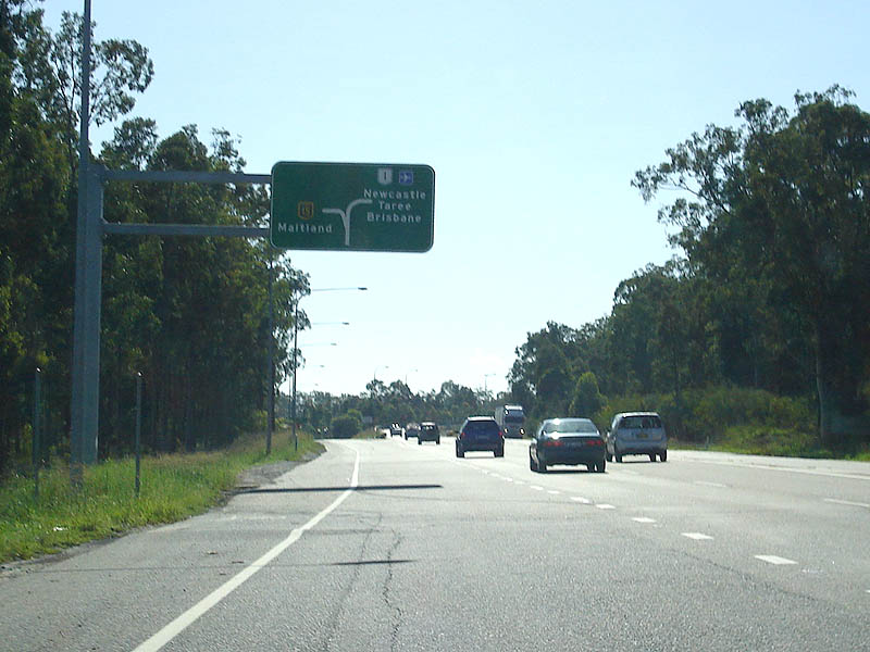 |
Advance Directional Sign: AD sign on John Renshaw Dr (NR1) approaching the interchange with New England Hwy at Beresfield. This interchange is the southern terminus for NH15. March 2007. Image © Paul Rands |
 |
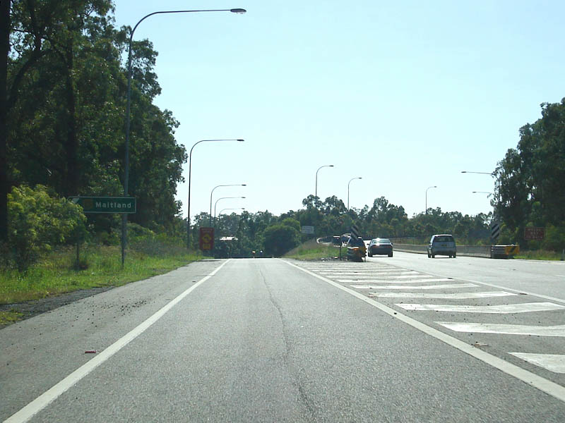
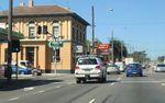
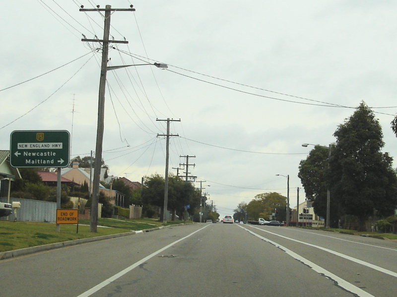
Maitland: New England Hwy (NH15) as it enters the town of Maitland, August 2011. Image © Paul Rands |
|
 |
New England Highway / John Renshaw Drive / Pacific Highway Interchange: Looking northeast at the New England Hwy (NH15) / John Renshaw Dr & Pacific Hwy (NR1) interchange at Beresfield. March 2007. Image © Paul Rands |
 |
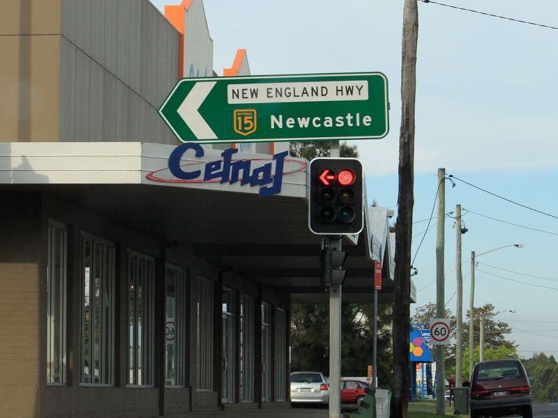
Advance Directional Sign: AD sign approaching Mt Pleasant St, Maitland, August 2011. Image © Paul Rands |
|
 |
New England Highway / John Renshaw Drive / Pacific Highway Interchange: Off ramp for the New England Hwy (NH15) at the John Renshaw Dr & Pacific Hwy (NR1) interchange at Beresfield. March 2007. Image © Paul Rands |
 |
Advance Directional Sign: AD sign approaching the roundabout with High St, Bungaree St and Johnson St at Maitland, August 2011. Image © Paul Rands |
|
 |
Distance Sign: First distance sign for the northbound carriageway of the New England Highway. Looking northeast at Beresfield, November 2010. Click here for a photo of this location from March 2007. Image © Rob Tilley |
 |
Intersection Directional Sign: ID sign on the roundabout with High St, Bungaree St and Johnson St at Maitland, August 2011. Image © Paul Rands |
|
 |
Advance Directional Sign: AD sign approaching Weakleys Dr, Beresfield, November 2010. Image © Rob Tilley |
 |
Intersection Directional Sign: ID sign on the roundabout with High St, Bungaree St and Johnson St at Maitland, August 2011. Image © Paul Rands |
|
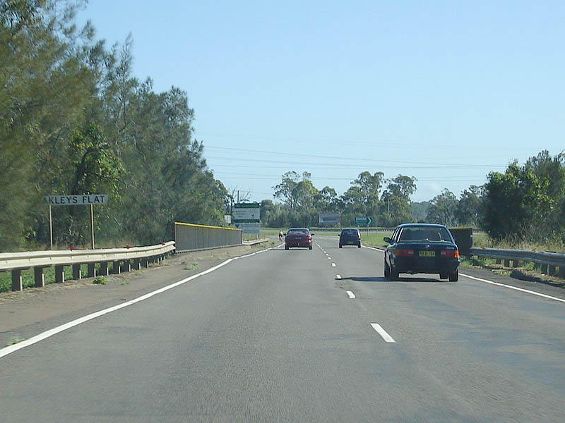 |
Weakleys Flat: Crossing Weakleys Flat at Beresfield. March 2007. Image © Paul Rands |
 |
Reassurance Directional Sign: Distance sign at Maitland, August 2011. Image © Paul Rands |
|
 |
Anderson Drive AD Sign: Advance directional sign for Anderson Drive (former New England Highway - Beresfield was bypassed during the 1970s) at Beresfield. March 2007. Image © Paul Rands |
 |
Main North Railway & North Coast Railway: New England Hwy (NH15) crossing the Main North Railway and North Coast Railway via PZ Trzecinski Bridge at Maitland, August 2011. Image © Paul Rands |
|
 |
Anderson Drive Intersection: Looking northwest at Anderson Drive in Beresfield, March 2007. Image © Paul Rands |
 |
Supplemental Advance Directional Sign: Supplemental AD sign approaching Cessnock Rd (SR135) and Church St, Maitland, August 2011. Image © Paul Rands |
|
 |
Weakleys Drive: Intersection directional sign at Weakleys Drive in Beresfield, November 2010. Click here for a photo of this location from March 2007. Image © Rob Tilley |
 |
Custom Warning Sign: Custom warning sign approaching Cessnock Rd (SR135) and Church St roundabout at Maitland, August 2011. Image © Paul Rands |
|
 |
Distance Sign: RD sign at Beresfield, November 2010. Image © Rob Tilley |
 |
Advance Directional Sign: AD sign approaching Cessnock Rd (SR135) and Church St, Maitland, August 2011. Image © Paul Rands |
|
 |
Supplemental Advance Directional Sign: Supplemental AD sign approaching Chisholm Dr in Ashtonfield, December 2008. Image © Paul Rands |
 |
Intersection Directional Sign: ID sign on the roundabout with Cessnock Rd (SR135) and Church St at Maitland, August 2011. Image © Paul Rands |
|
 |
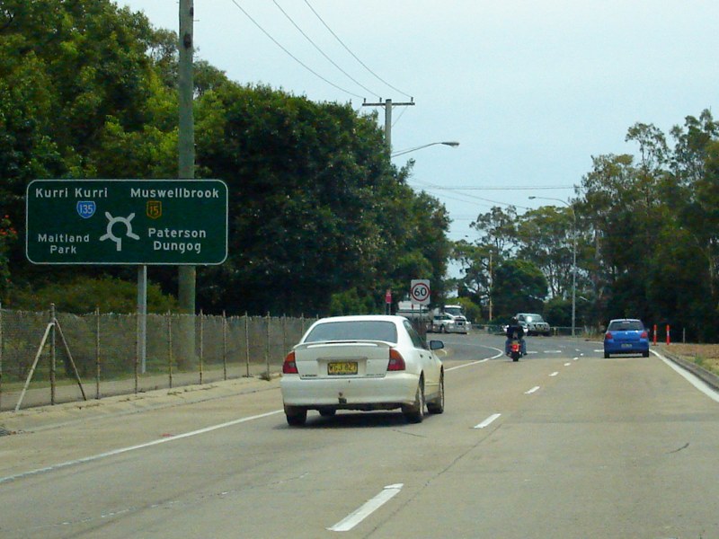
Chisholm Drive Intersection: Intersection directional sign at the Chisholm Dr junction at Ashtonfield, November 2010. Image © Rob Tilley |
 |
Intersection Directional Sign: ID sign on the roundabout with Cessnock Rd (SR135) and Church St at Maitland, August 2011. Image © Paul Rands |
|
 |
Supplemental Advance Directional Sign: Supplemental AD sign near Chisholm Dr in Ashtonfield for the Morpeth Rd (TD31) intersection, December 2008. Image © Paul Rands |
 |
Reassurance Directional Sign: Distance sign at Maitland, August 2011. Image © Paul Rands |
|
 |
Chelmsford Drive: New England Hwy (NH15) at the junction with Chelmsford Dr in East Maitland, December 2008. Image © Paul Rands |
 |
Advance Directional Sign: AD sign at Maitland approaching High St, August 2011. Image © Paul Rands |
|
 |
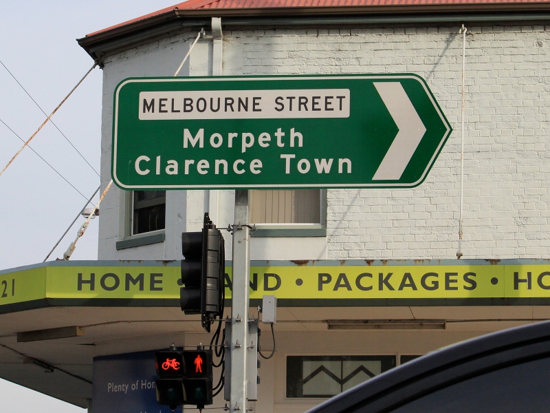
Advance Directional Sign: AD sign approaching the junction with Melbourne Street (Morpeth Road) at East Maitland. November 2010. Click here for a photo of this location from July 2007. Image © Rob Tilley |
 |
High Street: Corner of New England Hwy (NH15) and High St and Maitland, August 2011. Image © Paul Rands |
|
 |
Intersection Directional Sign: ID sign at Melbourne St, East Maitland, November 2010. Image © Rob Tilley |
 |
East Maitland: New England Hwy (NH15) as it enters the town of East Maitland, August 2011. Image © Paul Rands |
|
 |
Entering Maitland: New England Hwy (NH15) entering the town of Maitland, November 2010. Image © Rob Tilley |
 |
Supplemental Advance Directional Sign: Supplemental AD sign approaching Melbourne St (TD31) at East Maitland, August 2011. Image © Paul Rands |
|
 |
Advance Directional Sign: AD sign approaching High Street in South Maitland, November 2010. Click here for a photo of this location from July 2007. Image © Rob Tilley |
 |
Advance Directional Sign: AD sign approaching Melbourne St (TD31) at East Maitland, August 2011. Image © Paul Rands |
|
 |
High Street Intersection: New England Highway at the junction with High Street in South Maitland. November 2010. Image © Rob Tilley |
 |
Melbourne Street: Corner of New England Hwy (NH15) and Melbourne St (TD31) at East Maitland, August 2011. Image © Paul Rands |
|
 |
Distance Sign: RD sign between the intersections of High Street and Anzac Street in South Maitland. November 2010. Image © Rob Tilley |
 |
Advance Directional Sign: AD sign on Melbourne St (TD31) approaching the unnumbered section of Melbourne St and New England Hwy (NH15), East Maitland, November 2010. Image © Rob Tilley |
|
 |
Supplemental AD Sign: Supplemental advance directional sign for the intersection with Church Street / Cessnock Road (SR135) in Maitland. December 2008. Image © Paul Rands |
 |
Intersection Directional Sign: ID sign facing Melbourne St (TD31) at the junction with the unnumbered section of Melbourne St and New England Hwy (NH15), East Maitland, November 2010. Image © Rob Tilley |
|
 |
Approaching Cessnock Road / Church Street: AD sign approaching the intersection with Church St and Cessnock Rd (SR135) in Maitland, December 2008. Image © Paul Rands |
 |
Intersection Directional Sign: ID sign facing Melbourne St (TD31) at the junction with the unnumbered section of Melbourne St and New England Hwy (NH15), East Maitland, November 2010. Image © Rob Tilley |
|
 |
Intersection Directional Sign: ID sign as you head westbound out of the roundabout with Cessnock Rd (SR135) and Church St in Maitland, July 2007. Image © Paul Rands |
 |
Advance Directional Sign: AD sign approaching High St, East Maitland, August 2011. Image © Paul Rands |
|
 |
Distance Sign: Westbound RD sign at Maitland, after the Cessnock Rd / Church St junction, December 2008. Click here for a photo (from May 2004) of the old black distance sign this sign replaced. Image © Paul Rands |
 |
Advance Directional Sign: Looking southwest as you travel towards the junction with New England Highway at East Maitland, August 2008. Image © Paul Rands |
|
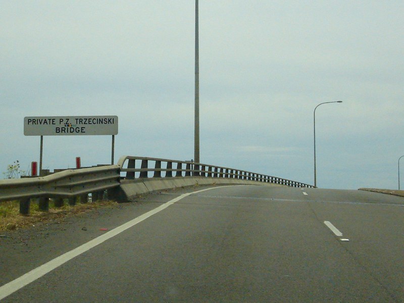 |
Private PZ Trzecinski Bridge: Crossing the main north railway line at Maitland, December 2008. Image © Paul Rands |
 |
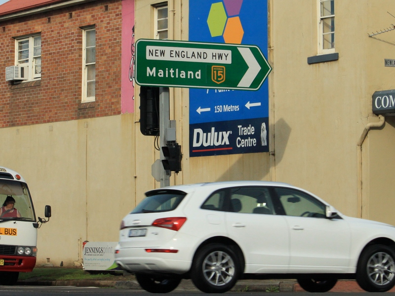
New England Highway / High Street Junction: Looking southwest on the corner of High Street and New England Highway at East Maitland. Click here for a photo from March 2007 showing the old black signs, these signs replaced. Image © Paul Rands |
|
 |
Caption Title: Corner of New England Hwy (NH15) and Caption, August 2011. Image © Paul Rands |
|||
 |
Supplemental Advance Directional Sign: Supplemental AD sign approaching Chelmsford Dr at Metford, August 2011. Image © Paul Rands |
|||
 |
Chelmsford Drive: New England Hwy (NH15) at Chelmsford Dr, Metford, August 2011. Image © Paul Rands |
|||
 |
Chisholm Drive: New England Hwy (NH15) at Chisholm Dr, Metford, August 2011. Image © Paul Rands |
|||
 |
Thornton: New England Hwy (NH15) as it enters the town of Thornton, August 2011. Image © Paul Rands |
|||
 |
Supplemental Advance Directional Sign: Supplemental AD sign at Thornton for the Weakleys Dr interchange, August 2011. Image © Paul Rands |
|||
 |
Supplemental AD Sign: Supplemental advance directional sign on New England Highway for Weakleys Drive at Beresfield on the New England Highway, travelling southeast. August 2011. Click here for a photo of the same location from August 2007. Image © Paul Rands |
|||
 |
Supplemental Advance Directional Sign: Supplemental AD sign at Thornton for the Weakleys Dr interchange, August 2011. Image © Paul Rands |
|||
 |
Weakleys Drive: New England Hwy (NH15) at the Weakleys Dr interchange in Thornton, August 2011. Image © Paul Rands |
|||
 |
Weakleys Drive: New England Hwy (NH15) at the Weakleys Dr interchange in Thornton, August 2011. Image © Paul Rands |
|||
 |
Distance Sign: Reassurance directional sign at Beresfield, August 2011. Image © Paul Rands |
|||
 |
John Renshaw Drive Interchange: Looking southeast at Beresfield, where NH15 becomes NR1, August 2011. Image © Paul Rands |
|||
 |
End National Highway 15: Southern terminus of National Highway 15 - the John Renshaw Drive interchange at Beresfield. New England Highway continues from this point as National Route 1 (formerly NH15). August 2011. Image © Paul Rands |
|||
| Click here for the continuation of National Highway 15 between Maitland and Singleton | ||||
1 Roads
& Traffic Authority, Schedule of Classified Roads and State & Regional Roads, 31 January 2011
2 Parliament of NSW, Waratah Electorate Roadworks Hansard,
12 June 1996
3 Roads & Traffic Authority
Weakleys Drive interchange project page
4 Department of Transport and
Regional Services "Contract Awarded For Weakleys Drive Interchange"
Media Release, 12 January 2007
5 The Herald, "Weakleys Drive Overpass To Open" article,
9 October 2008
Last updated: 15-Sep-2020 20:47
This site © Paul Rands. All rights reserved. Some portions © (copyright) by their respective and credited owners. Permission must be obtained before using any images from this site. For details, please email by clicking here.