|
|
|
|
|
| B76 | Gwydir Highway & Kamilaroi Highway (B76) |
Statistics:
Route Numbering:


General Information:
B76 is a rural highway in northern and western New South Wales, which connects the north coast with outback NSW. For the most part it's undivided, except in a handful of spots.
A section of the route runs parallel with the Gwydir River, and is named after Lord Gwydir by Alan Cunningham who crossed the river at Gravesend in 1827. The section between Walgett and Bourke is named after the Kamilaroi Aboriginal people of north western NSW. 2
Multiplexes along the route include:
History:
Click here for the former alignment in the Moree area

| Grafton To Bourke | Bourke to Grafton | |||
| Preview: | Description: | Preview: | Description: | |
 |
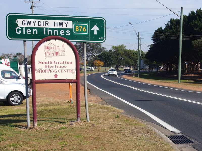
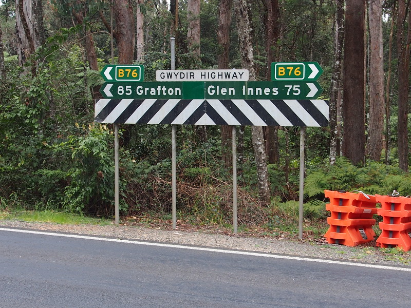
Intersection
Directional Sign: ID sign assembly at the junction with Pacific Hwy (A1) at South Grafton, August 2013. Image © Peter Renshaw |
 |
Intersection Directional Sign: ID sign on the corner of Castlereagh Hwy (B55) and Kamilaroi Hwy (B76) in Walgett, July 2009. Image © Richard Wardle |
|
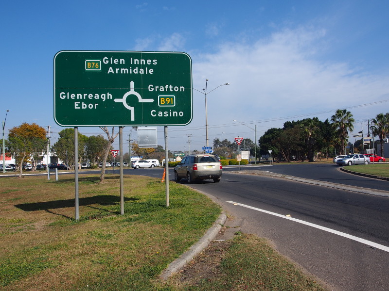 |
Advance
Directional Sign: AD sign at the roundabout with Summerland Way (B91) and Ryan St at South Grafton, August 2013. Image © Peter Renshaw |
 |
Reassurance
Directional Sign: Distance sign as Gwydir Hwy (B76) leaves Moree, September 2013. Image © Peter Renshaw |
|
 |
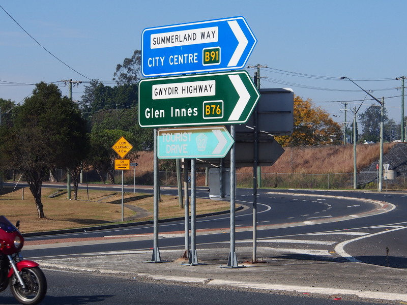
Intersection
Directional Sign: ID sign at the roundabout with Summerland Way (B91) and Ryan St at South Grafton, August 2013. Image © Peter Renshaw |
 |
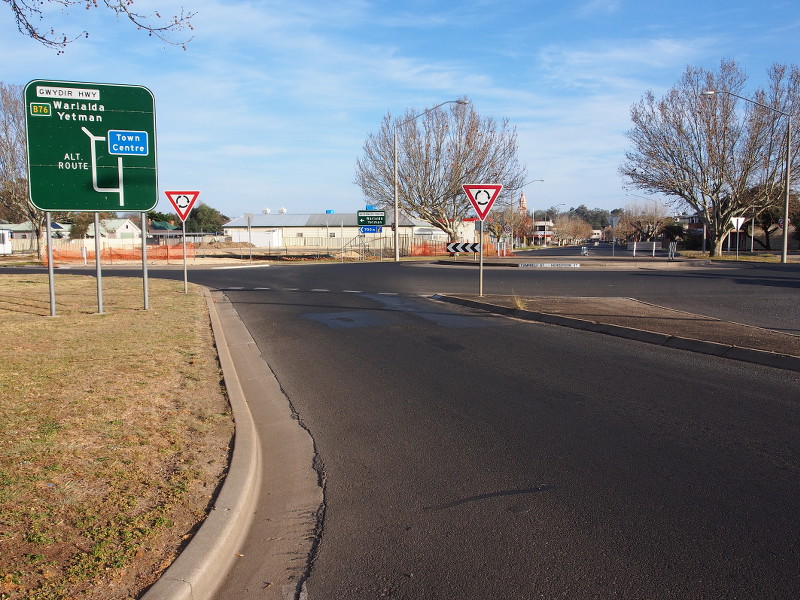
Intersection
Directional Sign: ID sign assembly at the corner of Stephen St (TD4) and Gwydir Hwy (B76) at Warialda, September 2013. Image © Peter Renshaw |
|
 |
Intersection
Directional Sign: ID sign on Gwydir Hwy (B76) at the junction with Old Grafton Rd at Waterview, August 2013. Image © Peter Renshaw |
 |
Byron
Street: Corner of Gwydir Hwy (NR38) and Byron St in Inverell. B76 turns right at this junction. September 2013. Image © Peter Renshaw |
|
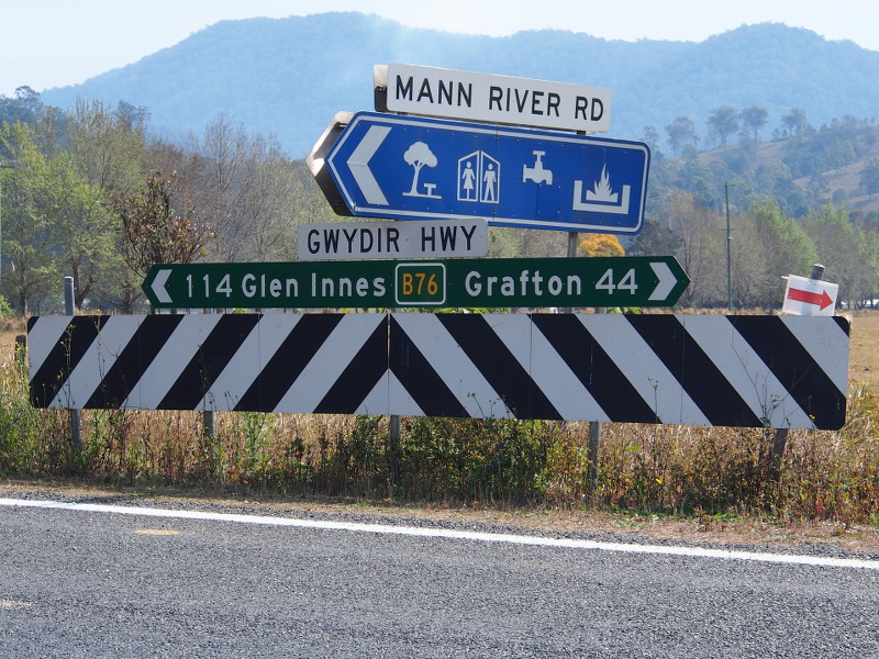 |
Intersection
Directional Sign: ID sign facing Mann River Rd at Jackadgery, August 2013. Image © Peter Renshaw |
 |
Intersection
Directional Sign: ID sign facing Beaufort Rd at Glen Innes, August 2013. Image © Peter Renshaw |
|
 |
Intersection
Directional Sign: ID sign facing Cangai Rd at Jackadgery, August 2013. Image © Peter Renshaw |
 |
New
England Highway: Corner of Gwydir Hwy (B76) and New England Hwy (A15) at Glen Innes, September 2013. B76 turns right at this junction, the A15 duplex starts here also. Image © Peter Renshaw |
|
 |
Advance
Directional Sign: AD sign on Gwydir Hwy (B76) approaching New England Hwy (A15) at Glen Innes, August 2013. The A15 duplex starts at this junction, and B76 turns right here as well. Image © Peter Renshaw |
 |
Advance
Directional Sign: AD sign on Gwydir Hwy (B76) approaching Rogan Bridge Rd, August 2013. Image © Peter Renshaw |
|
 |
Distance
Sign: RD sign leaving Glen Innes, August 2013. Image © Peter Renshaw |
 |
Intersection
Directional Sign: ID sign at Gibraltar Range facing Washpool Forest Way, August 2013. Image © Peter Renshaw |
|
 |
Intersection
Directional Sign: ID sign facing the rest area at Swanvale, September 2013. Image © Peter Renshaw |
|||
 |
Intersection
Directional Sign: ID sign facing Elsmore Rd, Inverell, September 2013. Image © Peter Renshaw |
|||
 |
Campbell
Street: Corner of Gwydir Hwy (B76) and Campbell St in Inverell, September 2013. Image © Peter Renshaw |
|||
 |
Advance
Directional Sign: AD sign in Inverell approaching Bannockburn Rd, September 2013. Image © Peter Renshaw |
|||
 |
Advance
Directional Sign: AD sign on Ashford-Delungra Rd at Delungra approaching Gwydir Hwy (B76), September 2013. Image © Peter Renshaw |
|||
 |
Distance
Sign: RD sign on the outskirts of Warialda, September 2013. Image © Peter Renshaw |
|||
 |
Advance Directional Sign: AD sign at Moree approaching Carnarvon Hwy, January 2014. Image © Michael Greenslade |
|||
 |
Advance Directional Sign: AD sign at Moree approaching Balo St and Gwydir St, January 2014. B76 turns right at this location. Image © Michael Greenslade |
|||
 |
Intersection
Directional Sign: ID sign facing Brewon Rd at Walgett, July 2009. Image © Richard Wardle |
|||
 |
Intersection
Directional Sign: ID sign at the junction with Belmore St and Bridge St, Brewarrina, July 2009. Image © Richard Wardle |
|||
1 Roads &
Maritime Services, Schedule of Classified Roads and Unclassified Regional
Roads, August 2013
2 Roads
& Traffic Authority, Heritage and Conservation Register, Brewarrina
Bridge over Barwon River
3 Department of Main Roads, The Roadmakers, A History of Main
Roads in New South Wales, ISBN 0 7240 0439 4
4 National Library of Australia,
Catalogue, Construction
of Jackadgery Bridge, New South Wales, 1959 / Thiess Bros. Pty Ltd.
5 Roads
& Traffic Authority,
Annual Report 2000, November 2000, ISSN 1037-3276
6 Roads & Traffic Authority, Annual
Report 2002
7 Roads & Traffic Authority, Road
activity update, Northern NSW, May 2003
Last updated: 23-Dec-2019 10:43
This site © Paul Rands. All rights reserved. Some portions © (copyright) by their respective and credited owners. Permission must be obtained before using any images from this site. For details, please email by clicking here.