|
|
|
|
|
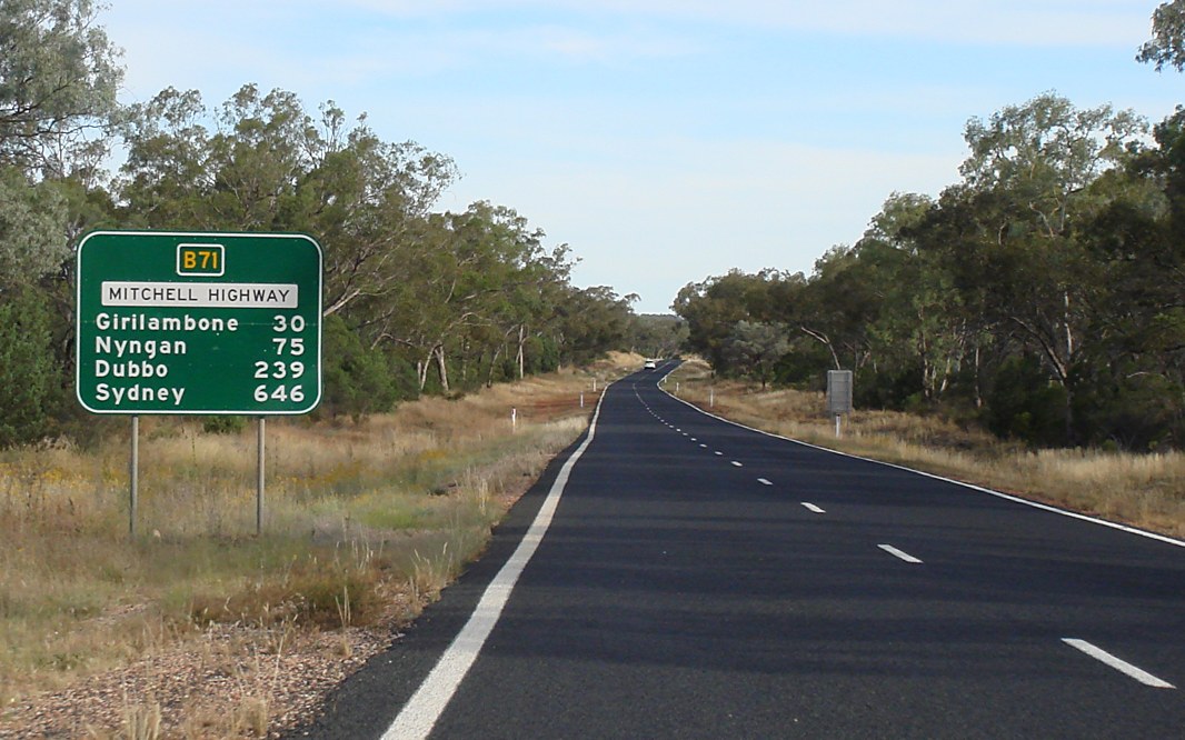
| B71 | Mitchell Highway (B71) |
Statistics:
Route Numbering:

General Information:
The Mitchell Highway, named after Major Thomas Mitchell, who was Surveyor-General of New South Wales in the 1820s and explored much of inland New South Wales and Victoria.
The route consists of typical NSW rural highway standard, undivided single carriageway.
History:
Click here for historic photos of Mitchell Highway between Nyngan and the Queensland Border

| Preview: | Description: |
 |
New South Wales / Queensland Border: Crossing from Queensland into New South Wales at Barringun, November 2016. The Mitchell Hwy changes at this location from A71 in Queensland to B71 in New South Wales. Image © Paul Rands |
 |
Reassurance Directional Sign: Tourism-based distance sign at Barringun, November 2016. Image © Paul Rands |
 |
Entering Barringun: Mitchell Hwy (B71) as it enters the town of Barringun, November 2016. Image © Paul Rands |
 |
Entering Barringun: Mitchell Hwy (B71) as it passes through the town of Barringun, November 2016. Image © Paul Rands |
 |
Services Sign: Services sign leaving Barringun town centre, November 2016. Image © Paul Rands |
 |
Kidman Way Sign: Southbound sign on Mitchell Hwy (B71) at Barringun showing the towns along the Kidman Way, which starts in Bourke, November 2016. Image © Paul Rands |
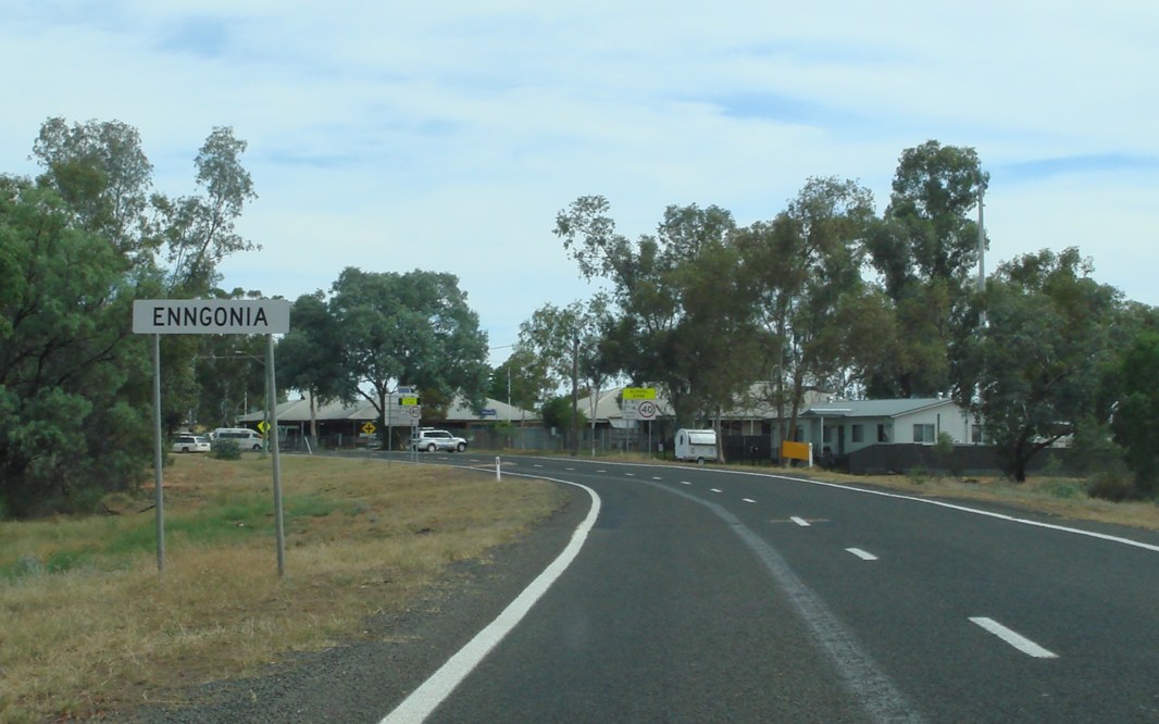 |
Entering Enngonia: Mitchell Hwy (B71) as it enters the town of Engonnia, November 2016. Image © Paul Rands |
 |
McCabe Street: Corner of Mitchell Hwy (B71) and McCabe St, Engonnia, November 2016. Image © Paul Rands |
 |
Shearer Street: Corner of Mitchell Hwy (B71) and Shearer St, Engonnia, November 2016. Image © Paul Rands |
 |
Lower Lila Road: Corner of Mitchell Hwy (B71) and Lower Lila Rd at North Bourke, November 2016. Image © Paul Rands |
 |
Twin Rivers Road: Corner of Mitchell Hwy (B71) and Twin Rivers Rd at North Bourke, November 2016. Image © Paul Rands |
 |
Bundy Road: Corner of Mitchell Hwy (B71) and Bundy Rd at North Bourke, November 2016. Image © Paul Rands |
 |
Advance Directional Sign: AD sign at North Bourke approaching Hungerford Rd, November 2016. B71 turns left at this intersection. Image © Paul Rands |
 |
Darling River: Mitchell Hwy (B71) as it crosses Darling River via Gateway Bridge at North Bourke, November 2016. Image © Paul Rands |
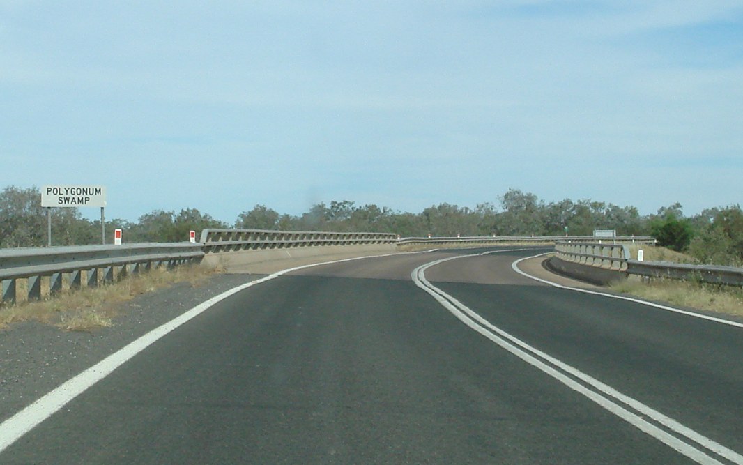 |
Polygonum Swamp: Mitchell Hwy (B71) as it crosses Polygonum Swamp at Bourke, November 2016. Image © Paul Rands |
 |
Polygonum Swamp: Mitchell Hwy (B71) as it crosses the Billabong of Polygonum Swamp at Bourke, November 2016. Image © Paul Rands |
 |
Advance Directional Sign: AD sign at Bourke approaching Mitchell St and Richard St, November 2016. Image © Paul Rands |
 |
Mitchell Street & Richard Street: Intersection directional sign on the junction with Mitchell St and Richard St in Bourke, November 2016. B71 turns left at this location. Image © Paul Rands |
 |
Advance Directional Sign: AD sign at Bourke approaching Kidman Way (B87) and Anson St, November 2016. Image © Paul Rands |
 |
Kidman Way & Anson Street: Intersection directional sign on the junction with Kidman Way (B87) and Anson St in Bourke, November 2016. B71 turns left at this location. Image © Paul Rands |
 |
Reassurance Directional Sign: Distance sign leaving Bourke, November 2016. Image © Paul Rands |
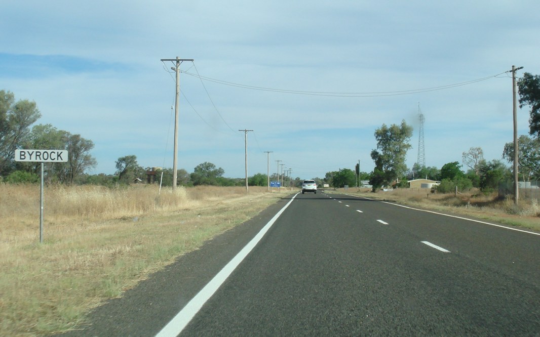 |
Entering Byrock: Mitchell Hwy (B71) as it enters the town of Byrock, November 2016. Image © Paul Rands |
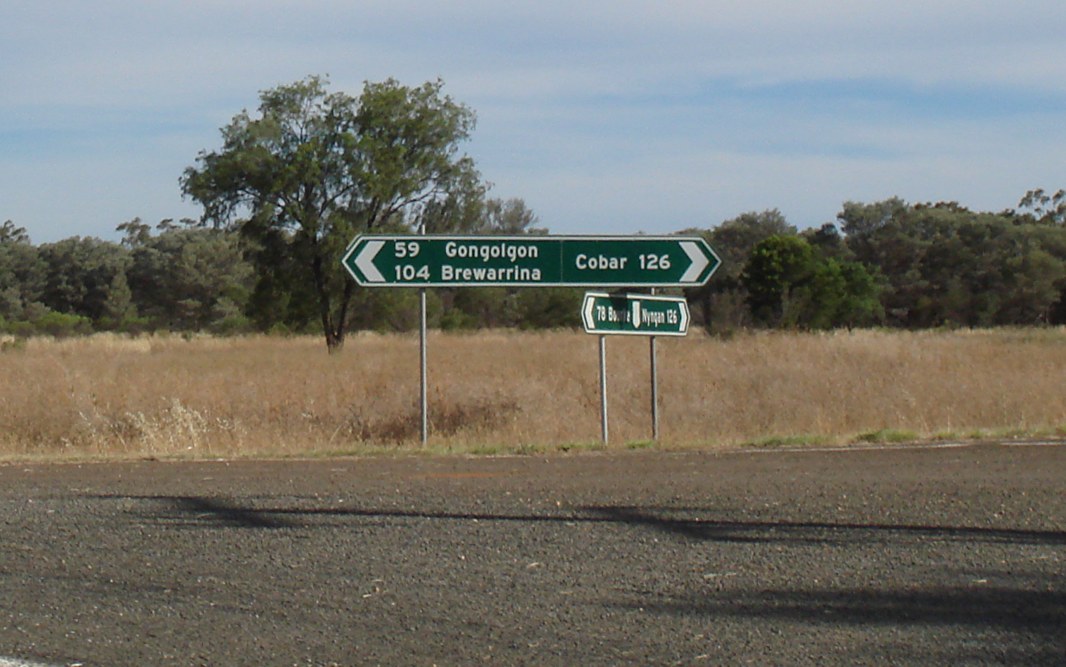 |
Intersection Directional Sign: Non-standard fingerboards at the corner of Gongolgon St and Cobar St in Byrock, November 2016. Image © Paul Rands |
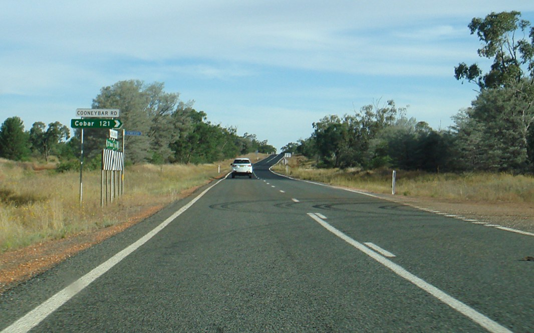 |
Cooneybar Road: Corner of Mitchell Hwy (B71) and Cooneybar Rd at Coolabah, November 2016. Image © Paul Rands |
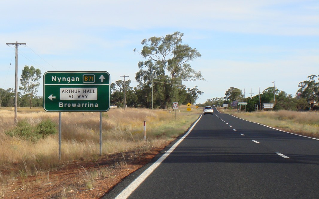 |
Advance Directional Sign: AD sign approaching Arthur Hall VC Way at Coolabah, November 2016. Image © Paul Rands |
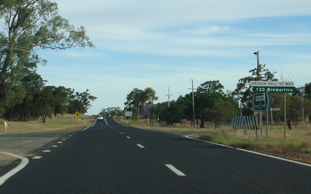 |
Arthur Hall VC Way: Corner of Mitchell Hwy (B71) and Arthur Hall VC Way at Coolabah, November 2016. Image © Paul Rands |
 |
Reassurance Directional Sign: Distance sign at Coolabah, November 2016. Image © Paul Rands |
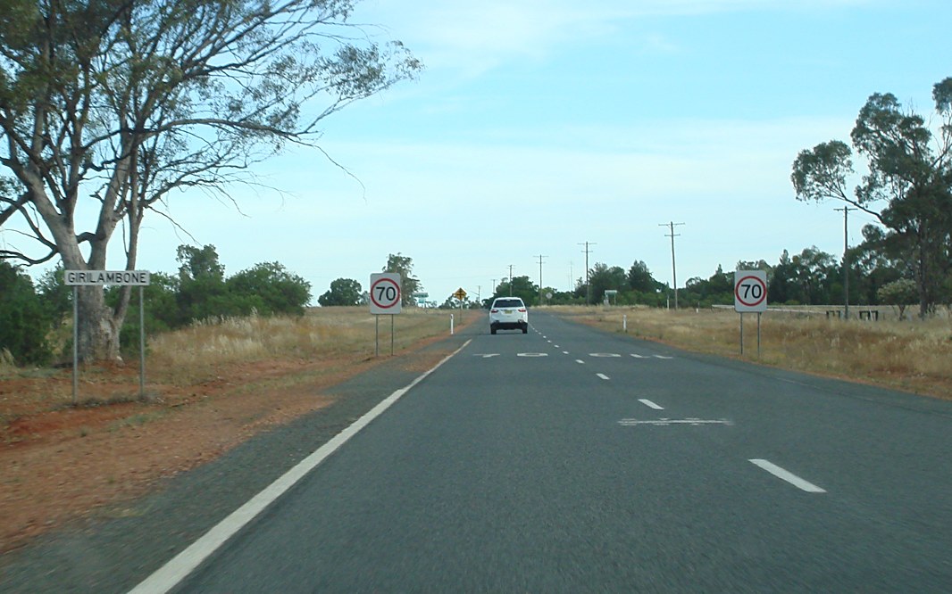 |
Entering Girilambone: Mitchell Hwy (B71) as it enters the town of Girilambone, November 2016. Image © Paul Rands |
 |
Booramugga Road: Corner of Mitchell Hwy (B71) and Booramugga Rd at Girilambone, November 2016. Image © Paul Rands |
 |
Advance Directional Sign: AD sign at Nyngan approaching Mitchell Hwy (A32) and Barrier Hwy (A32), November 2016. Image © Paul Rands |
 |
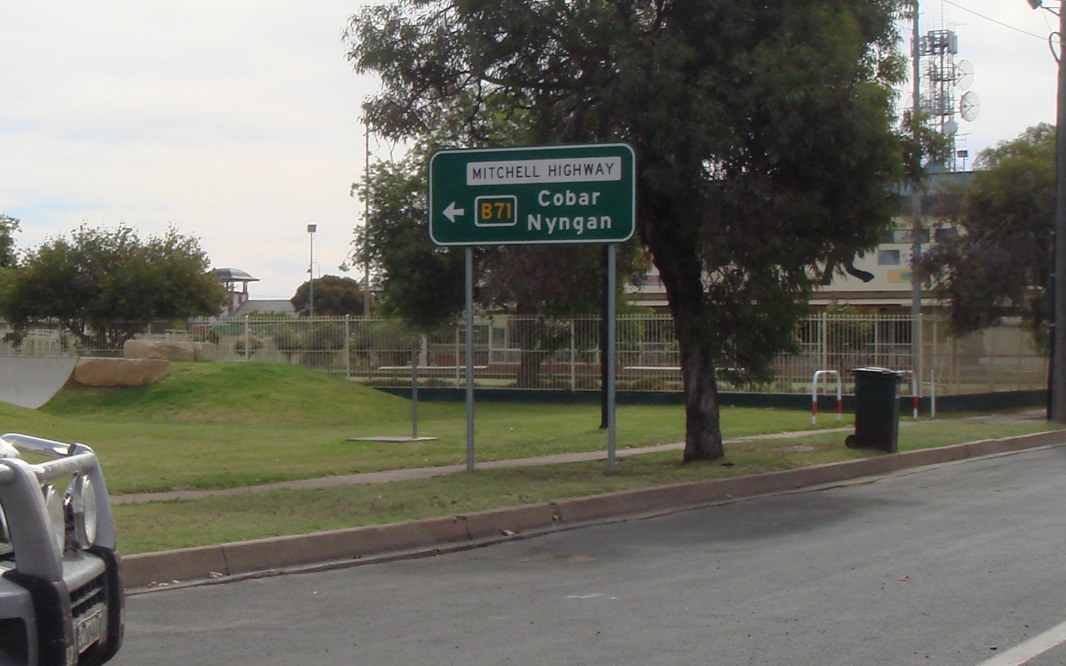
Mitchell Highway & Barrier Highway: Southern terminus of B71: Mitchell Hwy (A32) and Barrier Hwy (A32) at Nyngan, November 2016. Image © Paul Rands |
1 NSW Government, Roads and Maritime Services, Schedule of Classified Roads and Unclassified Regional Roads, April 2017
2 Department of Main Roads, The Roadmakers, A History of Main Roads in New South Wales, ISBN 0 7240 0439 4
3 Western Herald, Mitchell Highway Bitumen Sealed Between Enngonia and Barringun, 1 Nov 1968
4 Western Herald, Construction of Mitchell Highway North of Bourke, 10 Oct 1969
Last updated: 21-Dec-2019 21:16
This site © Paul Rands. All rights reserved. Some portions © (copyright) by their respective and credited owners. Permission must be obtained before using any images from this site. For details, please email by clicking here.