|
|
|
|
|
Hobart is the state capital of Tasmania and was founded in 1804 as a penal colony. Hobart has also been known as Hobart Town and Hobarton and was named after Lord Hobart, the British secretary of state for war and the colonies. The first European settlement began in 1803. The city, initially known as Hobart Town or Hobarton, The area's indigenous inhabitants were members of the semi-nomadic Mouheneener people. The city is the southernmost capital city in Australia and the least populated state capital.
Featuring the second deepest natural port in the world annd shipping is a significant contributor to the city's economy. Hobart is the home port for the Antarctic activities of Australia and France. Manufacturing and also tourism are other big parts of the economy. The River Derwent and Mount Wellington / kunanyi are dominating natural features of the city and visitors that come to the city are usually there to explore its historic inner suburbs and nationally acclaimed restaurants and cafes, as well as its vibrant music and nightlife culture. The two major draw-cards are the weekly market in Salamanca Place, and the Museum of Old and New Art (MONA). Hobart also offers a thriving wine industry.
 , Tasman Hwy A3, Southern Outlet A6, Domain Hwy B36 and Sandy Bay Rd B68
| Preview: | Description: |
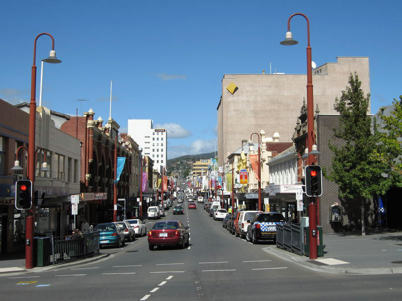 |
Hobart CBD: Liverpool St Hobart, 2008. Image © Jamie Scuglia |
 |
Elizabeth Mall: Elizabeth Mall in Hobart CBD, 2008. Image © Jamie Scuglia |
 |
Franklin Square: Franklin Square, named after a John Franklin, a former Governor of Tasmania, 2008. Image © Jamie Scuglia |
 |
Hobart Post Office: View of Hobart GPO at the corner of Elizabeth St and Macquarie St, 2008. Image © Jamie Scuglia |
 |
Constitution Dock: Constitution Dock in Hobart is a working dock but also features a number of good eateries including fresh seafood, 2008. Image © Jamie Scuglia |
 |
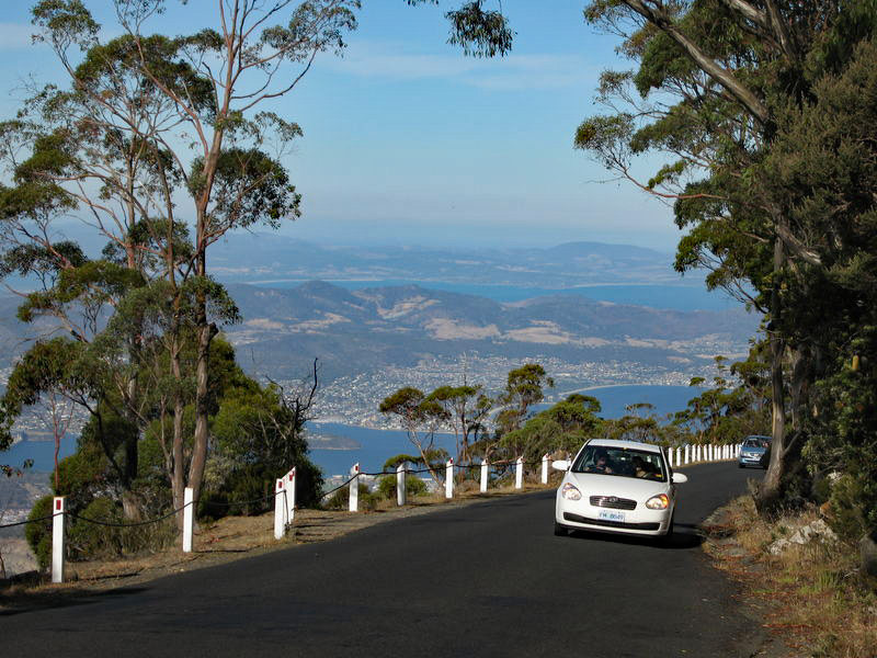
Hobart: View of greater Hobart from Mt Wellington / kunanyi, 2008. Image © Jamie Scuglia |
 |
Hobart: View of greater Hobart from Mt Wellington / kunanyi, 2008. Image © Jamie Scuglia |
 |
Hobart: View of greater Hobart from Mt Wellington / kunanyi, 2008. Image © Jamie Scuglia |
 |
Hobart: View of greater Hobart from Mt Wellington / kunanyi, 2008. Image © Jamie Scuglia |
 |
Hobart: View of greater Hobart from Mt Wellington / kunanyi, 2008. Image © Jamie Scuglia |
 |
Mount Wellington / kunanyi: View of Mt Wellington / kunanyi from Salamanca Place in Hobart, 2008. This area is home to the famous Salamanca Markets. Image © Jamie Scuglia |
 |
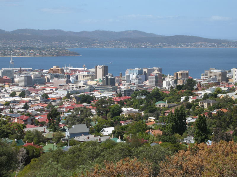
Tasman Bridge: View of Hobart CBD and Tasman Bridge over the River Derwent, Hobart, 2008. Image © Jamie Scuglia |
 |
Hobart & River Derwent: View of Hobart CBD and River Derwent, 2008. Image © Jamie Scuglia |
 |
Molle Street: View of Molle St on the outskirts of Hobart CBD, 2008. Image © Jamie Scuglia |
 |
Hobart & River Derwent: View of Hobart and River Derwent from Forest Rd, West Hobart, 2008. Image © Jamie Scuglia |
 |
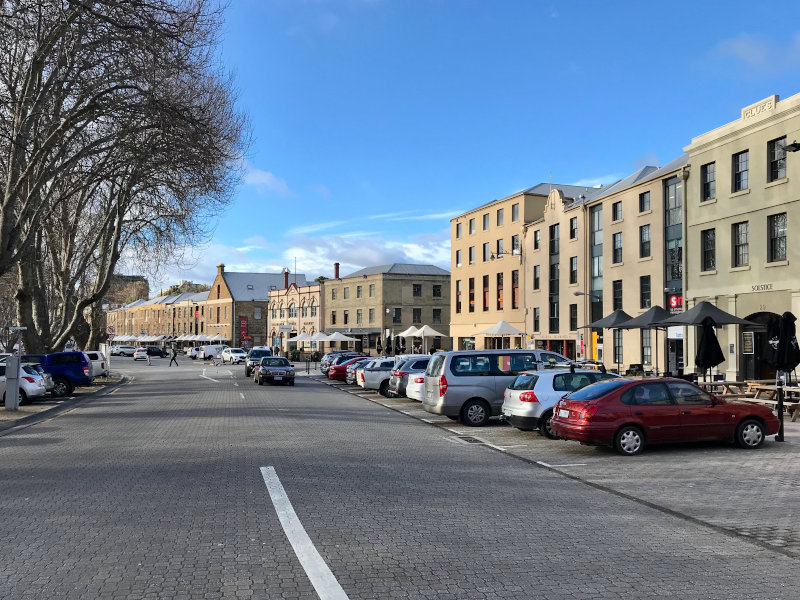
Salamanca Place: View of Salamanca Place in Hobart, July 2018. This area is well known for its markets and eateries. Image © Paul Rands |
 |
Salamanca Place: View of Salamanca Place in Hobart, July 2018. Image © Paul Rands |
 |
Princes Wharf: The icebreaker ship Aurora Australis moored at Princes Wharf in Hobart, July 2018. The ship is used as a research and supply ship to the Antarctic, and is painted its colour for better visibility in the extremes of weather. Image © Paul Rands |
 |
Brooke Street Pier: The Spirit of Hobart moored at Brooke St Pier, Hobart, July 2018. Image © Paul Rands |
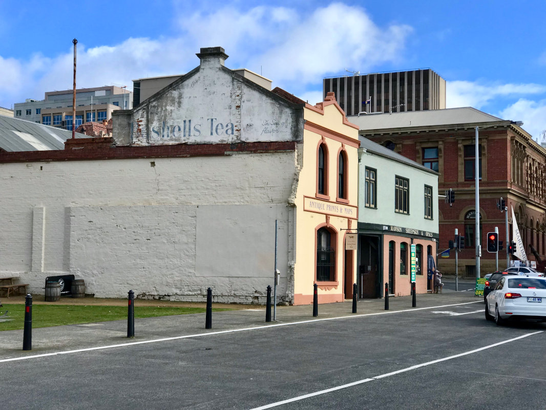 |
Argyle Street: Several of the historic convict era historic buildings on Argyle St, Hobart, July 2018. Note the old advertising on the side of the building. Image © Paul Rands |
 |
Tasmanian Museum and Gallery: View of the Tasmanian Museum & Gallery on the corner of Davey St and Argyle St, Hobart, July 2018. Image © Paul Rands |
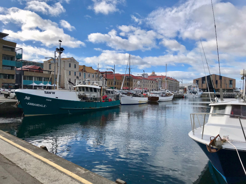 |
Victoria Dock: View of Victoria Dock in Hobart which opens out onto the River Derwent, July 2018. Image © Paul Rands |
 |
Hobart City Hall: Corner of Macquarie and Campbell St, July 2018. The area on which City Hall stands was originally reserved for markets. The City Hall was completed in 1915, with a formal opening in July. Image © Paul Rands |
 |
Memorial Fountain: Memorial Fountain, Hobart, July 2018. Located within the middle of the Railway Roundabout at the junction of the Tasman and Brooker Highways, the fountain was dedicated in 1963, and commemorates the former Mayor and Lord Mayors of Hobart since 1853. A plaque was added to the fountain in 2013 to commemorate the 50th anniversary. Image © Paul Rands |
 |
Mount Wellington / kunanyi: View of the pinnacle of Mt Wellington / kunanyi behind the Hobart CBD, July 2018. Image © Paul Rands |
1 Australian Bureau of Statistics, 2016 Census QuickStats
Last updated: 02-Aug-2020 11:43
This site © Paul Rands. All rights reserved. Some portions © (copyright) by their respective and credited owners. Permission must be obtained before using any images from this site. For details, please email by clicking here.