|
|
|
|
|
| A20 | Sturt Highway & Main North Road (A20) - Barmera To Nuriootpa |
Statistics:
Route Numbering:


General Information:
The Sturt Highway and Main North Road are major routes connecting New South Wales, Victoria and South Australia. The highway connects the Hume Highway (A31) in NSW with the Newell Hwy (A39) and other major routes of South Western NSW. The route also connects with the Calder Highway (A79) in Victoria.
The highway itself varies from 2-lane rural highway in the less populated areas to multilaned main road in some of the larger towns along the route to freeway standard and 6-lane arterial road standard in Adelaide.
The route receives Auslink funding from the Federal Government, recognising its importance as a major Australian highway for freight and travel.
The Sturt Highway is named after Charles Sturt, who explored south western New South Wales, the Murrumbidgee and Murray Rivers and also parts of central Australia in the 1800s.
History:
| Barmera to Nuriootpa | Nuriootpa to Barmera | |||
| Preview: | Description: | Preview: | Description: | |
 |
Approaching Coats Road / Joyce Street: Westbound at Cobdogla. December 2007. Image © Paul Rands |
 |
Distance Sign: RD sign after the Murray St junction at Nuriootpa. December 2007. Image © Paul Rands |
|
 |
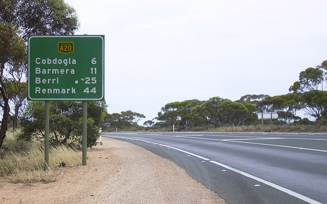
Distance Sign: Westbound as you leave Cobdogla, December 2007. Image © Paul Rands |
 |
Advance Directional Sign: RD sign after the Murray St junction at Nuriootpa. October 2012. Image © Michael Greenslade |
|
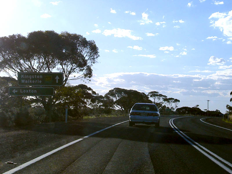 |
Black Directional Sign: Black AD sign assembly approaching Loxton Rd, Kingston-On-Murray. December 2007. Image © Paul Rands |
 |
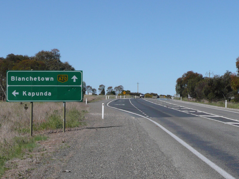
Advance Directional Sign: AD sign approaching Murraylands Rd at Blanchetown, December 2003. Image © Michael Greenslade |
|
 |
AD Sign: Advance directional sign approaching Petersen Road in Kingston-On-Murray, December 2007. Image © Paul Rands |
 |
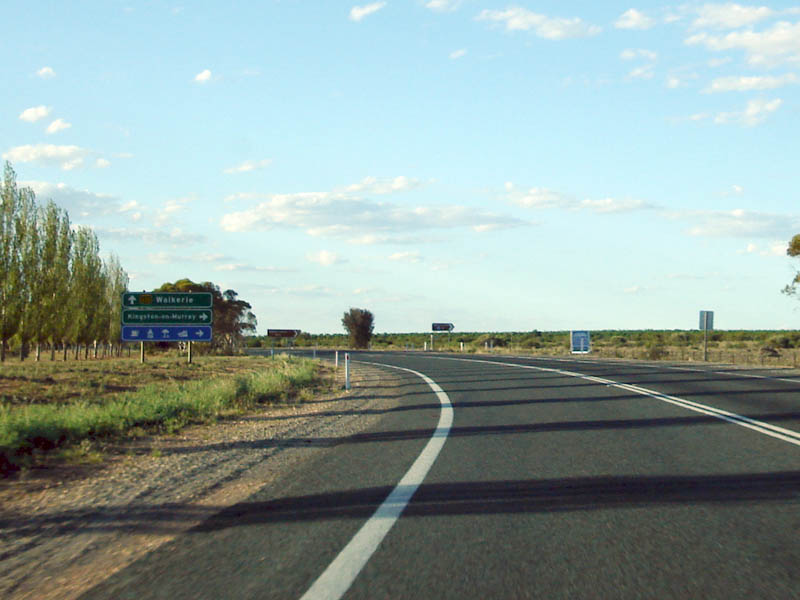
Advance Directional Sign: AD sign at Waikerie approaching Old Blanchetown Rd & Vasey Rd, December 2003. Image © Michael Greenslade |
|
 |
Distance Sign: Westbound leaving Kingston-On-Murray, December 2007. Image © Paul Rands |
 |
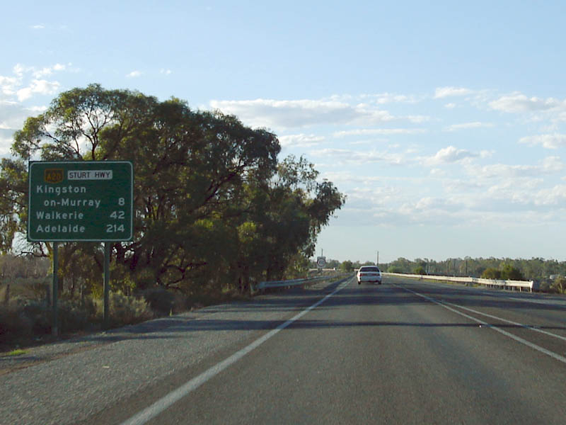
Reassurance Directional Sign: Distance sign at Kingston-On-Murray, December 2003. Image © Michael Greenslade |
|
 |
holmes Rd Approach: Westbound approaching Holmes Road at Kingston-On-Murray. December 2007. Image © Paul Rands |
 |
Advance Directional Sign: AD sign at Barmera approaching Nookamka Tce, December 2003. Image © Michael Greenslade |
|
 |
Approaching Ian Oliver Drive: Westbound near the Waikerie Bypass near Ian Oliver Dr, December 2007. Image © Paul Rands |
 |
Advance Directional Sign: Bypassed town AD sign approaching Old Sturt Hwy (B201) at Barmera, December 2003. Image © Michael Greenslade |
|
 |
Approaching Ian Oliver Drive: AD sign for Ian Oliver Drive, the old Sturt Hwy alignment at Waikerie, December 2007. Image © Paul Rands |
|||
 |
Approaching blanchetown Rd: Westbound at Waikerie on the bypass as you approach Blanchetown Road, part of the former Sturt Hwy alignment, December 2007. Image © Paul Rands |
|||
 |
Distance Sign: Westbound RD sign as you leave Waikerie, December 2007. Click here for a photo of this location by Michael Greenslade from December 2003. Image © Paul Rands |
|||
 |
Stockyard Flat: Westbound at Stockyard Flat, as you approach an unnamed gravel road which travels to Morgan, December 2007. Image © Paul Rands |
|||
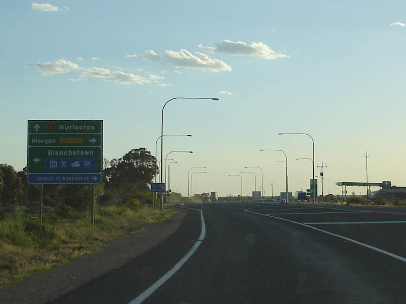
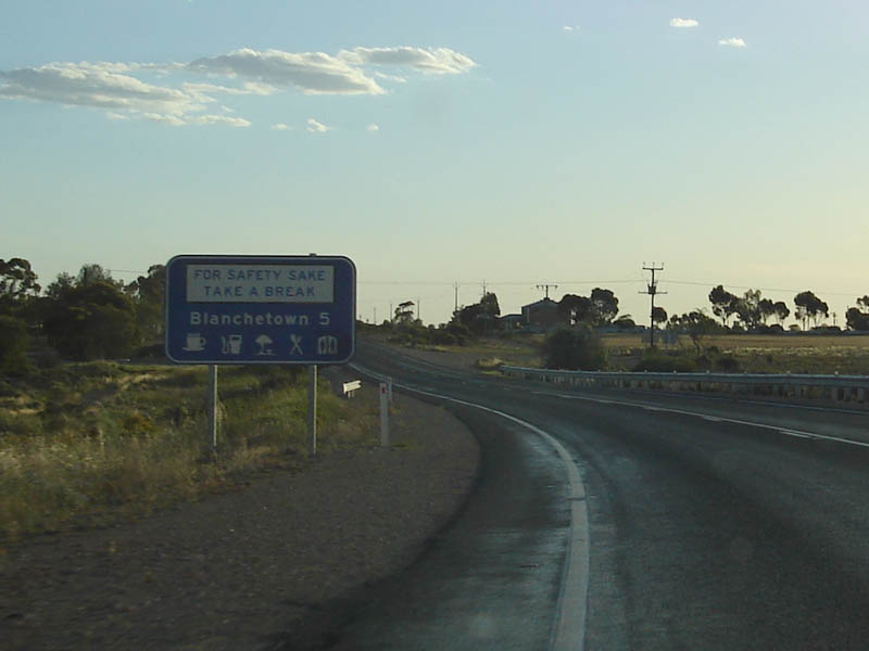 |
Services Sign: Sign listing available services in Blanchetown as you approach the town, December 2007. Image © Paul Rands |
|||
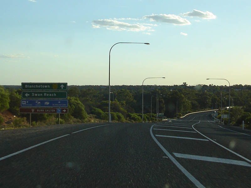 |
Advance Directional Sign: AD sign for Swan Reach Road at Blanchetown. December 2007. Image © Paul Rands |
|||
 |
Advance Directional Sign: AD sign for Murraylands Road at Blanchetown. December 2007. Image © Paul Rands |
|||
 |
Advance Directional Sign: AD sign on Murraylands Rd at Blanchetown approaching Sturt Hwy (A20), December 2003. Image © Michael Greenslade |
|||
 |
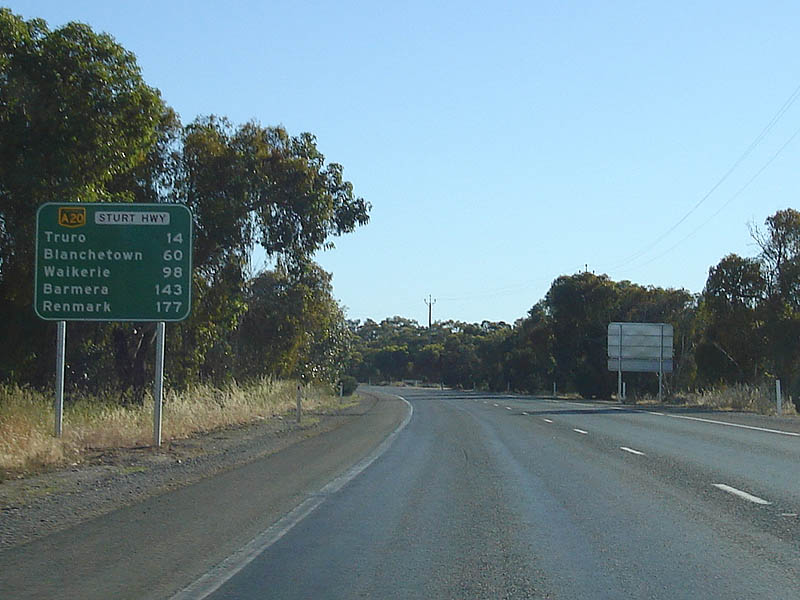
Services Sign: Westbound services sign approaching Truro. December 2007. Image © Paul Rands |
|||
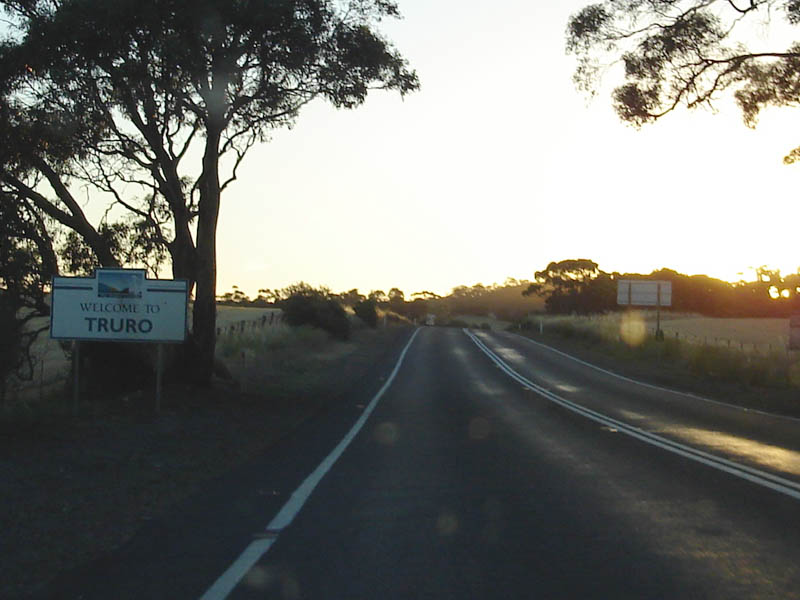 |
Entering Truro: Westbound as you drive into Truro, December 2007. Image © Paul Rands |
|||
 |
Truro: Westbound through the town of Truro. December 2007. Image © Paul Rands |
|||
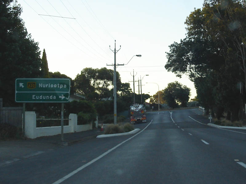 |
AD Sign: Approaching Truro-Eudunda Road, Truro, December 2007. Image © Paul Rands |
|||
 |
Distance Sign: RD sign on the hill west of Truro, October 2012. Image © Michael Greenslade |
|||
 |
Ebenezer Road Approach: Heading southwest at Stockwell. December 2007. Image © Paul Rands |
|||
 |
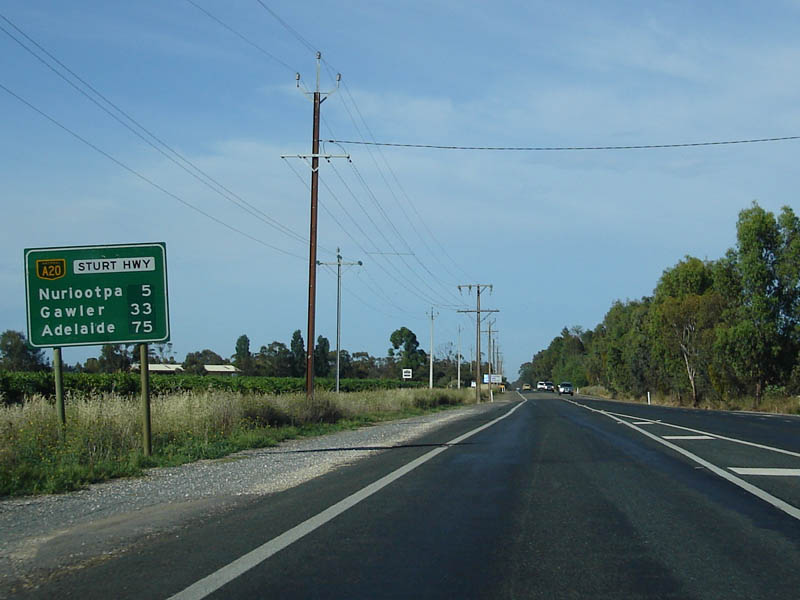
Distance Sign: Heading southwest at Stockwell, October 2012. Image © Michael Greenslade |
|
|
|
 |
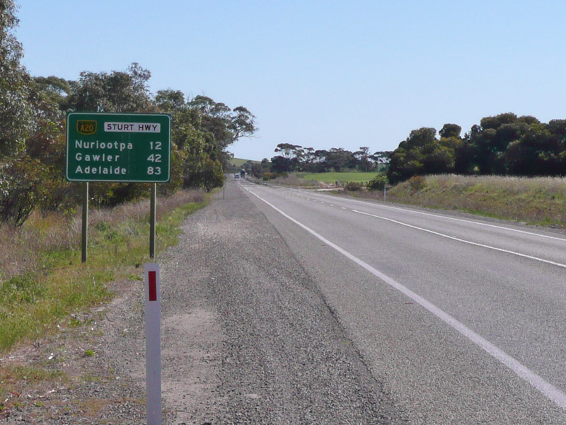
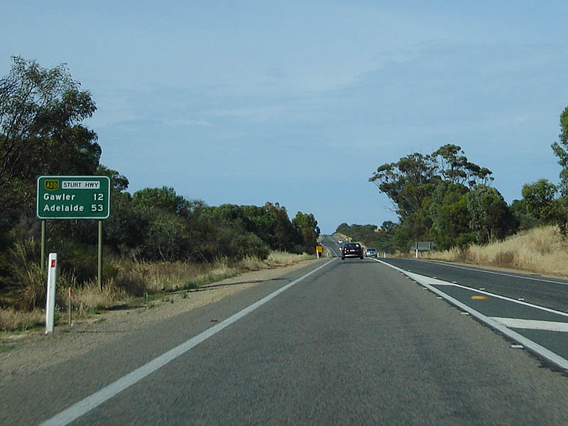
Distance Sign: Heading southwest at Nuriootpa, December 2007. Image © Paul Rands |
|||
 |
Approaching Murray Street: Advance directional sign approaching B19 - the Barossa Valley Way (Murray St) at Nuriootpa, December 2007. Click here for a photo of the old AD sign, taken Octover 2004 by Darrin Smith. Image © Paul Rands |
|||
 |
Supplemental AD Sign: Supplemental advance directional sign as you approach Murray St Nuriootpa, December 2007. Image © Paul Rands |
|||
 |
Murray St Intersection: Looking southwest at the corner of Sturt Hwy and Murray St in Nuriootpa, December 2007. Image © Paul Rands |
|||
 |
ID Sign: Intersection directional sign facing Murray St traffic at Nuriootpa, December 2007. Image © Paul Rands |
|||
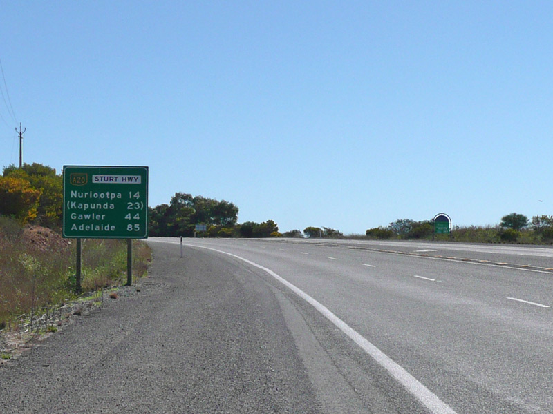
 |
Distance Sign: RD sign on the Nuriootpa Bypass, December 2007. Image © Paul Rands |
|||
 |
Advance Directional Sign: AD sign for the Peramangk Road intersection, looking southwest at Nuriootpa. December 2007. Image © Paul Rands |
|||
 |
Greenock Road Overpass: The Sturt Hwy as it passes under Greenock Rd in Greenock, December 2007. Image © Paul Rands |
|||
 |
AD Sign: Advance directional sign approaching Adelaide and Seppeltsfield Roads at Greenock, December 2007. Image © Paul Rands |
|||
 |
Distance Sign: RD sign after the intersection with Seppeltsfield and Adelaide Roads in Greenock, December 2007. Image © Paul Rands |
|||
 |
Advance Directional Sign: AD sign for the Ahrens Road intersection, at She Oak Log. December 2007. Image © Paul Rands |
|||
 |
Distance Sign: RD sign located after the intersection with Ahrens Rd at She Oak, December 2007. Image © Paul Rands |
|||
| Click here for the continuation of A20 between Nuriootpa and Gepps Cross / Adelaide Click here for the continuation of A20 between Bamera and SA-Vic Border |
||||
1 Location SA Map Viewer
2 SA Memory, The river as a highway: Crossing the Murray
3 Peter Morris, Australian Minister for Transport, Press Release, $18 Million Gawler Bypass Gets Go Ahead, 9 May 1984
4 Australian Department of Infrastructure, Transport, Regional Development and Local Government
5 Government of South Australia, Department of Transport, Energy & Infrastructure, The Sturt Highway Upgrade Gawler to Nuriootpa, Proejct Update, January 2007
6 Government of South Australia, Department of Planning, Transport & Infrastructure, Road Projects, Sturt Highway Upgrade
7 Government of South Australia, Department of Planning, Transport & Infrastructure, News, New roadside facilities for truck drivers, 29 Nov 2013
8 Government of South Australia, Department of Planning, Transport & Infrastructure, News, Works on Sturt Hwy, 10 Dec 2014
9 Government of South Australia, Department of Planning, Transport & Infrastructure, News, Sturt Hwy safety improvement, 19 Jan 2015
10 Government of South Australia, Department of Planning, Transport & Infrastructure, News, Sturt Highway safer as point-to-point safety cameras switched on
11 Government of South Australia, Department of Planning, Transport & Infrastructure, Community Update, Regional Bridges Upgrade Project, Sturt Highway Bridges, Commencement of Works, 20 Dec 2018
12 Government of South Australia, Department of Planning, Transport & Infrastructure, News, Speed limit change on Sturt Highway at Blanchetown, 03 Feb 2017
Last updated: 01-Dec-2020 12:24
This site © Paul Rands. All rights reserved. Some portions © (copyright) by their respective and credited owners. Permission must be obtained before using any images from this site. For details, please email by clicking here.