|
|
|
|
|
 |
Wide Bay Highway, Bunya Highway, Moonie Highway & Balonne Highway (State Route 85) |
Statistics:
Route Numbering:
General Information:
State Route 85 is a rural route linking the central southwest border towns of Queensland with Goondiwindi.
Named after the Barwon River, which parallels the route, SR85 passes through mainly rural farmland and a handful of small towns.
History:

| Nindigully to Goondiwindi | Goondiwindi to Nindigully | |||
| Preview: | Description: | Preview: | Description: | |
 |
Services sign: Services sign, eastbound near Weengallon, October 2005. Image © Paul Rands |
 |
Black Advance Directional Sign: Image © Michael Greenslade |
|
 |
Services sign: Services sign, eastbound at Weengallon, October 2005. Image © Paul Rands |
 |
Lagoon Street & Brennans Road: ID sign at the corner of Barwon Hwy (SR85), Lagoon St and Brennans Rd at Goondiwindi, January 2003. Image © Michael Greenslade |
|
 |
Kilometre Plate: Kilometre plate near Talwood, showing distance to Goondiwindi, October 2005. Image © Paul Rands |
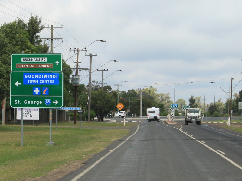 |
Advance Directional Sign: AD sign at Goondiwindi approaching Lagoon St (former NH39) and Brennans Rd, May 2011. SR85 turns right at this junction. Image © Rob Tilley |
|
 |
Talwood: Barwon Hwy (SR85) as it enters the town of Talwood, October 2005. Image © Paul Rands |
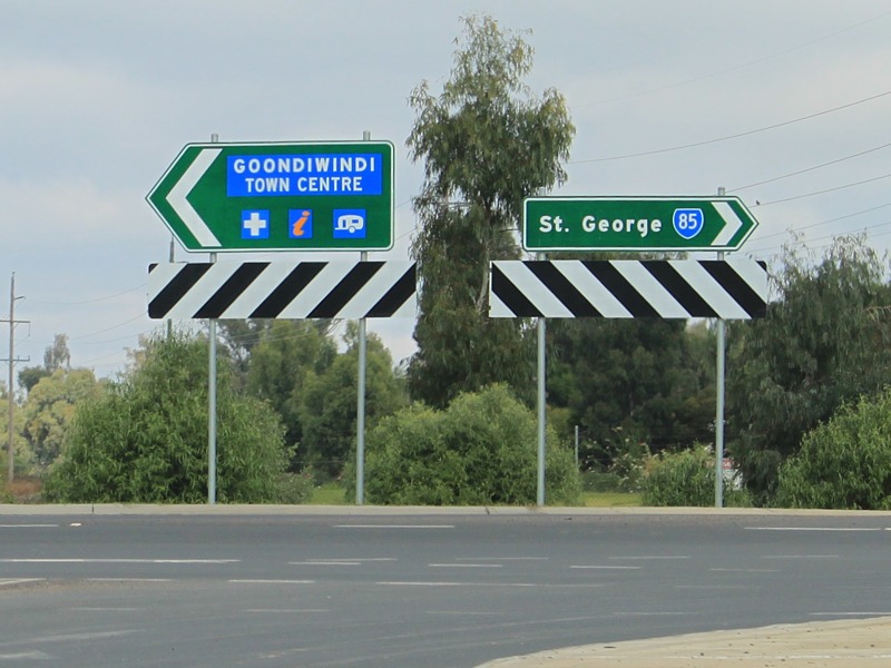 |
Intersection Directional Signs: ID signs at the junction with Lagoon St and Brennans Rd in Goondiwindi, May 2011. Image © Rob Tilley |
|
 |
Advance Directional Sign: AD sign approaching North Talwood Rd & Walwood-Mungindi Rd at Talwood, October 2005. Image © Paul Rands |
 |
Reassurance Directional Sign: Image © Michael Greenslade |
|
 |
Services sign: Services sign, eastbound at Bungunya, October 2005. Image © Paul Rands |
 |
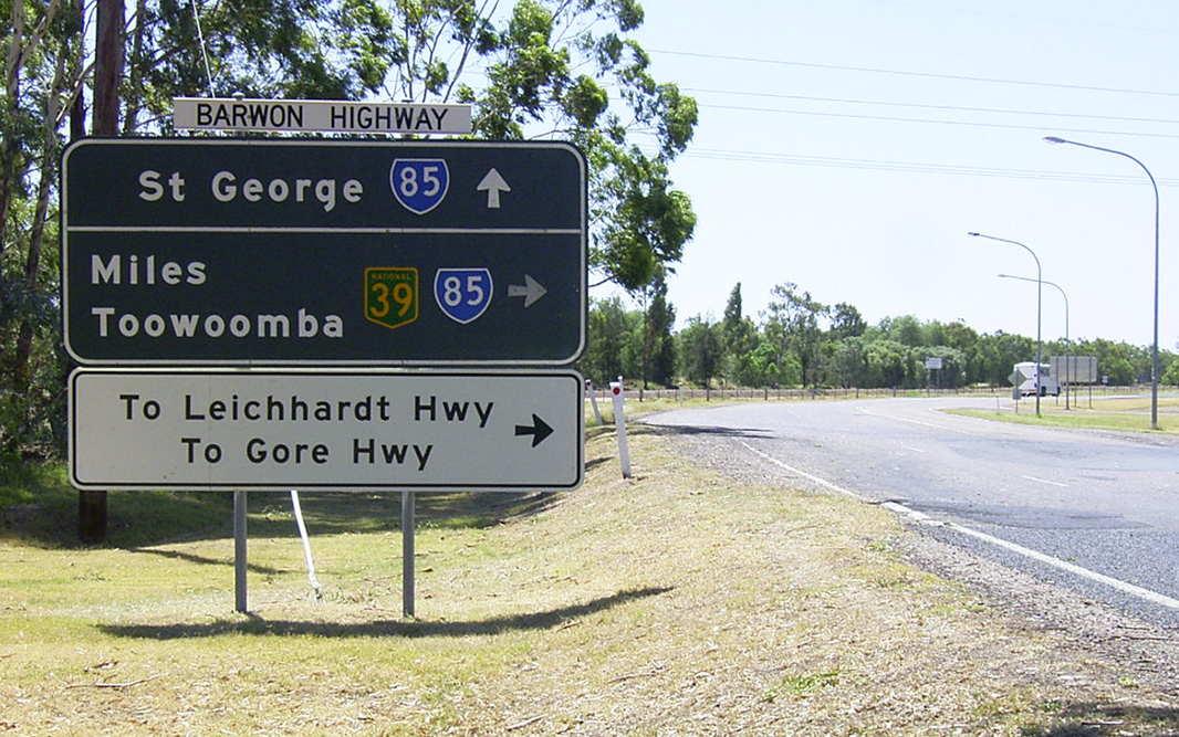
Advance Directional Sign: AD sign on Barwon Hwy (SR85) approaching Carnarvon Hwy (NR46) at Nindigully, June 2012. Image © Peter Renshaw |
|
 |
Main Street: Corner of Barwon Hwy (SR85) and Main St at Bungunya, October 2005. Image © Paul Rands |
 |
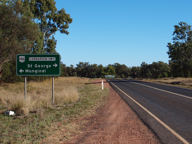
Intersection Directional Sign: ID sign with badly coverplated A46 route number at the junction with Carnarvon Hwy (NR46) at Nindigully, June 2012. The is the western terminus of SR85. Image © Peter Renshaw |
|
 |
Advance Directional Sign: AD sign at Bungunya approaching Meandarra-Talwood Rd (SR74), October 2005. Image © Paul Rands |
|||
 |
Meandarra-Talwood Road: Corner of Barwon Hwy (SR85) and Meandarra-Talwood Rd (SR74) at Bungunya, October 2005. Image © Paul Rands |
|||
 |
Distance Sign: Reassurance directional sign as Barwon Hwy (SR85) leaves Bungunya, October 2005. Image © Paul Rands |
|||
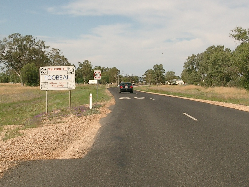 |
Toobeah: Barwon Hwy (SR85) as it enters the town of Toobeah, October 2005. Image © Paul Rands |
|||
 |
Toobeah: Barwon Hwy (SR85) as it passes through the town of Toobeah, October 2005. Image © Paul Rands |
|||
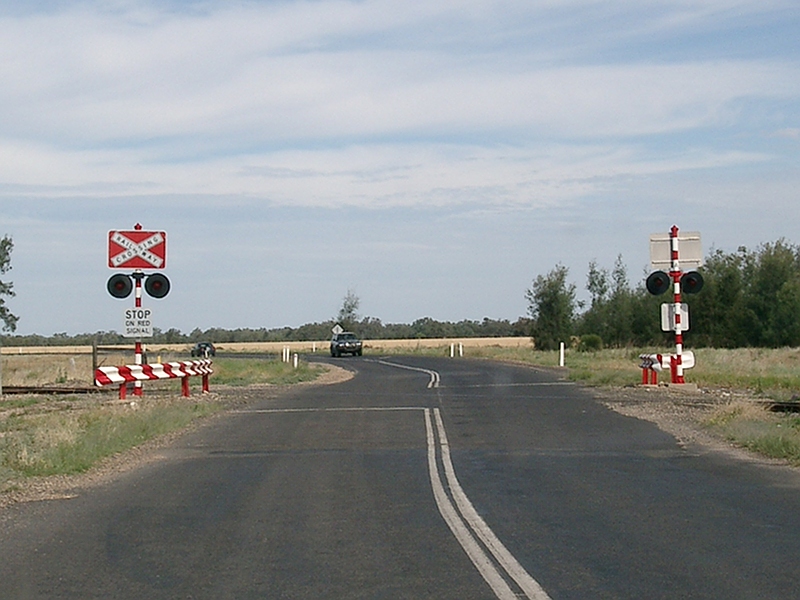 |
Level Crossing: Railway level crossing in Toobeah, as the Barwon Hwy (SR85) crosses the southwestern freight line, October 2005. Image © Paul Rands |
|||
 |
Tourist Radio Sign: Aging services sign for tourist radio as Barwon Hwy reaches the outskirts of Goondiwindi, October 2005. Image © Paul Rands |
|||
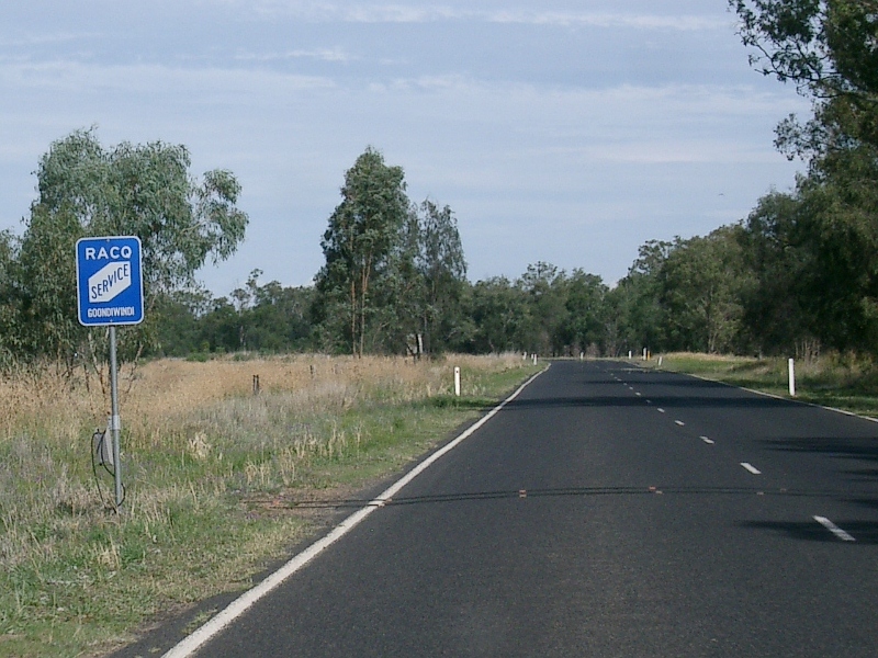 |
Services Sign: Services sign indicating Goondiwindi has a full RACQ roadside service provider in town, October 2005. Image © Paul Rands |
|||
 |
Prohibition Sign: Regulatory sign prohibiting road trains and B-double trucks within the Goondiwindi CBD, October 2005. Image © Paul Rands |
|||
 |
Advance Directional Sign: AD sign approaching Lagoon St and Russell St, SR85 turns left at this junction and the NH39 duplex has since been removed, October 2005. Since this photo was taken, this sign has been replaced. Image © Paul Rands |
|||
 |
Advance Directional Sign: AD sign approaching Lagoon St and Russell St, SR85 turns left at this junction and the NH39 routing has since been removed, October 2005. Since this photo was taken, this sign has been replaced. Image © Paul Rands |
|||
 |
Reassurance Directional Sign: RD sign at Goondiwindi, September 2014. Click here for a photo of this location by Michael Greenslade from January 2004 featuring a black sign. Image © Dean Sherry |
|||
1 Transport & Main Roads, Queensland state-controlled roads and region maps, South West Region
2 Queensland Government, Ministerial Media Statements, Barwon Highway upgrade to help keep local jobs, 19 February 2009
Last updated: 21-Oct-2021 19:25
This site Paul Rands. All rights reserved. Some portions (copyright) by their respective and credited owners. Permission must be obtained before using any images from this site. For details, please email by clicking here.