|
|
|
|
|
 |
Caboolture Bypass, D'Aguilar Highway, Brisbane Valley Highway & Esk-Hampton Road (State Route 85) |
Statistics:
Route Numbering:

General Information:
State Route 85 is a major rural route that connects the Sunshine Coast to the Toowoomba area. The route joins 3 highways: Bruce Hwy (M1), Brisbane Valley Hwy (NR17) and New Engand Hwy (A3).
The route west of Caboolture is single carriageway rural highway standard, and becomes arterial standard through Caboolture. State Route 85 passes through mostly residential, commercial and rural zones.
Multiplexes along the route include:
History:
Click here for the former alignment of State Route 85

| Caboolture to Hampton | Hampton to Caboolture | |||
| Preview: | Description: | Preview: | Description: | |
 |
Advance Directional
Sign: AD sign on Old Gympie Rd at Caboolture, November 2009. Image © Rob Tilley |
 |
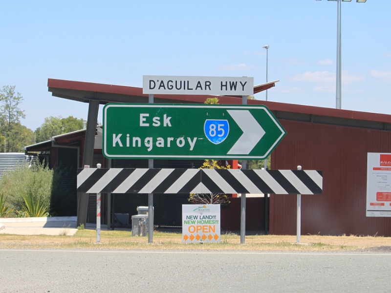
Intersection
Directional Sign: ID sign at Esk, facing Esk-Hampton Rd (SR85), November 2009. Image © Rob Tilley |
|
 |
D'Aguilar Highway
& Old Gympie Road: Old Gympie Rd at the interchange with D'Aguilar Hwy (SR85) at Caboolture, November 2009. Image © Rob Tilley |
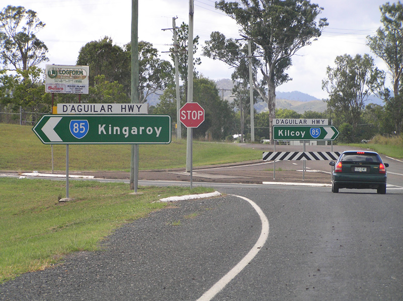
 |
Intersection
Directional Sign: ID sign at the junction with Esk-Kilcoy Rd at Kilcoy, April 2005. Image © Rob Tilley |
|
 |
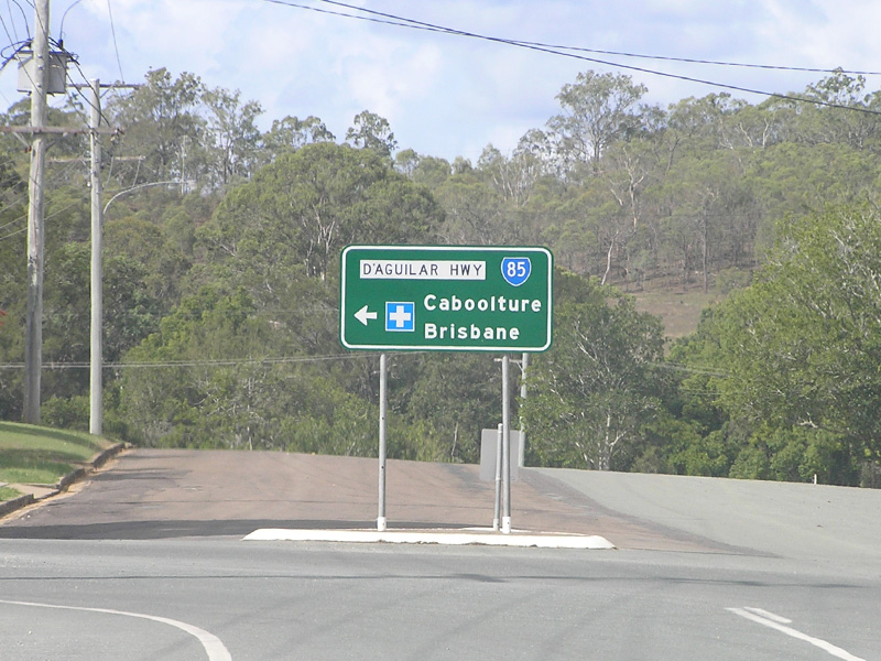
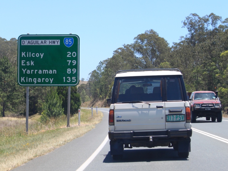
Distance Sign: Reassurance directional sign as D'Aguilar Hwy (SR85) leaves Caboolture, November 2009. Image © Rob Tilley |
 |
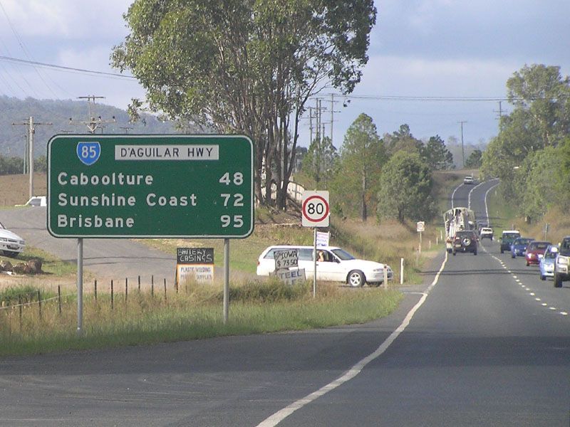
Distance
Sign: RD sign on D'Aguilar Hwy (SR85) at Kilcoy, April 2005. This sign has been relocated further from the Esk-Kilcoy Rd intersection. Image © Rob Tilley |
|
 |
Advance Directional
Sign: AD sign approaching King St at Moodlu, November 2009. Image © Rob Tilley |
 |
Distance
Sign: RD sign on D'Aguilar Hwy (SR85) at Kilcoy, August 2018. Image © Rob Tilley |
|
 |
Intersection
Directional Sign: ID sign at the corner D'Aguilar Hwy (SR85) and King St in Moodlu, November 2009. Image © Rob Tilley |
 |
Entering
Kilcoy: D'Aguilar Hwy (SR85) as it enters the town of Kilcoy, August 2018. Image © Rob Tilley |
|
 |
Distance Sign: RD sign at Moodlu, November 2009. Image © Rob Tilley |
 |
Intersection
Directional Sign: AD style sign at the junction with Hope St in Kilcoy, April 2005. Image © Rob Tilley |
|
 |
Entering Wamuran: D'Aguilar Hwy (SR85) as it enters the town of Wamuran, November 2009. Image © Rob Tilley |
 |
Intersection
Directional Sign: ID sign at the William St junction in Kilcoy, August 2018. Click here for a photo of this location by Rob Tilley from April 2005. Image © Rob Tilley |
|
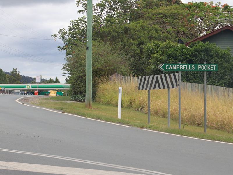 |
Intersection
DIrectional Sign: ID sign at the junction with Campbells Pocket Rd at Wamuran, November 2009. Image © Rob Tilley |
 |
Distance
Sign: RD sign as D'Aguilar Hwy (SR85) leaves Kilcoy, April 2005. Image © Rob Tilley |
|
 |
Crash Zone Sign: Crash zone sign on D'Aguilar Hwy (SR85) as it makes its way through Wamuran, November 2009. Image © Rob Tilley |
 |
Neurum
Road: Corner of D'Aguilar Hwy (SR85) and Neurum Rd at Winya, August 2018. Image © Rob Tilley |
|
 |
Steep Climb: D'Aguilar Hwy (SR85) as it winds its way up through the hills at Bracalba, November 2009. Image © Rob Tilley |
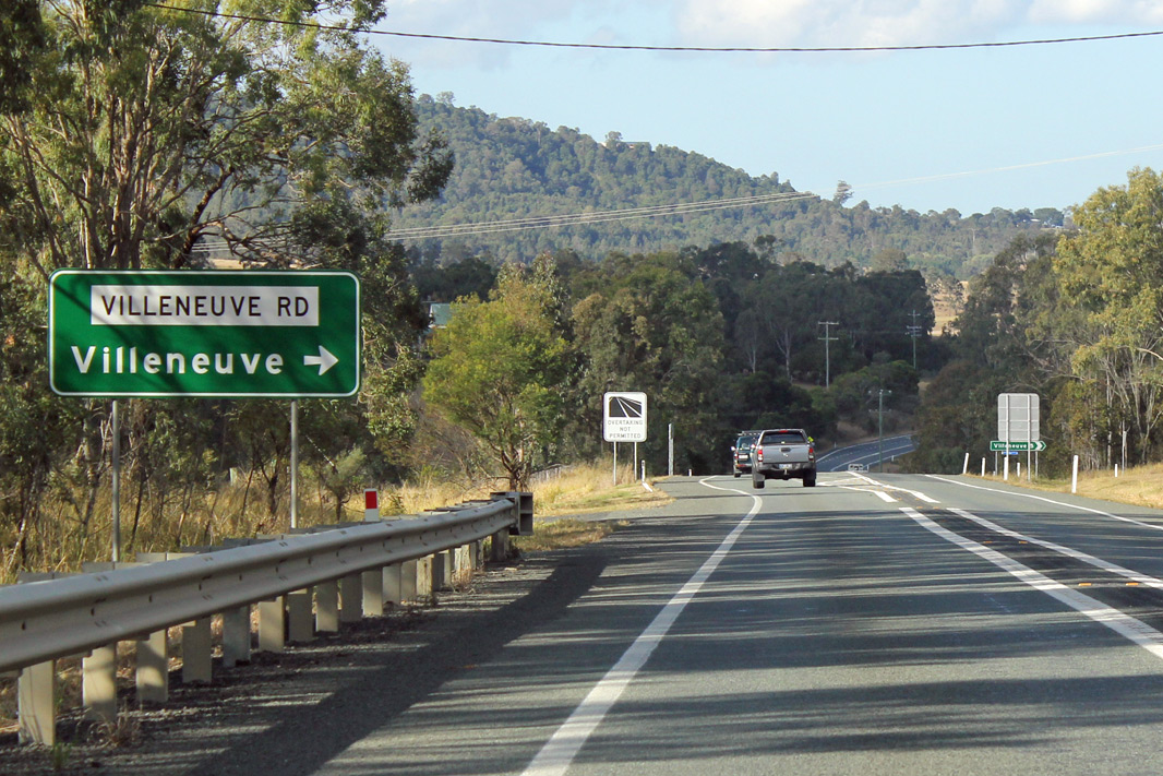 |
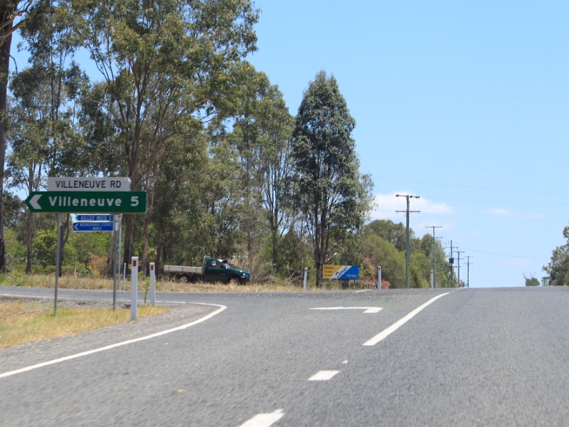
Advance
Directional Sign: AD sign on D'Aguilar Hwy (SR85) at Villeneuve approaching Villeneuve Rd, August 2018. Image © Rob Tilley |
|
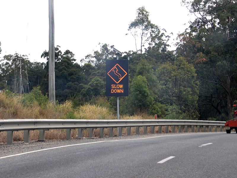 |
Electronic Warning
Sign: Electronic warning sign on D'Aguilar Hwy (SR85) at D'Aguilar, November 2009. Image © Rob Tilley |
 |
Villeneuve
Road: Corner of D'Aguilar Hwy (SR85) and Villeneuve Rd at Villeneuve, August 2018. Image © Rob Tilley |
|
 |
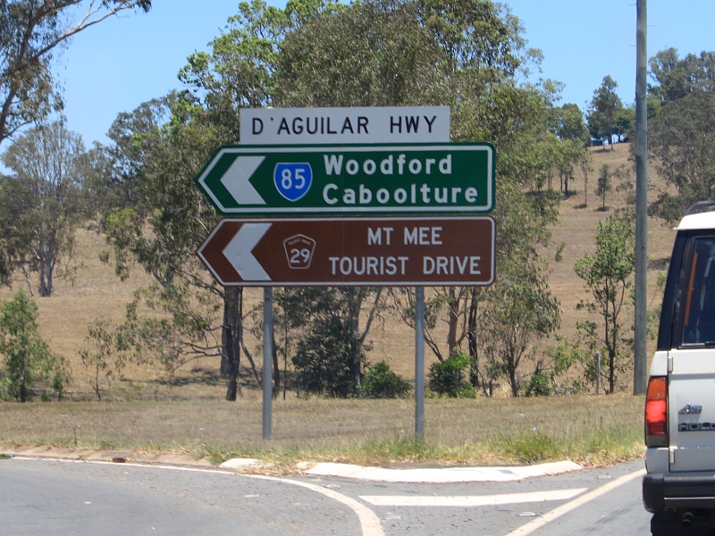
Advance Directional
Sign: AD sign at D'Aguilar approaching Mt Mee Rd (SR58/TD29), November 2009. The TD29 duplex begins at this junction. Image © Rob Tilley |
 |
Advance Directional
Sign: AD sign approaching Kilcoy-Beerwah Rd (SR6) at Woodford, April 2005. Image © Rob Tilley |
|
 |
Intersection
Directional Sign: ID sign at the junction of D'Aguilar Hwy (SR85) and Mt Mee Rd (SR58/TD29) at D'Aguilar, November 2009. Image © Rob Tilley |
 |
Intersection
Directional Sign: ID sign on D'Aguilar Hwy (SR85) at Woodford at the Kilcoy-Beerwah (SR6) intersection, August 2018. Image © Rob Tilley |
|
 |
Intersection
Directional Sign: ID sign facing Kilcoy-Beerwah Rd (SR6) at Woodford, November 2009. Image © Rob Tilley |
 |
Intersection
Directional Sign: ID sign facing Kilcoy-Beerwah Rd (SR6) at Woodford, November 2009. Image © Rob Tilley |
|
 |
Distance Sign: RD sign on D'Aguilar Hwy (SR85) at Woodford, November 2009. Image © Rob Tilley |
 |
Distance Sign: RD sign as the TD29 duplex begins at Woodford, November 2009. Image © Rob Tilley |
|
 |
Advance Directional
Sign: AD sign approaching Villeneuve Rd at Royston, November 2009. Image © Rob Tilley |
|||
 |
Villeneuve Road: Corner of D'Aguilar Hwy (SR85) and Villeneuve Rd at Royston, November 2009. Image © Rob Tilley |
|||
 |
Trailblazer: State Route 85 trailblazer at Royston, November 2009. Image © Rob Tilley |
|||
 |
Intersection
Directional Sign: Obscured ID sign at the junction with Neurum Rd at Winya, November 2009. Image © Rob Tilley |
|||
 |
Advance Directional
Sign: AD sign approaching William St at Kilcoy, August 2018. Click here for a photo of this location by Rob Tilley from November 2009. Image © Rob Tilley |
|||
 |
Intersection
Directional Sign: ID sign at the corner of D'Aguilar Hwy (SR85) and William St in Kilcoy, November 2009. Image © Rob Tilley |
|||
 |
Intersection
Directional Sign: ID sign at the corner of D'Aguilar Hwy (SR85) and Hope St in Kilcoy, November 2009. Image © Rob Tilley |
|||
 |
Distance Sign: RD sign as the D'Aguilar Hwy (SR85) leaves Kilcoy town centre, November 2009. Image © Rob Tilley |
|||
 |
Advance Directional
Sign: AD sign approaching Esk-Kilcoy Rd, November 2009. Image © Rob Tilley |
|||
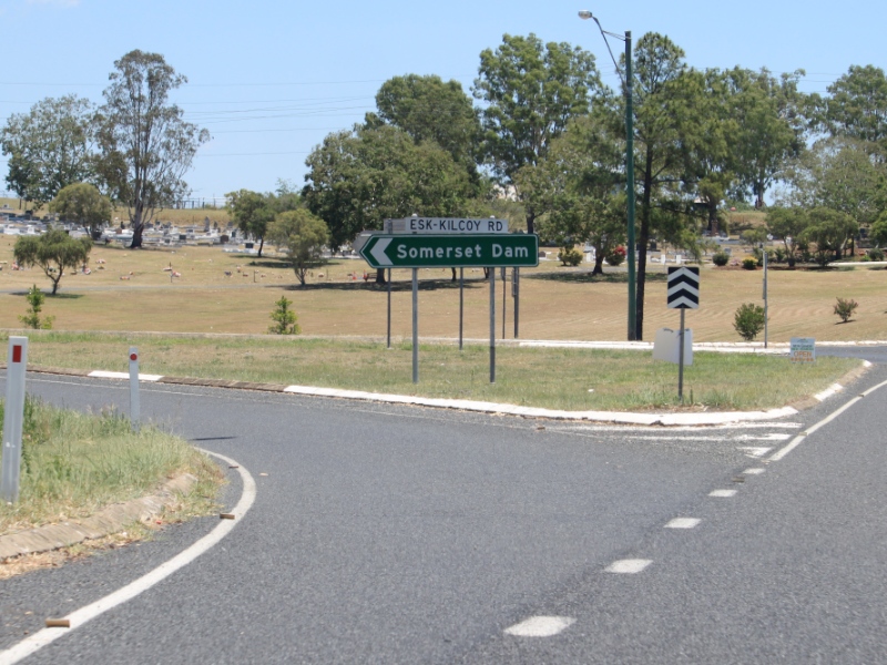 |
Esk-Kilcoy Road: Corner of D'Aguilar Rd (SR85) and Esk-Kilcoy Rd at Kilcoy, November 2009. Image © Rob Tilley |
|||
 |
Advance Directional
Sign: AD sign on Esk-Kilcoy Rd at Kilcoy approaching D'Aguilar Hwy (SR85), August 2018. Image © Rob Tilley |
|||
 |
Esk-Kilcoy Road: Intersection directional signs facing Esk-Kilcoy Rd at Kilcoy, April 2005. Image © Rob Tilley |
|||
 |
Distance Sign: RD sign as D'Aguilar Hwy (SR85) leaves Kilcoy, August 2018. Image © Rob Tilley |
|||
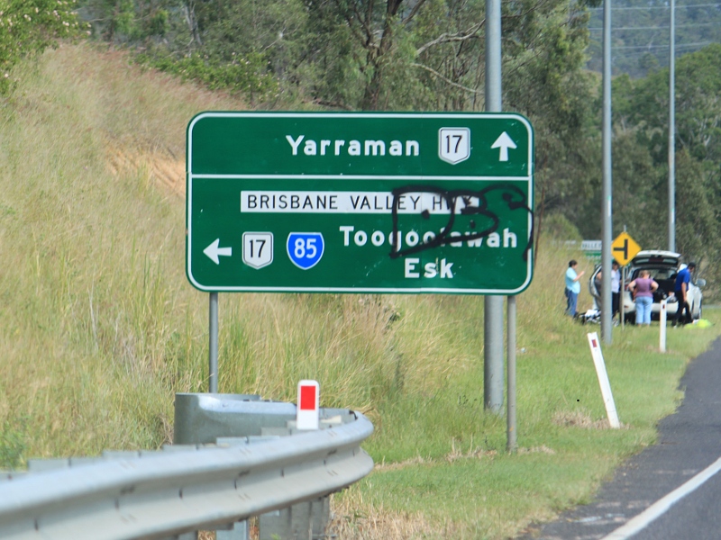 |
Advance Directional
Sign: AD sign on D'Aguilar Hwy (SR85) approaching Brisbane Valley Hwy (NR17) at Harlin, November 2009. SR85 turns left at this junction and duplexes with NR17. Image © Rob Tilley |
|||
 |
Advance Directional
Sign: AD sign on Esk-Kilcoy Rd at Esk, November 2009. SR85 should also be marked for the left turn as well. Image © Rob Tilley |
|||
 |
Intersection
Directional Sign: ID sign facing Esk-Kilcoy Rd at Esk, November 2009. Image © Rob Tilley |
|||
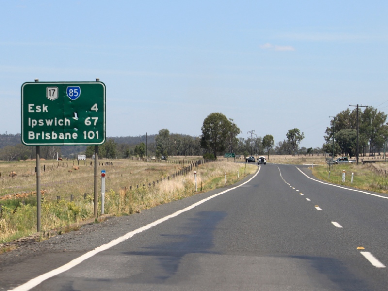 |
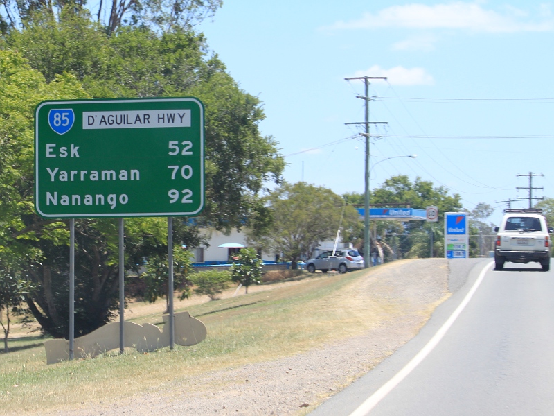
Distance Sign: RD sign on Brisbane Valley Hwy (SR85/NR17) at Esk, November 2009. Image © Rob Tilley |
|||
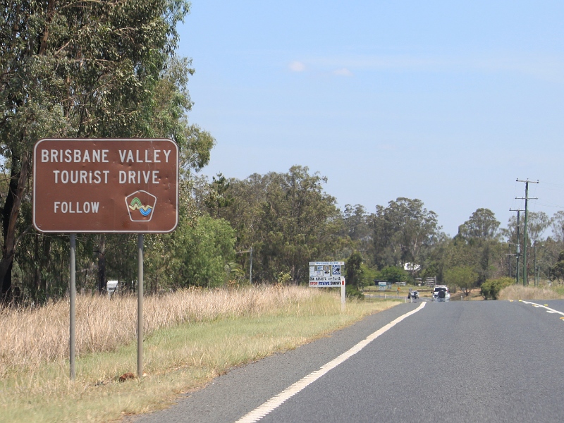 |
Brisbane Valley
Tourist Drive: Reassurance sign in Esk, November 2009. Image © Rob Tilley |
|||
 |
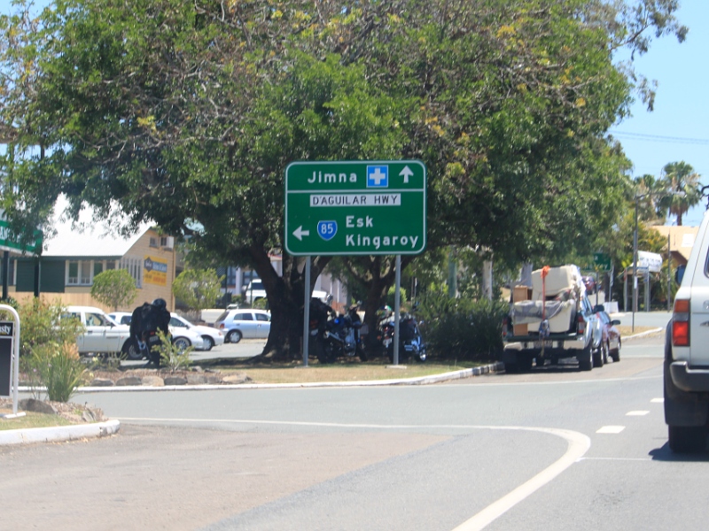
Esk-Hampton Road &
Brisbane Valley Highway: Corner of Esk-Hampton Rd (SR85) and Brisbane Valley Hwy (NR17) at Esk, November 2009. Image © Rob Tilley |
|||
1 Transport
and Main Roads, Queensland state-controlled roads and region maps, North
Coast Region
2 Queensland Government, Community
celebrates opening of Caboolture Bypass, 18 November 2007
Last updated: 21-Oct-2021 18:52
This site © Paul Rands. All rights reserved. Some portions © (copyright) by their respective and credited owners. Permission must be obtained before using any images from this site. For details, please email by clicking here.