|
|
|
|
|
 |
Anzac Avenue (State Route 71) |
Statistics:
Route Numbering:


General Information:
Text
Multiplexes along the route include:

| Petrie to Redcliffe | Redcliffe to Petrie | |||
| Preview: | Description: | Preview: | Description: | |
 |
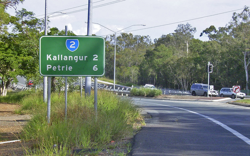
Intersection Directional Sign: ID sign at the roundabout with Gympie Rd (SR58) & Dayboro Rd (SR58) at Petrie, July 2011. Image © Rob Tilley |
 |
Oxley Avenue: Anzac Av (SR71) at the junction with Oxley Av (SR27) and the unnumbered section of Anzac Av, January 2009. This is the eastern terminus of SR71. Image © Rob Tilley |
|
 |
Reassurance Directional Sign: RD sign at Petrie, near Station St, July 2011. Image © Rob Tilley |
 |
Advance Directional Sign: AD sign approaching Recreation St & Victoria Av at Redcliffe, January 2009. Image © Rob Tilley |
|
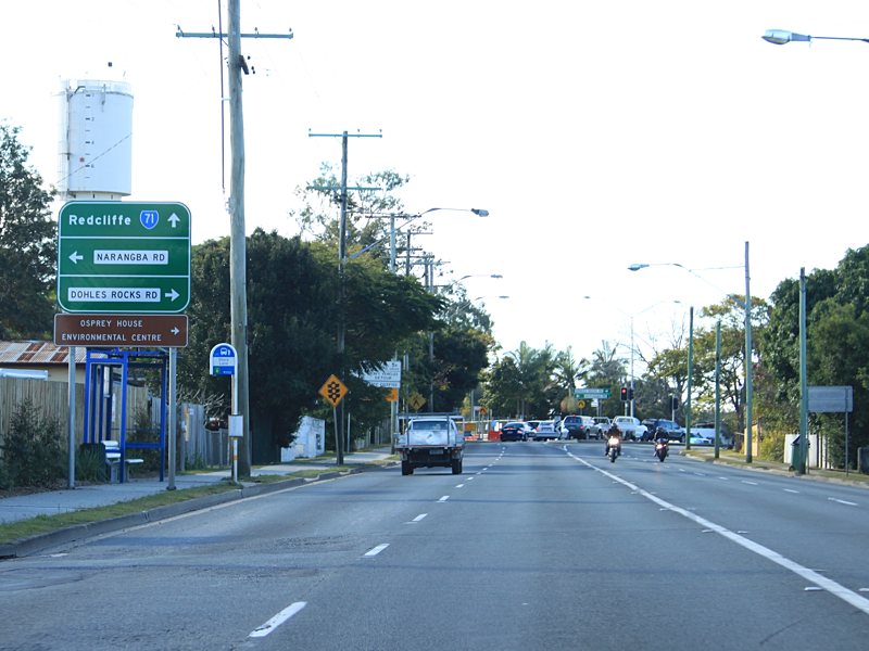 |
Advance Directional Sign: AD sign at Kallangur approaching Narangba Rd ad Dohles Rocks Rd, July 2011. Image © Rob Tilley |
 |
Supplemental Advance Directional Sign: Supplemental AD sign approaching Recreation St & Victoria Av at Redcliffe, January 2009. Image © Rob Tilley |
|
 |
Narangba Road & Dohles Rocks Road: Anzac Av (SR71) at the Narangba Rd & Dohles Rocks Rd at Kallangur, July 2011. Image © Rob Tilley |
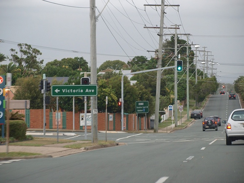 |
Recreation Street & Victoria Avenue: Corner of Anzac Av (SR71), Recreation St and Victoria Av, January 2009. Image © Rob Tilley |
|
 |
Advance Directional Sign: AD sign at Kallangur approaching Old Gympie Rd, July 2011. Image © Rob Tilley |
 |
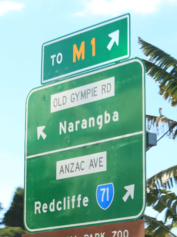
Advance Directional Sign: AD sign at Mango Hill approaching the interchange with Bruce Hwy (M1), May 2005. Image © Michael Greenslade |
|
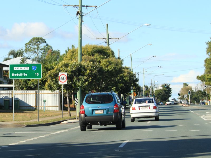 |
Distance Sign: RD sign at Kallangur, July 2011. Image © Rob Tilley |
 |
Bruce Highway: Anzac Av (SR71) at the Bruce Hwy (M1) interchange at Kallangur, May 2005. Image © Michael Greenslade |
|
 |
Freeway Green Advance Directional Sign: Freeway green and standard green AD sign at Kallangur approaching the interchange with Bruce Hwy (M1), May 2005. Image © Michael Greenslade |
 |
Reassurance Directional Sign: Distance sign at Kallangur, May 2005. Image © Michael Greenslade |
|
 |
Advance Directional Sign: AD sign at Kallangur approaching the interchange with Bruce Hwy (M1), May 2005. Image © Michael Greenslade |
 |
Freeway Green Intersection Directional Sign: Freeway green and standard green ID signs at Kallangur facing the off ramp from with Bruce Hwy (M1), May 2005. Image © Michael Greenslade |
|
 |
Advance Directional Sign: AD sign approaching the Bruce Hwy (M1) interchange at Kallangur, July 2011. Image © Rob Tilley |
|||
 |
Bruce Highway: Anzac Av (SR71) at the Bruce Hwy (M1) interchange at Kallangur, July 2011. Image © Rob Tilley |
|||
 |
Advance Directional Sign: AD sign on Anzac Av (SR71) at Rothwell, approaching Anzac Av (SR26 / SR71) and Deception Bay Rd (SR26), May 2005. SR71 turns right at this junction and the SR26 duplex starts at this intersection as well. Image © Michael Greenslade |
|||
 |
Advance Directional Sign: AD sign on Anzac Av (SR26 / SR71) approaching Klingner Rd at Kippa-Ring, January 2009. Image © Rob Tilley |
|||
 |
Supplemental Advance Directional Sign: Supplemental AD sign on Anzac Av (SR26 / SR71) approaching Klingner Rd at Kippa-Ring, January 2009. Image © Rob Tilley |
|||
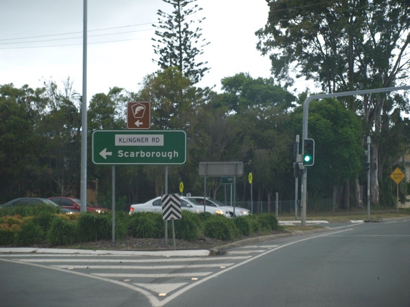 |
Klingner Road: ID sign at the corner of Anzac Av (SR26 / SR71) and Klingner Rd (North Moreton Bay Tourist Drive), January 2009. Image © Rob Tilley |
|||
 |
Advance Directional Sign: AD sign on Anzac Av (SR26 / SR71) approaching Boardman Rd, Anzac Av (SR71) and Elizabeth Av (SR26) at Kippa-Ring, January 2009. Image © Rob Tilley |
|||
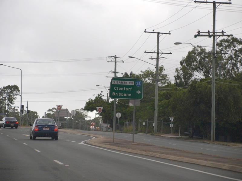 |
Intersection Directional Sign: AD style ID sign at the junction with Boardman Rd, Anzac Av (SR71) and Elizabeth Av (SR26) at Kippa-Ring, January 2009. Image © Rob Tilley |
|||
 |
Advance Directional Sign: AD sign approaching Recreation St & Victoria Av at Redcliffe, January 2009. Image © Rob Tilley |
|||
 |
Supplemental Advance Directional Sign: Supplemental AD sign approaching Recreation St & Victoria Av at Redcliffe, January 2009. Image © Rob Tilley |
|||
 |
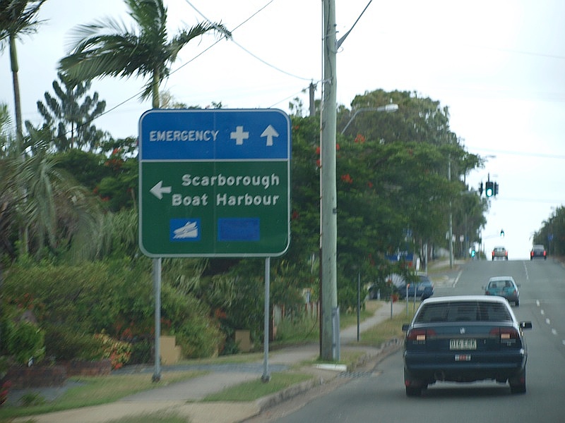
Advance Directional Sign: AD sign at Redcliffe approaching the unnumbered section of Anzac Av and Oxley Av (SR27), January 2009. Image © Rob Tilley |
|||
 |
Oxley Avenue: Anzac Av (SR71) at the junction with Oxley Av (SR27) and the unnumbered section of Anzac Av, January 2009. This is the eastern terminus of SR71. Image © Rob Tilley |
|||
 |
Oxley Avenue: Anzac Av (SR71) at the junction with Oxley Av (SR27) and the unnumbered section of Anzac Av, January 2009. This is the eastern terminus of SR71. Image © Rob Tilley |
|||
1 Transport & Main Roads, Queensland state-controlled roads and region maps, North Coast Region: front
Last updated: 21-Oct-2021 18:49
This site © Paul Rands. All rights reserved. Some portions © (copyright) by their respective and credited owners. Permission must be obtained before using any images from this site. For details, please email by clicking here.