|
|
|
|
|
 |
Strathpine Road, Gympie Road, Dayboro Road, Hay Road & Mount Mee Road (State Route 58) |
Statistics:
Route Numbering:


General Information:
State Route 58 is a route in the outer reaches of Brisbane's northern suburbs, and links what was once the main route between Brisbane and the north coast of Queensland, with the mountain tourist towns to the northwest.
The route is a mix of divided arterial road and undivided rural road that passes through commercial, residential, rural and bushland areas.
Multiplexes along the route include:

| Bald Hills to D'Aguilar | D'Aguilar to Bald Hills | |||
| Preview: | Description: | Preview: | Description: | |
 |
Advance Directional Sign: AD sign on the unnumbered section of Gympie Rd at Bald Hills approaching Gympie Rd (SR58) and Strathpine Rd (SR58), November 2009. Image © Rob Tilley |
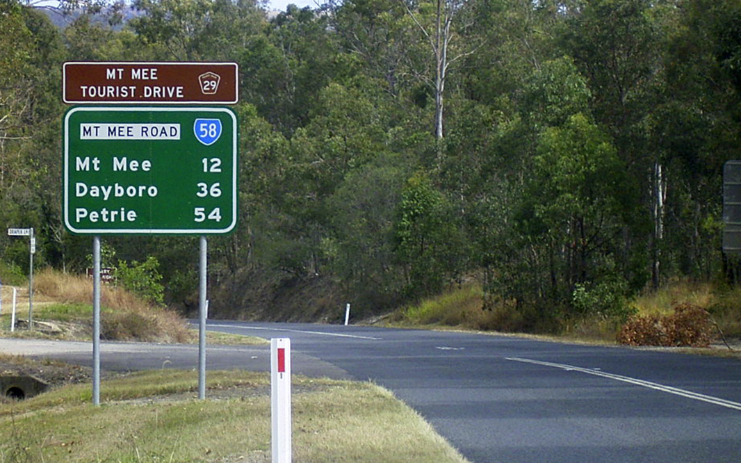 |
Distance Sign: RD sign on Mt Mee Rd (SR58/TD29) at D'Aguilar, July 2004. Image © Michael Greenslade |
|
 |
Advance Directional Sign: AD sign assembly on Gympie Rd (SR58) approaching Kremzow Rd at Strathpine, November 2009. Note the incorrect font on the bottom panel. Image © Rob Tilley |
 |
Delaneys Creek: Mt Mee Rd (SR58/TD29) as it passes through Delaney's Creek, July 2011. Image © Rob Tilley |
|
 |
Kremzow Road: Corner of Gympie Rd (SR58) and Kremzow Rd at Strathpine, November 2009. Note the incorrect font on the bottom panel. Image © Rob Tilley |
 |
Delaneys Creek: Mt Mee Rd (SR58/TD29) as it passes through Delaney's Creek, July 2011. Image © Rob Tilley |
|
 |
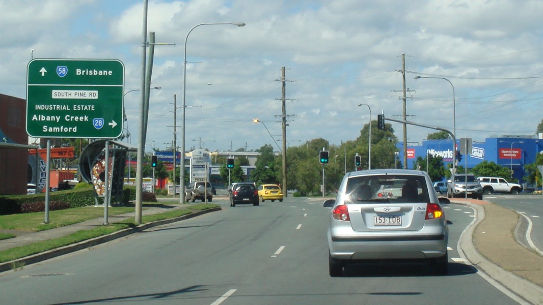
Advance Directional Sign: AD sign on Gympie Rd (SR58) approaching South Pine Rd (SR28) at Strathpine, November 2009. Image © Rob Tilley |
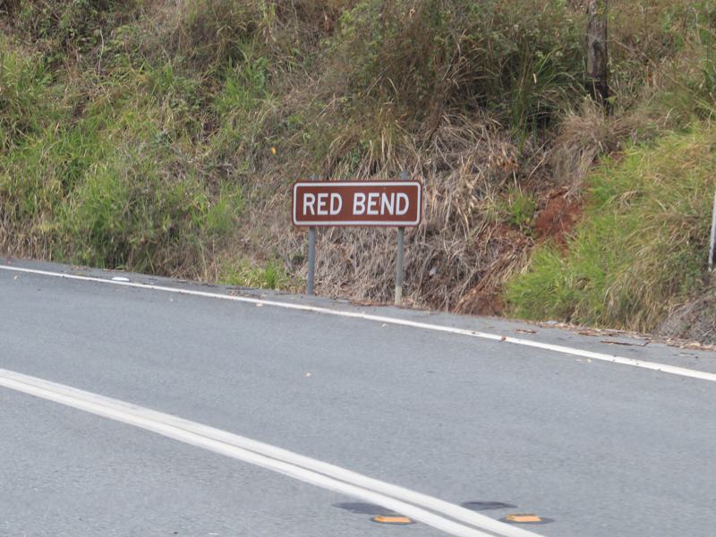 |
Red Bend: Mt Mee Rd (SR58/TD29) at Red Bend in Mt Mee, July 2011. Image © Rob Tilley |
|
 |
Distance Sign: RD sign on Gympie Rd (SR58) at Strathpine featuring the incorrect font on the road name patch, November 2009. Image © Rob Tilley |
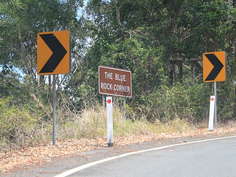 |
Blue Rock Corner: Mt Mee Rd (SR58/TD29) at Blue Rock Corner at Mt Mee, July 2011. Image © Rob Tilley |
|
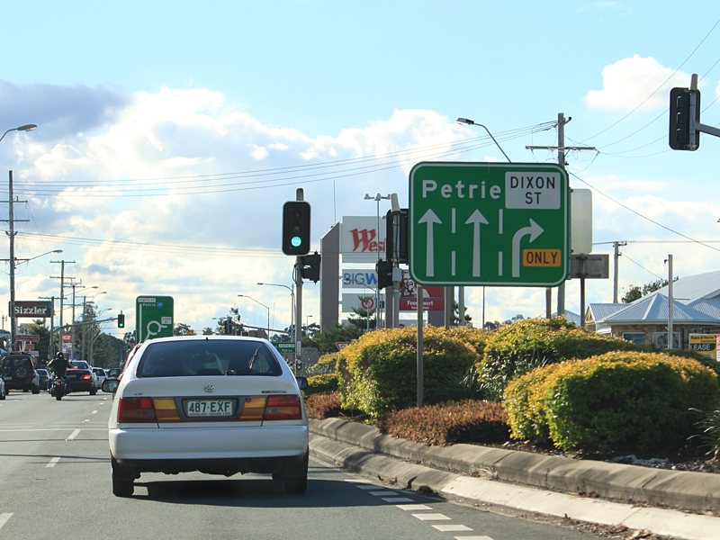 |
Lane Allocation Sign: Gympie Rd (SR58) approaching Dixon St at Strathpine, November 2009. Image © Rob Tilley |
 |
Advance Directional Sign: AD sign approaching Dahmongah Lookout at Mt Mee, July 2011. Image © Rob Tilley |
|
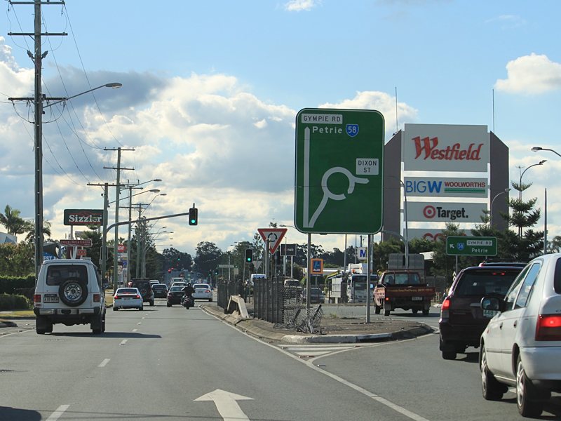 |
Dixon Street: AD style sign at the Dixon St junction in Strathpine, November 2009. Image © Rob Tilley |
 |
Dahmongah Lookout: Mt Mee Rd (SR58/TD29) at the junction with Dahmongah Lookout in Mt Mee, July 2011. Image © Rob Tilley |
|
 |
Trailblazer: SR58 trailblazer as Gympie Rd crosses Four Mile Ck at Lawnton, November 2009. Image © Rob Tilley |
 |
Motorcycle Crash Zone: Motorcycle crash zone sign on Mt Mee Rd (SR58/TD29) at Mt Mee, July 2011. Image © Rob Tilley |
|
 |
Advance Directional Sign: AD sign approaching Todds Rd and Lawnton Pocket Rd at Lawnton, November 2009. Image © Rob Tilley |
 |
Intersection Directional Sign: ID sign assembly at the corner of Mt Mee Rd (SR58/TD29) and Campbells Pocket Rd, July 2011. Image © Rob Tilley |
|
 |
North Pine River: Gympie Rd (SR58) as it crosses North Pine River at Lawnton, November 2009. Image © Rob Tilley |
 |
Intersection Directional Sign: ID sign at the corner of Mt Mee Rd (SR58/TD29) and Robinson Rd at Mt Mee, July 2011. Image © Rob Tilley |
|
 |
Supplemental Advance Directional Sign: Supplemental AD sign on Gympie Rd (SR58) approaching Dayboro Rd (SR58) and Anzac Av (SR71) at Petrie, November 2009. Image © Rob Tilley |
 |
Advance Directional Sign: AD sign on Mt Mee Rd (SR58/TD29) at Mt Mee, approaching Sellin Rd, July 2011. Image © Rob Tilley |
|
 |
Advance Directional Sign: AD sign on Gympie Rd (SR58) approaching Dayboro Rd (SR58) and Anzac Av (SR71) at Petrie, November 2009. Image © Rob Tilley |
 |
Sellin Road: Corner of Mt Mee Rd (SR58/TD29) and Sellin Rd at Mt Mee, July 2011. Image © Rob Tilley |
|
 |
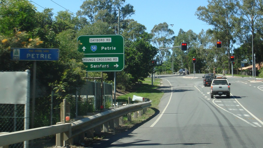
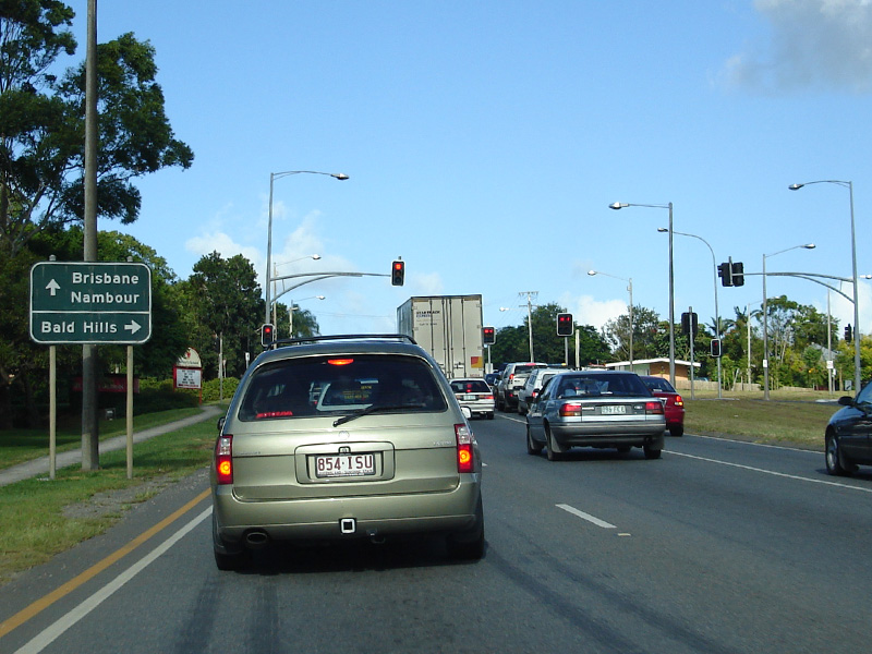
Gympie Road, Anzac Avenue & Dayboro Road: Signage on the Gympie Rd (SR58), Dayboro Rd (SR58) and Anzac Ave (SR71) roundabout at Petrie, November 2009. SR58 turns left at this junction. Image © Rob Tilley |
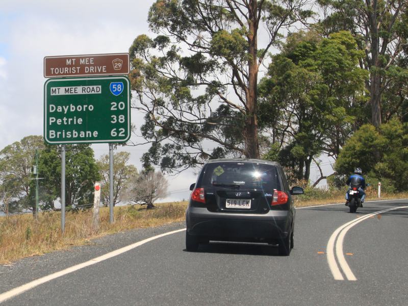 |
Distance Sign: RD sign on Mt Mee Rd (SR58/TD29) at Mt Mee, July 2011. Image © Rob Tilley |
|
 |
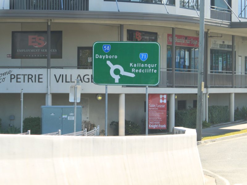
Intersection Directional Sign: ID sign assembly at the corner of Hay Rd (SR58), Mt Mee Rd (SR58/TD29) and Williams St (SR22) at Dayboro, November 2009. SR58 turns right at this junction, and also picks up the TD29 duplex. Image © Rob Tilley |
 |
Entering Ocean View: Mt Mee Rd (SR58/TD29) as it enters the town of Ocean View, July 2011. Image © Rob Tilley |
|
 |
End Tourist Drive 29: End TD29 sign on Mt Mee Rd (SR58/TD29) at Dayboro, approaching William St (SR22), July 2011. Image © Rob Tilley |
|||
 |
Advance Directional Sign: AD sign on Mt Mee Rd (SR58/TD12) approaching Hay Rd (SR58) and Williams St (SR22), July 2011. Image © Rob Tilley |
|||
 |
Intersection Directional Sign: ID sign assembly at the corner of Hay Rd (SR58), Mt Mee Rd (SR58/TD29) and Williams St (SR22) at Dayboro, July 2011. Image © Rob Tilley |
|||
 |
Reassurance Directional Sign: Distance sign on Hay Rd (SR58) at Dayboro, March 2012. Image © Paul Rands |
|||
 |
Rush Creek : Dayboro Rd (SR58) as it enters the town of Rush Creek, March 2012. Image © Paul Rands |
|||
 |
Whiteside: Dayboro Rd (SR58) as it enters the town of Whiteside, March 2012. Image © Paul Rands |
|||
 |
Voires Road : ID sign at the corner of Dayboro Rd (SR58) and Voires Rd at Kurwongbah, March 2012. Image © Paul Rands |
|||
 |
Advance Directional Sign: AD sign at Kurwongbah approaching the entrance to Old Petrie Town, March 2012. Image © Paul Rands |
|||
 |
Old Petrie Town : Dayboro Rd (SR58) at the entrance to Old Petrie Town, Kurwongbah, March 2012. Image © Paul Rands |
|||
 |
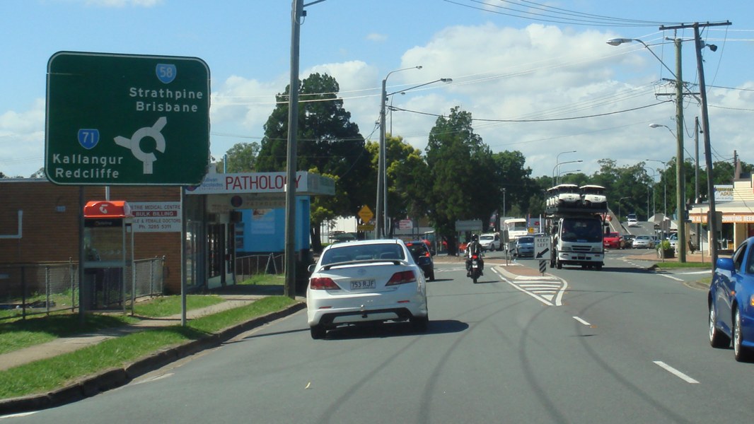
Advance Directional Sign : AD sign at Petrie, approaching Youngs Crossing Rd, March 2012. Image © Paul Rands |
|||
 |
Advance Directional Sign: AD sign approaching the roundabout with Beeville Rd and Andrew Petrie Dr at Petrie, March 2012. Image © Paul Rands |
|||
 |
Intersection Directional Sign: ID sign on the roundabout with Beeville Rd and Andrew Petrie Dr at Petrie, March 2012. Image © Paul Rands |
|||
 |
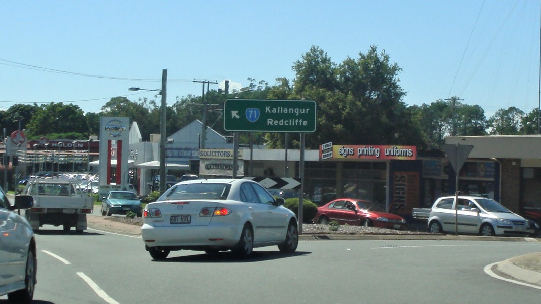
Advance Directional Sign: AD sign approaching the roundabout with Anzac Av (SR71) at Petrie, March 2012. Image © Paul Rands |
|||
 |
Intersection Directional Sign: ID sign on the roundabout with Anzac Av (SR71) at Petrie, March 2012. Image © Paul Rands |
|||
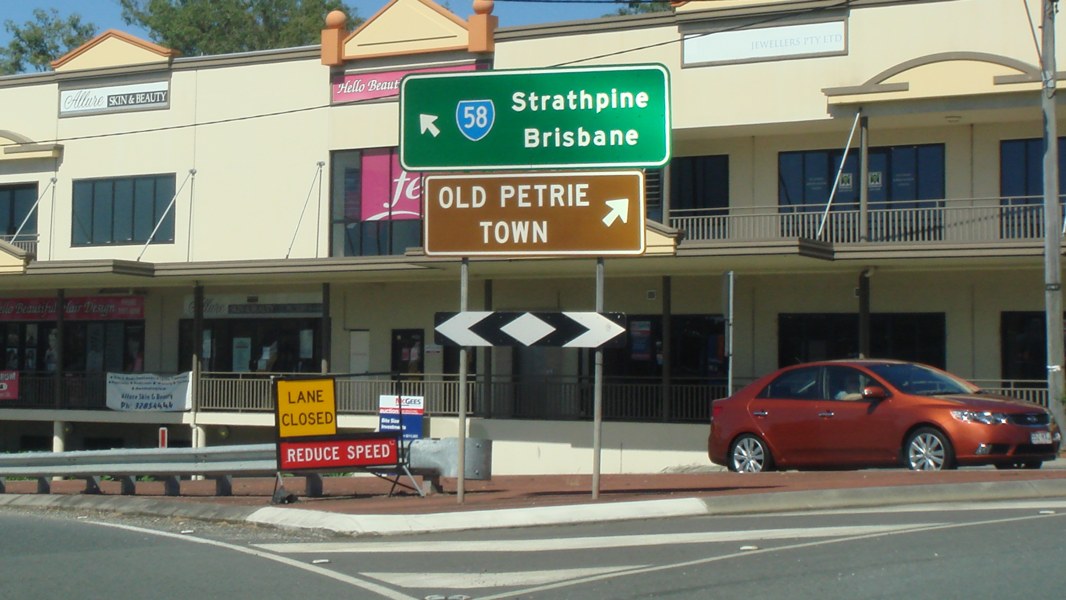 |
Intersection Directional Sign: ID sign on the roundabout with Anzac Av (SR71) at Petrie, March 2012. Image © Paul Rands |
|||
 |
Black Reassurance Directional Sign: Black distance sign on Dayboro Rd (SR58) at Petrie, March 2012. Image © Paul Rands |
|||
 |
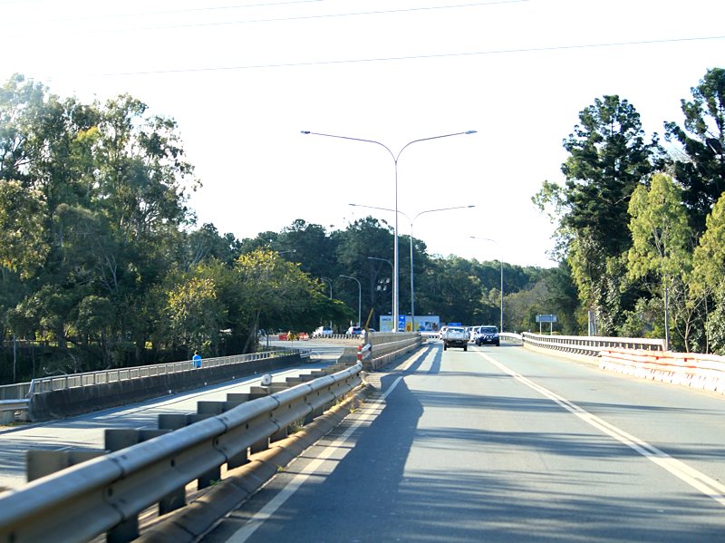
North Pine River : Dayboro Rd (SR58) crossing North Pine River via AJ Wyllie Bridge at Petrie, March 2012. Image © Paul Rands |
|||
 |
Advance Directional Signs: AD signs on Gympie Rd (SR58) approaching Todds Rd and Lawnton Pocket Rd at Lawnton, March 2012. Image © Paul Rands |
|||
 |
Trailblazer: SR58 trailblazer on Gympie Rd (SR58) at Lawnton, March 2012. Image © Paul Rands |
|||
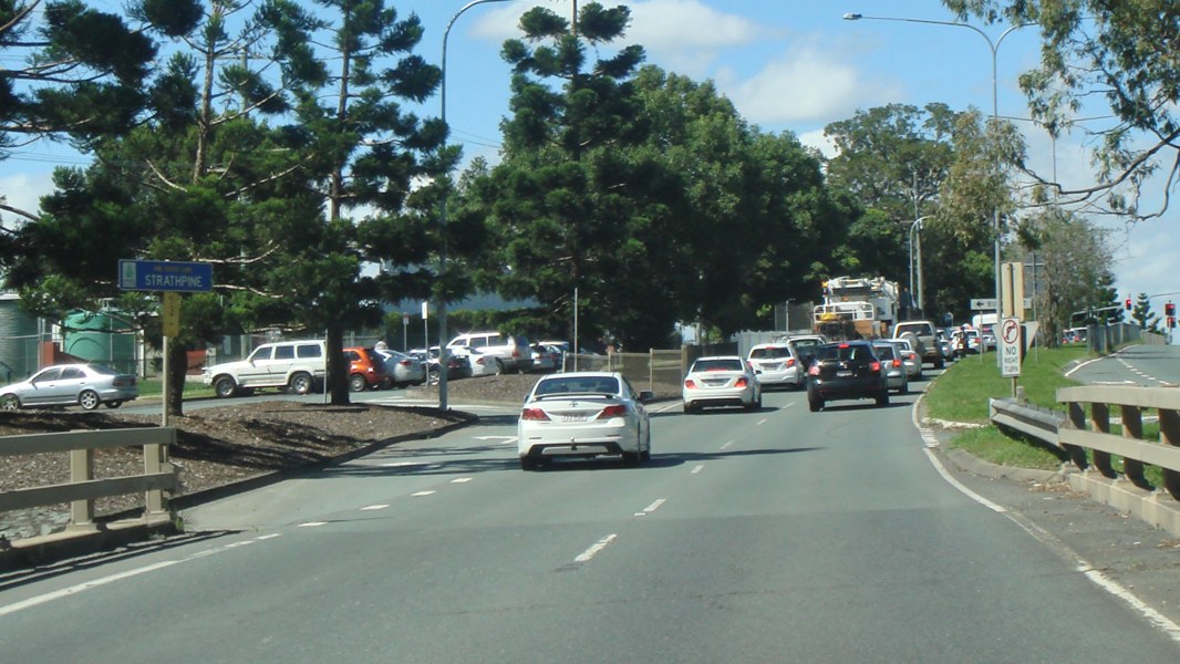 |
Strathpine: Gympie Rd (SR58) as it enters the suburb of Strathpine, March 2012. Image © Paul Rands |
|||
 |
Advance Directional Sign: AD sign at Strathpine, approaching Dixon St roundabout, March 2012. Image © Paul Rands |
|||
 |
Intersection Directional Sign : ID sign at the roundabout with Dixon St, Strathpine, March 2012. Image © Paul Rands |
|||
 |
Intersection Directional Sign : ID sign at the roundabout with Dixon St, Strathpine, March 2012. Image © Paul Rands |
|||
 |
Black Advance Directional Sign: Black AD sign on Gympie Rd (SR58) approaching South Pine Rd (SR28) at Strathpine, March 2012. Click here for a photo by Paul Rands of the old black sign that was in this location from March 2006. Image © Paul Rands |
|||
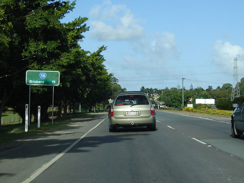 |
Distance Sign: RD signage as you head east along Gympie Road at Strathpine, March 2006. Image © Paul Rands |
|||
 |
Crossing South Pine River: Eastbound at Bald Hills (note sign announcing town) as you travel over South Pine River on Gympie Road, March 2006. Image © Paul Rands |
|||
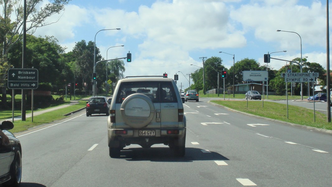 |
Black AD Sign: Heading east through Bald Hills approaching the intersection of Strathpine Road (SR58) and Gympie Road, March 2012. Click here for a photo by Paul Rands of the old black sign that was in this location from March 2006. Image © Paul Rands |
|||
 |
Trailblazer: SR58 trailblazer on Strathpine Rd (SR58) at Bald Hills, March 2012. Image © Paul Rands |
|||
 |
Caption Title: Caption, March 2012. Image © Paul Rands |
|||
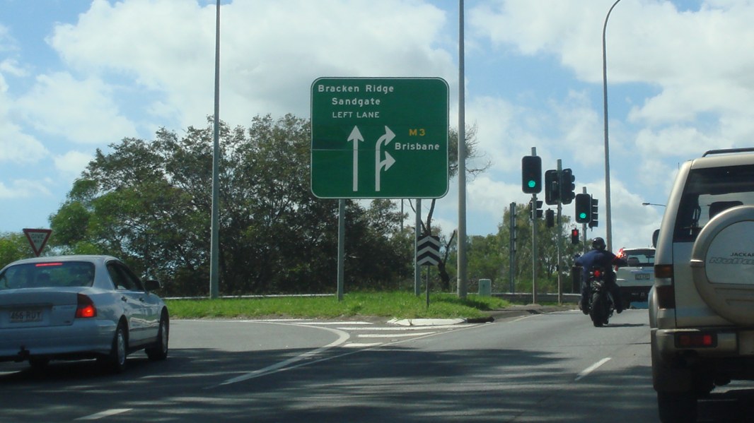 |
Advance Directional Sign: Strathpine Road (SR58) at Bald Hills approaching the Gympie Arterial Road (M3) interchange, Hoyland Road and also the southern terminus of SR58, March 2012. Click here for a photo by Paul Rands of this location from March 2006. Image © Paul Rands |
|||
 |
End SR58: No sign indicating this is the end of SR58, but it is the southern terminus of the route, with signage for the Gympie Arterial Road interchange, eastbound on Strathpine Road at Bald Hills, March 2012. Click here for a photo by Paul Rands of this location from March 2006. Image © Paul Rands |
|||
1 Transport & Main Roads, Queensland state-controlled roads and region maps, North Coast Region: front
Last updated: 21-Oct-2021 16:53
This site © Paul Rands. All rights reserved. Some portions © (copyright) by their respective and credited owners. Permission must be obtained before using any images from this site. For details, please email by clicking here.