|
|
|
|
|
 |
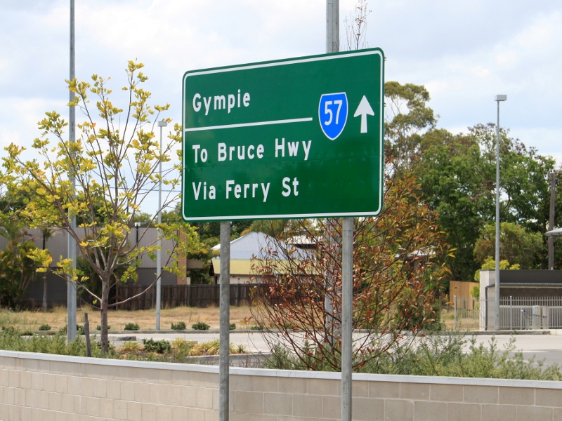
Gympie Road, Ferry Street, Walker Street, John Street, Saltwater Creek Road, Maryborough-Hervey Bay Road & Boat Harbour Drive (State Route 57) |
Statistics:
Route Numbering:


General Information:
State route 57 is located about 3 hours north of Brisbane in the Maryborough area, and varies from suburban street, rural road and semi-arterial road conditions and passes by shopping areas, farms and homes. The route through Tinana and Maryborough was once the Bruce Highway.
Multiplexes along the route include:
History:
Click here for photos of former alignments along State Route 57

| Tinana to Urangan | Urangan to Tinana | |||
| Preview: | Description: | Preview: | Description: | |
 |
Distance
Sign: Reassurance directional sign on Gympie Rd (SR57) at Tinana, December 2003. Image © Michael Greenslade |
 |
Intersection
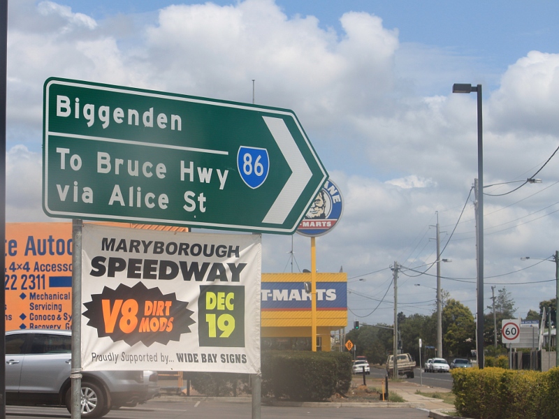
Directional Sign: ID sign at the corner Ferry St (SR57) and Alice St (SR86) at Maryborough, December 2009. Image © Rob Tilley |
|
 |
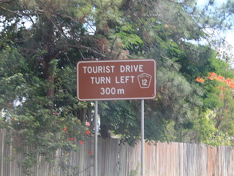
Start
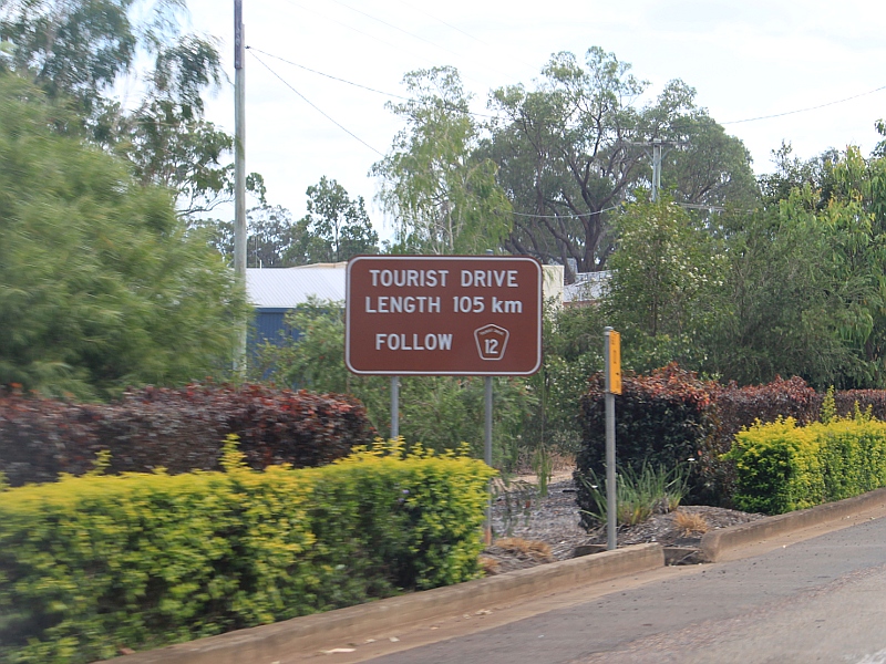
Tourist Drive 12: Sign on Gympie Rd at Tinana showing the start of TD12, December 2009. Image © Rob Tilley |
 |
Advance Directional
Sign: AD sign placed in the wrong spot, at the junction of Ferry St (SR57) and Alice St (SR86) in Maryborough, December 2009. Image © Rob Tilley |
|
 |
Mary Bridge: Gympie Rd (SR57/TD12) as it becomes Ferry St at Lamington Bridge over Mary River, October 2004. Image © Michael Greenslade |
 |
Intersection
Directional Sign: ID sign at the corner Ferry St (SR57) and Alice St (SR86) at Maryborough, December 2009. Image © Rob Tilley |
|
 |
Trailblazer: TD12 trailblazer along Ferry St in Maryborough, December 2009. Image © Rob Tilley |
 |
Intersection
Directional Sign: ID sign at the corner Ferry St (SR57) and Alice St (SR86) at Maryborough, December 2009. Image © Rob Tilley |
|
 |
Advance Directional
Sign: AD sign on Ferry St (SR57/TD12) in Maryborough approaching Ann St (TD12), December 2009. Image © Rob Tilley |
 |
Distance
Sign: Reassurance directional sign on Ferry St (SR57) at Maryborough, October 2004. Image © Michael Greenslade |
|
 |
Intersection
Directional Sign: ID sign at the corner Ferry St (SR57) and Ann St (TD12) in Maryborough, December 2009. The TD12 duplex ends at this junction. Image © Rob Tilley |
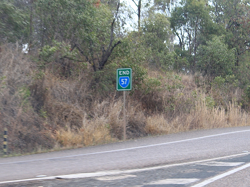 |
End State Route 57: End SR57 trailblazer on Gympie Rd (SR57) at Tinana approaching the junction with Bruce Hwy (A1), December 2009. Image © Rob Tilley |
|
 |
Advance Directional
Sign: AD sign on Ferry St (SR57) approaching Alice St (SR86) in Maryborough, December 2009. Image © Rob Tilley |
 |
Bruce Highway: Image © Michael Greenslade |
|
 |
Intersection
Directional Sign: ID sign at the corner Ferry St (SR57) and Alice St (SR86) at Maryborough, December 2009. Image © Rob Tilley |
|||
 |
Intersection
Directional Sign: ID sign at the corner Ferry St (SR57) and Alice St (SR86) at Maryborough, December 2009. Image © Rob Tilley |
|||
 |
Advance Directional
Sign: AD sign placed in the wrong spot, at the junction of Ferry St (SR57) and Alice St (SR86) in Maryborough, December 2009. Image © Rob Tilley |
|||
 |
Advance Directional
Sign: AD sign on Ferry St (SR57) approaching the unnumbered sections of Walker St and Ferry St, plus the SR57 segment of Walker St, March 2006. Image © Paul Rands |
|||
 |
Walker Street &
Ferry Street: Corner of Walker St (SR57) and Ferry St (SR57) at Maryborough, March 2006. SR57 turns right at this junction. When the Bruce Hwy was routed through town, it turned left here. Image © Paul Rands |
|||
 |
Walker Street &
John Street: Corner of Walker St and John St in Maryborough, March 2006. SR57 turns left at this junction. Image © Paul Rands |
|||
 |
Advance Directional
Sign: AD sign on Walker St approaching Ferry St in Maryborough. SR57 should have 'To' prefixed on it, and also be included in the bottom panel. January 2014. Image © Terry Siva |
|||
 |
Advance Directional
Sign: AD sign on Saltwater Creek Rd (SR57) approaching Pallas St at Maryborough, March 2006. Image © Paul Rands |
|||
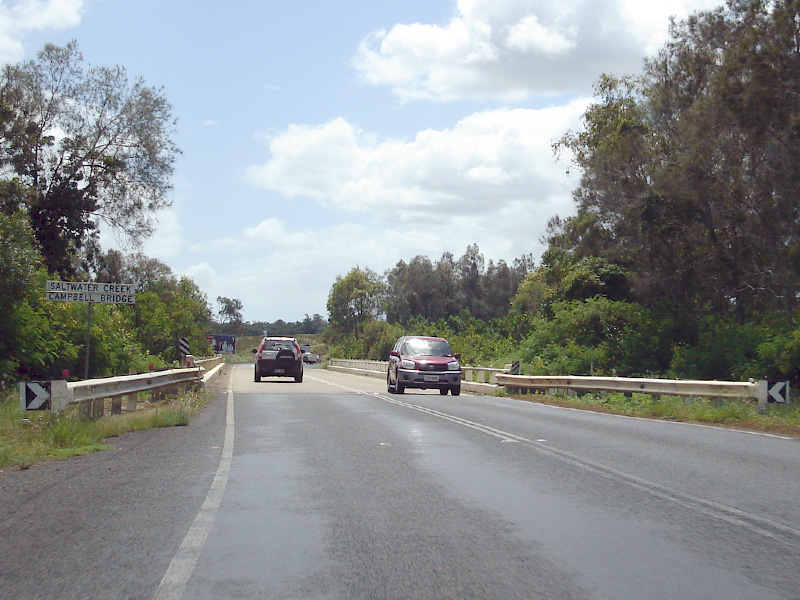 |
Saltwater Creek: State Route 57 as it crosses Saltwater Creek via Campbells Bridge, March 2006. This is where Saltwater Creek Rd becomes Maryborough-Hervey Bay Rd. Image © Paul Rands |
|||
 |
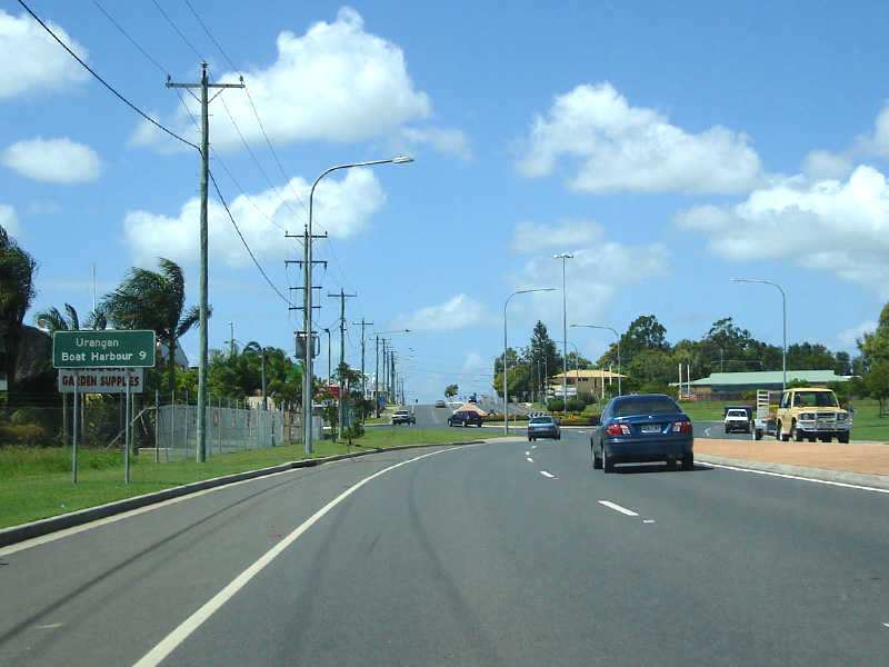
Distance Sign: RD sign on Maryborough-Hervey Bay Rd (SR57) at Walligan, March 2006. Image © Paul Rands |
|||
 |
Distance Sign: RD sign on Maryborough-Hervey Bay Rd (SR57) at Urraween, December 2002. |
|||
 |
Advance Directional
Sign: AD sign on Maryborough-Hervey Bay Rd (SR57) approaching Pialba-Burrum Heads Rd at Eli Waters, December 2002. Image © Michael Greenslade |
|||
 |
Advance Directional
Sign: AD sign on Maryborough-Hervey Bay Rd (SR57) approaching Old Maryborough Rd (TD12) at Eli Waters, March 2006. SR57 becomes Boat Harbour Rd from this junction. Image © Paul Rands |
|||
 |
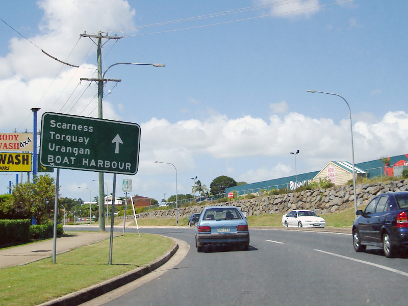
Reassurance
Directional Sign: Distance sign on Boat Harbour Dr (SR57) at Pialba, near Picnic St roundabout, March 2006. Note the missing SR57 shield. Image © Paul Rands |
|||
 |
Advance Directional
Sign: AD sign on Boat Harbour Dr (SR57) approaching Main St at Pialba, March 2006. The Esplanade patch on the sign should be prefixed with 'To' and the CBD and marine terminal destinations should be blue patches. Image © Paul Rands |
|||
 |
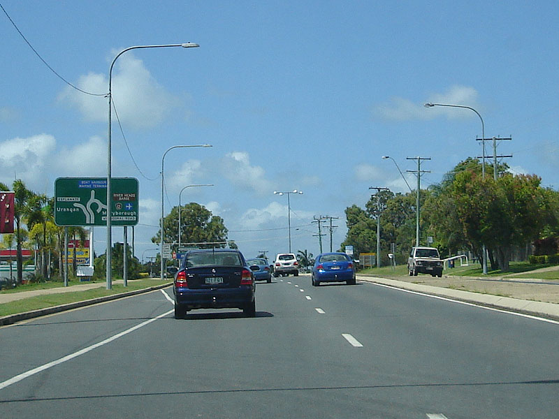
Intersection
Directionl Sign: ID sign on the roundabout of Boat Harbour Dr (SR57) and Main St in Piabla, March 2006. Image © Paul Rands |
|||
 |
Advance Directional
Sign: AD sign on Boat Harbour Dr (SR57) approaching Bideford St at Torquay, March 2006. Image © Paul Rands |
|||
 |
Advance Directional
Sign: AD sign on Boat Harbour Dr approaching Elizabeth St (TD12) at Urangan, March 2006. The Esplanade patch should be prefixed with 'To'. Image © Paul Rands |
|||
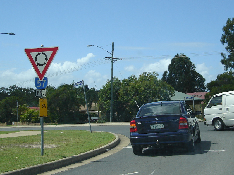 |
End State Route 57: End SR57 trailblazer at the roundabout with the unnumbered section of Boat Harbour Dr and Elizabeth St (TD12) at Urangan, March 2006. Image © Paul Rands |
|||
1 Transport and
Main Roads, Queensland state-controlled roads and region maps, Wide
Bay/Burnett Region: back
2 Queensland Government, Environment
& Resource Management, Queensland Heritage Register, Lamington Bridge
3 Transport and Main Roads, Annual
Report 1989/1990
4 Queensland Government, Ministerial
Media Statements, $10m upgrade for Boat Harbour Drive gets started, 10
April 2008
5 Queensland Government, Ministerial
Media Statements, First of two major upgrades to Maryborough–Hervey Bay
Road complete, 2 July 2009
6 Queensland Government, Ministerial
Media Statements, Traffic flow improved with completion of Fraser Coast
project, 19 August 2011
7 Transport & Main Roads, Media
Releases, Maryborough-Hervey Bay Road (Between Dundowran Road and
Torbanlea–Pialba Road), December 2010
Last updated: 21-Oct-2021 16:46
This site © Paul Rands. All rights reserved. Some portions © (copyright) by their respective and credited owners. Permission must be obtained before using any images from this site. For details, please email by clicking here.