|
|
|
|
|
 |
Wide Bay Highway, Bunya Highway, Moonie Highway, Balonne Highway & Bulloo Developmental Road (State Route 49) |
Statistics:
Route Numbering:

General Information:
State Route 49 is a rural highway that links the Burnett and Darling Downs regions of Queensland with south western Queensland.
The route passes through rural, residential and commercial zones.
Multiplexes along the route include:
History:

| Bells Bridge to Cunnamulla | Cunnamulla to Bells Bridge | |||
| Preview: | Description: | Preview: | Description: | |
 |
Intersection
Directional Sign: ID sign assembly at Bells Bridge near Gympie, at the junction with Bruce Hwy (A1), October 2010. Image © Rob Tilley |
 |
Advance
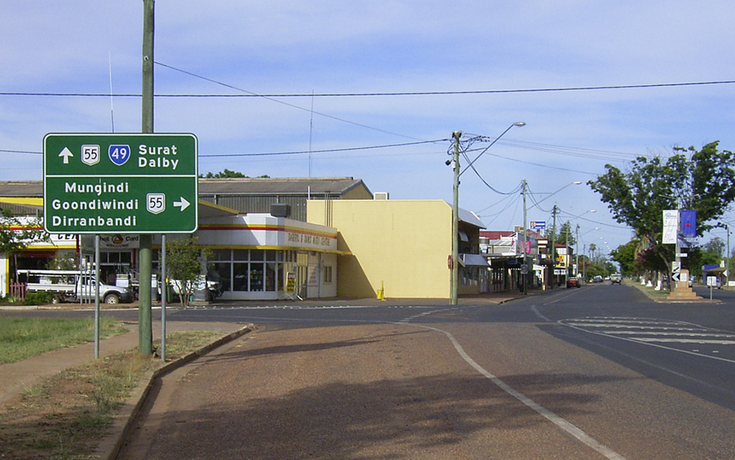
Directional Sign: AD sign on Moonie Hwy (SR49) approaching Grey St (A55) at St George, August 2014. The A55 duplex starts here. Click here for a photo of this location by Michael Greenslade from December 2003. Image © Ed Huang |
|
 |
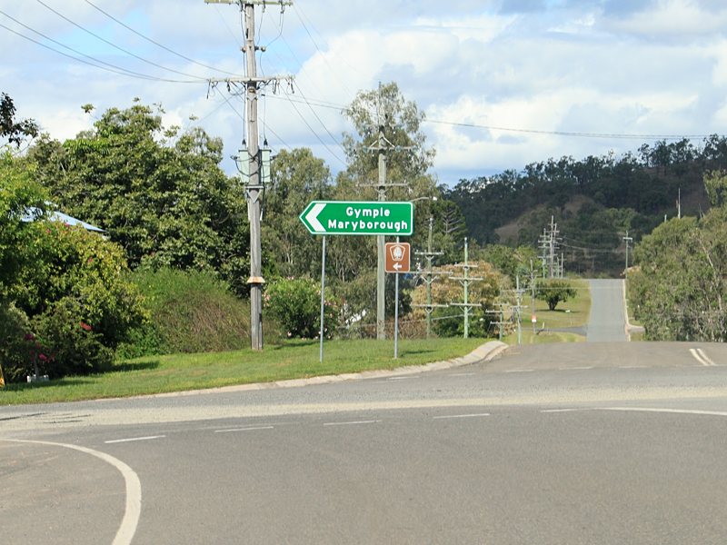
Ressurance
Directional Sign: RD sign without SR49 shield at Bells Bridge, October 2010. Image © Rob Tilley |
 |
Cairn: Cairn at St George commemorating the sealing and opening of Moonie Hwy, December 2003. Image © Michael Greenslade |
|
 |
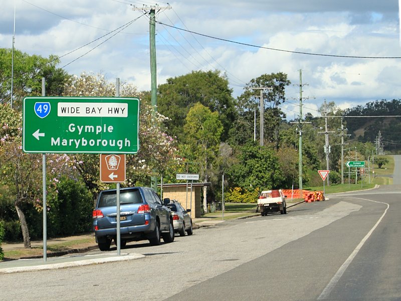
Advance Directional
Sign: AD sign on Wide Bay Hwy (SR49) approaching Petersen Rd at Bells Bridge, October 2010. Image © Rob Tilley |
 |
Distance
Sign: RD sign at St George, October 2005. Note the missing SR49 shield. Image © Paul Rands |
|
 |
Trailblazer: Great Bunya Tourist Drive trailblazer at Bells Bridge, October 2010. Image © Rob Tilley |
 |
Advance
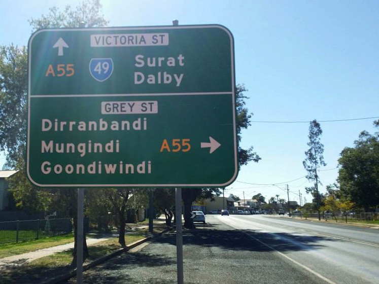
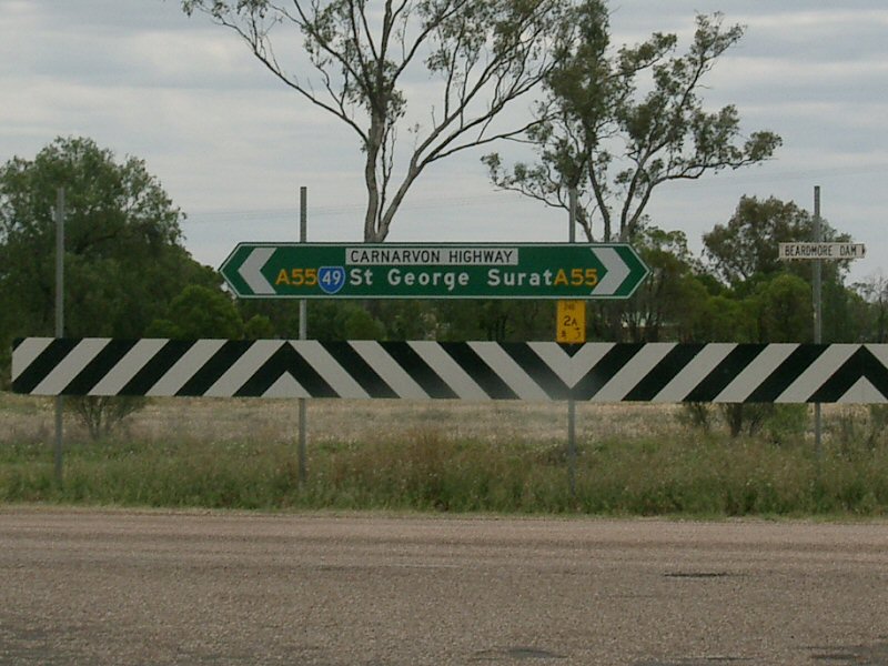
Directional Sign: AD sign on Moonie Hwy (SR49) approaching Carnarvon Hwy (A55) at St George, September 2014. The A55 duplex ends here, as SR49 turns right. Click here for a photo of the previous sign by Paul Rands from October 2005. Image © Dean Sherry |
|
 |
Advance Directional
Sign: AD sign at Lower Wonga approaching Gympie-Woolooga Rd, October 2010. Note the missing SR49 shield. Image © Rob Tilley |
 |
Intersection
Directional Sign: ID sign approaching Moonie Hwy (SR49) and Carnarvon Hwy (A55) at St George, October 2005. The A55 duplex ends here, as SR49 turns right. Image © Paul Rands |
|
 |
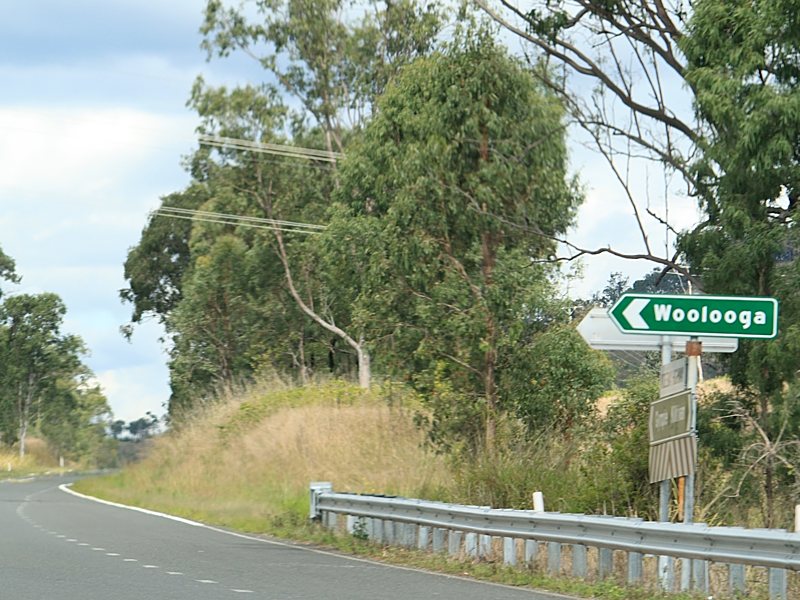
Intersection
Directional Sign: ID sign assembly at the corner of Wide Bay Hwy (SR49) and Gympie-Woolooga Rd at Lower Wonga, October 2010. Note the missing SR49 shield. Image © Rob Tilley |
 |
Distance
Sign: RD sign at St George, October 2005. Image © Paul Rands |
|
 |
Distance Sign: RD sign at Lower Wonga, October 2010. Note the missing SR49 shield. Image © Rob Tilley |
 |
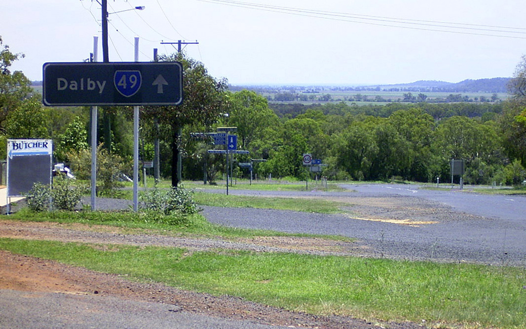
Advance Directional Sign: AD sign on D'Aguilar Hwy (SR49) approaching Warrego Hwy (A2 / SR49 / SR82) at Dalby, December 2003. Note the remnant NH54 shields. SR49 turns right at this location. Image © Michael Greenslade |
|
 |
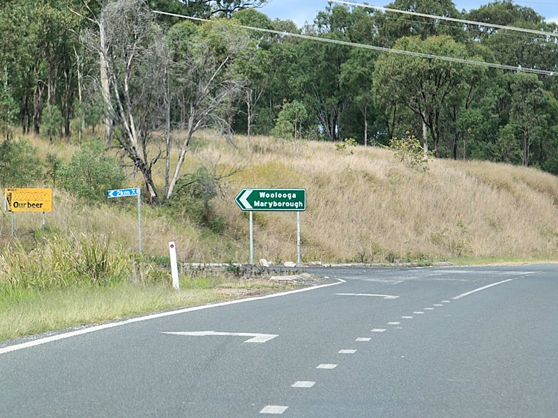
Advance Directional
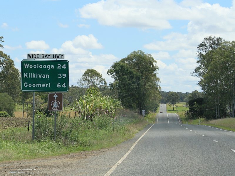
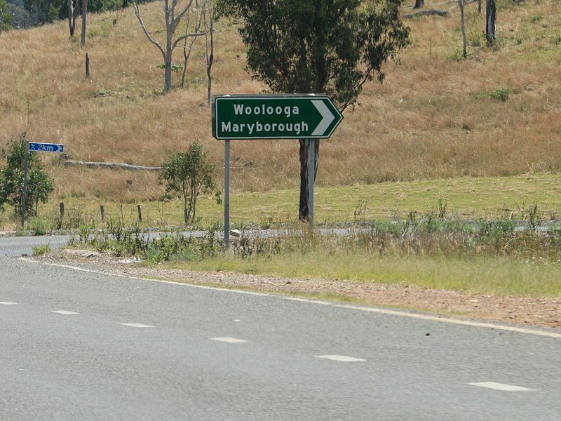
Sign: AD sign on Wide Bay Hwy (SR49) approaching Bauple-Woolooga Rd at Woolooga, October 2010. Note the missing SR49 shield. Image © Rob Tilley |
 |
Distance
Sign: RD sign at Dalby. SR49 multiplexes with A2 and SR82 in this location, September 2014. Image © Dean Sherry |
|
 |
Bauple-Woolooga
Road: ID sign at the junction with Bauple-Woolooga Rd at Woolooga, October 2010. Image © Rob Tilley |
 |
Advance
Directional Sign: AD sign approaching Gayndah Rd in Murgon, October 2010. Image © Rob Tilley |
|
 |
Bauple-Woolooga
Road: ID sign at the junction with Bauple-Woolooga Rd at Woolooga, October 2010. Note the missing SR49 shield. Image © Rob Tilley |
 |
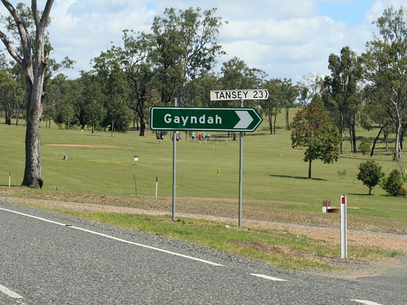
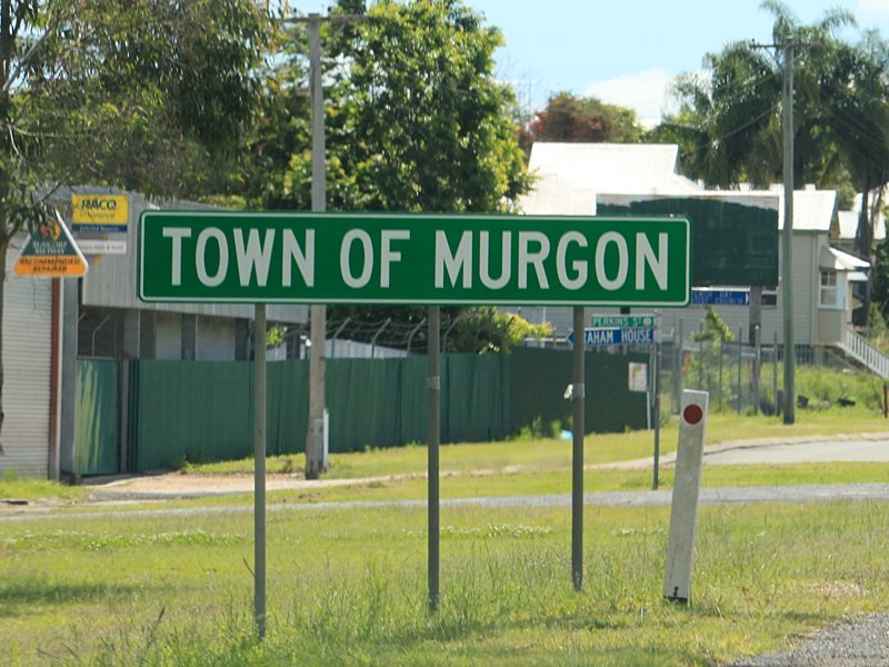
Gayndah
Road: Corner of Bunya Hwy (SR49) and Gayndah Rd in Murgon, October 2010. Image © Rob Tilley |
|
 |
Distance Sign: RD sign at Woolooga, October 2010. Note the missing SR49 shield. Image © Rob Tilley |
 |
Advance
Directional Sign: AD sign acting as some kind of reassurance sign in Murgon, October 2010. Image © Rob Tilley |
|
 |
Trailblazer: Great Bunya Tourist Drive trailblazer at Woolooga, October 2010. Image © Rob Tilley |
 |
Advance
Directional Sign: AD sign approaching Lamb St in Murgon, October 2010. Image © Rob Tilley |
|
 |
Intersection
Directional Sign: Non-standard ID sign at Rossmore Rd in Kilkivan, October 2010. Image © Rob Tilley |
 |
Lamb
Street: ID sign at the corner of Bunya Hwy (SR49) and Lamb St in Murgon, October 2010. Image © Rob Tilley |
|
 |
Entering Kilkivan: Wide Bay Hwy (SR49) as it enters the town of Kilkivan, October 2010. Image © Rob Tilley |
 |
Advance
Directional Sign: AD sign approaching Kilcoy-Murgon Rd at Murgon, October 2010. Image © Rob Tilley |
|
 |
Advance Directional
Sign: AD sign approaching Council St and Bligh St in Kilkivan, October 2010. Image © Rob Tilley |
 |
Intersection
Directional Sign: ID sign assembly at the Kilcoy-Murgon Rd junction in Murgon, October 2010. Image © Rob Tilley |
|
 |
Intersection
Directional Sign: ID sign at the junction with Council St and Bligh St in Kilkivan, October 2010. Note the missing SR49 shield. Image © Rob Tilley |
 |
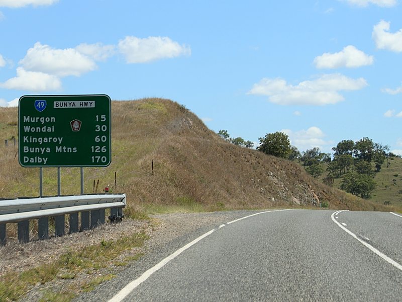
Distance
Sign: RD sign as Bunya Hwy (SR49) leaves Murgon, October 2010. Image © Rob Tilley |
|
 |
Advance Directional
Sign: AD sign at Kilkivan approaching Kilkvan-Tansey Rd, October 2010. Note the missing SR49 shield. Image © Rob Tilley |
 |
Distance
Sign: RD sign as Bunya Hwy (SR49) leaves Murgon, October 2010. Image © Rob Tilley |
|
 |
Intersection
Directional Sign: ID sign at the junction with Kilkivan-Tansey Rd at Kilkivan, October 2010. Image © Rob Tilley |
 |
Intersection
Directional Sign: ID sign at the junction with Manyung Rd in Manyung, October 2010. Image © Rob Tilley |
|
 |
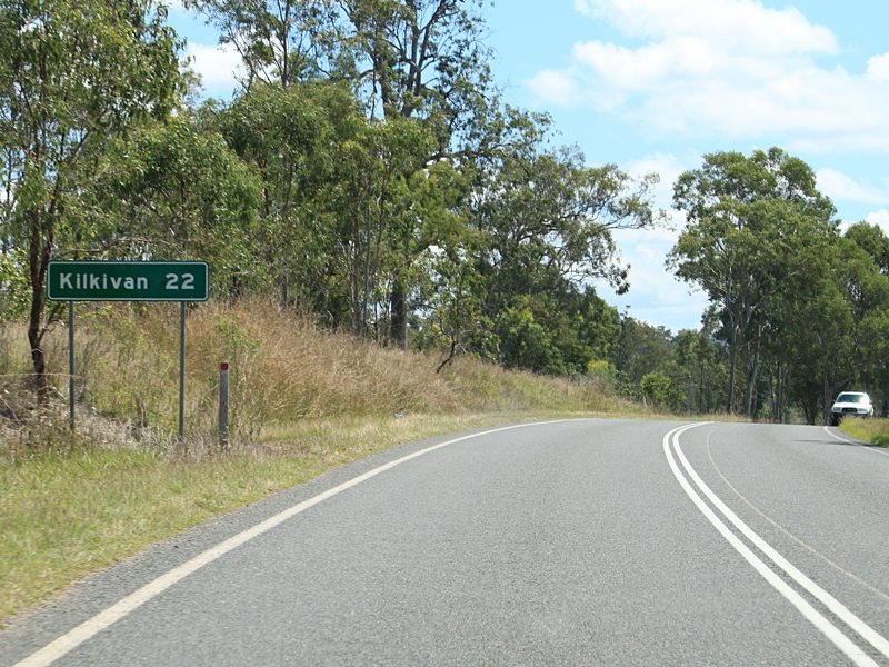
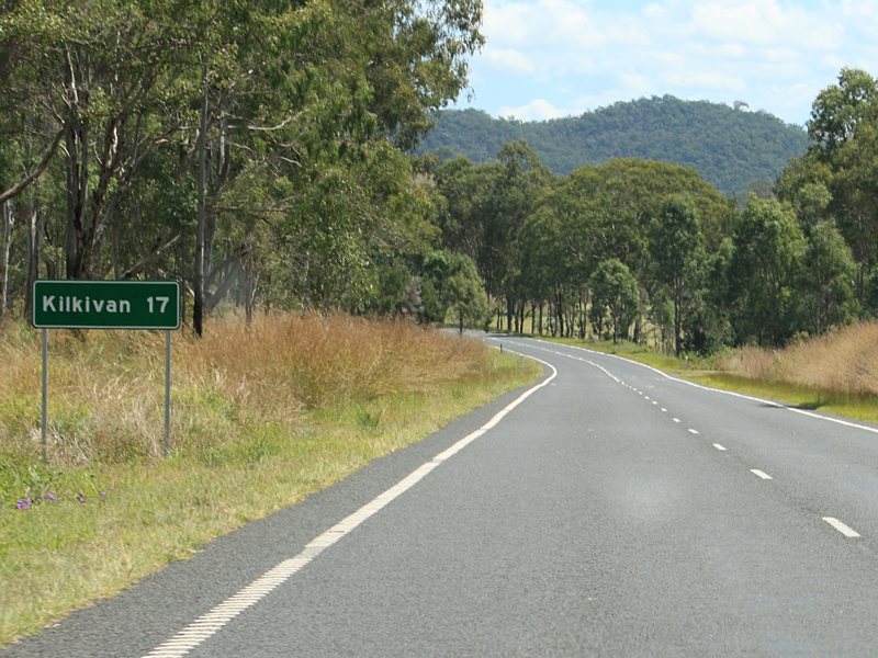
Distance Sign: RD sign on Wide Bay Hwy (SR49) at Kilkivan, October 2010. Note the missing SR49 shield. Image © Rob Tilley |
 |
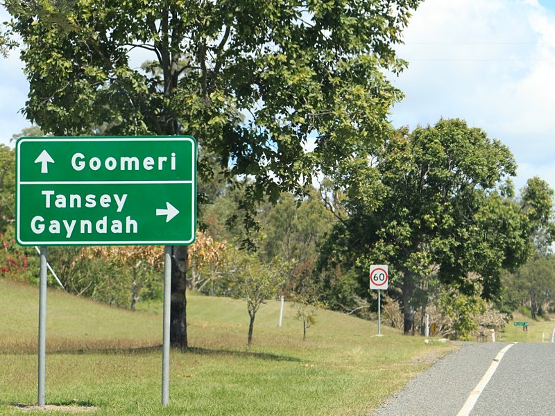
Advance
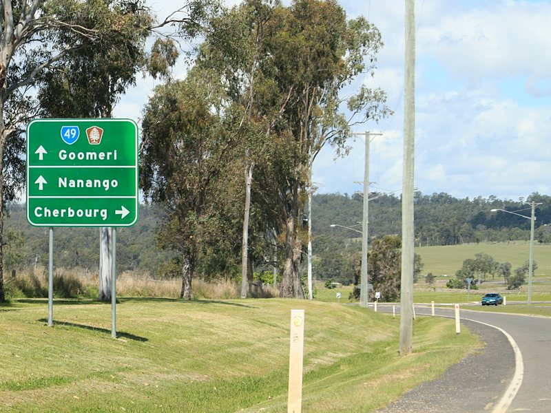
Directional Sign: AD sign approaching Burnett Hwy (A3) and Bunya Hwy (SR49) on the outskirts of Goomeri, October 2010. Note the missing SR49 shield. Image © Rob Tilley |
|
 |
Intersection
Directional Sign: Non-standard ID sign at the Kinkombi Rd junction at Kinkombi, October 2010. Image © Rob Tilley |
 |
Intersection
Directional Sign: ID sign assembly at the junction with Bunya Hwy (SR49) and Burnett Hwy (A3) at Goomeri, October 2010. Image © Rob Tilley |
|
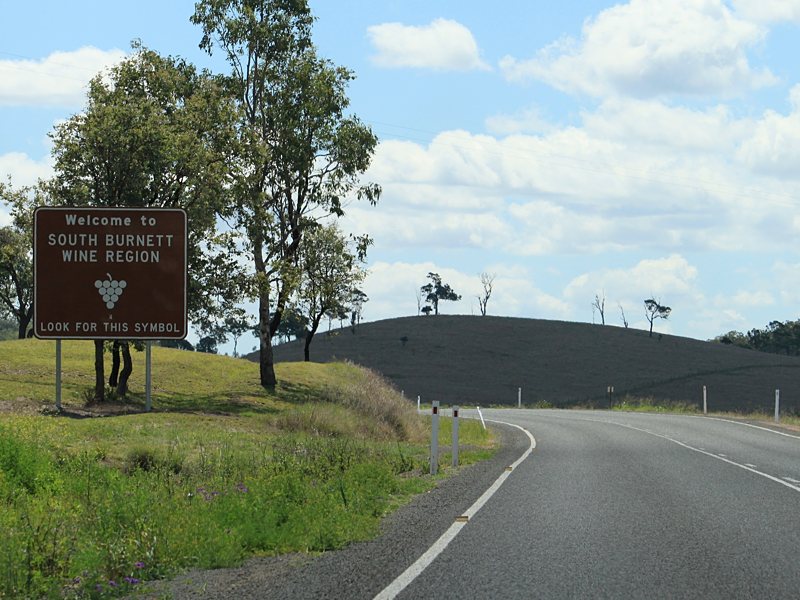 |
Tourism Sign: Sign at Goomeri welcoming visitors to the South Burnett Wine Region, October 2010. Image © Rob Tilley |
 |
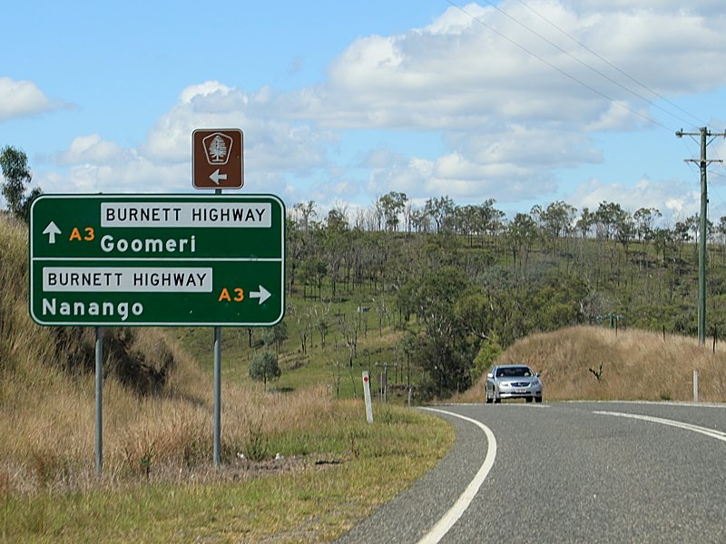
Advance
Directional Sign: AD sign approaching split of Burnett Hwy (A3) and Wide Bay Hwy (SR49) at Goomeri, October 2010. SR49 turns right at this junction. Note the missing SR49 shield. Image © Rob Tilley |
|
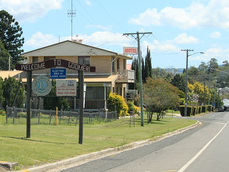 |
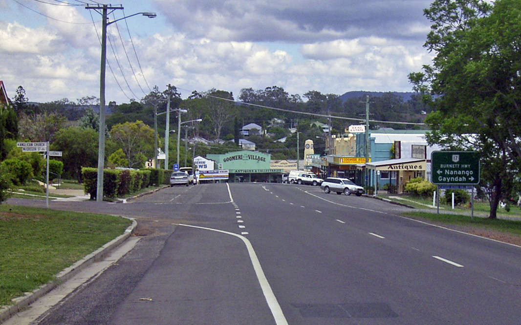
Entering Goomeri: Wide Bay Hwy (SR49) as it enters the town of Goomeri, October 2010. Image © Rob Tilley |
 |
Intersection
Directional Sign: ID sign at the junction with Burnett Hwy (A3) in Goomeri, October 2010. SR49 turns right at this junction. Note the missing SR49 shield. Image © Rob Tilley |
|
 |
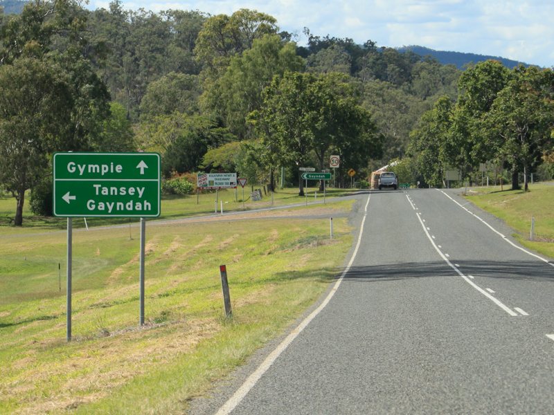
Advance Directional
Sign: AD sign approaching Burnett Hwy (A3) at Goomeri, October 2010. SR49 turns left at this junction. Note the missing SR49 shield. Click here for a photo of this location by Michael Greenslade from January 2003. Image © Rob Tilley |
 |
Intersection
Directional Sign: ID sign at the junction with Burnett Hwy (A3) in Goomeri, October 2010. SR49 turns right at this junction. Image © Rob Tilley |
|
 |
Advance Directional
Sign: AD sign approaching Burnett Hwy (A3) at Goomeri, October 2010. SR49 turns left at this junction. Note the missing SR49 shield. Image © Rob Tilley |
 |
Distance
Sign: RD sign at Goomeri, October 2010. Note the missing SR49 shield. Click here for a photo of this location by Michael Greenslade from January 2003. Image © Rob Tilley |
|
 |
Intersection
Directional Sign: Typical ID fingerboard at the junction with Burnett Hwy (A3) in Goomeri, October 2010. SR49 turns left at this junction. Image © Rob Tilley |
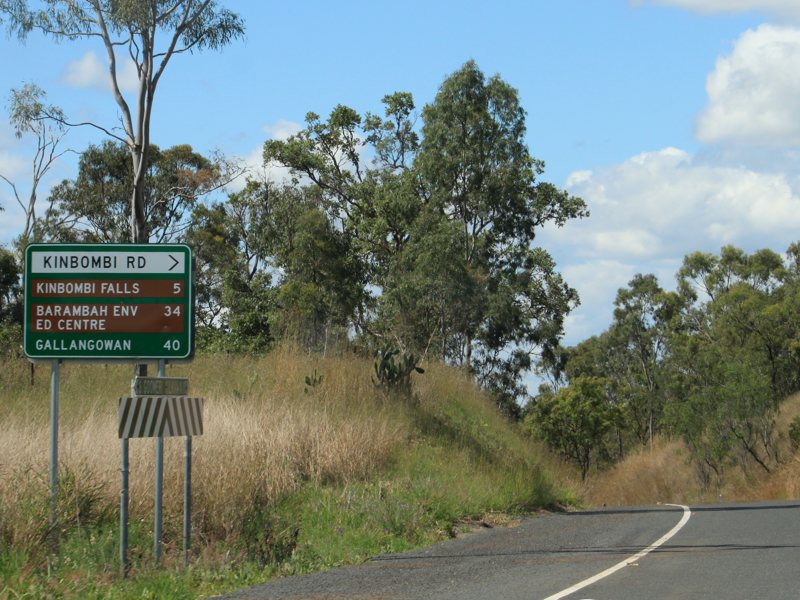 |
Intersection
Directional Sign: Non-standard ID sign at the Kinkombi Rd junction at Kinkombi, October 2010. Image © Rob Tilley |
|
 |
Distance Sign: RD sign at Goomeri, October 2010. Note the missing SR49 shield. Image © Rob Tilley |
 |
Advance
Directional Sign: AD sign at Kilkivan approaching Kilkvan-Tansey Rd, October 2010. Note the missing SR49 shield. Image © Rob Tilley |
|
 |
Advance Directional
Sign: AD sign approaching Burnett Hwy (A3) and Bunya Hwy (SR49) on the outskirts of Goomeri, October 2010. Note the missing SR49 shield. Image © Rob Tilley |
 |
Intersection
Directional Sign: ID sign at the junction with Kilkivan-Tansey Rd at Kilkivan, October 2010. Image © Rob Tilley |
|
 |
Intersection
Directional Sign: ID sign assembly at the junction with Bunya Hwy (SR49) and Burnett Hwy (A3) at Goomeri, October 2010. Note the missing SR49 shield. Image © Rob Tilley |
 |
Distance
Sign: RD sign on Wide Bay Hwy (SR49) at Kilkivan, October 2010. Note the missing SR49 shield. Image © Rob Tilley |
|
 |
Distance Sign: RD sign on Bunya Hwy (SR49) at Goomeri, October 2010. Image © Rob Tilley |
 |
Advance
Directional Sign: AD sign approaching Council St and Bligh St in Kilkivan, October 2010. Image © Rob Tilley |
|
 |
Intersection
Directional Sign: ID sign at the junction with Manyung Rd in Manyung, October 2010. Image © Rob Tilley |
 |
Intersection
Directional Sign: ID sign at the junction with Council St and Bligh St in Kilkivan, October 2010. Note the missing SR49 shield. Image © Rob Tilley |
|
 |
Advance Directional
Sign: AD sign approaching Kilcoy-Murgon Rd at Murgon, October 2010. Click here for a photo of this location by Michael Greenslade from December 2003. Image © Rob Tilley |
 |
Advance
Directional Sign: AD sign on Wide Bay Hwy (SR49) approaching Bauple-Woolooga Rd at Woolooga, October 2010. Note the missing SR49 shield. Image © Rob Tilley |
|
 |
Intersection
Directional Sign: ID sign assembly at the Kilcoy-Murgon Rd junction in Murgon, October 2010. Image © Rob Tilley |
 |
Bauple-Woolooga
Road: ID sign at the junction with Bauple-Woolooga Rd at Woolooga, October 2010. Image © Rob Tilley |
|
 |
Advance Directional Sign: AD sign on Kilcoy-Murgon Rd at Murgon approaching Bunya Hwy (SR49), December 2003. Image © Michael Greenslade |
 |
Bauple-Woolooga
Road: ID sign at the junction with Bauple-Woolooga Rd at Woolooga, October 2010. Note the missing SR49 shield. Image © Rob Tilley |
|
 |
Distance Sign: RD sign at Murgon, October 2010. Image © Rob Tilley |
 |
Distance
Sign: RD sign at Woolooga, October 2010. Note the missing SR49 shield. Image © Rob Tilley |
|
 |
Agriculture Sign: Sign for stock movement restrictions, Murgon, October 2010. Image © Rob Tilley |
 |
Advance
Directional Sign: AD sign at Lower Wonga approaching Gympie-Woolooga Rd, October 2010. Note the missing SR49 shield. Image © Rob Tilley |
|
 |
Advance Directional
Sign: AD sign approaching Cherbourg Rd in Murgon, October 2010. Image © Rob Tilley |
 |
Intersection
Directional Sign: ID sign assembly at the corner of Wide Bay Hwy (SR49) and Gympie-Woolooga Rd at Lower Wonga, October 2010. Image © Rob Tilley |
|
 |
Lamb Street: ID sign at the corner of Bunya Hwy (SR49) and Cherbourg Rd in Murgon, October 2010. Image © Rob Tilley |
 |
Distance
Sign: RD sign at Lower Wonga, October 2010. Note the missing SR49 shield. Image © Rob Tilley |
|
 |
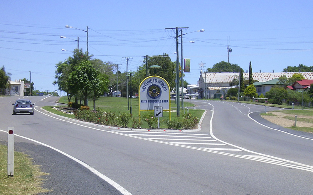
Entering Murgon: Bunya Hwy (SR49) as it enters the Murgon town centre, October 2010. Image © Rob Tilley |
 |
Trailblazer: Great Bunya Tourist Drive trailblazer at Bells Bridge, October 2010. Image © Rob Tilley |
|
 |
Murgon: Bunya Hwy (SR49) as it passes through the town of Murgon, December 2003. Image © Michael Greenslade |
 |
Advance
Directional Sign: AD sign on Wide Bay Hwy (SR49) approaching Petersen Rd at Bells Bridge, October 2010. Image © Rob Tilley |
|
 |
Advance Directional
Sign: AD sign approaching McAlister St in Murgon, October 2010. Image © Rob Tilley |
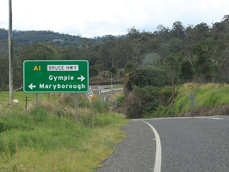 |
Advance
Directional Sign: AD sign on Wide Bay Hwy (SR49) approaching Bruce Hwy (A1) at Bels Bridge, October 2010. Image © Rob Tilley |
|
 |
Advance Directional
Sign: AD sign approaching Gayndah Rd in Murgon, October 2010. Image © Rob Tilley |
 |
Intersection
Directional Sign: ID sign assembly at Bells Bridge near Gympie, at the junction with Bruce Hwy (A1), October 2010. Image © Rob Tilley |
|
 |
Gayndah Road: Corner of Bunya Hwy (SR49) and Gayndah Rd in Murgon, October 2010. Image © Rob Tilley |
|||
 |
Distance Sign: RD sign as Bunya Hwy (SR49) leaves Murgon, October 2010. Image © Rob Tilley |
|||
 |
Black Reassurance Directional Sign: Black distance sign at Kumbia, January 2003. Image © Michael Greenslade |
|||
 |
Black Kilometre Plate: Black kilometre plate at Bell, December 2003. Image © Michael Greenslade |
|||
 |
Black Advance Directional Sign: Black AD sign at Bell approaching Dennis St, December 2003. Image © Michael Greenslade |
|||
 |
Black Advance Directional Sign: Black AD sign at Dalby approaching Warrego Hwy (A2) / SR49 / SR82) and Condamine St, December 2003. Image © Michael Greenslade |
|||
 |
Black Kilometre Plate: Black kilometre plate at Kumbarilla, January 2003. Image © Michael Greenslade |
|||
 |
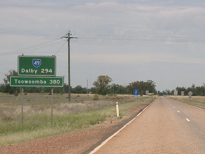
Reassurance Directional Sign: Distance sign at Halliford after Surat Developmental Rd (SR87), January 2003. Image © Michael Greenslade |
|||
 |
Advance Directional Sign: AD sign at Moonie approaching Leichhardt Hwy (A5) (formerly NR39), December 2003. Image © Michael Greenslade |
|||
 |
Advance Directional Sign: Moonie Hwy (SR49) approaching Meandarra-Talwood Rd (SR74) at Westmar, December 2003. Image © Michael Greenslade |
|||
 |
Advance Directional
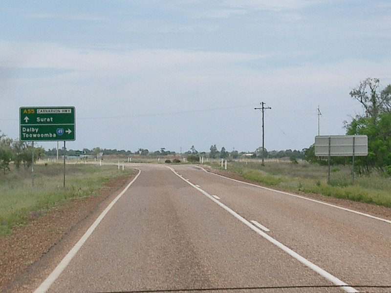
Sign: AD sign on Moonie Hwy (SR49) approaching Carnarvon Hwy (A55) at St George, October 2005. The A55 duplex begins here, as SR49 turns left. Click here for a photo of this location by Michael Greenslade from December 2003. Image © Paul Rands |
|||
 |
Intersection
Directional Sign: ID sign facing Moonie Hwy (SR49) at the junction with Carnarvon Hwy (A55) at St George, October 2005. The A55 duplex begins here, as SR49 turns left. Image © Paul Rands |
|||
 |
Distance Sign: RD sign at St George, October 2005. Note the missing SR49 shield. Image © Paul Rands |
|||
 |
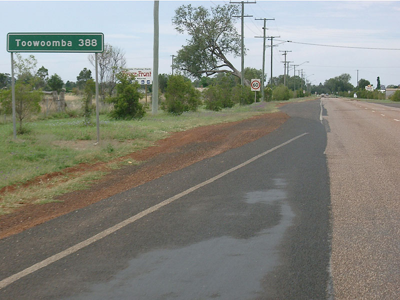
Distance Sign: RD sign in the St George town centre, August 2014. Click here for a photo of this location by Michael Greenslade from December 2003. Image © Ed Huang |
|||
 |
Intersection Directional Sign: ID sign facing Whyenbah Rd at St George, September 2014. Image © Dean Sherry |
|||
 |
Advance Directional Sign: AD sign approaching Mitchell-St George Rd at St George, 2014. Image © Dean Sherry |
|||
1 Transport
and Main Roads, Queensland state-controlled roads and region maps, South West Region
2 Transport and Main Roads,
Queensland state-controlled roads and region maps,Darling Downs Region: front
3 Transport and Main Roads,
Queensland state-controlled roads and region maps, Wide Bay/Burnett Region: front
4 Queensland Government, Ministerial
Media Statements, Wider and safer section for the Bunya Highway, 12
November 2007
5 Queensland Government, Media Statements, Safety upgrade to Moonjarre Crossing, 15 Jan 2009
6 Queenslad Government, Ministerial
Media Statements, Safety works commencing on Wide Bay Highway, 28
August 2009.
7 Queensland Government, Ministerial
Media Statements, New traffic signals to provide safer roads in Kingaroy,
8 September 2011
Last updated: 21-Oct-2021 16:41
This site © Paul Rands. All rights reserved. Some portions © (copyright) by their respective and credited owners. Permission must be obtained before using any images from this site. For details, please email by clicking here.