Road Photos & Information: Queensland

|
|
Captain Cook Highway & Kennedy Highway (State Route 44) |
Statistics:
- Length: 86 km
- Eastern Terminus: Captain Cook Hwy (NR1) and Kennedy Hwy (NR1) at Barron Falls
- Western Terminus: Mulligan Hwy (SR81) at Mt Molloy
- Miscellaneous: Captain Cook Hwy continues as NR1 at Barron Falls
- Suburbs, Towns & Localities Along The Route: Barron Falls, Smithfield, Kewarra Beach, Palm Cove, Wangetti, Oak Beach, Mowbray, Craiglie, Shannonvale, Julatten and Mt Molloy
Route Numbering:
- Current:
- Former:

- Multiplexes:

- Road Authority Internal Classification: 20A 1
General Information:
State Route 44 in Queensland's far north is a route connecting Port Douglas with Cairns, as well as forming part of the link between Port Douglas and Mareeba. The highway travels along the coast of tropical seaside rainforest heading towards Port Douglas and Daintree. 20 km of the route hugs the shoreline providing spectacular ocean views.
Multiplexes along the route include:
- Great Tropical Drive, for 58 km between Barron Falls and Shannonvale 2
History:
- 1930s: The Cook Highway gazetted as Cook State Highway No. 11. 3
- 1931: Construction begins on the Cairns-Port Douglas Road. This started near Double Island (Buchans Point) using day labour, with many men being recruited from the unemployed. 3
- June 1932: A contract had been let for six miles of road starting at the Port Douglas end. Five bridges with a total length of 285 feet were constructed or were in the process of construction, between the end of the contract and Cairns. 3
- 17 December 1933: The Cook Highway was officially opened at Hartleys Creek by the then Minister for Public Works, the Honorable H.I. Bruce. However, the cost of the road's construction had been high and, as it was to be used extensively by tourist traffic, arrangements were made for the institution of a toll. The proceeds from the toll were to go towards the cost of road's maintenance. 3
- 1938: Bitumen surfacing commenced at the Cairns end and, except for a short length at Craiglie, was fully sealed to to Shannonval and onto Mossman by the end of 1940. 3
- 1940: Cairns Shire was replaced by Mulgrave Shire and work was undertaken on what was to be the Kennedy Highway. 3
- 1945: Soon after the end of World War II, the last remaining unsealed section of the highway was sealed at Craiglie. 3
- 1946: The toll was abolished, having raised a gross revenue of $12 755 during 12 years. 3
- 1959: Mowbray River Bridge was redecked. 3
- 1964: The Cook Highway was renumbered as Highway No. 20. 3
- 1966: Replacement of the timber bridge over Hartleys Creek and Saltwater Creek. 3
- 1970s: Widening of the route between Barron Falls and Shannonvale. 3
- 1971: Replacement of the timber bridge over Deep Creek. 3
- 2011: Safety upgrade between Palm Cove and Craiglie, which included remarking lanes, upgrading safety barriers and adding reflectors to pavements. 4
- February 2012: Completion of drainage and widening works along Captain Cook Hwy between Mowbray and Craiglie. 5

| |
| |
 |
Intersection Directional Sign:
ID sign at the junction with Captain Cook Hwy (unnumbered section) and Tollentini Rd at Cassowary, March 2013.
Image © Terry Siva
|
|
 |
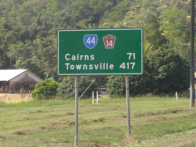
Distance Sign:
Reassurance directional sign at Shannonvale, May 2005.
Image © Rob Tilley |
| |
|
|
 |
Distance Sign:
Reassurance directional sign at Shannonvale, May 2005.
Image © Rob Tilley |
| |
|
|
 |
Intersection Directional Sign:
ID sign facing Endeavour Rd in Clifton Beach, January 2014.
Image © Terry Siva |
1 Department of Transport and Main Roads, Queensland state-controlled roads and region maps, Far North Region: front
2 Great Tropical Drive - A New Discovery Around Every Corner brochure, 23 April 2009
3 The Captain Cook Highway 1788-1988, A. Churchward
4 Queensland Government, Media Statements, $3.4m safety upgrade starts on Captain Cook Highway, 18 April 2011
5 Department of Transport and Main Roads, Projects, Captain Cook Highway Cairns to Mossman Craiglie, 6 February 2012
Last updated: 21:7:46 2/7/2016.
This site © Paul Rands. All rights reserved. Some portions © (copyright) by their respective and credited owners. Permission must be obtained before using any images from this site. For details, please email by clicking here.