|
|
|
|
|
| Settlement Road, Samford Road, Dawson Parade, Pimelea Street, South Pine Road, Queens Road, Beckett Road, Bridgeman Road, Beams Road, Neville Road, Roghan Road, Carseldine Road, Linkfield Road, Lacey Road & Telegraph Road (State Route 40) |
Statistics:
Route Numbering:
General Information:
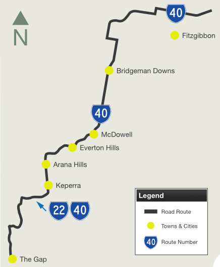
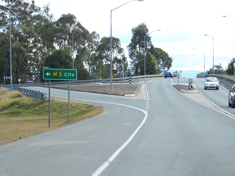
State Route 40 is a suburban route on Brisbane's northside. It connects several northwestern suburbs with several important routes including Gympie Arterial Road (M3), Gateway Mwy (M1) (via another nearby road) and Waterworks Rd (SR31).
The route passes through residential, commercial and industrial zones.
Multiplexes along the route include:
History:
Click here for construction photos along the route.
| The Gap to Fitzgibbon | Fitzgibbon to The Gap | |||
| Preview: | Description: | Preview: | Description: | |
 |
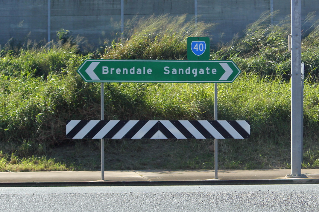
Samford Road: Intersection directional sign at the junction of Settlement Rd (SR40) and Samford Rd (SR22 / SR40) at Keperra, July 2011. Image © Rob Tilley |
 |
Trailblazer: Trailblazer assembly on Depot Rd (SR27 / SR40) at Deagon, May 2005. Image © Michael Greenslade |
|
 |
Intersection
Directional Sign: ID sign at McDowell, on the roundabout with Queens Rd (SR40), Beckett Rd (SR40), Old Northern Rd and Rode Rd, May 2018. Image © Rob Tilley |
 |
Freeway Green Advance Directional Sign: Freeway green and standard green AD sign approaching Gateway Mwy (M1) at Deagon, May 2005. Image © Michael Greenslade |
|
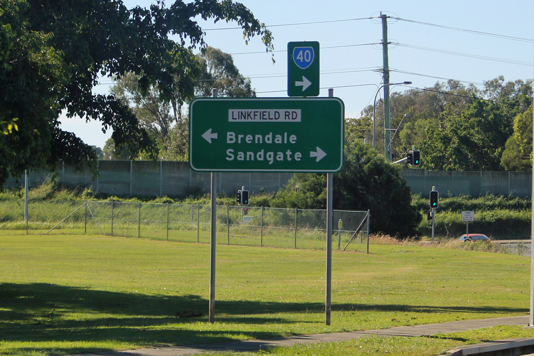 |
Advance
Directional Sign: AD sign on Carseldine Rd (SR40) at Bridgeman Downs approaching Linkfield Rd (SR40 and unnumbered), May 2018. Image © Rob Tilley |
 |
Intersection
Directional Sign: ID sign at the roundabout with Lemke Rd (SR27), Depot Rd (SR27) and Telegraph Rd (SR40) at Deagon, July 2011. Image © Rob Tilley |
|
 |
Intersection
Directional Sign: ID sign facing Carseldine Rd (SR40) at Bridgeman Downs at the junction with Linkfield Rd (SR40 and unnumbered), May 2018. Image © Rob Tilley |
 |
Trailblazer: SR40 trailblazer on Telegraph Rd at Fitzgibbon, July 2011. Image © Rob Tilley |
|
 |
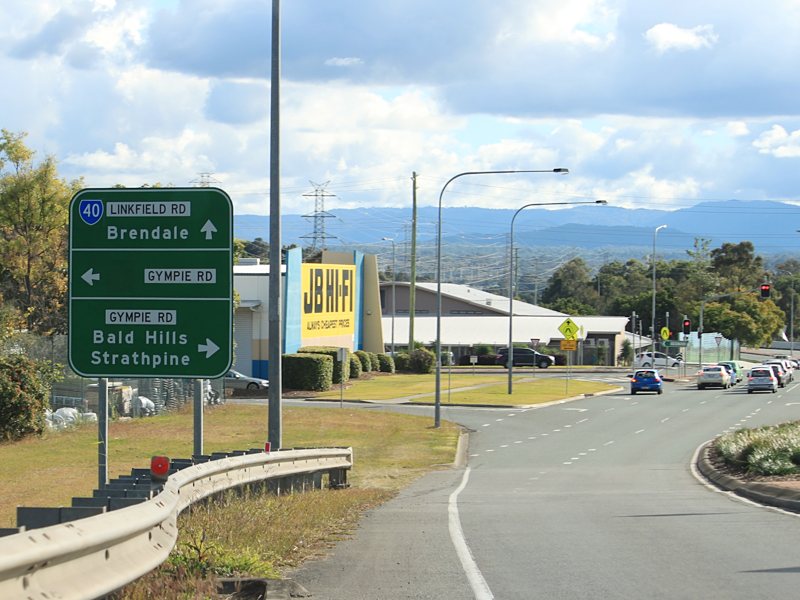
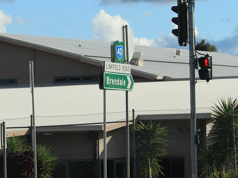
Intersection
Directional Sign: ID sign at the interchange of Linkfield Rd (SR40) and Gympie Arterial Rd (M3) at Bald Hills, July 2011. Image © Rob Tilley |
 |
Advance Directional
Sign: Unusual AD sign with distance approaching Denham St at Fitzgibbon, May 2005. |
|
 |
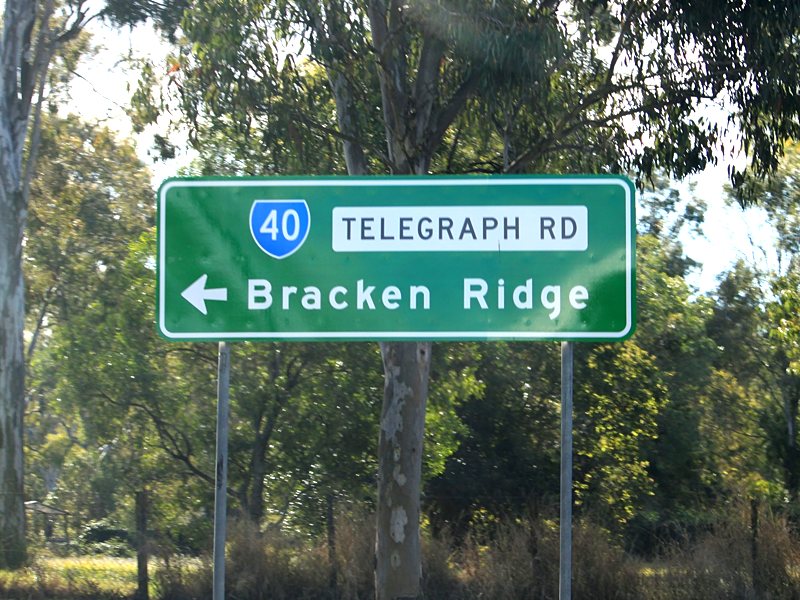
Intersection
Directional Sign: ID sign at the corner of Linkfield Rd (SR40) and Lacey Rd (SR40) at Bald Hills, July 2011. Despite the lack of route number on the sign, SR40 turns left at this junction. Image © Rob Tilley |
 |
Intersection
Directional Sign: ID sign facing Denham Rd at Fitzgibbon, July 2011. Image © Rob Tilley |
|
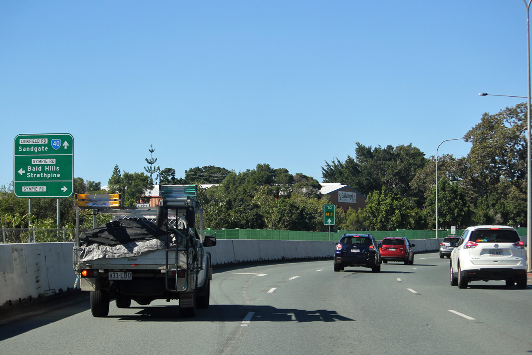 |
Advance Directional
Sign: AD sign on Linkfield Rd (SR40) approaching Gympie Rd at Bald Hills, May 2018. Image © Rob Tilley |
 |
Advance Directional
Sign: Diagrammatic AD sign on Telegraph Rd approaching Lacey Rd at Fitzgibbon, July 2011. SR40 turns left at this junction. Image © Rob Tilley |
|
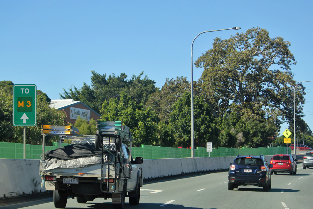 |
Trailblazer: Trailblazer on Linkfield Rd approaching Gympie Rd at Bald Hills for Gympie Arterial Rd (M3), May 2018. Image © Rob Tilley |
 |
Trailblazer: SR40 trailblazer at the corner of Lacey Rd and Linkfield Rd at Bald Hills, July 2011. SR40 turns right at this junction. Image © Rob Tilley |
|
 |
Gympie Road: Corner Linkfield Rd (SR40) and Gympie Rd at Bald Hills, May 2018. Image © Rob Tilley |
 |
Intersection
Directional sign: ID sign at the corner of Lacey Rd and Linkfield Rd at Bald Hills, July 2011. SR40 turns right at this junction. Image © Rob Tilley |
|
 |
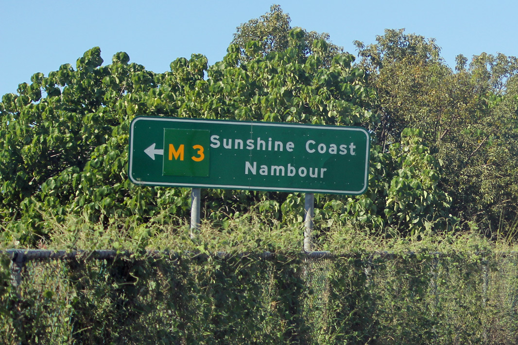
Advance Directional
Sign: AD sign on Linkfield Rd (SR40) approaching Gympie Arterial Rd (M3), May 2018. Image © Rob Tilley |
 |
Advance Directional
Sign: AD sign on Linkfield Rd (SR40) approaching the Gympie Arterial Rd (M3) interchange at Bald Hills, July 2011. Image © Rob Tilley |
|
 |
Gympie Arterial Road: ID sign at the interchange with Gympie Art Rd (M3) at Bald Hills, May 2018. Image © Rob Tilley |
 |
Intersection
Directional Sign: ID sign at the interchange with Gympie Art Rd (M3) at Bald Hills, July 2011. Image © Rob Tilley |
|
 |
Advance Directional
Sign: AD sign on Linkfield Rd (SR40) within the Gympie Arterial Rd (M3) interchange at Bald Hills, July 2011. Image © Rob Tilley |
|||
 |
Advance Directional
Sign: AD sign on Linkfield Rd (SR40) approaching the Gympie Rd (former NR1) junction at Bald Hills, July 2011. Image © Rob Tilley |
|||
 |
Intersection
Directional Sign: ID sign at the corner of Linkfield Rd (SR40) and Gympie Rd at Bald Hills, July 2011. Image © Rob Tilley |
|||
|
Intersection
Directional Sign: ID sign with topknot at the corner of Linkfield Rd (SR40) and Gympie Rd at Bald Hills, July 2011. Image © Rob Tilley |
|||
 |
Advance Directional
Sign: AD sign on Beckett Rd (SR40) approaching the roundabout and interchange with Rode Rd, Old Northern Rd and Queens Rd (SR40) at McDowell, July 2011. Image © Rob Tilley |
|||
 |
Intersection
Directional Sign: ID sign at the roundabout and interchange with Beckett Rd (SR40), Rode Rd, Old Northern Rd and Queens Rd (SR40) at McDowell, July 2011. Image © Rob Tilley |
|||
 |
Intersection
Directional Sign: ID sign at the roundabout and interchange with Beckett Rd (SR40), Rode Rd, Old Northern Rd and Queens Rd (SR40) at McDowell, July 2011. Image © Rob Tilley |
|||
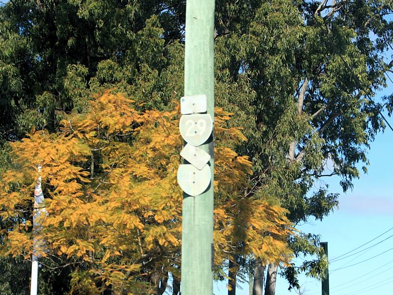
 |
South pine Road: Queens Rd (SR40) at Everton Hills approaching South Pine Rd (SR29), July 2011. SR40 turns right at this junction. Image © Rob Tilley |
|||
 |
Trailblazers Old faded trailblazers at Everton Hills at the junction with South Pine Rd (SR29), July 2011. Image © Rob Tilley |
|||
 |
Advance Directional
Sign: AD sign approaching South Pine Rd (SR29 and SR40) at Everton Hills, March 2012. Image © Paul Rands |
|||
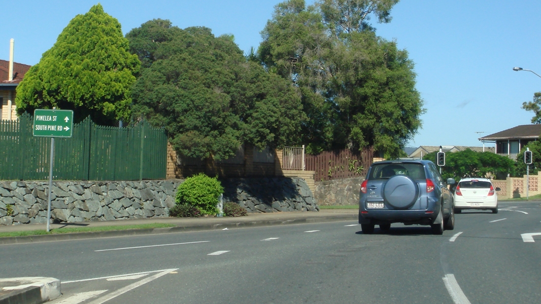 |
Intersection
Directional Sign: ID sign at the junction with South Pine Rd (former SR40) and Pimelea St (SR40) at Everton Hills, March 2012. Image © Paul Rands |
|||
 |
Trailblazer: SR40 trailblazer on Dawson Pde (SR40) as it approaches Samford Rd (SR22) at Keperra, March 2012. The dual arrow should be a left only arrow and there should be a double arrow with an SR22 traiblazer on this post as well, as this is where the SR22 duplex starts. Image © Paul Rands |
|||
 |
Vintage Signal Mast
Arm: Pre 1980s signal mast arm with newer halogen signal head at the junction with Patricks Rd & Dawson Pde (SR40) at Arana Hills, July 2011. Image © Rob Tilley |
|||
 |
1980s Incandescent
Signals: 1980s style incandescent signals at the Patrick Rd & Dawson Pde (SR40) junction at Arana Hills, July 2011. Target boards on signals were only installed on overhead signals until they became standard on all signals in the late 90s. Image © Rob Tilley |
|||
 |
Trailblazer: SR40 trailblazer approaching Samford Rd (SR22) at Keperra, July 2011. SR40 duplexes with SR22 from this junction, but the arrows and trailblazer do not reflect this. Image © Rob Tilley |
|||
 |
Trailblazers: Old faded trailblazers on Samford Rd at Keperra showing the SR22 / SR40 duplex, July 2011. Image © Rob Tilley |
|||
 |
Settlement Road: Samford Rd (SR22 / SR40) at the junction with Settlement Rd (SR40) in Keperra, July 2011. SR40 turns left at this junction. Image © Rob Tilley |
|||
 |
Settlement Road: Settlement Rd (SR40) near Chaprowe Rd at The Gap, with Mt Coot-tha in the distance, July 2011. Image © Rob Tilley |
|||
1 Transport & Main Roads, Queensland state-controlled roads and region maps, Metropolitan Region: east
Last updated: 21-Oct-2021 16:25
This site © Paul Rands. All rights reserved. Some portions © (copyright) by their respective and credited owners. Permission must be obtained before using any images from this site. For details, please email by clicking here.