|
|
|
|
|

|
McLachlan Street, James Street, East Street, Wickham Street, Ann Streeet, Breakfast Creek Road & Kingsford Smith Drive (State Route 25) |
Statistics:
Route Numbering:
General Information:
State Route 25 is an arterial route linking the Brisbane CBD with the industrial suburbs and airport east of the city.
The route is a mix of divided and undivided road, which features a one-way pair in Fortitude Valley, and also travels along the foreshore of Brisbane River through the Hamilton area.
History:

| Fortitude Valley to Pinkenba | Pinkenba to Fortitude Valley | |||
| Preview: | Description: | Preview: | Description: | |
 |
Reassurance Directional Sign: Distance sign on Kingsford Smith Dr (SR25) at Hamilton near Cooksley St, June 2012. Image © Justin Cozart |
 |
Advance Directional Sign: AD sign, looking westbound on Kingsford Smith Dr (SR25) at Eagle Farm approaching Links Av, May 2005. Image © Michael Greenslade |
|
 |
Advance Directional Sign: AD sign on Kingsford Smith Dr (SR25) approaching Links Av and Schneider Rd at Eagle Farm, May 2005. Image © Michael Greenslade |
 |
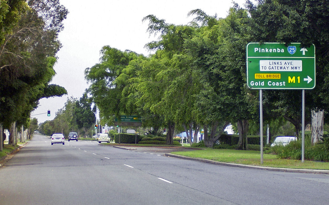
Advance Directional Sign: AD sign on Kingsford Smith Dr (SR25) at the Gateway Mwy (M1) interchange at Eagle Farm, May 2005. Note the freeway green sign in the distance, showing the old Gateway Arterial name. Image © Michael Greenslade |
|
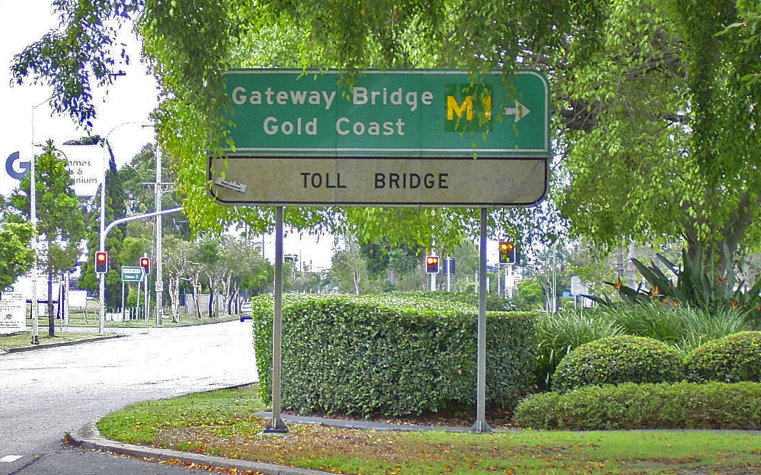 |
Freeway Green Advance Directional Sign: Freeway Green AD sign on Kingsford Smith Dr (SR25) approaching Links Av and Schneider Rd at Eagle Farm, May 2005. Image © Michael Greenslade |
 |
Intersection Directional Sign: AD style sign on the corner of Kingsford Smith Dr (SR25) and Sugarmill Rd at Pinkenba, January 2010. Note the mention of Gateway Arterial Rd. Image © Rob Tilley |
|
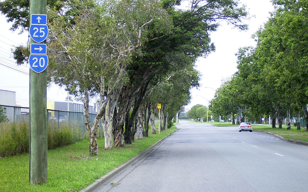 |
Trailblazer: Trailblazer assembly at the corner of Kingsford Smith Dr (SR25), Links Av and Schneider Rd at Eagle Farm, May 2005. Note the old route number for Gateway Arterial Rd (SR20), which was decommissioned in the 1990s. Image © Michael Greenslade |
|||
1 State Library of Queensland, Early view of Hamilton, Brisbane, 1868
Last updated: 21-Oct-2021 15:23
This site © Paul Rands. All rights reserved. Some portions © (copyright) by their respective and credited owners. Permission must be obtained before using any images from this site. For details, please email by clicking here.