|
|
|
|
|
| Gold Coast Highway (State Route 2) - NSW Border to Surfers Paradise - Remnant Signage: NSW Border to Tugun |
Statistics:
Route Numbering:

General Information:
The Gold Coast Highway is the former Pacific Highway route between the NSW border and Helensvale.
The route is a mix of divided and undivided urban highway, which passes mostly along the coast, right through the heart of the Gold Coast. The route passes through light industrial areas, as well as commercial, residential and tourist areas.
In 2008, State Route 2 was extended between Tugun and NSW Border, replacing National Route 1. This page covers remnant signage after the route number changed.
History:
| Preview: | Description: |
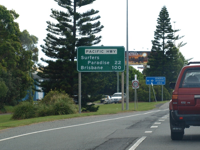 |
Distance
Sign: Old Pacific Highway reassurance directional sign at Bilinga, February 2009. Image © Rob Tilley |
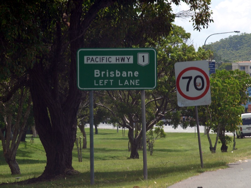 |
Advance
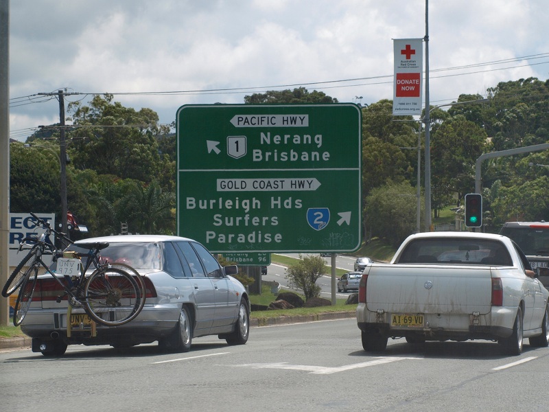
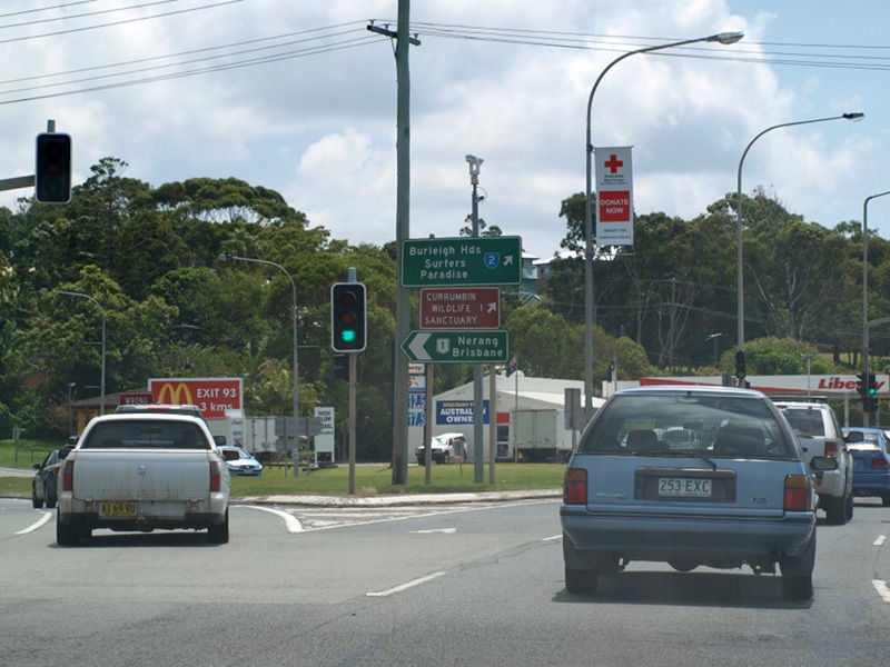
Directional Sign: AD sign at Tugun for the what is now the Stewart Av intersection, February 2009. Image © Rob Tilley |
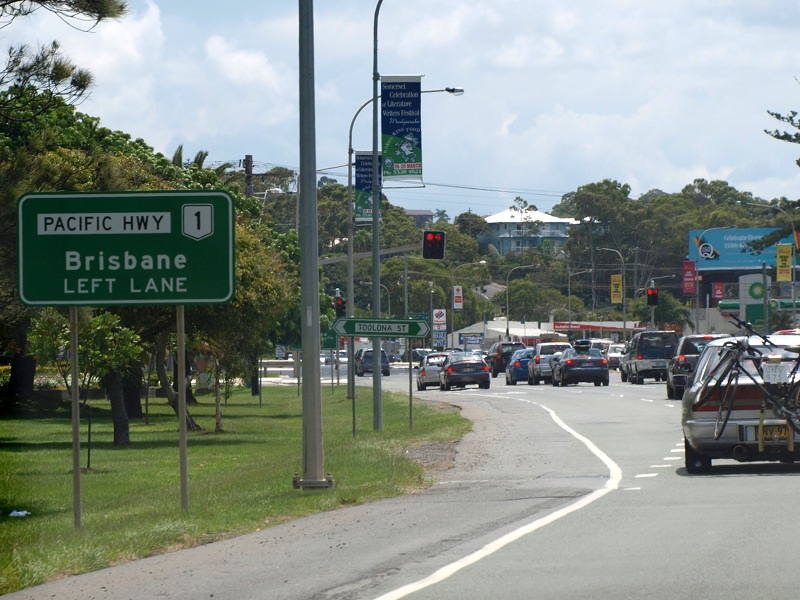 |
Advance
Directional Sign: AD sign at Tugun for the what is now the Stewart Av intersection, February 2009. Image © Rob Tilley |
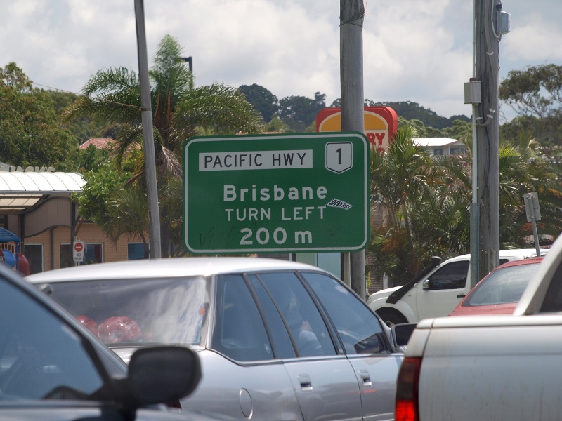 |
Advance
Directional Sign: AD sign at Tugun for the what is now the Stewart Av intersection, February 2009. Image © Rob Tilley |
 |
Former
Pacific Highway & Gold Coast Highway Junction: Pacific Hwy from this junction to Pacific Mwy (M1) was renamed to Stewart Av, February 2009. Image © Rob Tilley |
 |
Former
Pacific Highway & Gold Coast Highway Junction: Pacific Hwy from this junction to Pacific Mwy (M1) was renamed to Stewart Av, February 2009. Image © Rob Tilley |
1 Transport
and Main Roads, Queensland state-controlled roads and region maps, South Coast Region: front
2 Transport and Main Roads,
From Bulldust to Beef Roads and Beyond: Main Roads –The first 50 years
3 Sam Laybutt (Ozroads)
4
Courier Mail, Tugun bypass opens - finally, 3 June 2008
5
Transport and Main Roads, Projects, Gold Coast Highway Southern Corridor – Bilinga
Interchange Proposed Works
Last updated: 04-Aug-2019 0:57
This site © Paul Rands. All rights reserved. Some portions © (copyright) by their respective and credited owners. Permission must be obtained before using any images from this site. For details, please email by clicking here.