|
|
|
|
|
 |
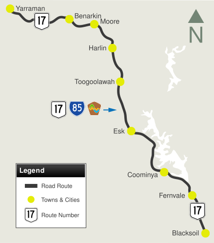
Brisbane Valley Highway & D'Aguilar Highway (National Route 17) |
Statistics:
Route Numbering:

General Information:
National Route 17 is a highway located west of Brisbane and forms part of a link from the metropolitan area to the Burnett region of Queensland.
Originally a much longer route, it passes through several small towns, rural areas and bushland. The route is of rural highway standards.
Multiplexes along the route include:
History:
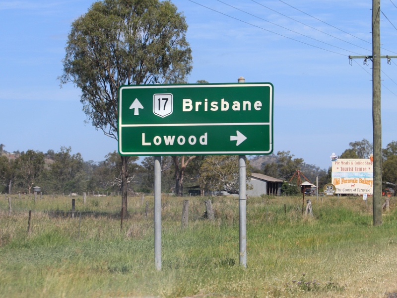
| Yarraman to Blacksoil | Blacksoil to Yarraman | |||
| Preview: | Description: | Preview: | Description: | |
 |
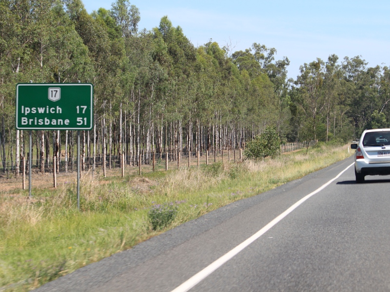
Distance
Sign: Reassurance directional sign at Harlin, July 2004. Image © Michael Greenslade |
 |
Black Kilometre Plate: Black kilometre plate at Fernvale, July 2004. Image © Michael Greenslade |
|
 |
Advance Directional Sign: AD sign at Toogoolawah approaching Dingyarra St, July 2004. Image © Michael Greenslade |
 |
Advance Directional Sign: AD sign at Wivenhoe Pocket approaching Wivenhoe-Somerset Rd, July 2004. Image © Michael Greenslade |
|
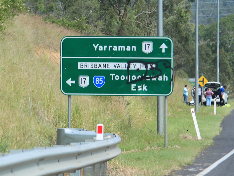 |
Advance
Directional Sign: AD sign on D'Aguilar Hwy (SR85) at Harlin approaching Brisbane Valley Hwy (NR17), April 2011. The SR85 duplex begins at his junction. Image © Rob Tilley |
 |
Reassurance Directional Sign: Distance sign at Coominya, July 2004. Image © Michael Greenslade |
|
 |
Advance
Directional Sign: AD sign on Esk-Kilcoy Rd approaching Brisbane Valley Hwy (NR17 / SR85) at Esk, November 2009. Image © Rob Tilley |
 |
Advance Directional Sign: AD sign at Esk approaching Esk-Hampton Rd (SR85), July 2004. Image © Michael Greenslade |
|
 |
Intersection
Directional Sign: ID sign at Esk facing Esk-Kilcoy Rd, November 2009. Image © Rob Tilley |
 |
Esk-Hampton Road: Corner of Brisbane Valley Hwy (NR17) and Esk-Hampton Rd (SR85) at Esk, July 2004. The SR85 duplex commences from this junction. Note the missing route number from sign. Image © Michael Greenslade |
|
 |
Distance
Sign: RD sign at Esk, after the Esk-Kilcoy Rd junction, November 2009. Image © Rob Tilley |
 |
Intersection
Directional Sign: Non-standard ID sign facing Esk-Hampton Rd (SR85) at Esk, November 2009. The SR85 duplex begins at this junction. Image © Rob Tilley |
|
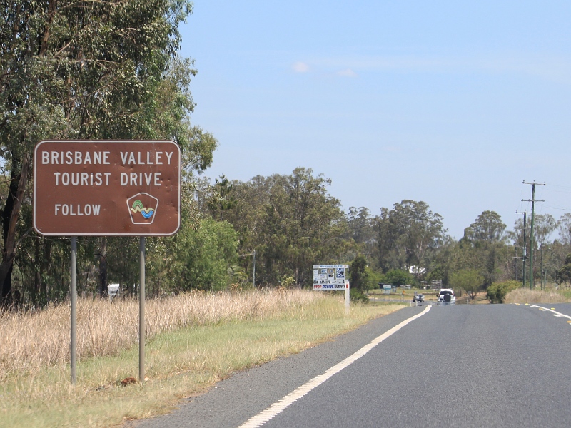 |
Supplemental
Directional Sign: Sign for Brisbane Valley Tourist Drive at Esk, November 2009. Image © Rob Tilley |
 |
Black Kilometre Plate: Black kilometre plate at Esk, July 2004. Image © Michael Greenslade |
|
 |
Esk-Hampton
Road: Corner of Brisbane Valley Hwy (NR17) and Esk-Hampton Rd (SR85) at Esk, November 2009. The SR85 duplex ends at this junction Image © Rob Tilley |
 |
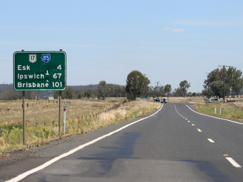
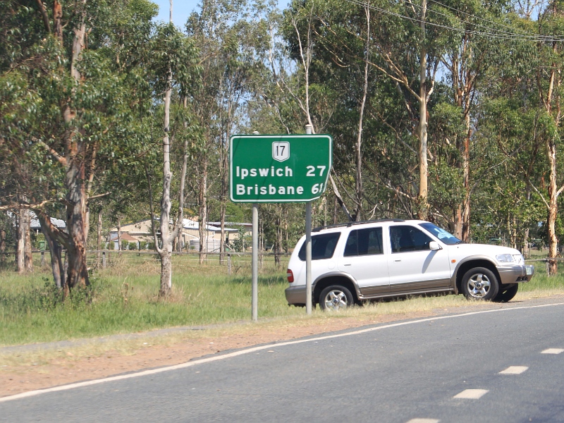
Reassurance Directional Sign: Distance sign at Esk, July 2004. Image © Michael Greenslade |
|
 |
Distance
Sign: RD sign as Brisbane Valley Hwy (NR17) leaves Esk, November 2009. Image © Rob Tilley |
 |
Black Reassurance Directional Sign: Distance sign at Toogoolawah, July 2004. Image © Michael Greenslade |
|
 |
Coominya
Connection Rd & McLean Rd: Corner of Brisbane Valley Hwy (NR17), McLean Rd and Coominya Connection Rd at Coominya, November 2009. Image © Rob Tilley |
 |
Advance Directional Sign: AD sign at Harlin approaching D'Aguilar Hwy (SR85), July 2004. The SR85 duplex ends at this location and NR17 becomes D'Aguilar Hwy at this location. Image © Michael Greenslade |
|
 |
Distance
Sign: RD sign on Brisbane Valley Hwy (NR17) at Coominya, November 2009. Image © Rob Tilley |
 |
Distance
Sign: Reassurance directional sign at Harlin, April 2011. Image © Rob Tilley |
|
 |
Lake Wivenhoe: Brisbane Vly Hwy (NR17) as it crosses Lake Wivenhoe via Wivenhoe Dam, July 2004. Image © Michael Greenslade |
 |
Distance
Sign: Reassurance directional sign at Harlin, July 2004. This sign has since been removed. Image © Michael Greenslade |
|
 |
Lake Wivenhoe: Brisbane Vly Hwy (NR17) as it crosses Lake Wivenhoe via Wivenhoe Dam, July 2004. Image © Michael Greenslade |
 |
Linville
Road: ID sign at the junction with Linville Rd at Moore, April 2011. Image © Rob Tilley |
|
 |
Advance
Direction Sign: AD sign approaching Wivenhoe-Somerset Rd at Wivenhoe Pocket, November 2009. Image © Rob Tilley |
 |
Advance
Directional Sign: AD sign on a windy section of Brisbane Valley Hwy (NR17) at Benarkin approaching the entrance to Benarkin State Forest, April 2011. Image © Rob Tilley |
|
 |
Wivenhoe-Somerset
Road: Corner of Brisbane Valley Hwy (NR17) and Wivenhoe-Somerset Rd at Wivenhoe Pocket, November 2009. Image © Rob Tilley |
 |
Advance
Directional Sign: AD sign on at Yarraman approaching New England Hwy (A3) and the A3 section of D'Aguilar Hwy, April 2011. Image © Rob Tilley |
|
 |
Advance
Directional Sign: AD sign at Fernvale approaching Forest Hill-Fernvale Rd, November 2009. Image © Rob Tilley |
 |
New
England Hwy & D'Aguilar Hwy: ID sign at the northern terminus of National Route 17, in Yarraman, April 2011. Image © Rob Tilley |
|
 |
Forest
Hill-Fernvale Road: Corner of Brisbane Valley Hwy (NR17) and Forest Hill-Fernvale Rd at Fernvale, November 2009. Image © Rob Tilley |
|||
 |
Distance
Sign: Reassurance directional sign as Brisbane Valley Hwy (NR17) at Fernvale, November 2009. Image © Rob Tilley |
|||
 |
End
Limited Access Road Sign: Sign in the Fernvale town centre indicating the end of access construction restrictions to Brisbane Valley Hwy (NR17), November 2009. Image © Rob Tilley |
|||
 |
Advance
Directional Sign: AD sign approaching Pine Mountain Rd and Leschkes Rd at Wanora, November 2009. Image © Rob Tilley |
|||
 |
Distance
Sign: RD sign at Wanora, November 2009. Image © Rob Tilley |
|||
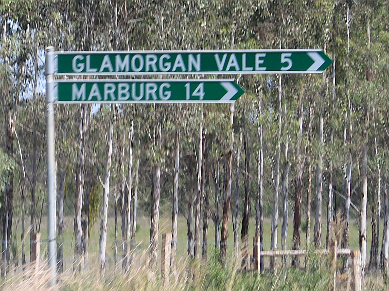 |
Fingerboard
Assembly: Typical Queensland fingerboards at the Glamorganvale Rd junction in Wanora, November 2009. Image © Rob Tilley |
|||
 |
Distance
Sign: RD sign at Wanora, November 2009. Image © Rob Tilley |
|||
 |
Advance
Directional Sign: AD sign at Blacksoil approaching Warrego Hwy (M/A2), November 2009. This is the southern terminus of NR17. Image © Rob Tilley |
|||
| Click here for the continuation of D'Aguilar Highway as A3 | ||||
1 Transport
& Main Roads, Queensland state-controlled roads and region maps, Wide Bay/Burnett Region: front
2 Sam Laybutt (OzRoads)
3 Queensland Government,
Minister
for Main Roads, The Honourable Craig Wallace, Safety improved on Brisbane Valley Highway near
Fairney Brook, 20 October 2009
Last Updated: 21-Oct-2021 15:05
This site © Paul Rands. All rights reserved. Some portions © (copyright) by their respective and credited owners. Permission must be obtained before using any images from this site. For details, please email by clicking here.