|
|
|
|
|

|
Leichhardt Highway (National Route 39) (Decommissioned) |
Statistics:
Route Numbering:

General Information:
National Route 39 headed north from just outside Goondiwindi through the remote western Darling Downs and cattle grazing regions past the intersection town of Moonie up to Miles where it met the Warrego Highway. Heading north from Miles, the same remote cattle country is prominent as the highway bypasses Wandoan to reach the pleasant town of Taroom. Once past the Isla Gorge, the highway enters the Callide Valley, bypassing Theodore before reaching the junction town of Banana. Originally the Leichhardt Highway terminated at Banana with NR39 following the Dawson Highway eastward towards Gladstone. However, with the extension of the Leichhardt Hwy north in 2000 to the small communities of Wowan and Dululu (where it touches the Burnett Hwy) to conclude near Westwood on the Capricorn Hwy. 3
Multiplexes along the route include:
History:

| Goondiwindi to Westwood | Westwood to Goondiwindi | |||
| Preview: | Description: | Preview: | Description: | |
 |
reassurance
Directional Sign: Distance sign at Goondiwindi, January 2004. Image © Michael Greenslade |
 |
Reassurance
Directional Sign: Distance sign at Dululu, 2004. Image © Jamie Scuglia |
|
 |
reassurance
Directional Sign: Distance sign at Moonie, January 2003. Image © Michael Greenslade |
 |
Advance Directional
Sign: AD sign at Miles approaching Jackson-Wandoan Rd and Zupps Rd, April 2004. Image © Michael Greenslade |
|
 |
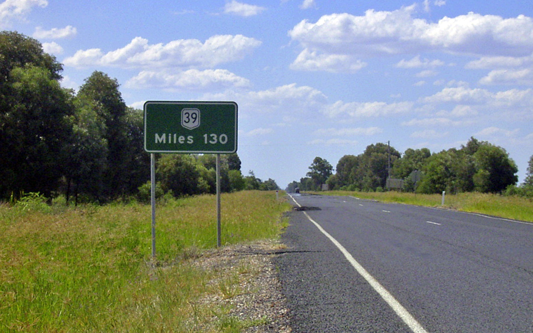
reassurance
Directional Sign: Distance sign at Miles, April 2004. Image © Michael Greenslade |
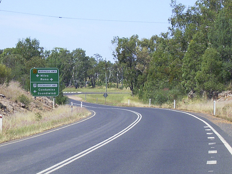 |
Advance Directional
Sign: AD sign at Miles approaching Warrego Hwy (NH-A2), April 2004. NR39 turned left here, and the NH-A2 started here as well. Image © Michael Greenslade |
|
 |
Black reassurance
Directional Sign: Black distance sign without route number at Wandoan April 2004. Image © Michael Greenslade |
 |
reassurance
Directional Sign: Distance sign at Miles, April 2004. Image © Michael Greenslade |
|
 |
Trailblazer &
Kilometre Plate: Trailblazer and kilometre plate at Wandoan, with reassurance directional sign in the distance, April 2004. Image © Michael Greenslade |
 |
Advance
Directional Sign: AD sign approaching Moonie Hwy (SR49) at Moonie, January 2003. Image © Michael Greenslade |
|
1 Queensland
Government, Transport & Main Roads, Fitzroy Road Region Map
2 Queensland Government, Transport & Main Roads, Darling
Downs Road Region Map
3 Michael Greenslade
4 Sam Laybutt (OzRoads)
Last updated: 25-Oct-2021 0:30
This site © Paul Rands. All rights reserved. Some portions © (copyright) by their respective and credited owners. Permission must be obtained before using any images from this site. For details, please email by clicking here.