|
|
|
|
|
 |
Bruce Highway (National Highway 1) (Decommissioned) - Former Alignment: Nambour to Gympie |
Statistics:
Route Numbering:

General Information:
The Highway 1 corridor is the main coastal route from the NSW border to the northern tip of the east coast of Australia, and links major cities and towns with Brisbane, and beyond the NSW border, Sydney.
Bruce Highway is named after former Minister of Public Works, Henry Bruce and connects Brisbane with all coastal regions north of the city.
The route is freeway standard from the Gateway Motorway interchange to Curra, north of Cooroy. From there, the route alterna tes between single and dual carriageway, and passes through rural, residential, industrial and commercial areas.
History:
This page concentrates on the former NH1 alignments between Nambour and Gympie
| Nambour to Gympie | Gympie To Nambour | |||
| Preview: | Description: | Preview: | Description: | |
 |
Intersection Directional Sign: ID sign at the corner of Coronation Av / Nambour Connection Rd (former Bruce Hwy), National Park Rd and Bli Bli Rd (TD23) at Nambour, January 2007. Note the missing TD23 shield. Image © Rob Tilley |
 |
Entering Cooroy: Elm St (former Bruce Hwy) as it enters the town of Cooroy, April 2012. Image © Paul Rands |
|
 |
Advance Directional Sign: AD sign on Old Gympie Rd at Yandina approaching Farrell St and Fleming St, November 2005. Image © Rob Tilley |
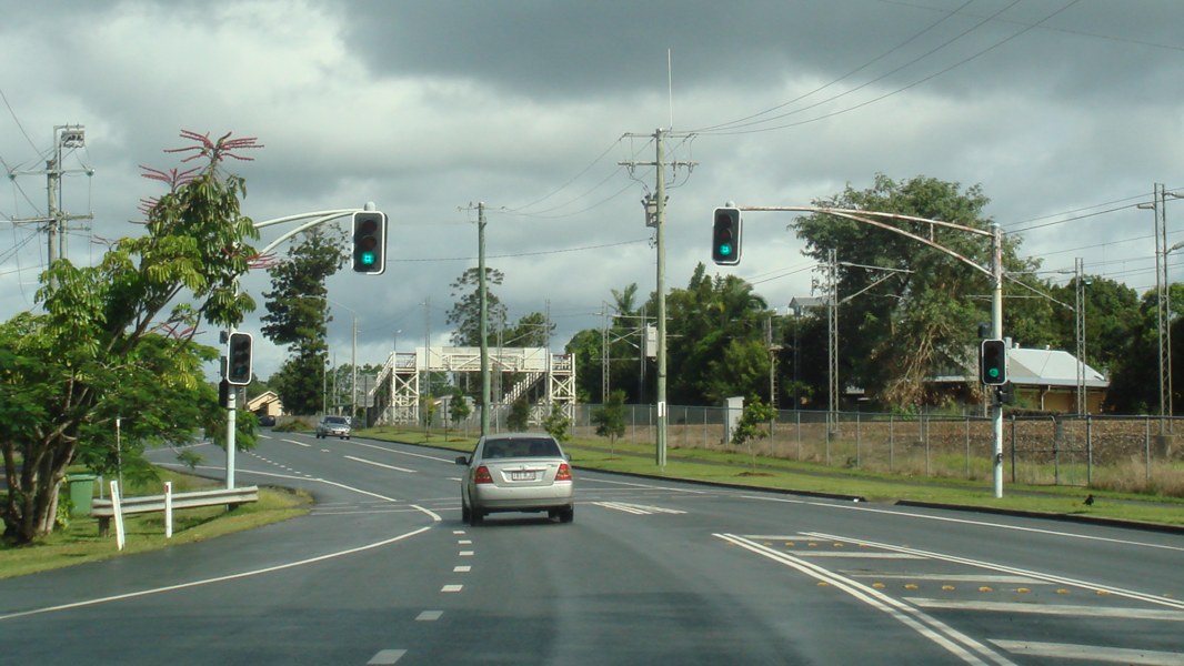 |
Old Pedestrian Signals: Old mast arm signals on Elm St at Cooroy, near the railway station, April 2012. These signals have since been replaced. Image © Paul Rands |
|
 |
Yandina Town Centre: AD style sign installed as ID sign in the Yandina town centre at the junction with Fleming St, January 2009. Image © Rob Tilley |
 |
Bridges: Bunya Rd (former Bruce Hwy) at Bridges with Mt Ninderry in the distance, March 2006. Image © Paul Rands |
|
 |
Browns Creek: Old bridge on Bunya Rd over Browns Ck at Bridges, March 2006. Image © Paul Rands |
|||
 |
Advance Directional Sign: AD sign on Old Gympie Rd at Yandina approaching Farrell St and Fleming St, March 2006. Image © Paul Rands |
|||
 |
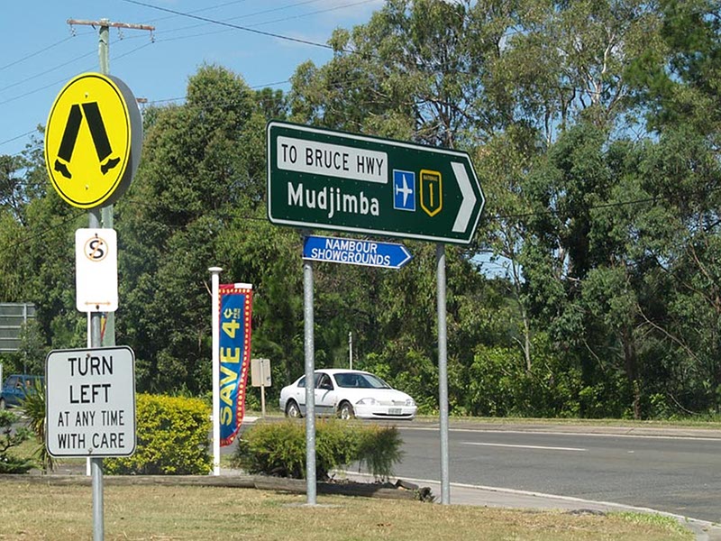
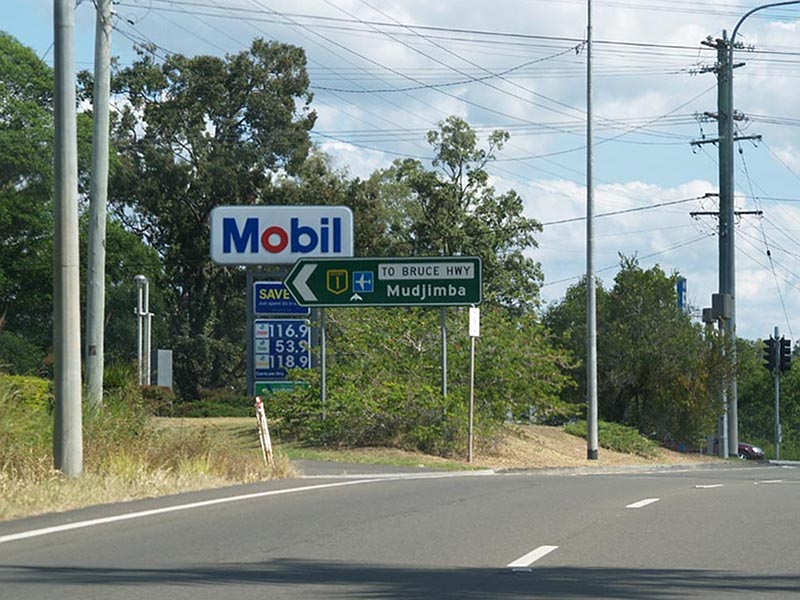
Advance Directional Sign: AD sign on Nambour Connection Rd (former Bruce Hwy), approaching Coronation Av, National Park Rd and Bli Bli Rd (TD23) at Nambour, May 2007. Image © Rob Tilley |
|||
 |
Intersection Directional Sign: ID sign at the corner of Coronation Av / Nambour Connection Rd (former Bruce Hwy), National Park Rd and Bli Bli Rd (TD23) at Nambour, May 2007. Note the missing TD23 shield. Image © Rob Tilley |
|||
1 Department of Transport and Main Roads, The State Road Network of Queensland, 30 June 2010
2 Nambour Chronicle, 8 November 1929
3 Nambour Chronicle, 26 October 1934
4 Nambour Chronicle, 23 November 1934
5 Tyler Bullock
6 Department of Transport and Main Roads, Projects, Bruce Highway (Cooroy to Curra)
Last updated: 27-Jan-2020 11:16
This site © Paul Rands. All rights reserved. Some portions © (copyright) by their respective and credited owners. Permission must be obtained before using any images from this site. For details, please email by clicking here.