|
|
|
|
|
 |
Bruce Highway (National Highway 1) (Decommissioned) - Beerburrum to Nambour |
Statistics:
Route Numbering:

General Information:
The Highway 1 corridor is the main coastal route from the NSW border to the northern tip of the east coast of Australia, and links major cities and towns with Brisbane, and beyond the NSW border, Sydney.
Bruce Highway is named after former Minister of Public Works, Henry Bruce and connects Brisbane with all coastal regions north of the city.
The route is freeway standard from the Gateway Motorway interchange to Curra, north of Cooroy. From there, the route alternates between single and dual carriageway, and passes through rural, residential, industrial and commercial areas.
History:
| Beerburrum to Nambour | Nambour to Beerburrum | |||
| Preview: | Description: | Preview: | Description: | |
 |
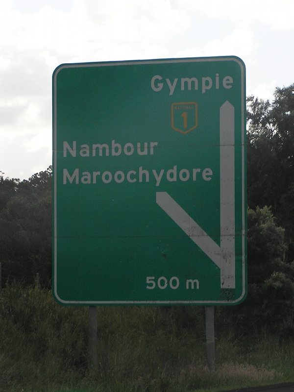
Freeway Green Advance Directional Sign: Freeway green AD sign at Palmview approaching the Sunshine Mwy (SR70) interchange, March 2006. Click here for a photo fo this location by Rob Tilley from April 2005. Image © Paul Rands |
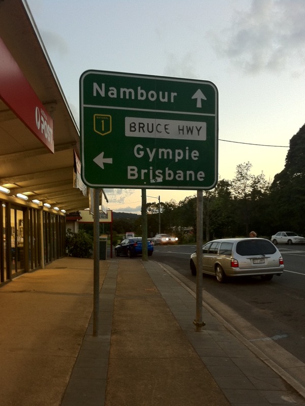 |
Advance Directional Sign: Southbound AD sign showing access to Bruce Hwy (NH1) on Farrell St (Old Bruce Hwy) (former NH1) approaching Fleming St and Old Gympie Rd in Yandina, April 2011. Image © Rob Tilley |
|
 |
Freeway Green Advance Directional Sign: Freeway green AD sign at Palmview approaching the Sunshine Mwy (SR70) interchange, March 2006. Click here for a photo fo this location by Rob Tilley from April 2005. Image © Paul Rands |
 |
Caloundra Road & Glass House Mountains Road: Bruce Hwy (NH1) at the interchange with Caloundra Rd (SR6) and Glass House Mtns Rd (SR6 / TD25) at Palmview, April 2005. Glass House Mtns Rd is now named Steve Irwin Way and is a former Bruce Hwy alignment. Image © Rob Tilley |
|
 |
Sippy Creek Road: Bruce Hwy (NH1) at the Sippy Ck Rd junction at Palmview, April 2005. Image © Rob Tilley |
|||
 |
Freeway Green Intersection Directional Sign: Freeway green ID sign at the Sunshine Mwy (NH1) interchange at Palmview, April 2005. Image © Rob Tilley |
|||
 |
Reassurance Directional Sign: Distance sign at Tanawha, April 2005. Image © Rob Tilley |
|||
 |
Advance Directional Sign: AD sign at Chevallum on the off ramp to Chevallum Rd and Mons Rd (TD25), November 2005. Image © Michael Greenslade |
|||
 |
Advance Directional Sign: AD sign at Chevallum approaching Maroochydore Rd (SR8), April 2005. Image © Rob Tilley |
|||
 |
Reassurance Directional Sign: Distance sign at Woombye, April 2005. Image © Rob Tilley |
|||
| Click here for the contination of National Highway 1 between Nambour and Gympie Click here for the continuation of National Highway 1 between Bald Hills and Beerburrum |
||||
1 Department of Transport and Main Roads, The State Road Network of Queensland, 30 June 2010
2 Nambour Chronicle, 4 October 1929
3 Nambour Chronicle, 8 November 1929
3 Nambour Chronicle, 26 October 1934
4 Nambour Chronicle, 23 November 1934
5 Nambour Chronicle, 21 December 1934
6 Department of Environment and Heritage Protection, North Coast Roadside Rest Areas
7 Nambour Chronicle, 16 June 1939
8 Tyler Bullock
9 Nambour Chronicle, 8 November 1963
10 Nambour Chronicle, 20 May 1982
11 Sam Laybutt (Ozroads)
Last updated: 24-Oct-2021 21:20
This site © Paul Rands. All rights reserved. Some portions © (copyright) by their respective and credited owners. Permission must be obtained before using any images from this site. For details, please email by clicking here.