|
|
|
|
|

|
Pacific Highway, Pacific Motorway & Gateway Motorway (Metroad 1) (Decommissioned) |
Statistics:
Route Numbering:

General Information:
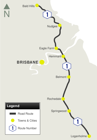
Metroad 1 is the former route number for a collection of motorway standard roads linking Brisbane's northern, eastern and souther suburbs.
Pacific Motorway:
The former Metroad 1 portion of the Pacific Motorway bypasses the suburban areas of outer Brisbane area, and passes through residential, commercial and industrial areas, and features a number of service roads to cater to some of the industrial and commercial zones.
The section from Brisbane to Springwood is formerly known as the South Eastern Freeway.
Gateway Motorway:
The Gateway Motorway passes through Brisbane's eastern suburbs, and services mostly residential and industrial areas, both north and south of the Brisbane River. It provides access to ports and the airport.
The Gateway Motorway features a bridge over the Brisbane River, once known as the Gateway Bridge, but now named Sir Leo Hielscher Bridge, named after an Australian senior public servant and administrator.
The bridge has a number of interesting features including: 2
- A height clearance of 55 m over the high tide mark of the Brisbane River, to allow the largest of ships to pass safely under the bridge.
- A clear span width of at least 230 m so ships of varying size and width could safely manoeuvre under the bridge.
- A maximum 80 m height of the superstructure (including the height of the lamp posts and direction signs) so as not to interfere with flight paths of aircraft taking off or landing at Brisbane Airport.
At the time of its completion, the bridge boasted a number of Australian and world class achievements, including:
- The longest cantilevered concrete box girder main river span, at a length of 260 m.
- An erection truss weighing 650 t.
- Stressing cables in the approach spans were the highest loaded cables in a structure in Australia, with 2200 t of 12 mm low relaxation stressing strand.
- Bridge bearings, with a maximum tested load of 4300 t, were the biggest pot bearings made in Australia.
History:
Pacific Highway & Pacific Motorway:
- 1927: Start of the formation and bitumen paving of the Pacific Highway in Logan area. 4
- 1930s: Pacific Highway named. 3
- 1 July 1931: Logan Bridge built to military specifications to bear the weight of a small tank. 3 4
- 1965: Brisbane Transportation Study recommended the construction of the South East Freeway. 4
- 1968: New bridge over the river at Loganholme was built in conjunction with the duplication of the Pacific Highway. 4
- November 1972: The first section, opened in Brisbane, was originally known as the Southeast Freeway. 5
- 1985: Completion of South East Freeway, from Brisbane to Springwood. 6
- 1995: National Route 1 replaced by Metroad 1 between Bald Hills and Loganholme.
- December 1996: Motorway upgrade to 6 lanes between Winnetts Road to Beenleigh-Redland Bay Road. 9
- September 2000: Metroad 1 replaced by M1 between Bald Hills and Loganholme.
Gateway Motorway:
- June 1980: The Gateway Bridge Company was established to oversee construction of the Gateway Bridge and, following construction, to maintain the bridge and collect tolls. 7
- August 1980 Work began on the six-lane Gateway Bridge over Brisbane River. 2
- December 1985: The Gateway Bridge and motorway approaches were completed.
- 1986: The Gateway Arterial was constructed in two stages and was completed.
- 11 January 1986: The original Gateway Bridge was officially opened. 18 Around 200,000 people attended the opening festivities and walked the new bridge.
- 1995: National Route 1 replaced by Metroad 1 between Bald Hills and Loganholme.
- September 2000: Metroad 1 replaced by M1 between Bald Hills and Loganholme.
| Loganholme to Bald Hills | Bald Hills to Loganholme | |||
| Preview: | Description: | Preview: | Description: | |
 |
Murrays Road: Pacific Hwy (Metroad 1) at Murrays Rd interchange at Shailer Park, May 2005. Image © Michael Greenslade |
 |
Advance Directional
Sign: AD sign on Bruce Hwy (NH1) at Bald Hills approaching the interchange with Gateway Mwy (Metroad1) and Gympie Arterial Rd (Metroad 3), May 2005. Click here for a photo of this location by Michael Greenslade from May 2005. Image © Rob Tilley |
|
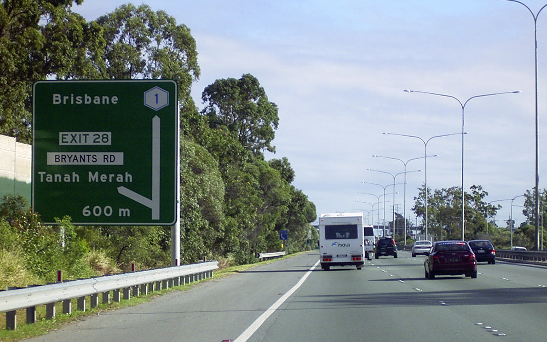 |
Advance Directional Sign: AD sign on Pacific Hwy (Metroad 1) at Tanah Merah approaching Bryants Rd interchange, May 2005. Image © Michael Greenslade |
 |
Advance Directional
Sign: AD sign on Bruce Hwy (NH1) at Bald Hills approaching the interchange with Gateway Mwy (Metroad1) and Gympie Arterial Rd (Metroad 3), May 2005. Image © Rob Tilley |
|
 |
Reassurance Directional Sign: Distance sign at Slacks Creek, near Nujooloo Rd interchange, May 2005. Image © Michael Greenslade |
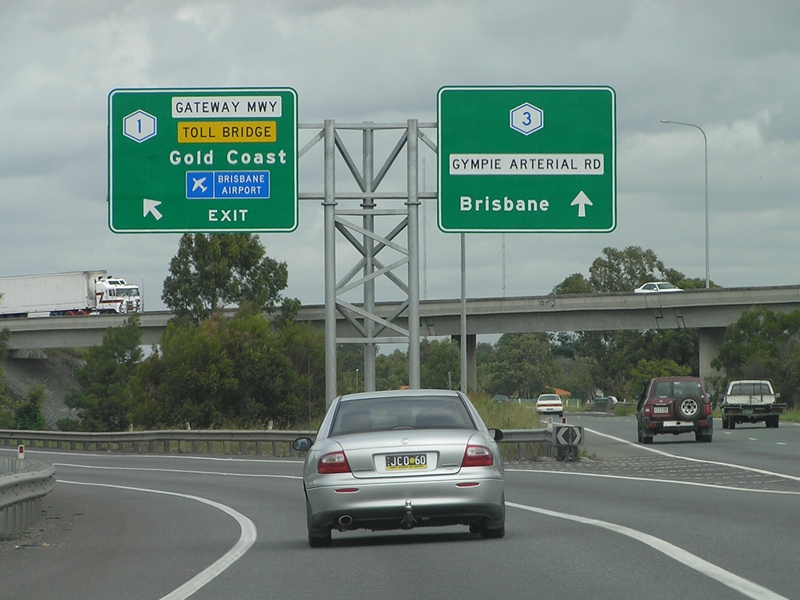 |
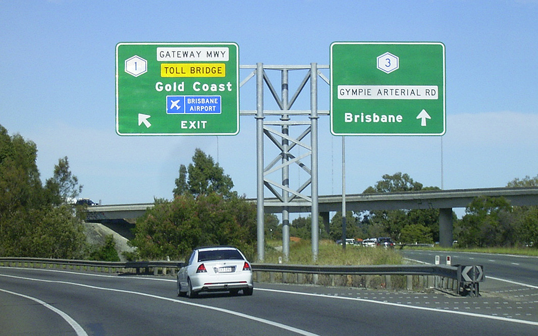
Gateway Motorway &
Gympie Arterial Road: Bruce Hwy (NH1) at the interchange with Gateway Mwy (Metroad 1) and Gympie Arterial Rd (Metroad 3) at Bald Hills, May 2005. This was the southern terminus of National Highway 1 in Queensland at the time, and the end of the Bruce Hwy. Click here for a photo of this location by Michael Greenslade from May 2005. Image © Rob Tilley |
|
 |
Advance Directional Sign: AD sign on Pacific Hwy (Metroad 1) approaching Loganlea Rd at Slacks Creek, May 2005. Image © Michael Greenslade |
 |
Reassurance Directional
Sign: Distance sign on Gateway Mwy (Metroad 1) near Wyampa Rd at Bald Hills, May 2005. Image © Michael Greenslade |
|
 |
Advance Directional Sign: Westbound AD sign on Paradise Rd (SR50) at Slacks Creek, approaching the roundabout with Pacific Hwy Service Rd and the on ramp to Pacific Hwy (Metroad 1), May 2005. The name Pacific Mwy is in error, as the name doesn't change from Pacific Hwy to Pacific Mwy until the Logan Rd (SR95) interchange. Image © Michael Greenslade |
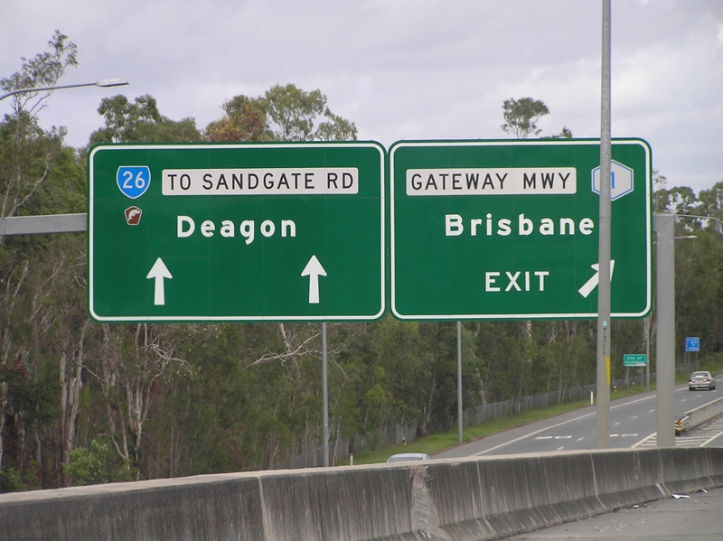 |
Advance Directional
Signs: AD signs on the connection with Deagon Deviation (SR26) at Sandgate, May 2005. Image © Rob Tilley |
|
 |
Reassurance Directional Sign: Distance sign at Slacks Creek, May 2005. Image © Michael Greenslade |
 |
Freeway Green Trailblazer: Freeway Green Metroad 1 trailbazer at the Deagon Dev (SR26) interchange at Sandgate, May 2005. Image © Michael Greenslade |
|
 |
Advance Directional Sign: AD sign on Pacific Mwy (Metroad 1) at Underwood, approaching Gateway Mwy (Metroad 1) and Pacific Mwy (Metroad 3), May 2005. Image © Michael Greenslade |
 |
Freeway Green Advance Directional Sign: Freeway Green AD sign on the off ramp to Bicentennial Rd at Boondall, May 2005. Image © Michael Greenslade |
|
 |
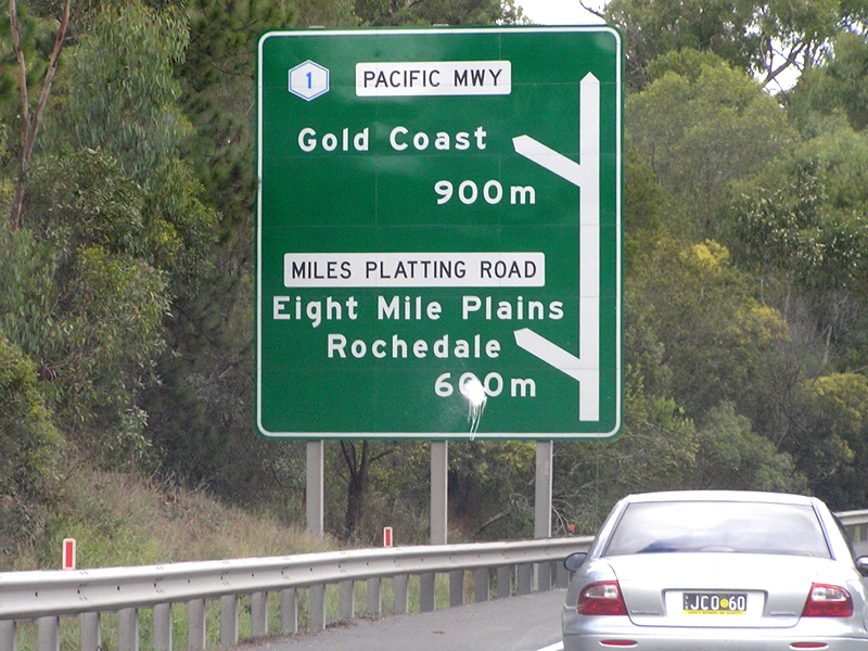
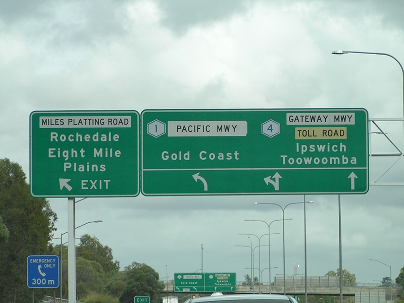
Miles Platting Road: Gateway Mwy (Metroad 1) at the Miles Platting Rd (SR56) interchange at Rochedale, May 2005. Note the missing SR56 shield. Image © Michael Greenslade |
 |
Freeway Green Reassurance Directional Sign: Freeway green distance sign at Boondall, May 2005. Image © Michael Greenslade |
|
 |
Reassurance Directional Sign: Distance sign at Eight Mile Plains, May 2005. Image © Michael Greenslade |
 |
Advance
Directional Sign: AD sign on Gateway Mwy (Metroad 1) at Nudgee Beach, approaching Nudgee Rd, May 2005. Image © Michael Greenslade |
|
 |
Trailblazer: Trailblazer on Gateway Mwy (Metroad 1) at Rochedale, October 2004. Image © Michael Greenslade |
 |
Freeway Green Advance
Directional Sign: Freeway green AD sign on Gateway Mwy (Metroad 1) at Nudgee Beach, approaching Nudgee Rd, May 2005. Image © Rob Tilley |
|
 |
Mount
Gravatt-Capalaba Road: Gateway Mwy (Metroad 1) at the Mt Gravatt-Capalaba Rd (SR21 / Metroad 2) interchange at Rochedale, October 2004. Image © Michael Greenslade |
 |
Advance Directional Sign: AD sign on Nudgee Rd approaching Gateway Mwy (Metroad 1) interchange, May 2005. Image © Michael Greenslade |
|
 |
Gateway Motorway: Northbound view of the Gateway Mwy (Metroad 1) from the Meadowlands Rd overpass at Belmont, October 2004. Image © Michael Greenslade |
 |
Freeway Green Prohibition Sign: Freeway green prohibition sign on Nudgee Rd at Nudgee at the Gateway Mwy (Metroad 1) interchange, showing the former name of Gateway Mwy; Gateway Arterial Rd, May 2005. Image © Michael Greenslade |
|
 |
Freeway Green Reassurance Directional Sign: Freeway green distance sign at Belmont, May 2005. Image © Michael Greenslade |
 |
Freeway Green Intersection Direction Sign: Freeway green ID sign on Nudgee Rd at Nudgee at the Gateway Mwy (Metroad 1) interchange, May 2005. Image © Michael Greenslade |
|
 |
Freeway Green Advance Directional
Sign: Freeway Green AD sign on Wynnum Rd (SR23) at Tingalpa approaching Gateway Mwy (Metroad 1), October 2004. Image © Michael Greenslade |
 |
Gateway Motorway: View of Gateway Mwy (Metroad 1) from Nudgee Rd overpass, May 2005. Image © Michael Greenslade |
|
 |
Freeway Green Advance Directional Sign: Freeway green AD sign on Gateway Mwy (Metroad 1) at Tingalpa, May 2005. Image © Michael Greenslade |
 |
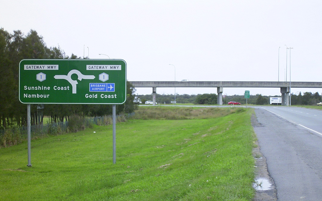
Advance Directional
Sign: AD sign on Gateway Mwy (Metroad 1) at Northgate approaching Toombul Rd, May 2005. Image © Rob Tilley |
|
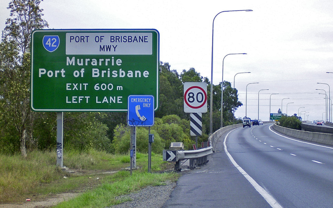 |
Advance Directional Sign: AD sign at Tingalpa approaching Port of Brisbane Mwy (SR42), May 2005. Image © Michael Greenslade |
 |
Freeway Green Advance DIrectional Sign: Freeway green AD sign on Toombul Rd at Northgate approaching Gateway Mwy (Metroad 1) interchange, May 2005. Image © Michael Greenslade |
|
 |
Toll Plaza Lane Allocation Signs: Toll plaza lane allocation signs near the Port of Brisbane Mwy (SR42) interchange at Murarrie, May 2005. Image © Michael Greenslade |
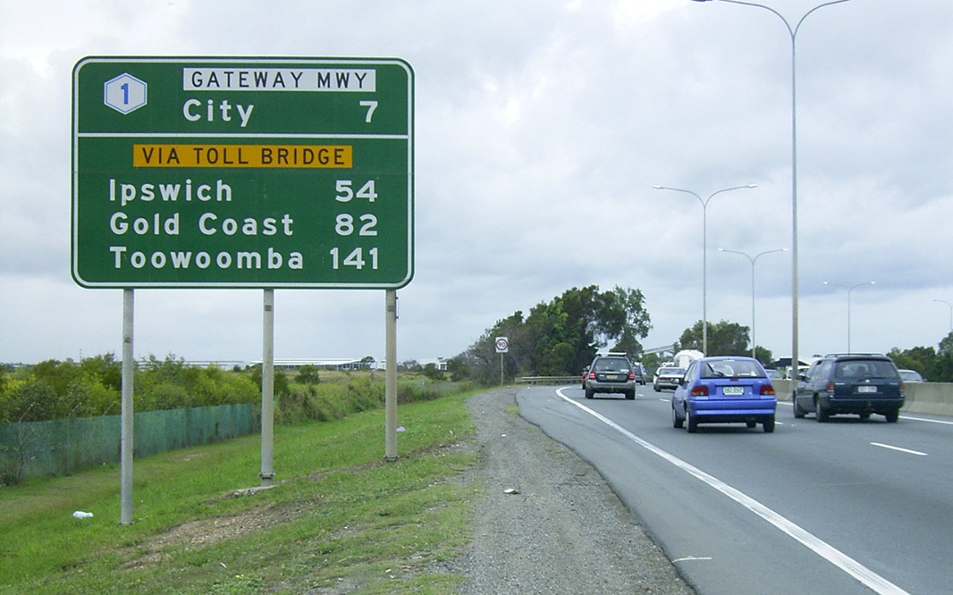 |
Reassurance Directional Sign: Distance sign at Nundah, May 2005. Image © Michael Greenslade |
|
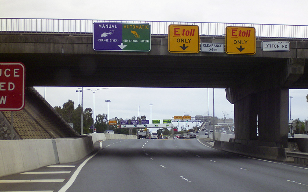 |
Toll Plaza Lane Allocation Signs: Toll plaza lane allocation signs on the Lytton Rd (SR24) overpass at Murarrie, May 2005. Image © Michael Greenslade |
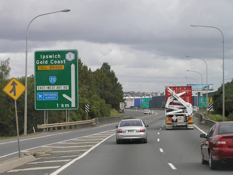 |
Advance Directional
Sign: AD sign on Gateway Mwy (Metroad 1) at Nundah approaching East-West Arterial Rd (SR20), May 2005. Image © Rob Tilley |
|
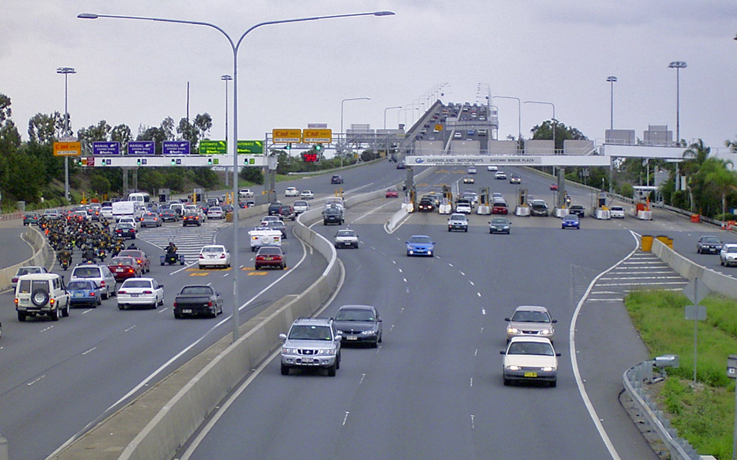 |
Toll Plaza: Gateway Bridge toll plaza viewed from Lytton Rd (SR24) at Murarrie, May 2005. Image © Michael Greenslade |
 |
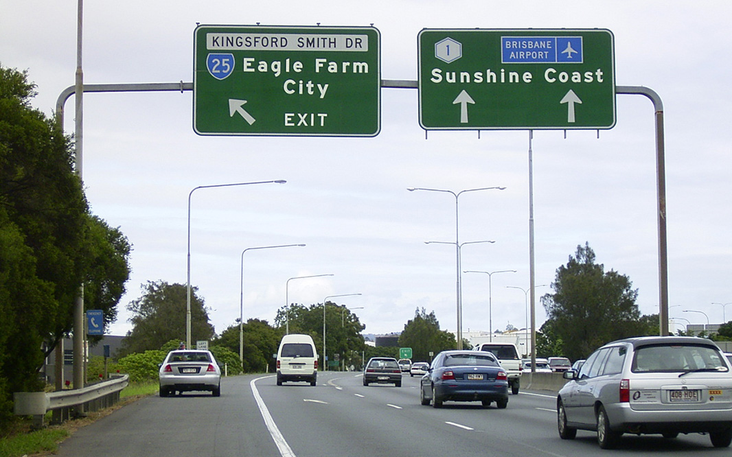
Kingsford Smith Drive: Gateway Mwy (Metroad 1) at the interchange with Kingsford Smith Dr (SR25) at Eagle Farm, May 2005. Image © Rob Tilley |
|
 |
Gateway Bridge: Gateway Br crossing Brisbane River at Eagle Farm, May 2005. Image © Michael Greenslade |
 |
Reassurance Directional
Sign: Distance sign at Eagle Farm, May 2005. Image © Rob Tilley |
|
 |
Advance Directional Sign: AD sign on Gateway Mwy (Metroad 1) at Eagle Farm, approaching Kingsford Smith Dr (SR25), May 2005. Image © Michael Greenslade |
 |
Brisbane River: Crossing Brisbane River via Gateway Br at Murarrie, May 2005. Image © Michael Greenslade |
|
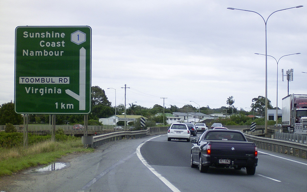 |
Advance Directional Sign: AD sign at Virginia, approaching Toombul Rd, May 2005. Image © Michael Greenslade |
 |
Toll Plaza: Gateway Mwy (Metroad 1) at the toll plaza after Gateway Bridge at Murrarie, May 2005. Image © Rob Tilley |
|
 |
Advance Directional Sign: AD sign on Toombul Rd at Northgate approaching Gateway Mwy (Metroad 1), May 2005. Image © Michael Greenslade |
 |
Toll Plaza: Gateway Mwy (Metroad 1) at the toll plaza after Gateway Bridge at Murrarie, May 2005. Image © Rob Tilley |
|
 |
Reassurance Directional Sign: Distance sign at Northgate, May 2005. Image © Michael Greenslade |
 |
Port of Brisbane Motorway: View of Port of Brisbane Mwy (SR42) and the abandoned on ramp from Lytton Rd onto Gateway Mwy (Metroad 1) at Murarrie, May 2005. Image © Michael Greenslade |
|
 |
Intersection Directional Sign: ID sign at the corner of Nudgee Rd and Childers Rd at Nudgee, showing the old name for Gateway Mwy; Gateway Arterial Rd, May 2005. Image © Michael Greenslade |
 |
Port of Brisbane Motorway: View of Port of Brisbane Mwy (SR42) and the abandoned on ramp from Lytton Rd at Murarrie, May 2005. Image © Michael Greenslade |
|
 |
Deagon Deviation: Gateway Mwy (Metroad 1) at Bracken Ridge at the Deagon Dev (SR26) interchange, May 2005. Image © Michael Greenslade |
 |
Reassurance Directional
Sign: Distance sign at Tingalpa, May 2005. Image © Rob Tilley |
|
 |
Reassurance Directional Sign: Distance sign at Bracken Ridge, May 2005. Image © Michael Greenslade |
 |
Intersection
Directional Sign: ID sign at the corner of Belmont Rd and Meadowlands Rd at Belmont pointing to access to Metroad 1, October 2004. Image © Michael Greenslade |
|
 |
Old Cleveland Road: View of Old Cleveland Rd (SR22) interchange from Meadowlands Rd overpass at Belmont, October 2004. Image © Michael Greenslade |
|||
 |
Freeway Green
Reassurance Directional Sign: Freeway green distance sign at Belmont, May 2005. Image © Rob Tilley |
|||
 |
Belmont: Gateway Mwy (Metroad 1) as it passes through the suburb of Belmont, May 2005. Image © Michael Greenslade |
|||
 |
Advance Directional
Sign: AD sign on Gateway Mwy (Metroad 1) at Mackenzie, approaching Mt Gravatt-Capalaba Rd (Metroad 2), May 2005. Image © Rob Tilley |
|||
 |
Freeway Green Intersection Directional Sign: Freeway green ID sign in facing the off ramp from Gateway Mwy (Metroad 1) onto Mt Gravatt-Capalaba Rd (Metroad 2) at Mackenzie, May 2005. Image © Michael Greenslade |
|||
 |
Freeway Green
Reassurance Directional Sign: Freeway green distance sign at Rochedale, May 2005. Image © Rob Tilley |
|||
 |
Advance Directional
Sign: AD sign on Gateway Mwy (Metroad 1) approaching Miles Platting Rd (SR56) at Rochedale, May 2005. Note the missing SR56 shield. Image © Rob Tilley |
|||
 |
Advance Directional
Sign: AD sign on Gateway Mwy (Metroad 1) approaching Miles Platting Rd (SR56) at Rochedale, May 2005. Note the missing SR56 shield. Image © Rob Tilley |
|||
 |
Miles Platting drive: Gateway Mwy (Metroad 1) at the Miles Platting Rd (SR56) interchange at Rochedale, May 2005. Image © Rob Tilley |
|||
 |
Advance Directional Sign: AD sign on the on ramp from Miles Platting Rd (SR56) at Rochedale onto Pacific Mwy (Metroad 1) and Gateway Mwy (Metroad 4), May 2005. Image © Michael Greenslade |
|||
 |
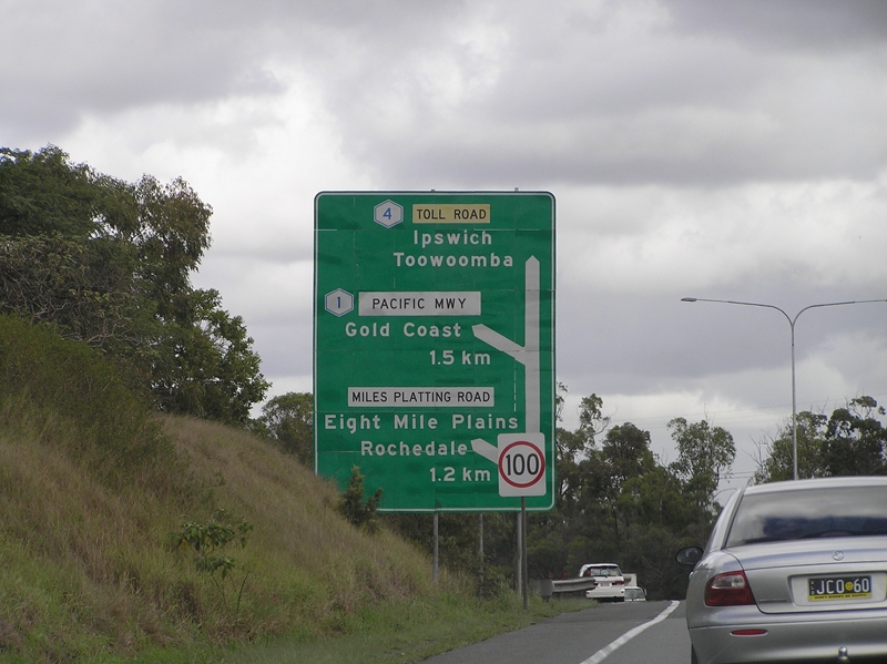
Intersection
Directional Sign: ID sign at the Pacific Mwy (Metroad 1) interchange at Rochedale, May 2005. Gateway Mwy continued at this point as Metroad 4. Image © Rob Tilley |
|||
 |
Reassurance Directional
Sign: Distance sign at Rochedale, May 2005. Image © Michael Greenslade |
|||
 |
Advance Directional Sign: AD sign on the Underwood Rd overpass at Rochedale for Rochedale Rd (SR30) and Fitzgerald Rd interchanges, May 2005. Image © Rob Tilley |
|||
 |
Freeway Green Advance Directional Sign: Freeway green AD sign at Rochedale approaching Rochedale Rd (SR30), May 2005. Image © Michael Greenslade |
|||
 |
Advance Directional Sign: AD sign on John Paul Dr at Daisy Hill approaching the junction with Winnetts Rd, Loganlea Rd and the Pacific Hwy (Metroad 1) interchange, May 2005. Image © Michael Greenslade |
|||
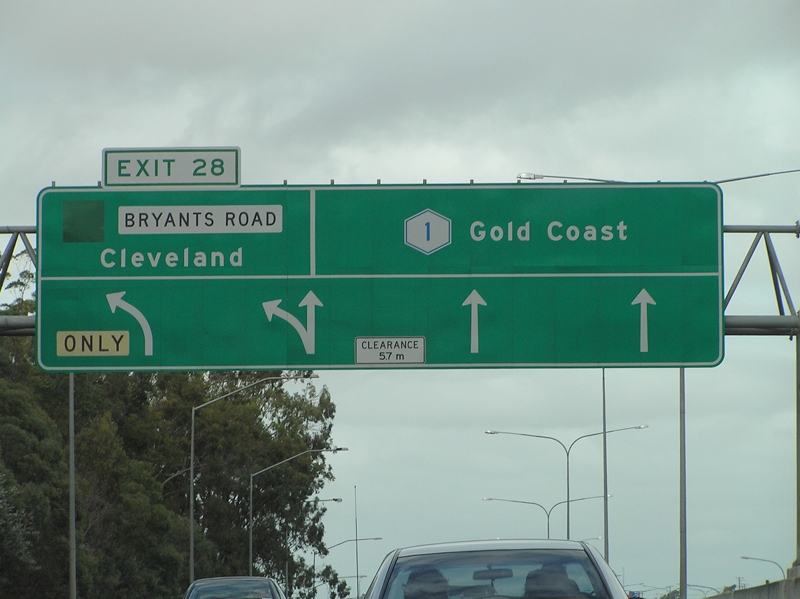 |
Intersection
Directional Sign: ID sign on Pacific Mwy (Metroad 1) at Shailer Park at the Bryants Rd interchange, May 2005. Image © Rob Tilley |
|||
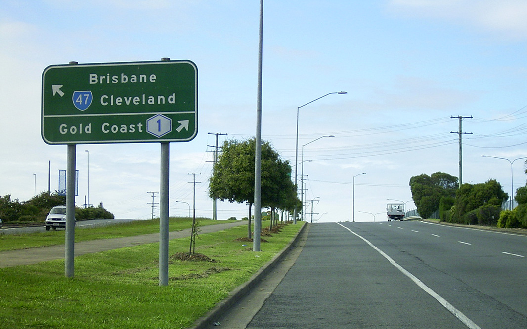 |
Advance Directional Sign: AD sign at Loganholme on the Pacific Hwy Service Rd approaching Beenleigh-Redland Bay Rd (SR47) and Pacific Hwy (Metroad 1), May 2005. Image © Michael Greenslade |
|||
1 Queensland
Government, Transport and Main Roads, Metropolitan Road Region Map, May
2011
2 Queensland Roads Edition No 1 March
2006
3 Bulldust, Beef & Beyond
4 Logan District History
5 Building Brisbane's History:
Structure, Sculptures, Stories and Secrets. ISBN 9781921606199
6 Brisbane Times, South-East Queensland
transport infrastructure rollout since 1975, 6 July 2010
7 Queensland Roads, Edition
No 8, March 2010
Last updated: 25-Oct-2021 15:20
This site © Paul Rands. All rights reserved. Some portions © (copyright) by their respective and credited owners. Permission must be obtained before using any images from this site. For details, please email by clicking here.