|
|
|
|
|
 |
Golden Highway (State Route 84) (Decommissioned) |
Statistics:
Route Numbering:

General Information:
State route 84 is an east-west rural highway which links the state's west with the Hunter Valley, and eventually the Newcastle ports, via New England and Pacific Highways.
The route services mostly rural, commericial, residential and vineyard areas.
Multiplexes along the route include:
History:

| Whittingham to Dubbo | Dubbo to Whittingham | |||
| Preview: | Description: | Preview: | Description: | |
 |
Advance Directional Sign: AD sign on New England Hwy (NH15) at Belford approaching Golden Hwy (SR84), July 2007. Image © Paul Rands |
 |
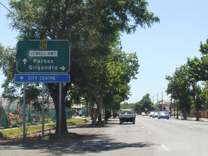
Advance Directional Sign: AD sign on Newell Hwy (NH39) approaching Golden Hwy (SR84) at Dubbo, November 2010. Click here for a photo from April 2005 of the previous sign. Image © Rob Tilley |
|
 |
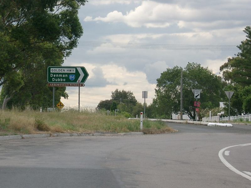
Supplemental Advance Directional Sign: Supplemental AD sign on New England Hwy (NH15) at Whittingham approaching Golden Hwy (SR84), July 2007. Image © Paul Rands |
|
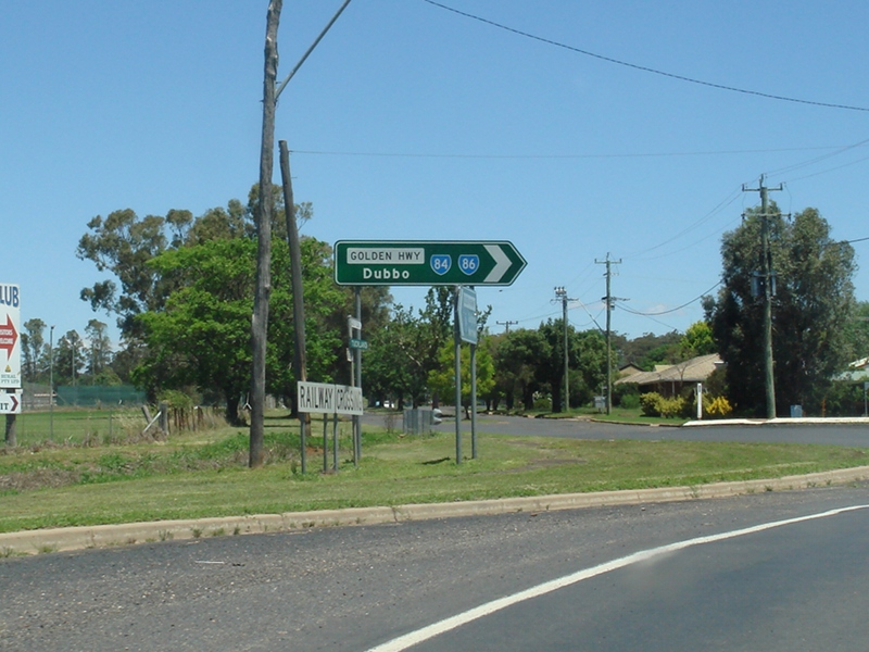
Western Terminus: Western terminus of SR84, the junction with Newell Hwy (NH39) in Dubbo, November 2010. Click here for a photo from May 2005 of the previous sign. Image © Rob Tilley |
|
 |
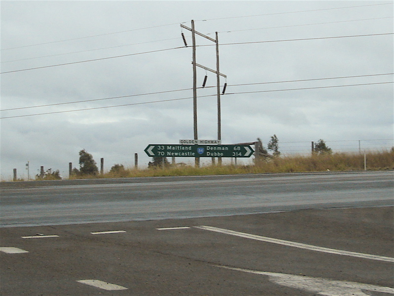
Advance Directional Sign: AD sign on New England Hwy (NH15) at Whittingham approaching Golden Hwy (SR84), July 2007. Image © Paul Rands |
 |
Reassurance Directional Sign: Distance sign at Dubbo, January 2003. Image © Michael Greenslade |
|
 |
Intersection Directional Sign: ID sign facing Wallaby Scrub Rd at Warkworth, December 2004. Image © Paul Rands |
 |
Intersection Directional Sign: ID sign facing the rest area at Whittingham, July 2007. Image © Paul Rands |
|
 |
Black Intersection Directional Sign: Black ID sign at the junction with Wambo Mine Rd at Warkworth, December 2004. Image © Paul Rands |
 |
Alphanumeric Intersection Directional Sign: Alphanumeric ID sign facing Golden Hwy (SR84) at Whittingham, July 2007. Image © Paul Rands |
|
 |
Wollombi Brook: Golden Hwy (SR84) as it crosses Wollombi Brook at Warkworth, December 2004. Image © Paul Rands |
|||
 |
Distance Sign: Tourism based reassurance directional sign at Warkworth, December 2004. Image © Paul Rands |
|||
 |
Former Alignment: Old alignment of Golden Hwy at Warkworth, December 2004. The road was shifted to make way for local mining activities. Image © Paul Rands |
|||
 |
Rest Area Distance Sign: RD sign with incorrect font showing distances to rest areas. Warkworth, December 2004. Image © Paul Rands |
|||
 |
Intersection Directional Sign: ID sign in the Jerry Plains town centre at the junction with Pagan St and Lonsdale St, December 2004. Image © Paul Rands |
|||
 |
Hunter River: Golden Hwy (SR84) at Jerrys Plains as it crosses Hunter River via Bowmans Crossing, December 2004. Image © Paul Rands |
|||
 |
Steep Climb: Golden Hwy (SR84) approaching Edderton Rd in Jerrys Plains, December 2004. Image © Paul Rands |
|||
 |
Black Advance Directional Sign: Old all caps black AD sign at Sandy Hollow approaching Bylong Valley Way, circa 1982. Image captured from State Bank of NSW commercial |
|||
 |
Distance Sign: Reassurance directional sign at Craboon, November 2011. Image © Paul Rands |
|||
 |
Entering Craboon: Golden Hwy (SR84 / SR86) as it enters the village of Craboon, November 2011. Image © Paul Rands |
|||
 |
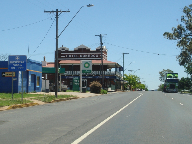
Entering Dunedoo: Golden Hwy (SR84 / SR86) entering the town of Dunedoo, November 2011. Image © Paul Rands |
|||
 |
Services Sign: Services sign at Dunedoo, November 2011. Image © Paul Rands |
|||
 |
Intersection Directional Sign: ID sign at Wargundy St, Dunedoo, November 2011. Image © Paul Rands |
|||
 |
Dunedoo: Golden Hwy (SR84 / SR86) passing through Dunedoo town centre, November 2011. Image © Paul Rands |
|||
 |
Advance Directional Sign: AD sign approaching Castlereagh Hwy (SR86) at Dunedoo, November 2011. The SR86 duplex ends at this junction. Image © Paul Rands |
|||
 |
Castlereagh Highway: Golden Hwy (SR84) at Castlereagh Hwy (SR86) at Dunedoo, November 2011. Image © Paul Rands |
|||
 |
Distance Sign: RD sign leaving Dunedoo, November 2011. Image © Paul Rands |
|||
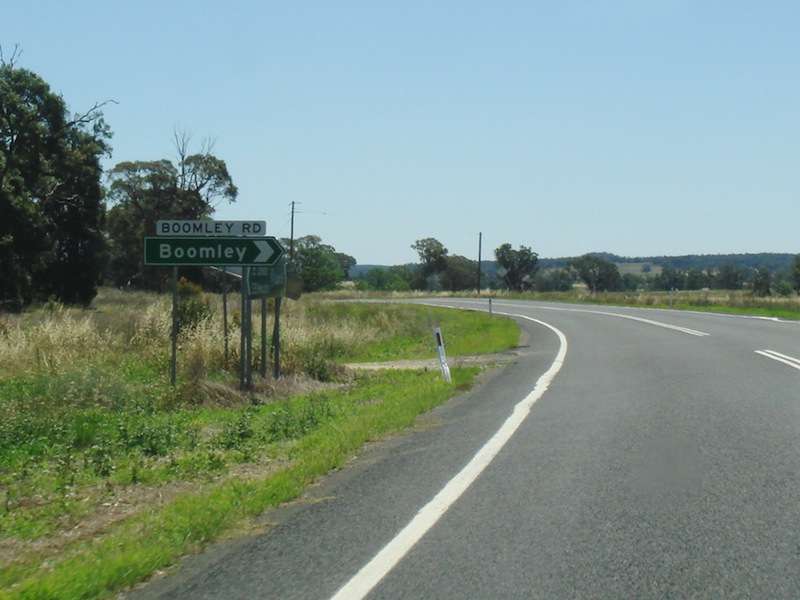 |
Boomley Road: Golden Hwy (SR84) at Boomley Rd at Elong Elong, November 2011. Image © Paul Rands |
|||
 |
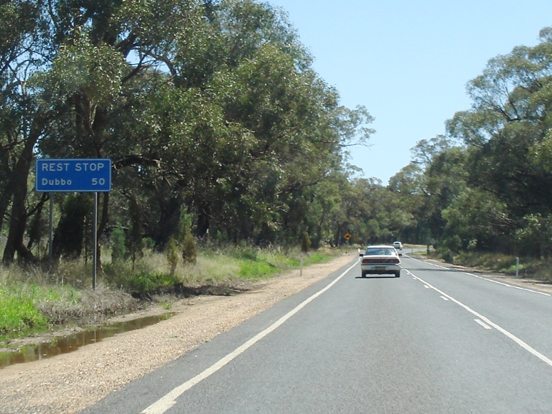
Advance Directional Sign: AD sign approaching Elong Elong Rest Area, November 2011. Image © Paul Rands |
|||
 |
Advance Directional Sign: AD sign approaching Elong Elong Rest Area, November 2011. Image © Paul Rands |
|||
 |
Entering Elong Elong: Golden Hwy (SR84) entering Elong Elong town centre, November 2011. Image © Paul Rands |
|||
 |
Intersection Directional Sign: ID sign at Bomely St in Elong Elong, November 2011. Image © Paul Rands |
|||
 |
Rest Area Distance Sign: Rest area RD sign as Golden Hwy (SR84) leaves Elong Elong, November 2011. Image © Paul Rands |
|||
 |
Advance Directional Sign: AD sign at Muronbung, approaching Muronbung Rd, November 2011. Image © Paul Rands |
|||
 |
Muronbung Road: Golden Hwy (SR84) at Muronbung Rd at Muronbung, November 2011. Image © Paul Rands |
|||
 |
Advance Directional Sign: AD sign approaching Ballimore Rd at Ballimore, November 2011. Image © Paul Rands |
|||
 |
Ballimore Road: ID sign at Ballimore Rd in Ballimore, November 2011. Image © Paul Rands |
|||
 |
Federation Street: ID sign at Federation St in Ballimore, November 2011. Image © Paul Rands |
|||
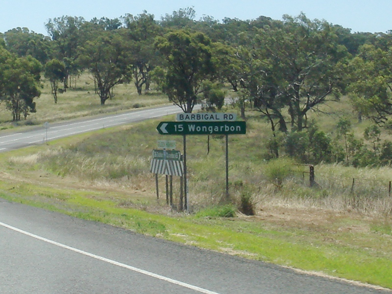 |
Barbigal Road: ID sign at Barbigal Rd in Barbigal, November 2011. Image © Paul Rands |
|||
 |
Warning Sign: Warning for road flooding, Barbigal, November 2011. Image © Paul Rands |
|||
 |
Services Sign: Services sign as Golden Hwy (SR84) enters the town of Dubbo, November 2011. Image © Paul Rands |
|||
 |
Advance Directional Sign: AD sign approaching Wheelers Ln & Yarrandale Rd in Dubbo, November 2011. Image © Paul Rands |
|||
 |
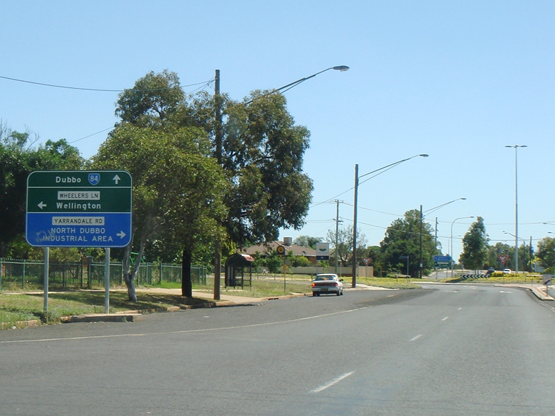
Intersection Directional Sign: ID sign at the roundabout with Wheelers Ln & Yarrandale Rd in Dubbo, November 2011. Image © Paul Rands |
|||
 |
Advance Directional Sign: AD sign approaching Myall St in Dubbo, January 2003. The mention of NR32 and NH39 should be prefixed with 'To'. Image © Michael Greenslade |
|||
 |
Level Crossing: Railway level crossing at Cobborah Junction in Dubbo, November 2011. Image © Paul Rands |
|||
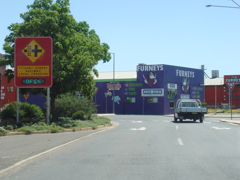 |
Warning Sign: Variable warning sign approaching Fitzroy St roundabout in Dubbo, November 2011. The sign displays open or closed depending on the crossing status of the railway level crossing on Fitzroy St. Image © Paul Rands |
|||
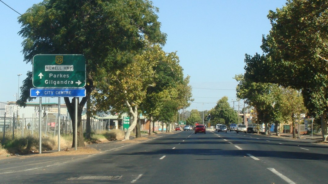 |
Advance Directional Sign: AD sign approaching Newell Hwy (NH39) in Dubbo, April 2012. Image © Paul Rands |
|||
 |
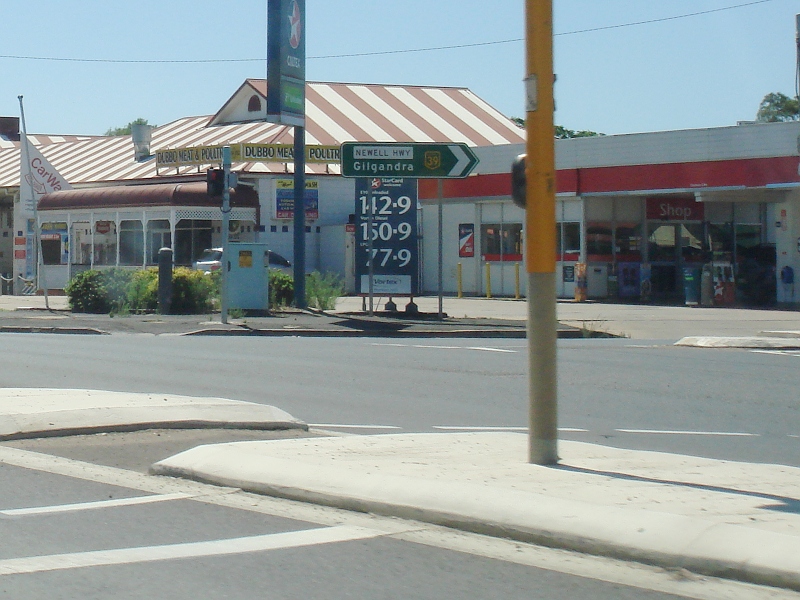
Newell Highway: Corner of Golden Hwy (SR84) and Newell Hwy (NH39) in Dubbo, April 2012. This was the western terminus of SR84. Image © Paul Rands |
|||
1 Roads & Traffic Authority, Schedule of Classified Roads and State & Regional Roads, January 2011
2 Roads & Traffic Authority, Annual Report, 2000
3 Minister for Tourism, Major Events, Hospitality and Racing Minister for the Arts, Media Release, Road Upgrade Completed on the Golden Highway at Gungal, June 2011
4 Roads & Traffic Authority, Projects approved under Round 2 of the Federal Government's Heavy Vehicle Safety Productivity Program, March 2010.
5 Federal Minister for Infrastructure and Transport, Media Release, Golden Highway: Cassilis Rest Area Upgrade Completed, 5 July 2011
Last updated: 18-Oct-2021 0:17
This site © Paul Rands. All rights reserved. Some portions © (copyright) by their respective and credited owners. Permission must be obtained before using any images from this site. For details, please email by clicking here.