|
|
|
|
|
 |
Gwydir Highway (National Route 38) - Glen Innes to Jackadgery |
Statistics:
Route Numbering:

General Information:
National Route 38 is a rural highway in northern New South Wales, which connects the north coast with outback NSW. For the most part it's undivided, except in a handful of spots.
It runs parallel with the Gwydir River, and is named after Lord Gwydir by Alan Cunningham who crossed the river at Gravesend in 1827.
Multiplexes along the route include:
History:
| Glen Innes to Jackadgery | Jackadgery to Glen Innes | |||
| Preview: | Description: | Preview: | Description: | |
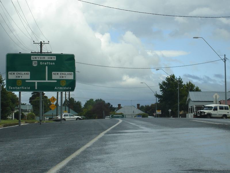 |
Advance Directional Sign: AD sign on Gwydir Hwy (NR38) approaching New England Hwy (NH15) at Glen Innes, July 2007. NR38 turns right at this junction, the NH15 duplex starts here too. Image © Paul Rands |
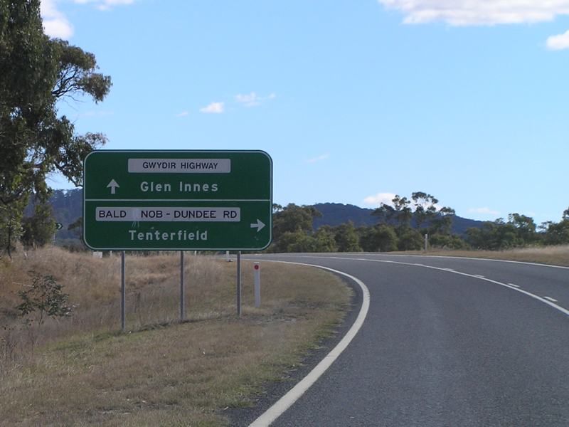 |
Advance Directional Sign: AD sign on Gwydir Hwy (NR38) at Bald Nob approaching Bald Nob-Dundee Rd, May 2005. Image © Rob Tilley |
|
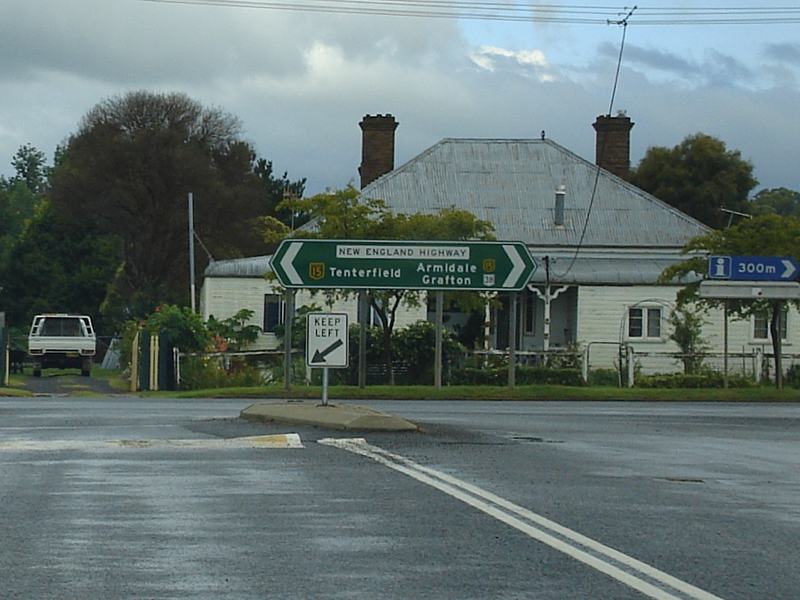 |
New England Highway: Corner of Gwydir Hwy (NR38) and New England Hwy (NH15) at Glen Innes, July 2007. NR38 turns right at this junction, the NH15 duplex starts here too. Image © Paul Rands |
 |
Advance Directional Sign: AD sign on Gwydir Hwy (NR38) approaching New England Hwy (NH15) at Glen Innes. NR38 turns right at this junction, the NH15 duplex starts here too. May 2005. Image © Rob Tilley |
|
 |
Advance directional Sign: AD sign on the NR38 / NH15 duplex approaching Meade St and also Gwydir Hwy (NH38) at Glen Innes, July 2007. NR38 turns left at this junction Image © Paul Rands |
 |
Advance directional Sign: AD sign on New England Hwy (NH15) duplex approaching Meade St and also Gwydir Hwy (NH38) at Glen Innes, January 2006. The NH15 duplex starts at this junction. Image © Paul Rands |
|
 |
Glen Innes: Gwydir Hwy (NR38) heads east at Glen Innes, July 2007. Image © Paul Rands |
 |
Meade Street & New England Highway: Roundabout with New England Hwy (NH15), Gwydir Hwy (NR38) and Meade St in Glen Innes, January 2006. Image © Paul Rands |
|
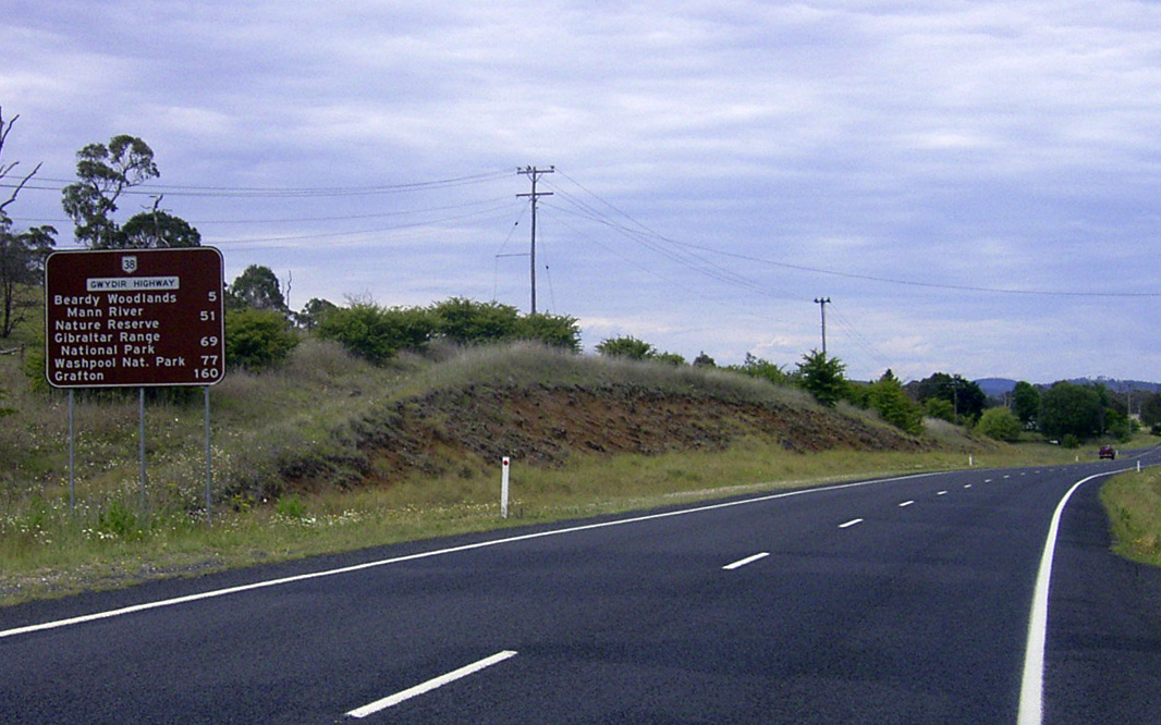 |
Distance Sign: Tourism based RD sign leaving Glen Innes, December 2002. |
 |
Advance directional Sign: AD sign on the NR38 / NH15 duplex approaching Ferguson St (Gwydir Hwy (NH38)) at Glen Innes. NR38 turns left at this junction, January 2006. Image © Paul Rands |
|
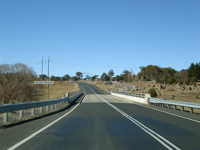 |
Beardy Waters: Gwydir Hwy (NR38) as it crosses Beardy Waters near Glen Innes, July 2007. Image © Paul Rands |
 |
Advance directional Sign: AD sign on the NR38 / NH15 duplex at the junction with Ferguson St (Gwydir Hwy (NH38)) at Glen Innes, July 2007. NR38 turns left at this junction Image © Paul Rands |
|
 |
Shannonville: Gwydir Hwy as it passes through the Shannonville area, July 2007. Image © Paul Rands |
 |
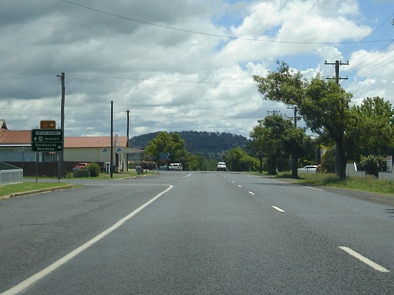
Meade Street: Gwydir Hwy (NR38) as it passes through the northern end of the Glen Innes town centre, January 2006. Image © Paul Rands |
|
 |
Services Sign: Unusual services sign at Shannonville for a rubbish bin, July 2007. Image © Paul Rands |
 |
Advance Directional Sign: AD sign on Gwydir Hwy (NR38) approaching Coronation Av (TD11), January 2006. Image © Paul Rands |
|
 |
Rocky River: Gwydir Hwy (NR38) as it crosses Rocky River at Bald Nob, July 2007. Image © Paul Rands |
 |
Coronation Avenue: Corner of Gwydir Hwy (NR38) and Coronation Av (TD11) at Glen Innes, January 2006. Image © Paul Rands |
|
 |
Old Grafton Road: Corner of Gwydir Hwy (NR38) and Old Grafton Rd at Bald Nob, July 2007. Image © Paul Rands |
 |
Distance Sign: Reassurance directional sign as Gwydir Hwy (NR38) leaves Glen Innes, January 2006. Image © Paul Rands |
|
 |
Advance Directional Sign: AD sign on Gwydir Hwy (NR38) at Glen Elgin approaching Wades Rd, July 2007. Image © Paul Rands |
|||
 |
Wades Road: ID sign at the corner of Gwydir Hwy (NR38) and Wades Rd in the Gibraltar Range National Park at Glen Elgin, July 2007. Image © Paul Rands |
|||
 |
Advance Directional Sign: AD sign at Glen Elgin approaching Raspberry Rd, July 2007. Image © Paul Rands |
|||
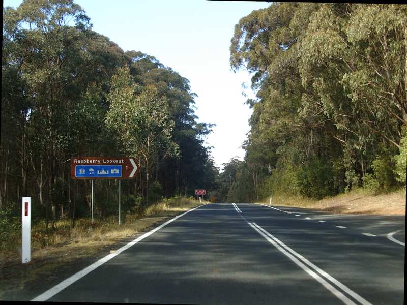 |
Raspberry Road: Corner of Gwydir Hwy (NR38) and Raspberry Rd at Glen Elgin, July 2007. Image © Paul Rands |
|||
 |
Advance Directional Sign: AD sign in the Gibraltar Range National Park on the Gwydir Hwy (NR38), approaching Dandahra Trail, July 2007. Image © Paul Rands |
|||
 |
Dandahra Creek: Gwydir Hwy (NR38) as it crosses Dandahra Ck (North Arm), with the junction with Dandahra Trail in the distance, July 2007. Image © Paul Rands |
|||
 |
Advance Directional Sign: AD sign approaching Washpool Forest Way in the Gibraltar Range National Park, July 2007. Image © Paul Rands |
|||
 |
Washpool Forest Way: Corner of Gwydir Hwy (NR38) and Washpool Forest Way in the Gibraltar Range National Park, July 2007. Image © Paul Rands |
|||
 |
Steep Descent: Warning sign for steep descent, as the Gwydir Hwy (NR38) descends the Great Dividing Range, July 2007. Image © Paul Rands |
|||
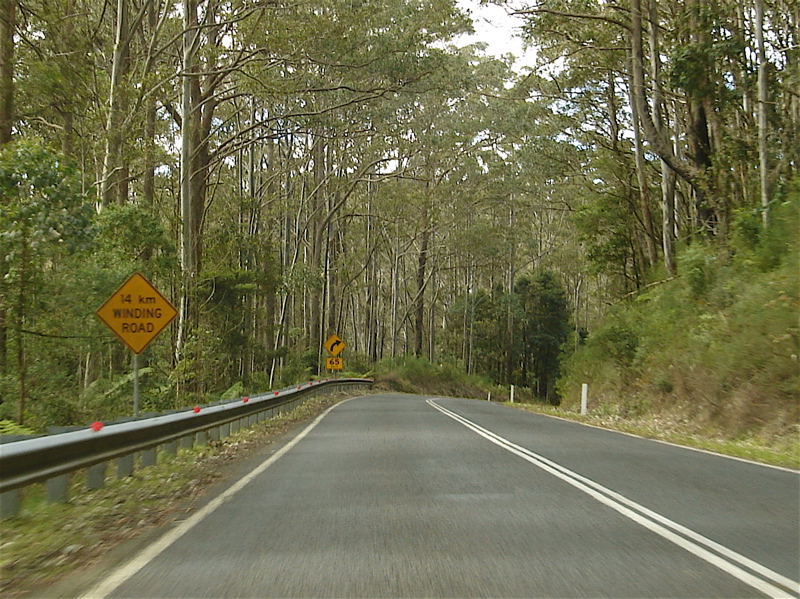 |
14km Winding Road: Warning sign for winding road, as the Gwydir Hwy (NR38) descends the Great Dividing Range, July 2007. Image © Paul Rands |
|||
 |
Advance Directional Sign: AD sign on Gwydir Hwy (NR38) approaching Heffrons Lookout in the Gibraltar Range National Park, July 2007. Image © Paul Rands |
|||
 |
Heffrons Lookout: Gwydir Hwy (NR38) at Heffrons Lookout. The plaque in the shot commemorates the opening of the current alignment between Glen Innes and Grafton, July 2007. Image © Paul Rands |
|||
 |
Commemorative Plaque: The plaque commemorates the opening of the current alignment between Glen Innes and Grafton. Gwydir Hwy (NR38) at Heffrons Lookout, May 2005. Image © Rob Tilley |
|||
 |
Steep Descent: The Gwydir Hwy (NR38) continues its steep descent of the Great Dividing Range inside the Gibraltar Range National Park, July 2007. Image © Paul Rands |
|||
 |
Advance Directional Sign: AD sign on Gwydir Hwy (NR38) approaching Hills Lookout in the Gibraltar Range National Park, July 2007. Image © Paul Rands |
|||
 |
Steep Descent: The Gwydir Hwy (NR38) continues its steep descent of the Great Dividing Range at Cangai, July 2007. Image © Paul Rands |
|||
 |
Distance Sign: Tourism based RD sign at Cangai, July 2007. Image © Paul Rands |
|||
 |
Camp Creek: Gwydir Hwy (NR38) crossing Camp Creek via the Peter Elks Bridge, July 2007. Image © Paul Rands |
|||
 |
Cattle Camp Creek: Gwydir Hwy (NR38) as it crosses Cattle Camp Ck at Cangai, July 2007. Image © Paul Rands |
|||
 |
Timber Safety Fencing: Obselete timber safety fencing from prior to the late 1960s in the Cangai area, July 2007. Image © Paul Rands |
|||
 |
Middle Creek: Gwydir Hwy (NR38) as it crosses Middle Ck at Cangai, July 2007. Image © Paul Rands |
|||
 |
Coombadjha Road: Corner of Gwydir Hwy (NR38) and Coombadjha Rd at Cangai, July 2007. Image © Paul Rands |
|||
 |
Dandahra Creek: Gwydir Highway as it crosses Dandahra Creek again, this time at Cangai, July 2007. Image © Paul Rands |
|||
 |
Cangai Bridge Road: Corner of Gwydir Hwy (NR38) and Cangai Bridge Rd at Cangai, July 2007. Image © Paul Rands |
|||
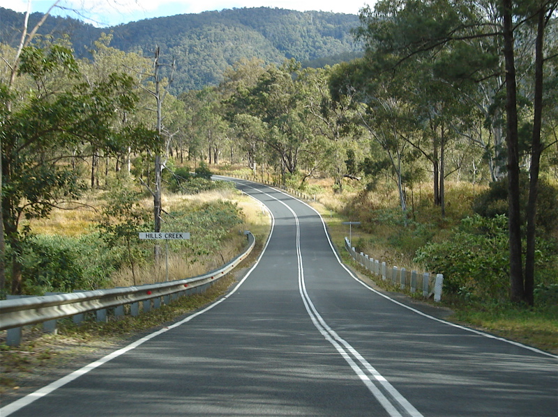 |
Hills Creek: Gwydir Hwy (NR38) as it crosses Hills Ck at Cangai, July 2007. Note more timber and wire safety fencing. Image © Paul Rands |
|||
 |
Mulligans Bluff: Gwydir Hwy (NR38) at Mulligans Bluff, July 2007. Image © Paul Rands |
|||
 |
Mulligans Bluff: Gwydir Hwy (NR38) at Mulligans Bluff, July 2007. Image © Paul Rands |
|||
 |
End Of Falling Stones Area: Unusual sign indicating end of falling stones area, July 2007. Image © Paul Rands |
|||
| Click here for the continuation of NR38 between Jackadgery and Grafton Click here for the continuation of NR38 between Warialda and Glen Innes |
||||
1 Roads & Traffic Authority, Schedule of Classified Roads and State & Regional Roads, January 2011
2 Department of Main Roads, The Roadmakers, A History of Main Roads in New South Wales, ISBN 0 7240 0439 4
3 National Library of Australia, Catalogue, Construction of Jackadgery Bridge, New South Wales, 1959 / Thiess Bros. Pty Ltd.
4 Roads & Traffic Authority, Road activity update, Northern NSW, May 2003
Last updated: 19-Oct-2021 0:54
This site © Paul Rands. All rights reserved. Some portions © (copyright) by their respective and credited owners. Permission must be obtained before using any images from this site. For details, please email by clicking here.