|
|
|
|
|
 |
Kamilaroi Highway (National Route 37) - Walgett to Narrabri (Decommissioned) |
Statistics:
Route Numbering:

General Information:
The highway is named after the Kamilaroi Aboriginal people of north western NSW. 2 The route connects the Hunter Valley with the far northwest outback of New South Wales.
The route consists of mostly single carriageway undivided roadway, passing through nature reserves, farmland, commercial and residential areas.
Multiplexes along the route include:
History:
| Walgett to Narrabri | Narrabri to Walgett | |||
| Preview: | Description: | Preview: | Description: | |
 |
Horses Sign: Sign that is common to the more isolated areas of the state asking motorists to stop and wait for horses if on the bridge, Namoi River at Walgett, October 2010. Image © Paul Rands |
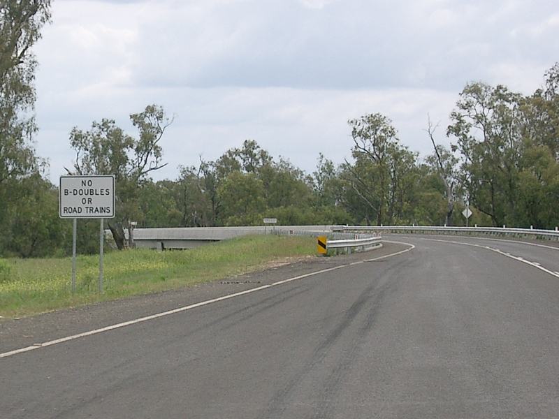 |
No B-Doubles or Road Trains: Sign prohibiting B-double trucks and road trains as the highway enters Wee Waa, October 2010. Image © Paul Rands |
|
 |
Intersection Directional Sign: ID sign assembly at the end of the NR55 duplex in Walgett, October 2010. NR37 turns right at this junction. Note the missing NR37 shield. Image © Paul Rands |
 |
Namoi River: Kamilaroi Hwy (NR37) as it crosses Namoi River via Collins Bridge at Wee Waa, October 2010. Image © Paul Rands |
|
 |
Reassurance Directional Sign: Image © Michael Greenslade |
 |
Entering Wee Waa: Kamilaroi Hwy (NR37) as it enters the Wee Waa town centre, October 2010. Image © Paul Rands |
|
 |
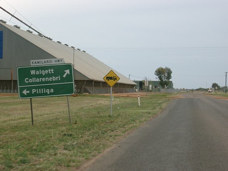
Advance Directional Sign: AD sign on Kamilaroi Hwy (NR37) approaching Charles St in Wee Waa, October 2010. The Pilliga desitination on the sign has since been coverplated. Note the missing NR37 shield. Image © Paul Rands |
|||
 |
Intersection Directional Sign: ID sign assembly at the junction of Kamilaroi Hwy (NR37), Warrior St and Rose St in Wee Waa, October 2010. NR37 turns right at this junction. Note the missing NR37 shield. Image © Paul Rands |
|||
 |
Intersection Directional Sign: ID sign at the corner of Boolcarrol Rd and Warrier St in Wee Waa, October 2010. NR37 turns left at this junction. Note the missing NR37 shield. Image © Paul Rands |
|||
 |
No Road Trains Sign: Sign at the corner of Kamilaroi Hwy (NR37) and Trucking Yards Ln at Wee Waa prohibiting road trains along Trucking Yards Ln, October 2010. Image © Paul Rands |
|||
 |
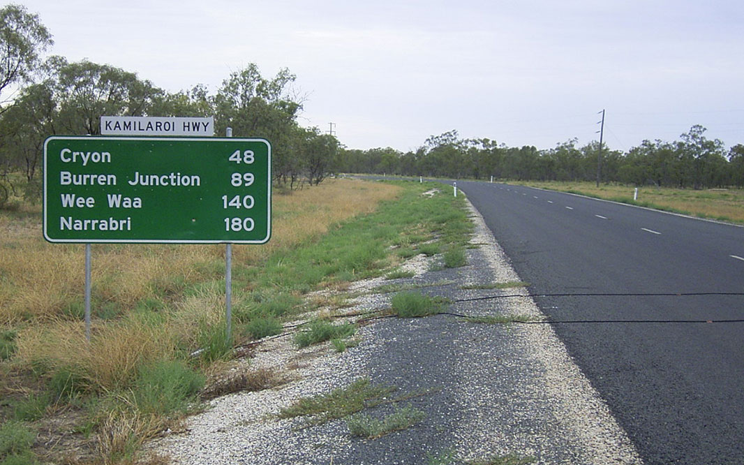
Distance Sign: RD sign as the Kamilaroi Hwy (NR37) leaves Wee Waa, October 2010. Note the missing NR37 shield. Image © Paul Rands |
|||
 |
Namoi River: Kamilaroi Hwy (NR37) as it crosses the Namoi River via Tulladunna Bridge at Wee Waa, October 2010. Image © Paul Rands |
|||
 |
Road Train Route: Sign indicating this section of the highway is a road train route, near Tulladunna Ln at Wee Waa, October 2010. Image © Paul Rands |
|||
 |
Intersection Directional Sign: ID sign assembly at the junction with Middle Route Rd at North Merah, October 2010. Image © Paul Rands |
|||
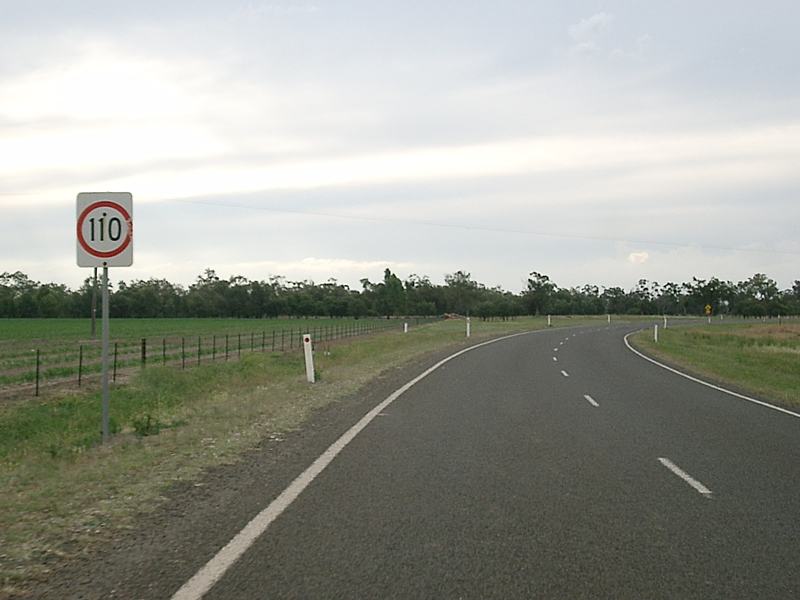 |
110km/h Zone: Much of the highway between Wee Waa and Burren Junction is 110 km/h, this is at North Merah, just after the Middle Route Rd junction, October 2010. Image © Paul Rands |
|||
 |
Entering Burren Junction: Kamilaroi Hwy (NR37) as it enters the town of Burren Junction, October 2010. Image © Paul Rands |
|||
 |
Advance Directional Sign: AD sign approaching Inkerman St at Burren Junction, October 2010. Kamilaroi Hwy used to turn right to travel along Inkerman St. Note the missing NR37 shield. Image © Paul Rands |
|||
 |
Advance Directional Sign: AD sign approaching Bugilbone Rd at Burren Junction, October 2010. Image © Paul Rands |
|||
 |
Bugilbone Road: Corner of Kamilaroi Hwy (NR37) and Bugilbone Rd at Burren Junction, October 2010. Note the missing NR37 shield. Image © Paul Rands |
|||
 |
Advance Directional Sign: AD sign approaching Merrywinebone Rd at Burren Junction, October 2010. NR37 turns left at this junction. Note the missing NR37 shield. Image © Paul Rands |
|||
 |
Intersection Directional Sign: ID sign assembly at the corner of Kamilaroi Hwy (NR37) and Merrywinebone Rd at Burren Junction, October 2010. NR37 turns left at this junction. Note the missing NR37 shield. Image © Paul Rands |
|||
 |
Intersection Directional Sign: ID sign at the corner of Kamilaroi Hwy (NR37) and Cryon Rd at Cryon, October 2010. NR37 turns left at this junction. Note the missing NR37 shield. Image © Paul Rands |
|||
 |
Intersection Directional Sign: ID sign assembly at the corner of Kamilaroi Hwy (NR37) and Yarraldool Rd at Cryon, October 2010. NR37 turns right at this junction. Note the missing NR37 shield. Image © Paul Rands |
|||
 |
Advance Directional Sign: AD sign on Kamilaroi Hwy (NR37) approaching Castlereagh Hwy (NR55) at Walgett, December 2003. Note the missing NR37 shield for the left turn, and the use of the wrong shield for NR55. Image © Michael Greenslade |
|||
 |
Castlereagh Highway: Intertsection directional sign at the corner of Kamilaroi Hwy (NR37) and Castlereagh Hwy (NR55) at Walgett, October 2010. NR37 turns left here and duplexes with NR55. Note the missing NR37 shield. Image © Paul Rands |
|||
 |
Dust Sign: Sign requesting truck drivers to stop at the bay beyond the sign to drop dust from their vehicles before entering the town centre, Walgett, October 2010. Image © Paul Rands |
|||
| Click here for the continuation of NR37 between Narrabri and Gunnedah | ||||
1 Roads & Traffic Authority, Schedule of Classified Roads and State & Regional Roads, January 2011
2 Roads & Traffic Authority, Heritage and Conservation Register, Brewarrina Bridge over Barwon River
3 Roads & Traffic Authority, Annual Report 2000, November 2000, ISSN 1037-3276
4 Roads & Traffic Authority, Annual Report 2002
Last updated: 11-Sep-2020 17:43
This site © Paul Rands. All rights reserved. Some portions © (copyright) by their respective and credited owners. Permission must be obtained before using any images from this site. For details, please email by clicking here.