|
|
|
|
|
 |
Oxley Highway (National Route 34) - Wauchope to Port Macquarie (Decommissioned) |
Statistics:
Route Numbering:

General Information:
National Route 34 is a rural highway that connects the coast with western New South Wales. It features several important towns along the route, and also crosses the Great Dividing Range.
The route is mostly single carriageway and undivided, except around Port Macquarie, Moonbi and Tamworth. At its eastern end, the route is quite windy because of the difficult terrain created by the Great Dividing Range, beyond Moonbi, the route generally passes through fairly flat terrain, except in the Coonabarabran area.
The Oxley Highway is named after explorer John Oxley, who was the first European to explore much of inland New South Wales in 1818. He crossed the southern end of the northern tableland and camped on the Apsley River in 1818 near the present Walcha.
Multiplexes along the route include:
History:
| Preview: | Description: |
 |
Port Macquarie CBD: AD sign on Gordon St in Port Macquarie approaching Hindman St and Hastings River Dr, March 2006. The roundabout is the official NR34 eastern terminus. Image © Paul Rands |
 |
Port Macquarie: Looking west after Morton Street & Garden Crescent at Port Macquarie, March 2006. Image © Paul Rands |
 |
Advance Directional Sign: AD sign approaching Widderson St roundabout at Port Macquarie, near the TAFE College, March 2006. Image © Paul Rands |
 |
AD Sign: Advance directional sign for Lake & Sherwood Roads. Westbound, Port Macquarie, March 2006. Image © Paul Rands |
 |
AD Sign: Advance directional sign for Wrights Road and the Port Macquarie Base Hospital, March 2006. Image © Paul Rands |
 |
Supplemental Advance Directional Sign: Supplemental AD sign at Thrumster for the Pacific Hwy (NR1) interchange, March 2006. Image © Paul Rands |
 |
Advance Directional Sign: AD sign at Thrumster for the Pacific Hwy (NR1) interchange, March 2006. Image © Paul Rands |
 |
Pacific Highway Interchange: Oxley Hwy (NR34) at the Pacific Hwy (NR1) interchange at Sancrox, March 2006. Image © Paul Rands |
 |
Pacific Highway Interchange: Oxley Hwy (NR34) at the Pacific Hwy (NR1) interchange at Sancrox, March 2006. Image © Paul Rands |
 |
Distance Sign: TD8 RD sign at Sancrox after the Pacific Hwy (NR1) interchange, March 2006. Image © Paul Rands |
 |
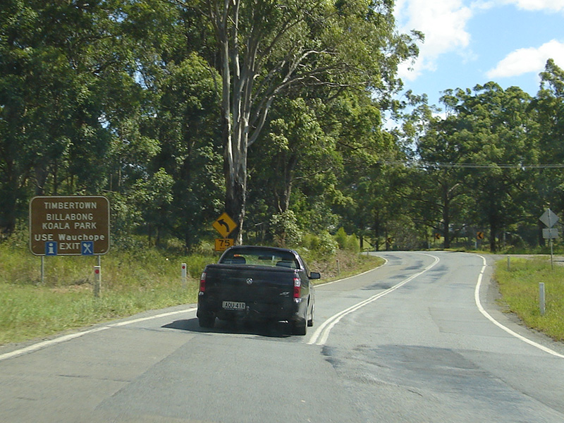
Redbank Road: Corner of Oxley Hwy (NR34) and Redbank Rd at Wauchope, March 2006. Image © Paul Rands |
 |
Entering Wauchope: Oxley Hwy (NR34) as it enters the town of Wauchope, March 2006. Image © Paul Rands |
 |
Entering Wauchope: Oxley Hwy (NR34) as it enters the town of Wauchope, March 2006. Image © Paul Rands |
 |
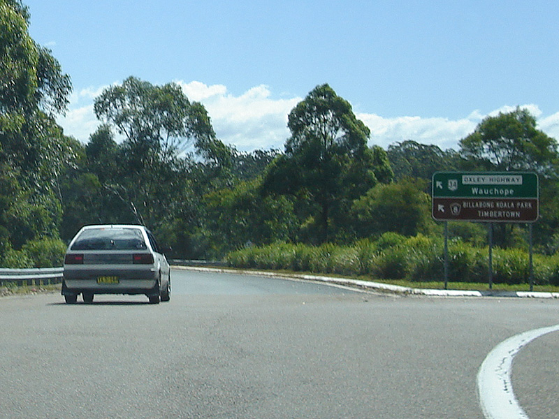
Randall Street: Intersection directional sign assembly, featuring a black fingerboard at the Randall St intersection at Wauchope, June 2005. NR34 turns left at this junction to cross the railway line. Image © Sam Laybutt |
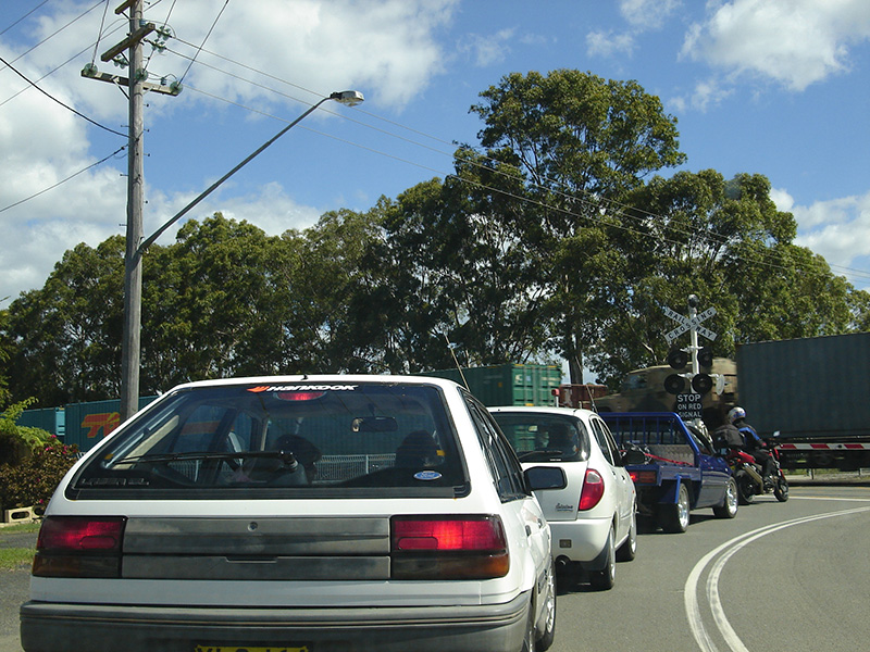 |
North Coast Railway: Oxley Hwy (NR34) at the level crossing with the North Coast Railway, westbound at Wauchope, March 2006. Image © Paul Rands |
 |
Wauchope CBD: Oxley Hwy (NR34) (High St) as it passes through Wauchope's town centre, March 2006. Image © Paul Rands |
 |
AD Sign: AD sign on Oxley Hwy (NR34) approaching the Beechwood Road intersection at Wauchope, March 2006. Image © Paul Rands |
 |
Wauchope: Oxley Hwy (NR34) as it passes through Wauchope's light industrial area, March 2006. Image © Paul Rands |
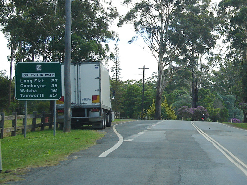 |
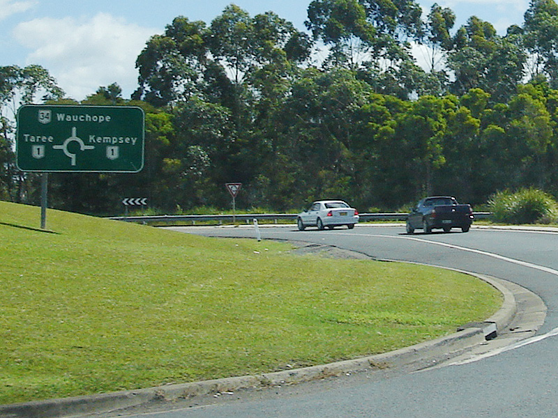
Distance Sign: RD sign leaving Wauchope, March 2006. Image © Paul Rands |
 |
Wauchope: Oxley Hwy (NR34), west of the Wauchope town centre, March 2006. Image © Paul Rands |
| Click here for the continuation of NR34 between Bendemeer and Wauchope | |
1 Roads and Traffic Authority, Schedule of Classified Roads and State & Regional Roads, 31 January 2011
2 Department of Main Roads, Historical Roads of New South Wales, Oxley Highway, Extract from March 1953 issue of "Main Roads" journal.
3 Department of Main Roads, The Roadmakers, A History of Main Roads in New South Wales, ISBN 0 7240 0439 4
4 Roads and Traffic Authority, Oxley Highway upgrade, Community Update, June 2009.
Last updated: 17-Dec-2019 0:55
This site © Paul Rands. All rights reserved. Some portions © (copyright) by their respective and credited owners. Permission must be obtained before using any images from this site. For details, please email by clicking here.