|
|
|
|
|

|
Great Western Highway, Mitchell Highway & Barrier Highway (National Route 32) - Katoomba to Springwood (Decommissioned) |
Statistics:
Route Numbering:
General Information:
National Route 32 is the main route linking the New South Wales state capital, Sydney, with the west of the state. The road varies from arterial road conditions, rural expressway and rural highway.
The highway is signposted as National Route 32 from Glenbrook in Sydney's west, to its terminus at Bathurst. Great Western Hwy is signposted as SR44 in the sydney area.
The Great Western Highway is regarded as one of the oldest roads in Australia. Starting as George Street in the Sydney CBD, and following Parramatta Road, it heads west across metropolitan Sydney to Penrith, where it crosses the Nepean River. It then crosses the Blue Mountains and the Great Dividing Range to Bathurst.
The road across the Blue Mountains was built by William Cox in the 1800s shortly after a viable route across the mountains was discovered. An obelisk at Macquarie Place in Sydney records the construction of the road during the rule of Governor Lachlan Macquarie.
In the 90s, the highway was terminated at Emu Plains with the closure of the Knapsack Gully Viaduct. An extension to the Western Mwy (Metroad 4) at Emu Plains was constructed, which rejoined with the highway at Glenbrook. The upper portion of the Great Western Highway from Russell Street is now only used by residents and cars coming from Blaxland via Mitchells Pass. Mitchells Pass is section of the former main road over the Blue Mountains.
History:
| Springwood to Katoomba | Katoomba to Springwood | |||
| Preview: | Description: | Preview: | Description: | |
 |
Entering Faulconbridge: Great Western Hwy (NR32) entering the town of Faulconbridge, November 2011. Image © Paul Rands |
 |
Divided Road Ahead : Sign at Katoomba denoting distance to divided road, April 2012. Image © Paul Rands |
|
 |
Faulconbridge: Great Western Hwy (NR32) passing through Faulconbridge town centre, November 2011. Image © Paul Rands |
 |
Explorers Tree. Pulpit Hill, Katoomba: The remains of The Explorers Tree. The tree features the inscribed initials of the explorers Blaxland, Wentworth and Lawson, who crossed the mountains in 1813. December 2005. Image © Paul Rands |
|
 |
Advance Directional Sign: AD sign approaching Grose Rd, November 2011. Image © Paul Rands |
 |
Explorers Road : Corner of Great Western Hwy (NR32) and Explorers Rd, Katoomba, April 2012. Image © Paul Rands |
|
 |
Grose Road: Great Western Hwy (NR32) at Grose Rd, Faulconbridge, November 2011. Image © Paul Rands |
 |
Entering Katoomba : Great Western Hwy (NR32) as it enters the town of Katoomba, April 2012. Image © Paul Rands |
|
 |
Advance Directional Sign: AD sign approaching Sir Henry's Pde at Faulconbridge, November 2010. Image © Rob Tilley |
 |
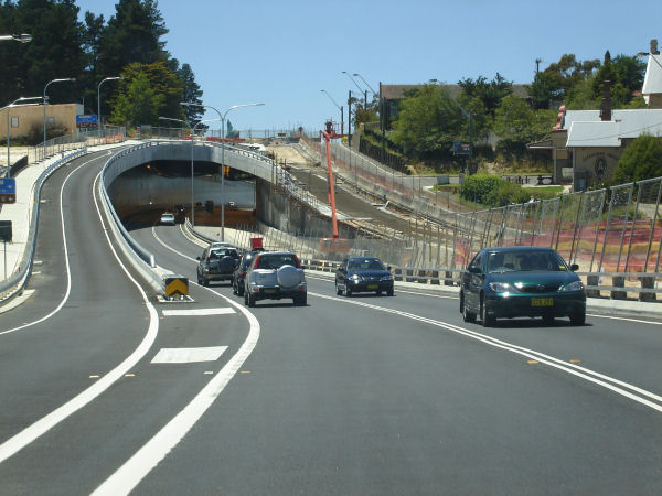
Shell Corner Deviation: As part of the Great Western Highway upgrade program, the RTA widened the existing two-lane highway to a four-lane divided highway between Albion Street and west of Watson Way at Katoomba. The project eliminated the notorious Shell Corner bends and opened to traffic on 6th of August 2004. April 2012. Image © Paul Rands |
|
 |
Heavy Vehicle Inspection Bay Sign: AD sign for the heavy vehicle inspection bay at Faulconbridge, November 2011. Image © Paul Rands |
 |
Supplemental Advance Directional Sign: Supplemental AD sign approaching Bathurst Rd (TD5) at Katoomba, April 2012. Image © Paul Rands |
|
 |
Heavy Vehicle Inspection Bay: The heavy vehicle inspection bay at Faulconbridge, November 2011. Image © Paul Rands |
 |
Bathurst Road : This is at the intersection with Bathurst Road (TD5) and Great Western Highway (NR32) at Katoomba. April 2012. Image © Paul Rands |
|
 |
Entering Linden: Great Western Hwy (NR32) entering the town of Linden, November 2011. Image © Paul Rands |
 |
Bathurst Road Overpass: Eastbound as you pass under Bathurst Road. The bridge is named after Aunty Dawn Colless. April 2012. Image © Paul Rands |
|
 |
Tollgate Drive: Great Western Hwy (NR32) passing under Kenneth Beames Br, which carries Tollgate Dr at Linden, November 2011. Tollgate Dr is a former alignment of the highway. Image © Paul Rands |
 |
AD Sign: Advance directional sign approaching Parke Street (TD5) Katoomba, April 2012. Image © Paul Rands |
|
 |
Entering Woodford: Great Western Hwy (NR32) entering the town of Woodford, November 2010. Image © Rob Tilley |
 |
AD Sign: Advance Directional Sign approaching the Whitton Street intersection and the turn off to Yeaman Bridge over the railway to connect with Parke Street Katoomba, April 2012. Image © Paul Rands |
|
 |
Station St: ID sign at the Station St junction, Woodford, November 2011. Image © Paul Rands |
 |
Advance Directional Sign : AD sign approaching Woodlands Rd, Katoomba, April 2012. Image © Paul Rands |
|
 |
The Appian Way: Great Western Hwy (NR32) passing under The Appian Way, Woodford, November 2011. Image © Paul Rands |
 |
Woodlands Road : Corner of Great Western Hwy (NR32) and Woodlands Rd, Katoomba, April 2012. Image © Paul Rands |
|
 |
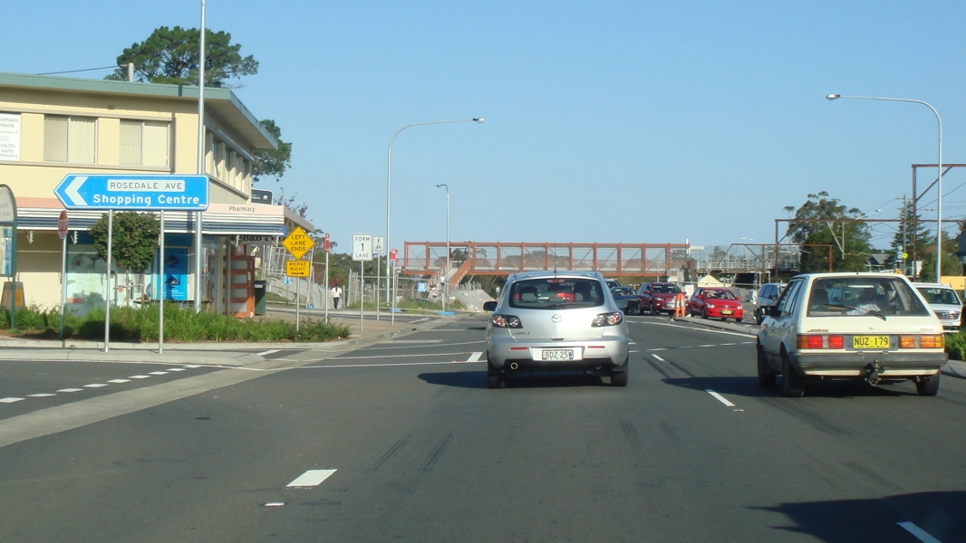
Rosedale Av: Great Western Hwy (NR32) at Rosedale Av in Hazelbrook town centre, November 2011. Image © Paul Rands |
 |
Supplemental Advance Directional Sign : AD sign at Leura approaching Leura Mall (TD5) interchange, April 2012. Image © Paul Rands |
|
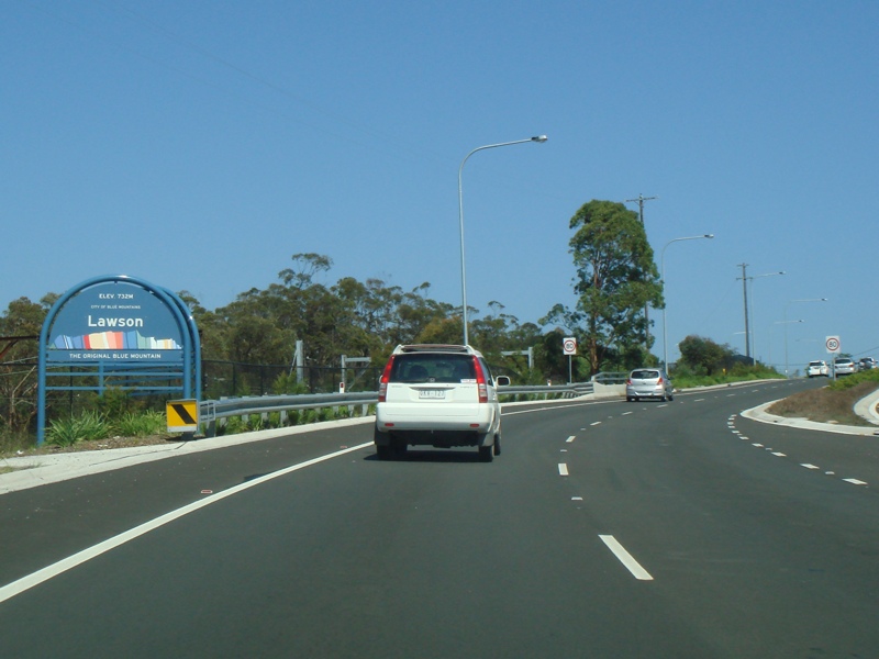 |
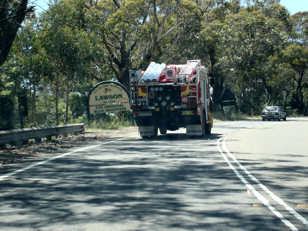
Entering Lawson: Great Western Hwy (NR32) entering the town of Lawson, December 2012. Click here for a photo of this location Rob Tilley from November 2010. |
 |
Supplemental Advance Directional Sign: AD sign approaching Leura Mall (TD5) interchange in Leura. April 2012. Click here for a photo by Paul Rands from December 2005. Image © Paul Rands |
|
 |
Advance Directional Sign: AD sign approaching Orient St, Lawson, December 2012. Click here for a photo of this location from November 2011. Image © Paul Rands |
 |
Leura Mall Interchange : Great Western Hwy (NR32) at the interchange with Leura Mall (TD5), Leura, April 2012. Image © Paul Rands |
|
 |
Orient Street: Great Western Hwy (NR32) at Orient St in Lawson, November 2011. Image © Paul Rands |
 |
Leura Interchange: Eastbound through Leura. The underpass at Leura Mall was partially opened to traffic on 17th of October 2005. April 2012. Click here for a photo by Paul Rands from December 2005. Image © Paul Rands |
|
 |
Advance Directional Sign: AD sign approaching Staples Cr, Lawson, November 2011. Image © Paul Rands |
 |
Advance Directional Sign: AD sign on the off ramp to Leura Mall (TD5), Leura, April 2012. Image © Paul Rands |
|
 |
Staples Crescent: Great Western Hwy (NR32) at Staples Cr, Lawson, November 2011. Image © Paul Rands |
 |
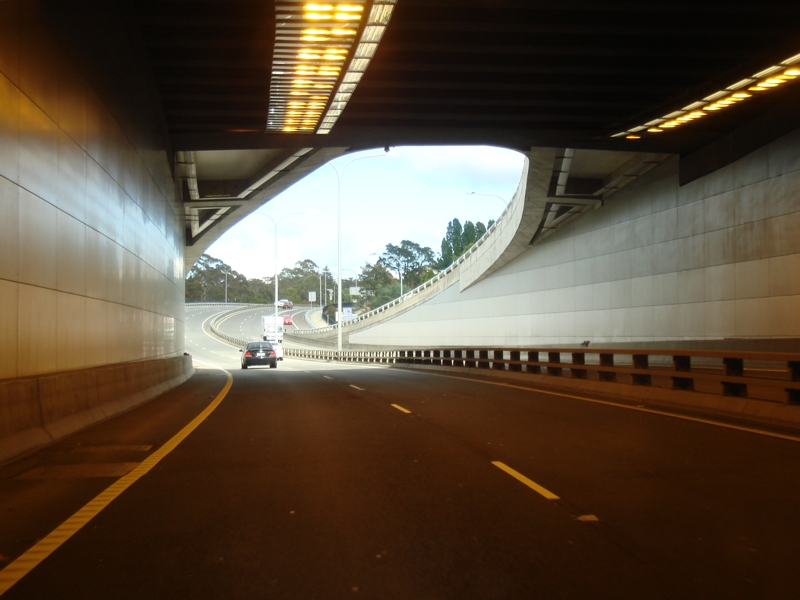
Leura Mall Underpass: View inside the Leura Mall tunnel, April 2012. Click here for a photo by Paul Rands from December 2005. Image © Paul Rands |
|
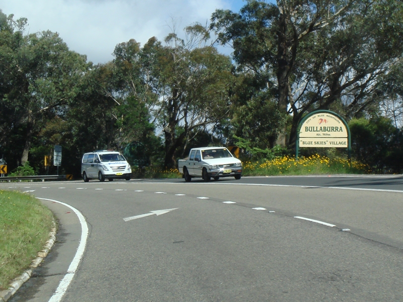 |
Entering Bullaburra: Great Western Hwy (NR32) entering the small town of Bullaburra, November 2011. Image © Paul Rands |
 |
Approaching Paul Sorenson Bridge: Image © Paul Rands |
|
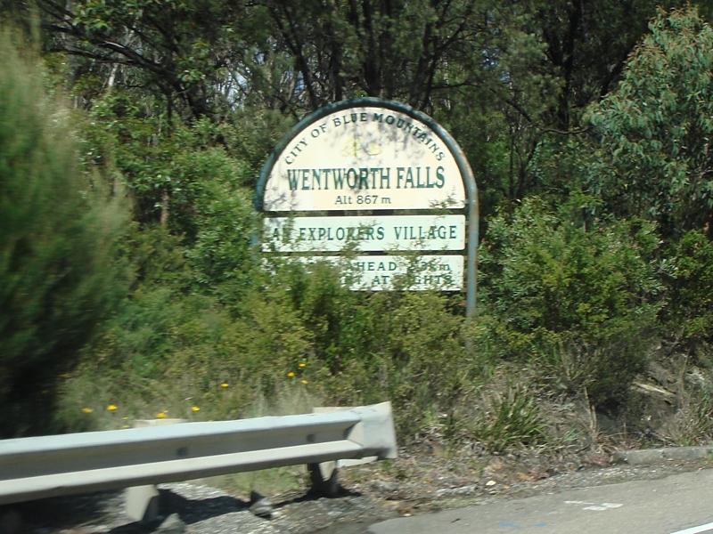 |
Entering Wentworth Falls: Great Western Hwy (NR32) entering the town of Wentworth Falls, November 2011. Image © Paul Rands |
 |
Sinclair Crescent : Corner of Great Western Hwy (NR32) and Sinclair Cr, Leura, April 2012. Image © Paul Rands |
|
 |
Advance Directional Sign: AD sign at Wentworth Falls for the Falls Rd / Mitchell Av junction, December 2012. Image © Paul Rands |
 |
Distance Sign: RD sign approaching Mitchell Street Wentworth Falls, December 2005. Image © Paul Rands |
|
 |
Advance Directional Sign: AD sign near Dalrymple St at Wentworth Falls approaching Station St, December 2012. Image © Paul Rands |
 |
Approaching Adele Avenue & Falls Road: Eastbound at Wentworth Falls, April 2012. Image © Paul Rands |
|
 |
Station Street: Great Western Hwy (NR32) at Station St, Wentworth Falls, December 2012. Click here for a photo of this location Rob Tilley from November 2010. Image © Paul Rands |
 |
Approaching Station Street Intersection: Eastbound at Wentworth Falls, April 2012. Image © Paul Rands |
|
 |
Advance Directional Sign: AD sign approaching Falls Rd & Mitchell St , Wentworth Falls, December 2012. Click here for a photo of this location Rob Tilley from November 2010. Image © Paul Rands |
 |
Old Bathurst Road Intersection: Heading south near the Rest Easy Motel at Wentworth Falls. This intersection connects to a former alignment of the highway. December 2005. Image © Paul Rands |
|
 |
Falls Road & Adele Avenue: Great Western Hwy (NR32) at Falls Rd & Mitchell St, Wentworth Falls, December 2012. Click here for a photo of this location by Rob Tilley from November 2010. Image © Paul Rands |
 |
Looking southeast at Wentworth Falls: Approaching the intersection with Shortland Street, Between the 2 connections to Old Bathurst Road, December 2005. Image © Paul Rands |
|
 |
Falls Road & Adele Avenue: Great Western Hwy (NR32) at Falls Rd & Mitchell St, Wentworth Falls, November 2011. Image © Paul Rands |
 |
Descending Boddington Hill: Looking towards Sydney from Boddington Hill at Wentworth Hills, December 2005. Image © Paul Rands |
|
 |
Entering Leura: Great Western Hwy (NR32) entering the town of Leura, November 2010. Image © Rob Tilley |
 |
Entering Bullaburra: Eastbound, April 2012. Image © Paul Rands |
|
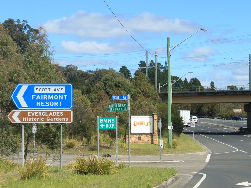 |
Scott Avenue: Great Western Hwy (NR32) at Scott Av, Leura, November 2010. Image © Rob Tilley |
 |
Bullaburra Town Centre: Approaching the pedestrian signals outside the railway station near Cooranga Street. December 2005. Image © Paul Rands |
|
 |
Approaching Leura Mall: Images © Paul Rands |
 |
Entering Lawson: Sydney bound into the town of Lawson, December 2005. Image © Paul Rands |
|
 |
AD Sign: Images © Paul Rands |
 |
Advance Directional Sign : AD sign at Lawson, approaching Staples Cr, April 2012. Image © Paul Rands |
|
 |
Leura Mall Interchange: Images © Paul Rands |
 |
Staples Crescent: Corner of Great Western Hwy (NR32) and Staples Cr, Lawson, April 2012. Image © Paul Rands |
|
 |
Approaching Leura Mall: Images © Paul Rands |
 |
Advance Directional Sign : AD sign approaching Orient St, Lawson, April 2012. Image © Paul Rands |
|
 |
Leura Mall Interchange: Images © Paul Rands |
 |
Oaklands Road : Corner of Great Western Hwy (NR32) and Oaklands Rd, Hazelbrook, April 2012. Image © Paul Rands |
|
 |
Leura Mall Interchange: Heading towards Katoomba at Leura, November 2011. Image © Paul Rands |
 |
Rosedale Avenue : Corner of Great Western Hwy (NR32) and Rosedale Av, Hazelbrook, April 2012. Image © Paul Rands |
|
 |
Entering Katoomba: Great Western Hwy (NR32) entering the town of Katoomba, November 2011. Image © Paul Rands |
 |
Woodford: Heading southeast. December 2005. Image © Paul Rands |
|
 |
Advance Directional Sign: AD sign approaching Woodlands Rd, Katoomba, November 2011. Image © Paul Rands |
 |
The Appian Way : Great Western Hwy (NR32) as it passes under The Appian Way, Woodford, April 2012. Image © Paul Rands |
|
 |
Woodlands Road: Great Western Hwy (NR32) at Woodlands Rd, Katoomba, November 2011. Image © Paul Rands |
 |
Inbound at Woodford: Signage for the Bulls Camp Reserve near The Appian Way at Woodford, December 2005. Image © Paul Rands |
|
 |
Camp Street: Advance directional sign close to the Camp St junction at Katoomba, November 2011. Image © Paul Rands |
 |
Headlights Sign : Sign for the usage of headlights in the daytime, Woodford, April 2012. Image © Paul Rands |
|
 |
Supplemental Advance Directional Sign: Supplemental AD sign approching Parke St (TD5) at Katoomba, November 2011. Image © Paul Rands |
 |
Bulls Camp Reserve Intersection: Great Western Hwy (NR32) at Woodford at Bulls Camp Reserve. Initially known as '18 Mile Hollow', it was set aside as a stock reserve in 1829 and became a camp for convicts engaged in repairs to the road. In conjunction with this, a military stockade was established here to supervise the repairs and maintain good order on the road, particularly with the emergence of gold shipments in the 1850s. The reserve's present name is derived from Captain John Bull (1806-1901). Bull arrived in Sydney in November 1842 and, almost immediately, was appointed assistant engineer and superintendent of road gangs on the Bathurst Road. Image © Paul Rands |
|
 |
Advance Directional Sign: AD sign approching Parke St (TD5) at Katoomba, November 2011. Image © Paul Rands |
|||
 |
Parke Street: Great Western Hwy (NR32) at Parke St, Katoomba, November 2011. Image © Paul Rands |
 |
Tollgate Drive : Great Western Hwy (NR32) as it passes under an old alignment, Tollgate Dr at Linden, April 2012. Image © Paul Rands |
|
 |
Advance Directional Sign: AD sign approaching Bathurst Rd (TD5) at Katoomba, November 2011. Image © Paul Rands |
 |
Eastbound at Linden: Great Western Highway as passes the railway station. This area was once quite narrow and windy. April 2012. Image © Paul Rands |
|
 |
Bathurst Road: Great Western Hwy (NR32) at Bathurst Rd (TD5) in Katoomba, November 2011. Image © Paul Rands |
 |
Entering Faulconbridge : Great Western Hwy (NR32) as it enters the town of Faulconbridge, April 2012. Image © Paul Rands |
|
 |
Bathurst Road: Great Western Hwy (NR32) passing under Aunty Dawn Colless Br, which carries Bathurst Rd (former highway), Katoomba, November 2011. Image © Paul Rands |
 |
Faulconbridge: Great Western Hwy (NR32) near the the U-turn facility and fruit market, December 2005. Image © Paul Rands |
|
 |
Distance Sign: RD sign leaving Katoomba, November 2011. Click here for a photo from November 2010 by Rob Tilley of the previous sign. Image © Paul Rands |
 |
Faulconbridge: Great Western Hwy (NR32) as it passes through Faulconbridge, April 2012. Image © Paul Rands |
|
 |
Faulconbridge: Image showing the roadway between Clifton Avenue and Parkes Crescent, December 2005. Image © Paul Rands |
|||
 |
Centenary Bridge: Great Western Hwy (NR32) at Faulconbridge near the railway station and Railway Avenue, April 2012. Image © Paul Rands |
|||
 |
Approaching Everton Road: Heading into the CBD of Faulconbridge, December 2005. Image © Paul Rands |
|||
 |
Grose Road : Corner of Great Western Hwy (NR32) and Grose Rd, Faulconbridge, April 2012. Image © Paul Rands |
|||
 |
Faulconbridge Town Centre: Looking southeast, April 2012. Image © Paul Rands |
|||
| Click here for the continuation of NR32 between Springwood and Glenbrook Click here for the continuation of NR32 between Lithgow and Katoomba |
||||
1 Roads and Traffic Authority, Schedule of Classified Roads (and unclassified Regional Roads), 25 February 2008
2Department of Main Roads. The Roadmakers, A History of Main Roads in New South Wales, ISBN 0 7240 0439 4
3 Roads & Traffic Authority, Projects, Great Western Highway, Completed projects.
4 Roads & Traffic Authority, News & Events, Great Western Highway upgrade at Lawson, 4 August 2008.
5 Roads & Traffic Authority, Projects, Great Western Highway, July 2011.
Last updated: 04-Nov-2018 12:42
This site © Paul Rands. All rights reserved. Some portions © (copyright) by their respective and credited owners. Permission must be obtained before using any images from this site. For details, please email by clicking here.