|
|
|
|
|

|
Great Western Highway, Mitchell Highway & Barrier Highway (National Route 32) - Dubbo to Wellington (Decommissioned) |
Statistics:
Route Numbering:
General Information:
National Route 32 is the main route linking the New South Wales state capital, Sydney, with the west of the state. The road varies from arterial road conditions, rural expressway and rural highway.
The Mitchell Highway links north-western NSW with Dubbo, Bathurst and eventually Sydney.The highway starts at Bathurst as National Route 32 and heads west through the Great Dividing Range to Orange then continues north through Molong, Wellington and Dubbo. From Dubbo, the highway follows the Bourke railway line in a north-westerly direction to Nyngan. The highway's route number changes to NR71 (after the Barrier Highway junction at Nyngan), and then it continues north-west to Bourke and terminates at the QLD border, just north of Barringun.
The Mitchell Highway is named after Major Thomas Mitchell, who was Surveyor-General of New South Wales in the 1820s and explored much of inland New South Wales and Victoria.
History:
| Wellington to Dubbo | Dubbo to Wellington | |||
| Preview: | Description: | Preview: | Description: | |
 |
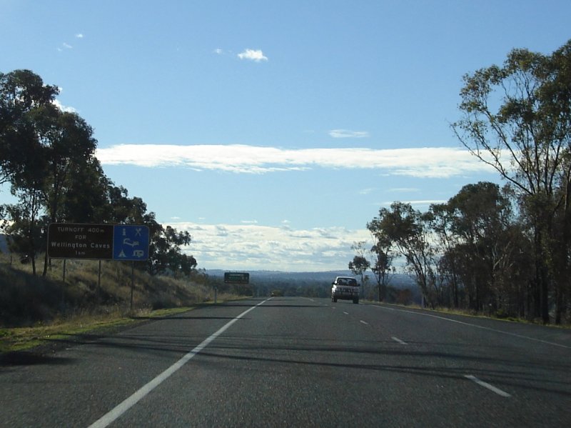
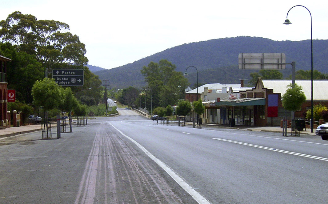
Supplemental Advance Directional Sign: Supplemental AD sign at Wellington approaching Caves Rd, August 2011. Image © Paul Rands |
 |
Intersection Directional Sign: ID sign at the roundabout with Newell Hwy (NH39) at West Dubbo, November 2011. Image © Paul Rands |
|
 |
Supplemental Advance Directional Sign: Supplemental AD sign at Wellington approaching Caves Rd, July 2006. Image © Paul Rands |
 |
Macquarie River: Looking southeast on the LH Ford Bridge over the Macquarie River in West Dubbo. It opened to traffic on the 29th September 1969, at the time it was the 4th longest road bridge in NSW. November 2011. Image © Paul Rands |
|
 |
Advance Directional Sign: AD sign for Caves Rd at Wellington, July 2006. Image © Paul Rands |
 |
Advance Directional Sign: AD sign approaching Macquarie St, Dubbo, November 2011. Image © Paul Rands |
|
 |
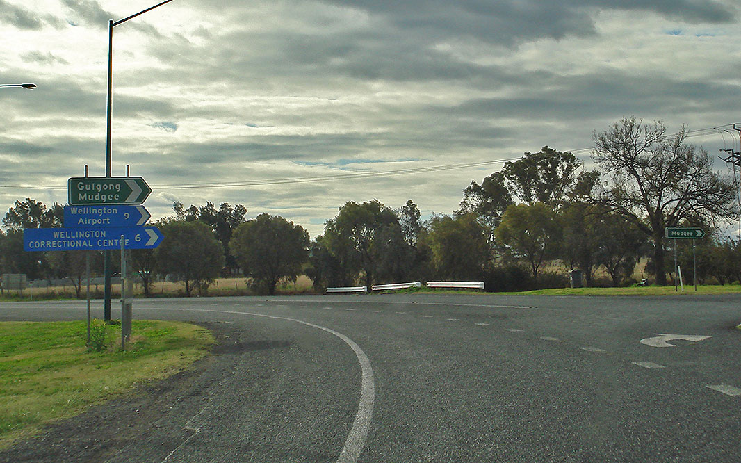
Caves Road: Corner of Mitchell Hwy (NR32) and Caves Rd at Wellington, August 2011. Image © Paul Rands |
 |
Macquarie Street: Mitchell Hwy (NR32) at Macquarie St, Dubbo, November 2011. Image © Paul Rands |
|
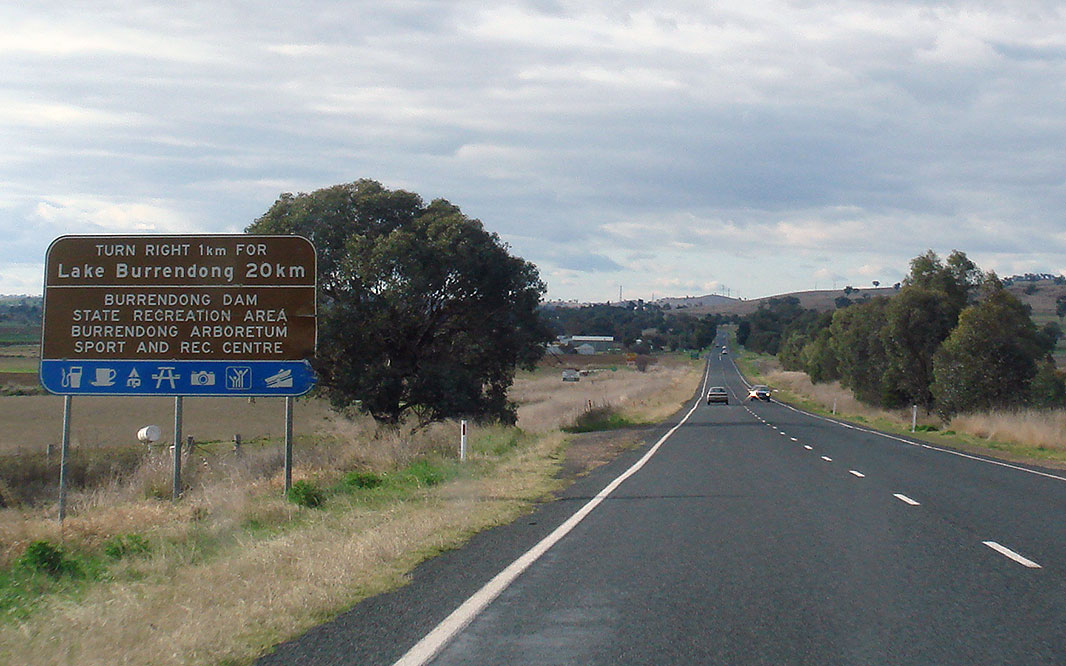 |
Tourism Sign: Looking north approaching Burrendong Way (TD5), August 2011. Image © Paul Rands |
 |
AD Sign: Advance directional sign on Darling Street (former Newell Hwy) approaching Mitchell Hwy, Dubbo. November 2011. Image © Paul Rands |
|
 |
AD Sign: Advance directional sign approaching Burrendong Way (TD5) at Wellington, August 2011. Image © Paul Rands |
 |
ID Sign: intersection directional sign on the corner of Darling Street (former Newell Hwy) and Mitchell Hwy. November 2011. Image © Paul Rands |
|
 |
Burrendong Way: Corner of Mitchell Hwy (NR32) and Burrendong Way (TD5) at Wellington, August 2011. Image © Paul Rands |
 |
ID Sign: intersection directional sign on the corner of Darling Street (former Newell Hwy) and Mitchell Hwy. November 2011. Image © Paul Rands |
|
 |
Distance Sign: Reassurance directional sign, Wellington, August 2011. Image © Paul Rands |
 |
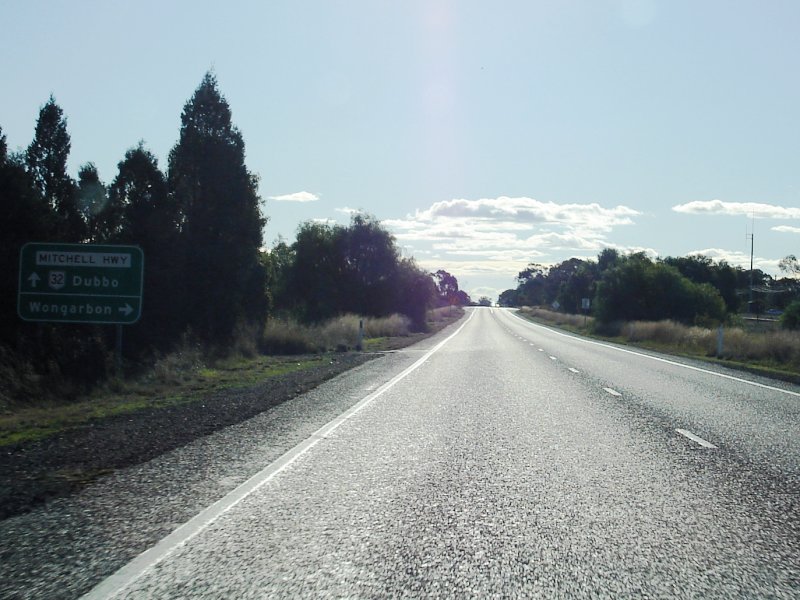
Distance Sign: Reassurance directional sign at Wongarbon, October 2004. Image © Jamie Scuglia |
|
 |
Entering Town Area: Mitchell Hwy (NR32) as it enters the town of Wellington. July 2006. Image © Paul Rands |
 |
Supplemental Advance Directional Sign: Supplemental AD sign at Apsley approaching Burrendong Way, December 2012. Image © Paul Rands |
|
 |
Advance Directional Sign: NR32 as it approaches Maughan St & Arthur St in Wellington, August 2011. Image © Paul Rands |
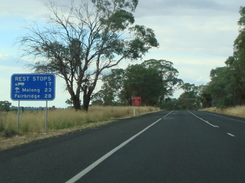 |
Rest Area Distance Sign: Rest area reassurance directional sign at Larras Lee, December 2012. Image © Paul Rands |
|
 |
ID Sign: Intersection directional sign at roundabout with Maughan St and Arthur St, Wellington, August 2011. Image © Paul Rands |
 |
Reassurance Directional Sign: Distance sign at Wellington, December 2002. Image © Michael Greenslade |
|
 |
Old Meets New: Westbound on Mitchell Hwy (NR32) (Showground Rd) with this old black sign and brand new alphanumeric sign, July 2006. Click here for a photo of this location from December 2002 by Michael Greenslade Image © Paul Rands |
|||
 |
Wellington CBD: Passing through the Wellington shopping precinct, northbound, July 2006. Image © Paul Rands |
|||
 |
Intersection Directional Sign: ID sign on the roundabout with Warne St, Wellington, August 2011. Image © Paul Rands |
|||
 |
Macquarie River: Mitchell Hwy (NR32) crossing Macquarie River via Macquarie River Bridge at Wellington, August 2011. Image © Paul Rands |
|||
 |
Advance Directional Sign: AD sign at Montefiores approaching Goolma Road, August 2011. Image © Paul Rands |
|||
 |
Goolma Road: Corner of Mitchell Hwy (NR32) and Goolma Rd at Montefiores, August 2011. Image © Paul Rands |
|||
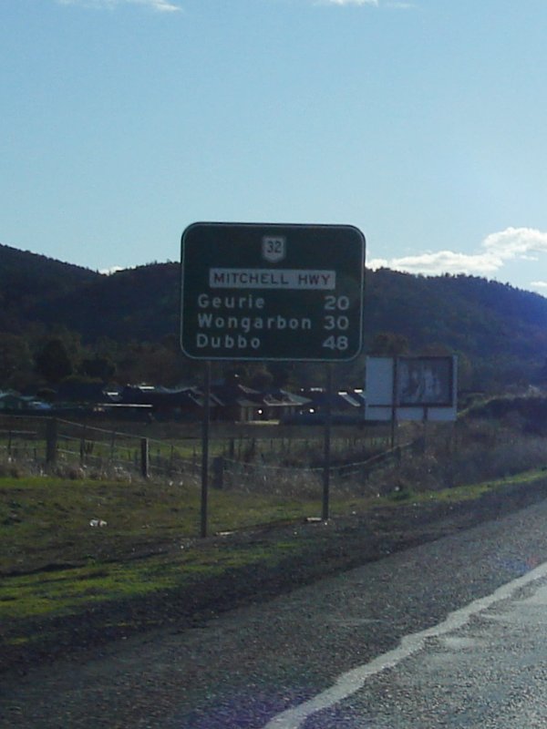 |
RD Sign: Distance sign at Montefiores after the Goolma Road junction, July 2006. Image © Paul Rands |
|||
 |
AD Sign: Northbound AD sign approaching Cobbora Road at Montefiores, August 2011. Click here for a photo of this location by Paul Rands from July 2006. Image © Paul Rands |
|||
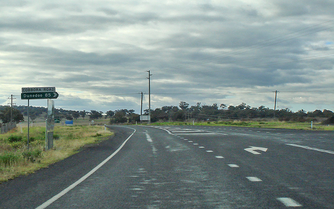 |
Cobbora Road Intersection: Heading northwest at Montefiores, August 2011. Click here for a photo of this location by Paul Rands from July 2006. Image © Paul Rands |
|||
 |
RD Sign: Distance sign at Maryvale, August 2011. Image © Paul Rands |
|||
 |
Maryvale: Heading northwest as you enter Maryvale, July 2006. Image © Paul Rands |
|||
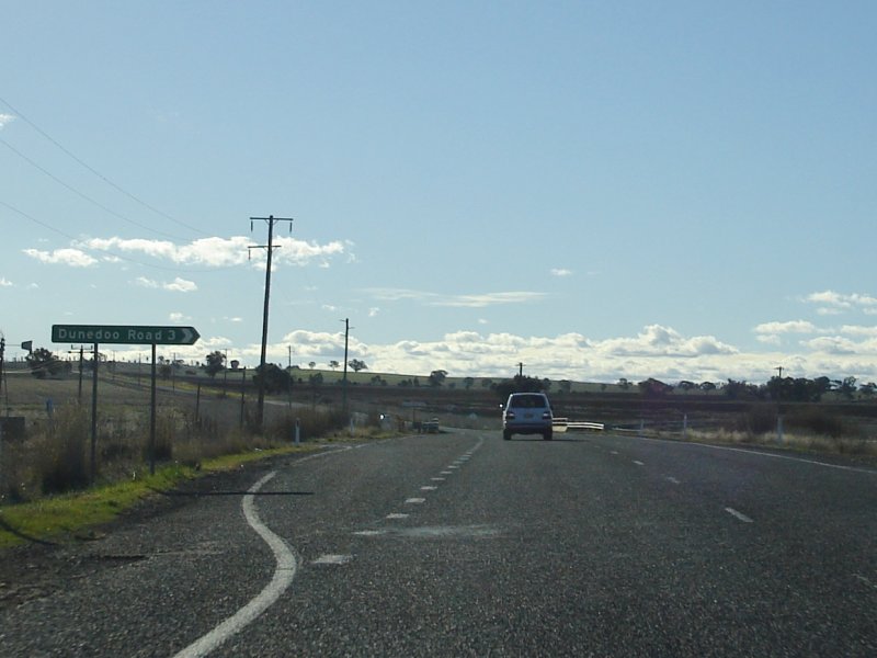 |
Dunedoo Road Fingerboard: ID signage at Maryvale showing access to Dunedoo Road, July 2006. Image © Paul Rands |
|||
 |
Maryvale Town Centre: Looking northwest in the town of Geurie, July 2006. Image © Paul Rands |
|||
 |
Mitchell St Intersection : ID sign assembly on the corner of Mitchell Street in Geurie. July 2006. Image © Paul Rands |
|||
 |
AD Sign : Advance directional sign approaching Beni St in Wongabon, July 2006. Image © Paul Rands |
|||
 |
Typical Conditions : Looking northwest on one of the many long and straight sections of the highway, July 2006 at Wongabon. Image © Paul Rands |
|||
 |
AD Sign: Advance directional sign at Orana Heights (in Dubbo) approaching Wheeler Street, July 2006. This sign is somewhat recent (say in the last 5 or so years) and is badly peeling. Image © Paul Rands |
|||
 |
Entering Dubbo: The Mitchell Hwy gains divided roadway as it enters Dubbo. July 2006. Image © Paul Rands |
|||
 |
Milepost: Old mile post (repositioned), near Sterling St, Dubbo, April 2012.. Image © Paul Rands |
|||
 |
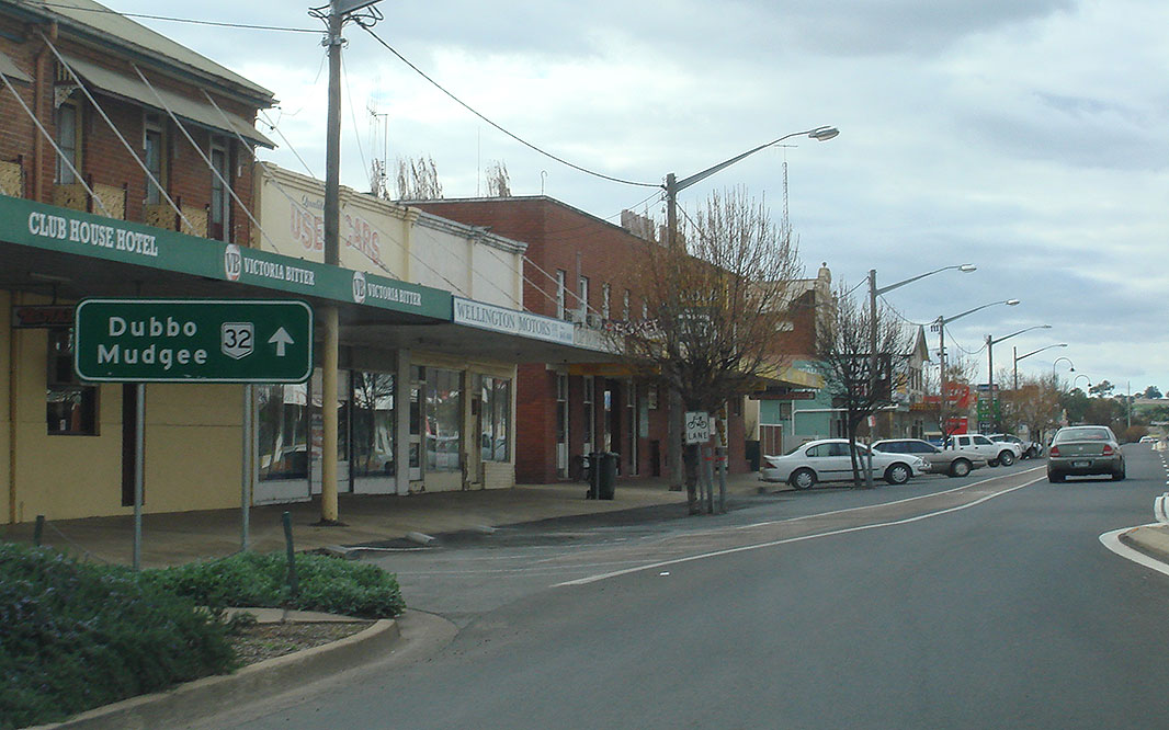
AD Sign: Westbound approaching Fitzroy Street in Dubbo, July 2006. Local name for Mitchell Hwy through town is Cobra St. Image © Paul Rands |
|||
 |
ID Sign: Westbound intersection directional sign on the roundabout with Fitzroy Street in Dubbo, April 2012. Image © Paul Rands |
|||
 |
Advance Directional Sign: AD sign at Dubbo, approaching Darling St (former Newell Hwy), August 2011. Image © Paul Rands |
|||
 |
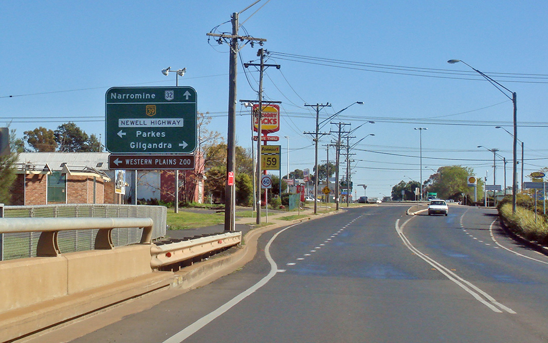
Darling Street intersection: Mitchell Hwy (NR32) at the junction with Darling St (former NR39) at Dubbo. July 2006. Image © Paul Rands |
|||
 |
Macquarie River: Looking northwest approaching the 2013 feet long, 2 lane, 28 span, prestressed concrete bridge over the Macquarie River in Dubbo. It opened to traffic on the 29th September 1969, at the time it was the 4th longest road bridge in NSW. August 2011. Image © Paul Rands |
|||
 |
Advance Directional Sign: Image © Paul Rands |
|||
 |
Reassurance Directional Sign: Image © Paul Rands |
|||
 |
Road Train Sign: Image © Mitchell Oliver |
|||
 |
Advance Directional Sign: Image © Paul Rands |
|||
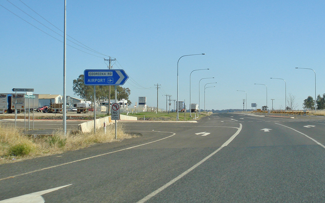 |
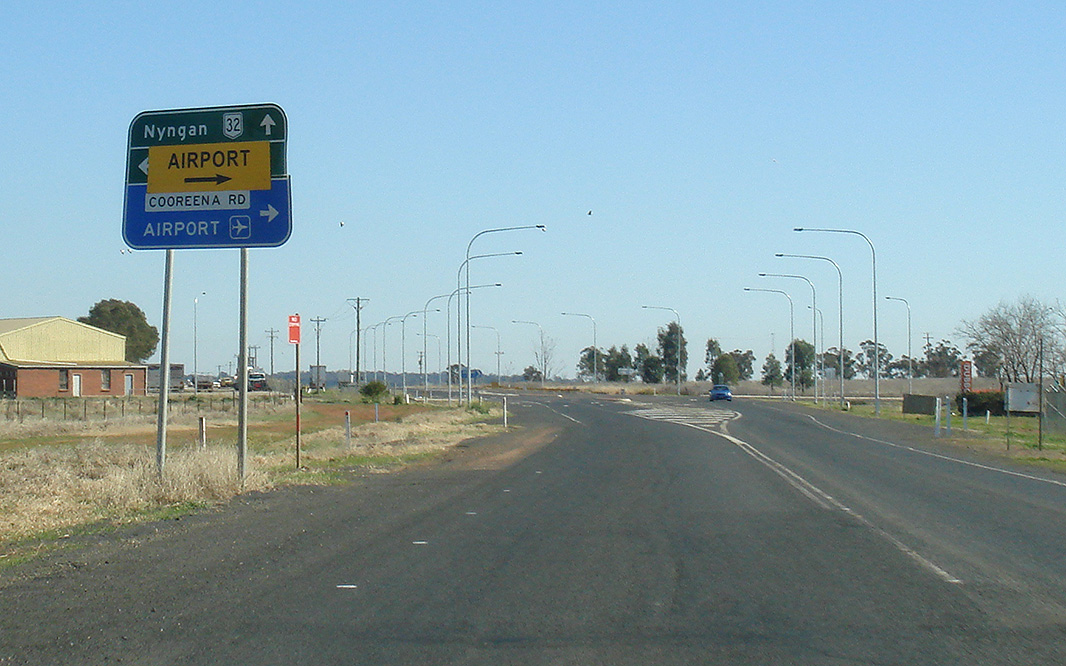
Cooreena Road & Pilons Drive: Corner of Mitchell Hwy (NR32), Cooreena Rd and Pilons Dr, Dubbo, August 2011. Image © Paul Rands |
|||
 |
Whylandra Crossing Road: Corner of Mitchell Hwy (NR32) and Whylandra Crossing Rd, Dubbo, August 2011. Image © Paul Rands |
|||
 |
The Falls Road: Corner of Mitchell Hwy (NR32) and The Falls Rd, Dubbo, August 2011. Image © Paul Rands |
|||
| Click here for the continuation of NR32 between Wellington and Molong Click here for the continuation of NR32 between Nyngan and Dubbo |
||||
1 Roads and Traffic Authority, Schedule of Classified Roads (and unclassified Regional Roads), 25 February 2008
2 Department of Main Roads. The Roadmakers, A History of Main Roads in New South Wales, ISBN 0 7240 0439 4
3 Roads & Traffic Authority, Community update, Road activity update – Western NSW, February 2003.
Last updated: 19-Oct-2021 0:18
This site © Paul Rands. All rights reserved. Some portions © (copyright) by their respective and credited owners. Permission must be obtained before using any images from this site. For details, please email by clicking here.