|
|
|
|
|
| M1 A1 | Pacific Motorway, Pacific Highway, New England Highway, John Renshaw Drive, Gore Hill Freeway, Warringah Freeway, Sydney Harbour Tunnel, Cahill Expressway, Eastern Distributor, Southern Cross Drive, General Holmes Drive, The Grand Parade, President Avenue, Princes Highway & Princes Motorway (M1 / A1) - South Nowra to Ulladulla |
Statistics:
Route Numbering:

General Information:
M1 / A1 is the principal coastal route through New South Wales, and forms part of the circumferential route around Australia.
The route varies greatly along its length and includes sections of rural highway, urban arterial road, divided rural highway and also motorway. The route also features several tunnels, located in the inner east, inner south and lower northern suburbs of Sydney and at Yelgun and Tweed Heads, at the northern end of the route in NSW. The route passes through forest, rural, residential, commercial and industrial areas.
The Princes Highway was formed from a string of roads linking Sydney to the Illawarra, and then forming a coastal route to Melbourne and into South Australia. The section covered by A1 is in 2 pieces - between Rockdale and Waterfall in Sydney, and then Yallah near Wollongong through to the Victorian Border. The route is a mix of urban arterial road, dual carriageway and also rural highway.
History:
- 1881: Construction of the Nowra Bridge over the Shoalhaven River
- 7 June 1926: The Princes Highway comes under a federal and state government £ for £ funding scheme, thus recognizing the importance of the highway as major route.
- August 1920: Official opening of Princes Highway performed at Warragul in Victoria. The formation of the Princes Highway is from existing roads being renamed, after the visit to Australia in 1920 of the Prince of Wales (later to become King Edward VIII, and after abdicating, the Duke of Windsor).
- 1 July 1928: Princes Highway became a state highway. 2
- 1936: Construction of deviations between Nowra and Batemans Bay, other deviations in this period include various sites including Tomerong, Stewarts and Luncheon Creeks, Myrtle Gully, Conjola, Ulladulla (East Lynne to Batemans Bay), straightening of highway between Nowra and Batemans Bay, including 22 new concrete bridges in that section.
- 1939: By the middle of the year, 300 miles (or 50% of the then highway) had been paved with bitumous surface.
- 1981: Duplication of Nowra Bridge.
- 16 March 2008: Work started on upgrading Princes Hwy to 4 lanes between Forest Road at South Nowra and Jervis Bay Road at Falls Creek. 3
- November 2011: Construction on the upgrade started at South Nowra to provide consistent four lane conditions on the Princes Highway between Bomaderry and Jervis Bay Road. 4
| Preview: | Description: |
 |
Jervis Bay Road: Corner of Princes Hwy (A1) and Jervis Bay Rd, Falls Creek, December 2013. Image © Paul Rands |
 |
Reassurance Directional Sign: Distance sign at Falls Creek, December 2013. Image © Paul Rands |
 |
Reassurance Directional Sign: Distance sign at Conjola, December 2013. Image © Paul Rands |
 |
Milton: Princes Hwy (A1) as it passes through the town of Milton, December 2013. Image © Paul Rands |
 |
Entering Ulladulla: Princes Hwy (A1) as it enters the town of Ulladulla, December 2013. Image © Paul Rands |
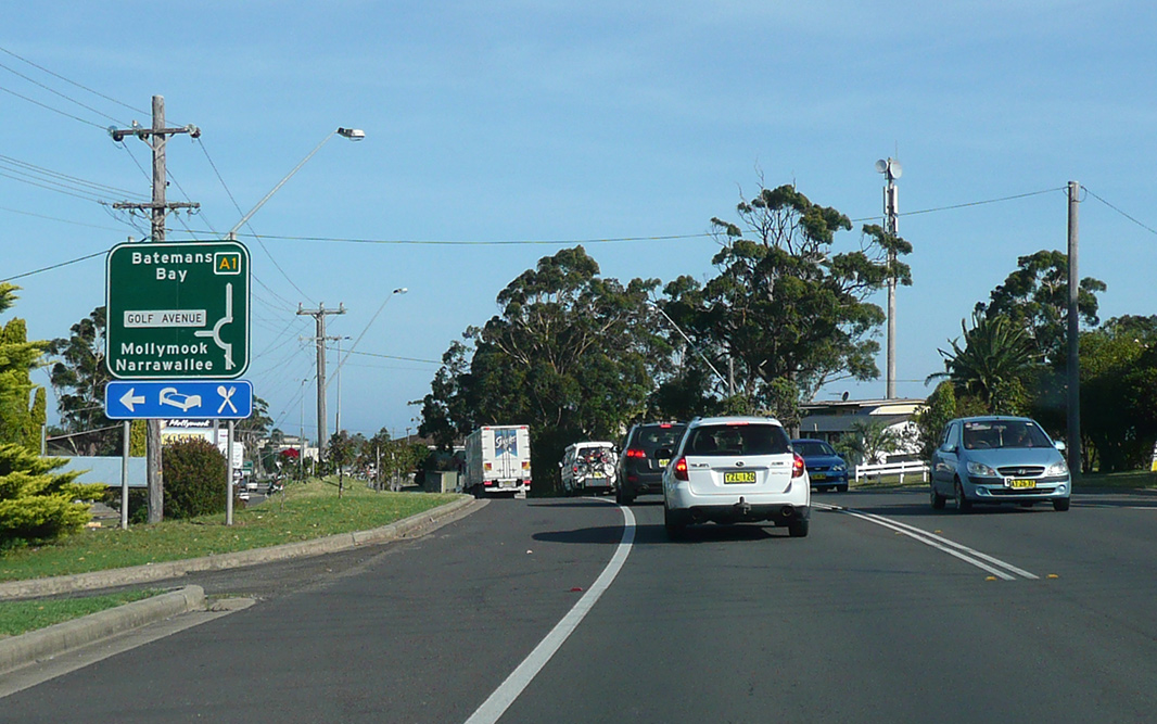 |
Advance Directional Sign: AD sign approaching Golf Av, Ulladulla, December 2013. Image © Paul Rands |
 |
Milton: Princes Hwy (A1) as it passes through the town of Ulladulla, December 2013. Image © Paul Rands |
| Click here for the continuation of A1 between Ulladulla and Batemans Bay Click here for the continuation of A1 between Gerringong and Nowra |
|
1 Roads & Maritime Services.
2 Main Roads Board, Annual Report, Volume 1, Number 1, September 1929.
3 Roads & Maritime Services, Projects, Southern region, Completed projects, Forest Road to Jervis Bay Road.
4 Roads & Maritime Services, Projects, Princes Highway upgrade, Nangudga Lake Bridge replacement.
Last updated: 01-Jul-2020 11:15
This site © Paul Rands. All rights reserved. Some portions © (copyright) by their respective and credited owners. Permission must be obtained before using any images from this site. For details, please email by clicking here.