|
|
|
|
|
| M1 A1 | Pacific Motorway, Pacific Highway, New England Highway, John Renshaw Drive, Gore Hill Freeway, Warringah Freeway, Sydney Harbour Tunnel, Cahill Expressway, Eastern Distributor, Southern Cross Drive, General Holmes Drive, The Grand Parade, President Avenue, Princes Highway & Princes Motorway (M1 / A1) - Waterfall to Gwynneville |
Statistics:
Route Numbering:


General Information:
M1 / A1 is the principal coastal route through New South Wales, and forms part of the circumferential route around Australia.
The route varies greatly along its length and includes sections of rural highway, urban arterial road, divided rural highway and also motorway. The route also features several tunnels, located in the inner east, inner south and lower northern suburbs of Sydney and at Yelgun and Tweed Heads, at the northern end of the route in NSW. The route passes through forest, rural, residential, commercial and industrial areas
The Princes Motorway started life as the Southern Expressway (later Freeway) and also Mount Ousley Road, and runs between Waterfall, bypassing Wollongong and ending at Yallah, in the Illawarra's southern suburbs. It is the main route between Sydney and Wollongong, and crosses the Illawarra Escarpment to the narrow coastal strip on which most of the Illawarra suburbs are built.
History:
| Gwynneville to Waterfall | Waterfall to Gwynneville | |||
| Preview: | Description: | Preview: | Description: | |
 |
New Mount Pleasant Road: Princes Mwy (M1) as it passes under New Mount Pleasant Rd at Mt Pleasant, November 2013. Image © Paul Rands |
 |
Reassurance Directional Sign: Distance sign on Princes Mwy (M1) at Waterfall, just after the Old Princes Hwy interchange, November 2013. Image © Michael Greenslade |
|
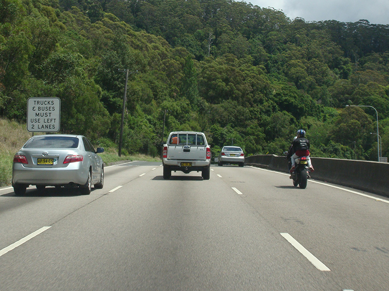 |
Trucks & Buses Must Use Left 2 Lanes: Heavy vehicle restrictions on Princes Mwy (M1) at Mt Pleasant, November 2013. Image © Paul Rands |
 |
Advance Directional Sign: AD sign at Bulli Tops approaching Appin Rd (B69), November 2013. Image © Michael Greenslade |
|
 |
Advance Directional Sign: AD sign at Brokers Nose approaching Clive Bissell Drive, November 2013. Image © Paul Rands |
 |
Advance Directional Sign: AD sign at Bulli Tops approaching Bulli Pass, November 2013. M1 becomes dual named at this point, Princes Mwy / Mt Ousley Rd Image © Michael Greenslade |
|
 |
Advance Directional Sign: AD sign approaching Picton Rd (B88) interchange at Brokers Nose, November 2013. Image © Paul Rands |
 |
Cataract Creek: Princes Mwy / Mt Ousley Rd (M1) at Cataract as it crosses Cataract Creek, November 2013. This crossing was built in the late 1970s. Image © Michael Greenslade |
|
 |
Picton Road Interchange: Princes Mwy (M1) at the Picton Rd (B88) interchange at Brokers Nose, November 2013. Image © Paul Rands |
 |
Advance Directional Sign: AD sign at Mt Ousley approaching the unnumbered segment of Mt Ousley Rd, November 2013. Image © Michael Greenslade |
|
 |
Picton Road Interchange: Princes Mwy (M1) at the Picton Rd (B88) interchange at Brokers Nose, November 2013. Image © Paul Rands |
 |
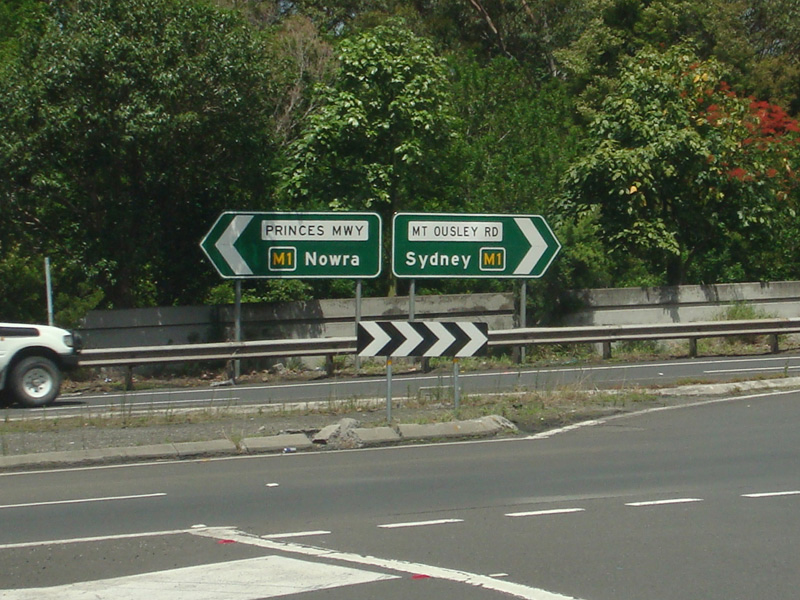
Advance Directional Sign: AD sign on Mt Ousley Rd at Mt Ousley approaching Princes Mwy (M1), November 2013. Image © Paul Rands |
|
 |
Intersection Directional Sign: ID sign facing Mt Ousley Rd at Mt Ousley, November 2013. Image © Paul Rands |
|||
 |
Intersection Directional Sign: ID sign facing Mt Ousley Rd at Mt Ousley, November 2013. Image © Paul Rands |
|||
| Click here for the contination of M1 between Gwynneville and Yallah Click here for A1 between Sylvania and Waterfall |
||||
1 Roads & Maritime Services, Schedule of Classified Roads and Unclassified Regional Roads, August 2013.
Last updated: 22-Dec-2019 17:19
This site © Paul Rands. All rights reserved. Some portions © (copyright) by their respective and credited owners. Permission must be obtained before using any images from this site. For details, please email by clicking here.