|
|
|
|
|
| A43 | Doyalson Link Road, Old Pacific Highway, Stewart Avenue, Hannell Street, Industrial Drive, Maitland Road, Pacific Highway and New England Highway (A43) |
Statistics:
Route Numbering:


General Information:
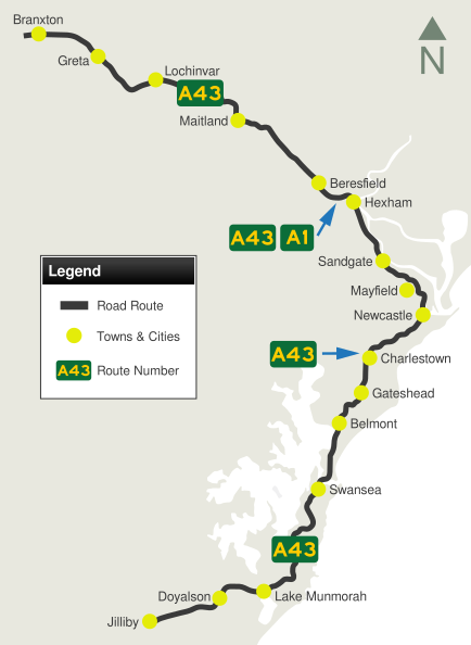
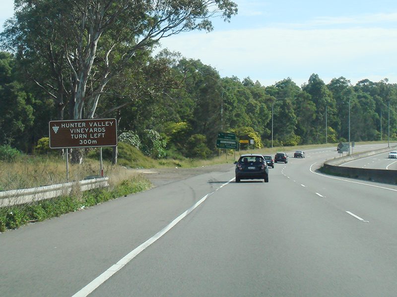
A43 is mostly an arterial route in the NSW Hunter region. It's a major route and forms a link with the Central Coast, Newcastle CBD and Maitland.
The section between Hexham and Mayfield West and also Newcastle West and Doyalson is the former route of National Route 1 through the Hunter region. The section south of Swansea was also briefly part of the National Highway system and signed as NH1. The Doyalson Link Road (formerly Motorway Link section) between Wallarah and Doyalson is super 2 expressway standard with a grade separated interchange with Tooheys Road. The rest is mostly dual carriageway highway or urban arterial road standard (either divided or undivided).
The route passes through mostly suburbia, although there are some nature reserves scattered along the southern section of the route.
The Newcastle West to Doyalson section features the Swansea Bridge spanning the entrance to Lake Macquarie. More than 27,000 road vehicles use the bridge each day. The bridge opens about 2000 times each year, and around five to six times per day, allowing up to 4500 boats to pass through. The number of openings is significant when you compare Swansea Bridge to other similar opening bridges in NSW eg the Spit Bridge in Sydney opens eight times each day during the summer, allowing more than 100 boats per day to pass, and the Harwood Bridge north of Grafton opens around 200 times a year. 2
Multiplexes along the route include:
History:
| Jilliby to Branxton | Branxton to Jilliby | ||
| Preview: | Description: | Preview: | Description: |
 |
Reassurance Directional Sign: Distance sign at Hexham, July 2013. Image © Paul Rands |
 |
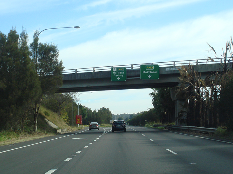
Advance
Directional Sign: AD sign on New England Hwy (A43) approaching Clift St at Branxton, August 2013. Image © Peter Renshaw |
 |
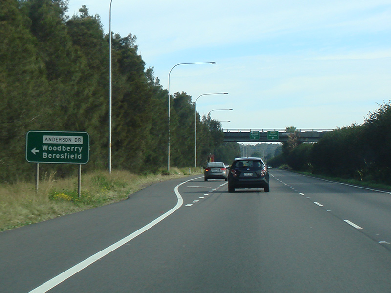
Supplemental Advance Directional Sign: Supplemental AD sign at Hexham approaching Anderson Dr, July 2013. Image © Paul Rands |
 |
Distance
Sign: Reassurance directional sign at Beresfield, August 2013. Image © Peter Renshaw |
 |
Advance Directional Signs: AD signs at Hexham approaching Anderson Dr, July 2013. Image © Paul Rands |
 |
Advance
Directional Signs: AD signs at the Anderson Dr interchange at Tarro, August 2013. Image © Peter Renshaw |
 |
Special Watch For Cyclists Sign: Special 'Watch For Cyclists' sign approaching the railway overpass at Tarro, July 2013. Image © Paul Rands |
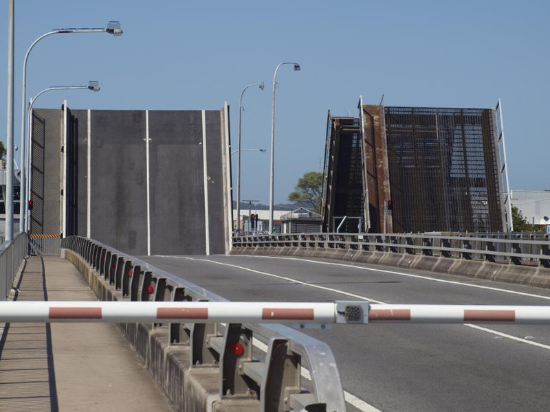 |
Swansea Bridge: Pacific Hwy (A43) as it crosses the entrance to Lake Macquarie via Swansea Bridge at Swansea. January 2013. The bridge on the left was built in 1989, and the bridge on the right was constructed in 1955. 5 Image © Paul Rands |
 |
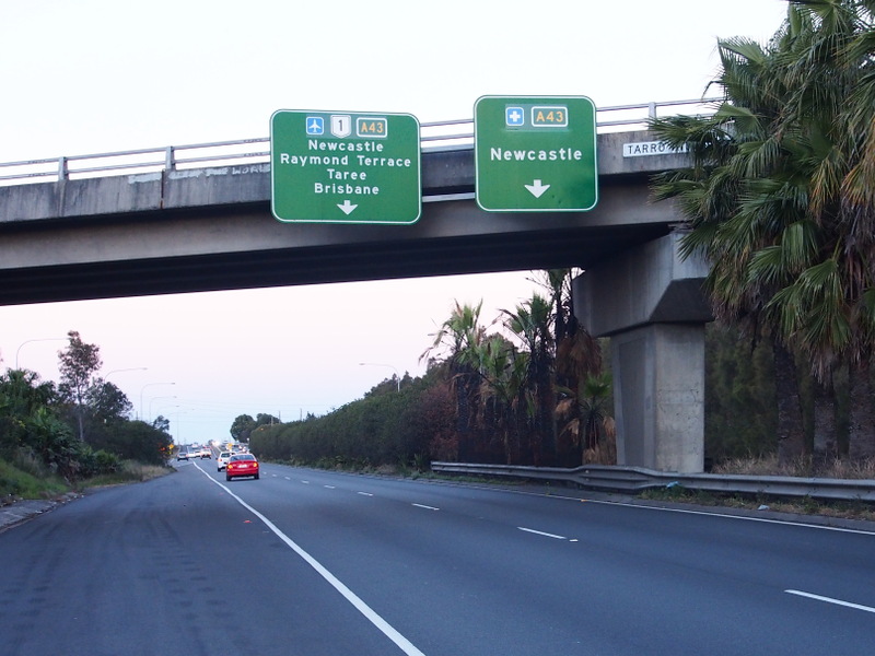
Tarro Interchange: New England Hwy (A43 / A1) at the Tarro Interchange with Anderson Dr, July 2013. Image © Paul Rands |
||
 |
Tarro Interchange: New England Hwy (A43 / A1) at the Tarro Interchange with Anderson Dr, July 2013. Image © Paul Rands |
||
 |
Advance Directional Sign: AD sign at Tarro for the John Renshaw Dr (A1) interchange, July 2013. Image © Paul Rands |
||
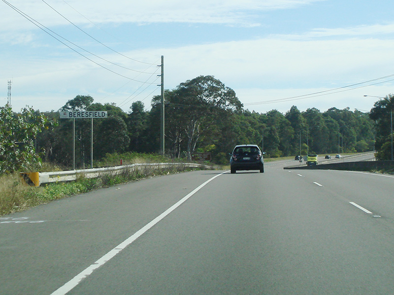 |
Entering Beresfield: New England Hwy (A43) as it enters the town of Beresfield, July 2013. Image © Paul Rands |
||
 |
Supplemental Advance Directional Sign: Supplemental AD sign at Beresfield for the John Renshaw Dr (A1) interchange, July 2013. Image © Paul Rands |
||
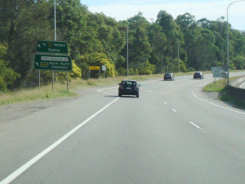 |
John Renshaw Drive Interchange: New England Hwy (A43) at the John Renshaw Dr (A1) interchange in Beresfield, July 2013. The A1 duplex ends at this interchange. Image © Paul Rands |
||
 |
John Renshaw Drive Interchange: New England Hwy (A43) at the John Renshaw Dr (A1) interchange in Beresfield, July 2013. The A1 duplex ends at this interchange. Image © Paul Rands |
||
 |
Intersection
Directional Sign: ID sign facing Clift St, Branxton, August 2013. Image © Peter Renshaw |
||
1 Roads &
Maritime Services, Schedule of Classified Roads and Unclassified Regional
Roads, August 2013.
2 Roads & Traffic Authority
3 Dept of Main Roads, Annual Report,
1956, p 62
4 Wyong Shire, Celebrating 60 Years
publication, 2007
5 Lake Macquarie City Council, The second Swansea Bridge
Last updated: 02-Jan-2019 19:28
This site © Paul Rands. All rights reserved. Some portions © (copyright) by their respective and credited owners. Permission must be obtained before using any images from this site. For details, please email by clicking here.