|
|
|
|
|
| A39 | Newell Highway (A39) |
Statistics:
Route Numbering:


General Information:
The Newell Highway is the longest highway in NSW, stretching from the Victorian border at Tocumwal to the Queensland border. It's the economic backbone for freight and livestock transporters, tourism operators, caravanners and holiday makers, emergency services, government, media and business owners. 2
The majority of the route is undivided roadway, with various overtaking sections where required.
The Newell Highway is named after HH Newell. He was the first commissioner for Main Roads in New South Wales. He passed away in 1941. 3 Prior to his appointment to the newly formed Main Roads Board on March 9, 1925, he was the District Engineer at the Wollongong branch of the Department of Public Works. 4
Multiplexes along the route include:
History:
Click
here for the official Newell Highway web site, which features
marketing campaigns, brochures and maps to help promote the regions
serviced by the highway.
Click here for photos of the former A39 alignment through Moree.

| Victoria to Queensland | Queensland to Victoria | |||
| Preview: | Description: | Preview: | Description: | |
 |
Wagga
Wagga Road: Intersection directional sign assembly at the junction with Wagga Wagga Rd at Ardlethan, November 2010. Image © Rob Tilley |
 |
Advance
Directional Sign: AD sign approaching Carnarvon Hwy in Moree, May 2011. Image © Rob Tilley |
|
 |
Advance Directional Sign: AD sign at Carabagal approaching Mid Western Hwy (B64), January 2014. The B64 duplex ends at this location. Image © Michael Greenslade |
 |
Advance
Directional Sign: AD sign in Moree approaching Gwydir Hwy (NR38), May 2011. Image © Rob Tilley |
|
 |
Reassurance Directional Sign: Distance sign at Forbes, January 2014. Image © Michael Greenslade |
 |
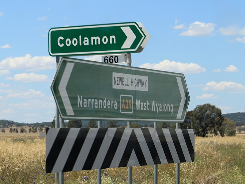
Gwydir
Highway: Newell Hwy (a39) at the Gwydir Hwy (B76) junction in Moree, May 2011. The second stage of Moree Bypass will be built behind the bollards. A39 turns right at this junction and the B76 duplex starts here. Image © Rob Tilley |
|
 |
Supplemental Advance Directional Sign: Supplemental AD sign approaching Station St, Parkes, January 2014. Image © Michael Greenslade |
 |
Reassurance Directional Sign: Distance sign at Peak Hill, January 2014. Image © Michael Greenslade |
|
 |
Reassurance Directional Sign: Distance sign at Parkes, January 2014. Image © Michael Greenslade |
 |
Advance Directional Sign: AD sign at Forbes approachign Camp St, January 2014. Image © Michael Greenslade |
|
 |
Intersection
Directional Sign: ID sign facing Tomingley-Narromine Rd at Tomingley, March 2011. Image © Paul Rands |
 |
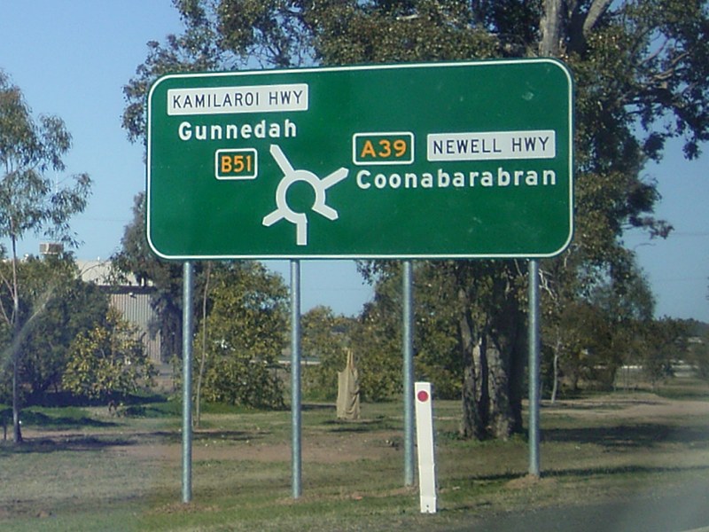
Advance
Directional Sign: AD sign in Narrabri approaching Kamilaroi Hwy (B51) roundabout, January 2014. |
|
 |
Reassurance Directional Sign: Distance sign at Tomingley, January 2014. Image © Michael Greenslade |
 |
Reassurance Directional Sign: Distance sign at Narrabri, January 2014. Image © Michael Greenslade |
|
 |
Advance Directional Sign: AD sign approaching Obley Rd, Dubbo, January 2014. Image © Michael Greenslade |
 |
Intersection
Directional Sign: ID sign assembly with Junee St in Grong Grong, May 2005. Image © Rob Tilley |
|
 |
Macquarie Street: Corner of Newell Hwy (A39) and Macquarie St, Dubbo, January 2014. Image © Michael Greenslade |
 |
Intersection
Directional Sign: ID sign assembly with Ganmain Rd in Grong Grong, May 2005. Image © Rob Tilley |
|
 |
Advance
Directional Sign: AD sign in Dubbo on Darling St (former Newell Hwy alignment) approaching Newell Hwy (A39), August 2008. Image © Richard Wardle |
|||
 |
Advance Directional Sign: AD sign at Dubbo approaching Golden Hwy (B84), January 2014. A39 turns left at this junction. Image © Michael Greenslade |
|||
 |
Reassurance Directional Sign: Distance sign at Dubbo, January 2014. Image © Michael Greenslade |
|||
 |
Intersection
DIrectional Sign: Intersection directional sign facing Hargraves Ln in Gilgandra, November 2010. Image © Rob Tilley |
|||
 |
Advance Directional Sign: AD sign at Brocklehurst approaching Mogriguy Rd and Burraway Rd, January 2014. Image © Michael Greenslade |
|||
 |
Advance Directional Sign: AD sign at Gilgandra approaching Castlereagh Hwy (B55), January 2014. Image © Michael Greenslade |
|||
 |
Castlereagh Highway: Corner of Newell Hwy (A39) and Castlereagh Hwy (B55) at Gilgandra, January 2014. A39 turns right and the B55 duplex begins at this location. Image © Michael Greenslade |
|||
 |
Castlereagh Highway: Corner of Newell Hwy (A39) and Castlereagh Hwy (B55) at Gilgandra, January 2014. The B55 duplex ends at this location. Image © Michael Greenslade |
|||
 |
Reassurance Directional Sign: Distance sign at Gilgandra, January 2014. Image © Michael Greenslade |
|||
 |
Advance Directional Sign: AD sign approaching John Renshaw Pkwy (TD1) and Tooraweenah Rd at Tooraweenah, January 2014. Note the missing TD1 shield and incorrect road name patch for Tooraweenah Rd. Image © Michael Greenslade |
|||
 |
Intersection
Directional Sign: ID sign at the junction with Hickeys Rd at Gowang, November 2010. Image © Rob Tilley |
|||
 |
Intersection
Directional Sign: ID sign at the junction with Cenn Cruaich Rd at Gowang, November 2010. Image © Rob Tilley |
|||
 |
Advance Directional Sign: AD sign at Wattle Springs approaching Mendooran Rd, January 2014. Image © Michael Greenslade |
|||
 |
Advance Directional Sign: AD sign at Coonabarabran approaching Oxley Hwy (B56), January 2014. Image © Michael Greenslade |
|||
 |
Oxley Highway: Corner of Newell Hwy (A39) and Oxley Hwy (B56) at Coonabarabran, January 2014. A39 turns left at this location. Image © Michael Greenslade |
|||
 |
Advance Directional Sign: AD sign approaching the unnumbered section of Kamilaroi Hwy at Narrabri, January 2014. Image © Michael Greenslade |
|||
 |
Reassurance Directional Sign: Distance sign at Narrabri, January 2014. Image © Michael Greenslade |
|||
 |
Distance
Sign: RD sign on the Moree Bypass (Newell Hwy (A39 / B76), January 2014. Click here for a photo of this location by Rob Tilley from May 2011. Image © Michael Greenslade |
|||
 |
Intersection
Directional Sign: ID sign facing Gwydirfield Rd in Moree, May 2011. Image © Rob Tilley |
|||
 |
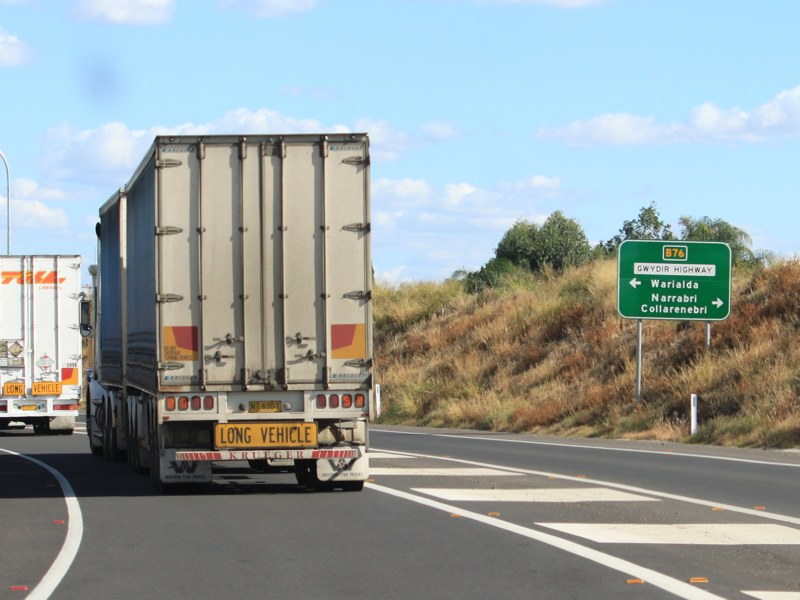
Advance
Directional Sign: AD sign approaching Gwydir Hwy (B76) in Moree, January 2014. Click here for a photo by Rob Tilley from May 2011 of this locaiton showing Carnarvon Hwy. Image © Michael Greenslade |
|||
 |
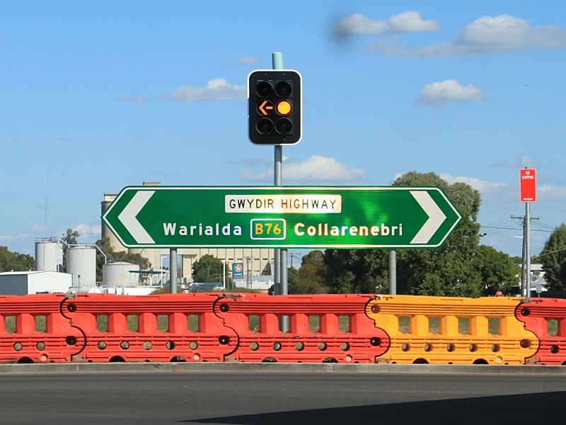
Carnarvon
Highway: Newell Hwy (A39 / B76) at the now Gwydir Hwy (B76) junction in Moree, May 2011. Sometime between 2011 and 2014, the Carnarvon Hwy extension was truncated and replaced by Gwydir Hwy. Image © Rob Tilley |
|||
 |
Intersection
Directional Sign: ID sign facing Gwydir Hwy (B76) (former Carnarvon Hwy) in Moree, May 2011. Image © Rob Tilley |
|||
| Click
here for the continuation of the route as NH39 in Queensland Click here for the continuation of A39 in Victoria |
||||
1 Roads and
Traffic Authority, Schedule of Classified Roads and State & Regional
Roads, 31 January 2011
2 Roads and Traffic Authority, Road
Projects, Western Region, Newell
Highway
3 Department of Main Roads, Main Roads
of New South Wales brochure
4 Department of Main Roads, The
Roadmakers, A History of Main Roads in New South Wales, ISBN0 7240 0439 4
5 Minister for Infrastructure,
Transport, Regional Development and Local Government, Media Release, Work
Underway On Newell Highway Blackspots, 16 November 2009.
6 Roads & Traffic Authority, Rules
& Regulations, Newell
Highway Reduced Speed Limit
7 Roads & Traffic Authority, NSW
Centre for Road Safety, Downloads, Newell
Highway centreline marking trial display
8 Roads & Traffic Authority,
Projects, Western Region, Moree
Town Centre Bypass
Last updated: 23-Dec-2019 9:10
This site © Paul Rands. All rights reserved. Some portions © (copyright) by their respective and credited owners. Permission must be obtained before using any images from this site. For details, please email by clicking here.