|
|
|
|
|
West Coast Highway, Curtin Avenue & Eric Street (State Route 71) |
Statistics:
Route Numbering:

General Information:
SR71 is a significant north-south route that runs more or less parallel with the coastline and connects some of Perth's oldest suburbs with its newest.
West Coast Highway is a major arterial coastal road located in the western and inner northern suburbs of Perth, linking the northern coastal suburbs of Perth with the city of Fremantle. It consists of both single and dual carriageway with 2 or 4 lanes. The highway began life as a minor coastal road (called Coast Road) between Swanbourne and North Beach in the 1940s.
History:
| Cottesloe to Karrinyup | Karrinyup to Cottesloe | |||
| Preview: | Description: | Preview: | Description: | |
 |
Trailblazer and Railway Overpass: Eric Street in Cottesloe, as you cross over the railway line. August 2008. Image © Paul Rands |
 |
Intersection Directional Sign: Southbound through the intersection of Karrinyup Rd / Marmion Av / West Coast Hwy at Karrinyup. August 2008. Image © Paul Rands |
|
 |
Intersection Directional Sign: ID sign facing westbound traffic on the corner of Eric Street and Curtin Avenue in Cottesloe. August 2008. Image © Paul Rands |
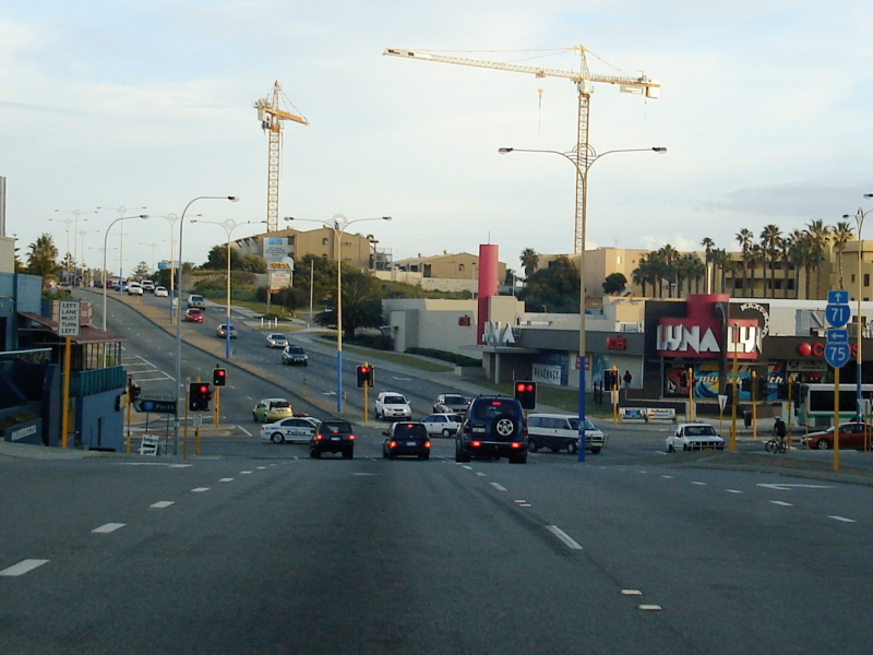 |
Scarborough: Approaching the Scarborough Beach Road intersection, August 2008. Image © Paul Rands |
|
 |
Langoulant Road Overpass: Travelling northbound at Cottesloe as you appoach the Langoulant Road overpass. August 2008. Image © Paul Rands |
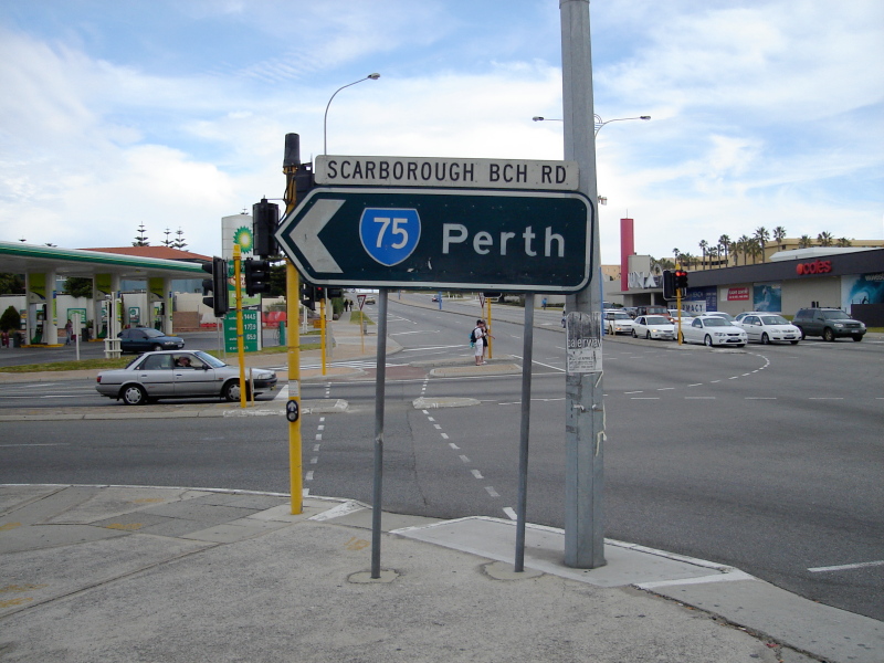 |
Black ID Sign: Southbound intersection directional sign on the corner of West Coast Hwy and Scarborough Bch Rd (SR75), August 2008. Image © Paul Rands |
|
 |
Rochedale Road Intersection: Corner of West Coast Hwy & Rochedale Rd (SR65) at Swanbourne, August 2008. Image © Paul Rands |
 |
Black ID Sign: Westbound intersection directional sign on the corner of West Coast Hwy and Scarborough Bch Rd (SR75), August 2008. Image © Paul Rands |
|
 |
Sunset Coast Tourist Drive Sign: Northbound sign indicating the Sunset Coast Tourist Drive, as you approach Oceanic Drive at City Beach, August 2008. Image © Paul Rands |
 |
Black ID Sign: Eastbound intersection directional sign on the corner of West Coast Hwy and Scarborough Bch Rd (SR75), August 2008. Image © Paul Rands |
|
 |
Oceanic Drive Junction: Northbound at City Beach at the Oceanic Dr intersection. August 2008. Image © Paul Rands |
 |
Challenger Pde Intersection: Southbound through Challenger Pde (SR204) at City Beach (former West Coast Hwy), August 2008. Image © Paul Rands |
|
 |
Approaching the Boulevard: Northbound on West Coast Hwy approaching The Boulevard (SR72) at City Beach, August 2008. Image © Paul Rands |
 |
Oceanic Dr Intersection: Southbound approaching the signalised junction with Oceanic Drive at City Beach, August 2008. Image © Paul Rands |
|
 |
Scarborough Beach Road intersection: Northbound at Scarborough as you approach Scarborough Beach Road (SR75), August 2008. Image © Paul Rands |
 |
Rochedale Rd Intersection: Southbound carriageway of the West Coast Highway as it passes across the Rochedale Road intersection at City Beach, August 2008. Image © Paul Rands |
|
 |
Intersection Directional Sign: Eastbound ID sign on the corner of Scarborough Beach Road and West Coast Highway at Scarborough, August 2008. Image © Paul Rands |
 |
Langoulant Road Overpass: Travelling southbound on Curtin Avenue at Cottesloe as you appoach the Langoulant Road overpass. August 2008. Image © Paul Rands |
|
 |
Black Intersection Directional Sign: Older northbound black ID sign on the corner of West Coast Hwy and Scarborough Beach Rd at Scarborough, August 2008. Image © Paul Rands |
 |
Approaching Eric Street: Southbound on the corner of Curtin Av & Eric St in Cottesloe, August 2008. Image © Paul Rands |
|
 |
Trailblazer: Northbound trailblazer assembly approaching Karrinyup Road (SR76) at Karrinyup, August 2008. Image © Paul Rands |
 |
Black Intersection Directional Signs: Black ID signs on the corner Stirling Hwy (SR5), Eric St and Osborne Pde at Cottesloe. August 2008. Image © Paul Rands |
|
 |
Karrinyup Road Intersection: Northbound approaching Karrinyup Road (SR76) at Karrinyup, August 2008. Image © Paul Rands |
|||
| Click here for the continuation of SR71 between Karrinyup and Yanchep | ||||
1 Main Roads Western Australia
2 MG Graphics
3 Town of Cambridge, Heritage Trail Brochure
Last updated: 08 Nov 2019 01:09
This site © Paul Rands. All rights reserved. Some portions © (copyright) by their respective and credited owners. Permission must be obtained before using any images from this site. For details, please email by clicking here.