|
|
|
|
|
 |
Manning Road (State Route 26) |
Statistics:
Route Numbering:
General Information:
Manning Road is mostly a dual carriageway route in Perth's inner south, connecting Albany Highway (SR30) with the Kwinana Freeway (SR2).
Manning Road is named after the Manning family, who were major landholders and businessmen in the Swan River Colony. 1
History:

| Preview: | Description: |
 |
Intersection Directional Sign: ID sign on Canning Hwy (SR6) at Como at the interchange with Kwinana Fwy (SR2), July 2009. Image © Paul Rands |
 |
Kwinana Fwy / Manning Rd Interchange: Southbound at Como, at the Kwinana Freeway interchange, where it splits with Manning Road (SR26), July 2009. Image © Paul Rands |
 |
Kwinana Fwy / Manning Rd Interchange: Southbound at Como, at the Kwinana Freeway interchange, where it splits with Manning Road (SR26), July 2009. Image © Paul Rands |
 |
Approaching Ley Street: Manning Road (eastbound) at Como, approaching Ley Street, July 2009. Image © Paul Rands |
 |
SR26 Trailblazer: SR26 trailblazer at Manning approaching Bickley Crescent and Wellwyn Avenue, July 2009. Image © Paul Rands |
 |
SR26 Trailblazer: SR26 trailblazer at Manning, July 2009. Image © Paul Rands |
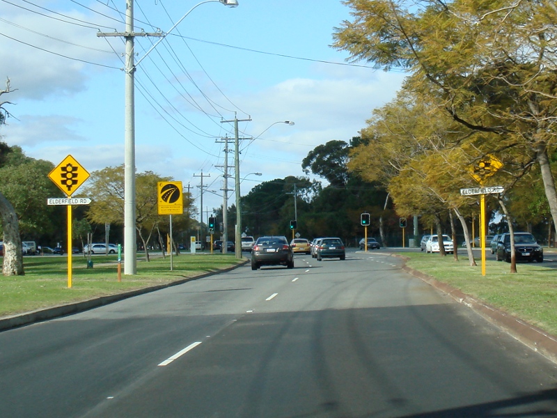 |
Elderfield Road Intersection: Manning Rd approaching Elderfield Rd in Karawara, July 2009. Image © Paul Rands |
 |
Approaching Waterford Avenue & Kent Street: Manning Rd (eastbound) approaching Waterford Av and Kent St in Karawara, July 2009. Image © Paul Rands |
 |
Approaching Curtin University: Manning Rd approaching the Curtin University entrance at Bentley, July 2009. Image © Paul Rands |
 |
AD Sign: Advance directional sign approaching Centenary Av at Waterford, July 2009. Image © Paul Rands |
 |
Approaching Centenary Avenue: Manning Rd approaching Centenary Av at Waterford, July 2009. Image © Paul Rands |
 |
Centenary Avenue Intersection: Corner of Manning Rd and Centenary Av in Waterford, July 2009. Image © Paul Rands |
 |
Intersection Directional Signs: ID signs facing Centenary Avenue at Waterford, July 2009. Image © Paul Rands |
 |
Approaching Lawson Street: Manning Rd approaching Lawson St at Bentley, July 2009. Image © Paul Rands |
 |
Approaching Wyong Road: Manning Rd approaching Wyong Rd at Bentley, July 2009. Image © Paul Rands |
 |
Vehicle Restriction Sign: Sign prohibiting trucks longer than 19 metres in length along Leach Hwy (SR7), Bentley, July 2009. Image © Paul Rands |
 |
Approaching Leach Highway: Manning Rd approaching Leach Hwy (SR7) at Bentley, July 2009. Image © Paul Rands |
 |
Advance Directional Sign & Trailblazers: Trailblazer assembly and advance directional sign on Manning Rd approaching Leach Hwy (SR7), July 2009. Note the incorrect route numbers on the AD sign. Image © Paul Rands |
 |
Leach Highway Intersection: Corner of Manning Rd (SR26) and Leach Hwy (SR7) at Bentley, July 2009. Image © Paul Rands |
 |
Approaching Albany Highway & Mallard Way: Manning Rd approaching its eastern terminus, Albany Hwy (SR30) and Mallard Way at Cannington, July 2009. Image © Paul Rands |
 |
End State Route 26: Trailblazer assembly indicating the end of SR26, at the junction with Albany Hwy (SR30) and Mallard Way at Cannington, July 2009. Image © Paul Rands |
1 City of South Perth, Municipal Heritage Inventory, Origin and Meaning of Street and Place Names, July 2004
2 City of Canning, Annual Report 2000/2001, Page 8
3 Government of Western Australia, Planning and Infrastructure, Improvement works to commence at Leach Highway and Manning Road, 21 August 2007
Last updated: 08 Nov 2019 01:09
This site © Paul Rands. All rights reserved. Some portions © (copyright) by their respective and credited owners. Permission must be obtained before using any images from this site. For details, please email by clicking here.