|
|
|
|
|
 |
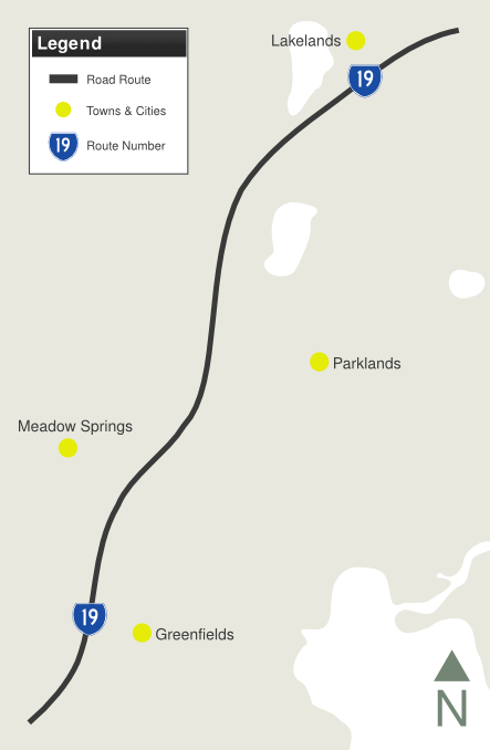
Mandjoogoordap Drive (State Route 19) |
Statistics:
Route Numbering:
General Information:
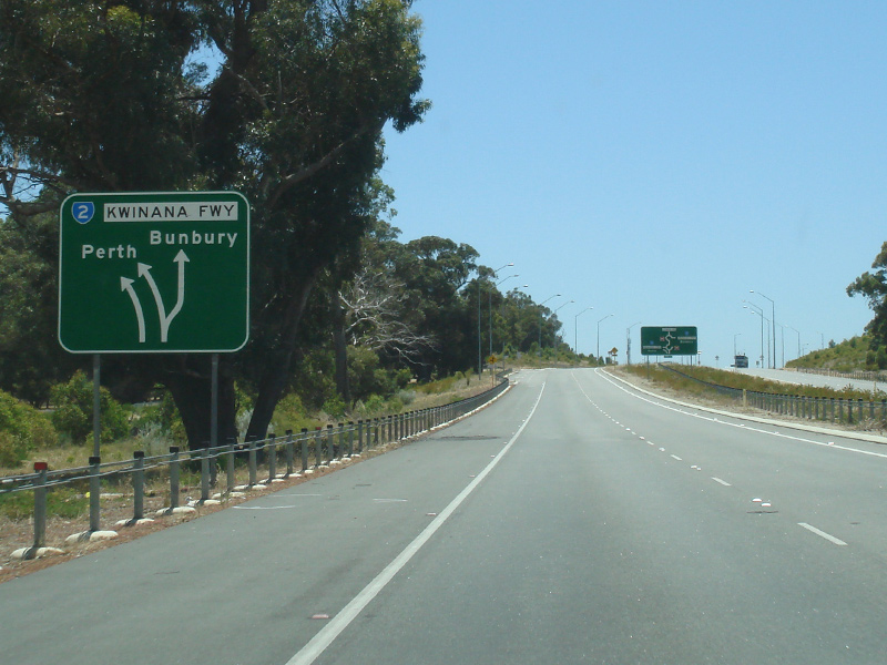
State Route 19 is a dual carriageway limited access road linking the Kwinana Freeway (SR2) with the city centre of Mandurah, south of Perth. A section of the route features the railway line linking Mandurah with Perth down the median strip.
Mandjoogoordap was the original Noongar name for Mandurah and means ‘meeting place of the heart’. 2
History:
| Lakelands to Greenfields | Greenfields to Lakelands | |||
| Preview: | Description: | Preview: | Description: | |
 |
Intersection Directional Sign: ID sign facing southbound traffic as they exit from Kwinana Fwy (SR2) at the interchange with Kwinana Fwy (SR2) and Lymon Rd in Lakelands, December 2012. Image © Paul Rands |
 |
Intersection Directional Sign: ID sign at the Mandjoogoordap Rotary with Mandurah Rd (NR1) at Greenfields, December 2012. Image © Paul Rands |
|
 |
Public Art: Public art on the interchange with Kwinana Fwy (SR2) at Lakelands, December 2012. Image © Paul Rands |
 |
Reassurance Directional Sign: Distance sign at Greenfields, December 2012. Image © Paul Rands |
|
 |
Intersection Directional Sign: ID sign on the interchange with Kwinana Fwy (SR2) at Lakelands, December 2012. Image © Paul Rands |
 |
Supplementary Advance Directional Sign: Supplementary AD sign at Lakelands approaching the Kwinana Fwy (SR2) and Lymon Rd interchange, December 2012. Image © Paul Rands |
|
 |
Intersection Directional Sign: ID sign on the interchange with Kwinana Fwy (SR2) at Lakelands, December 2012. Image © Paul Rands |
 |
Advance Directional Sign: AD sign at Lakelands approaching the Kwinana Fwy (SR2) and Lymon Rd interchange, December 2012. Image © Paul Rands |
|
 |
Distance Sign: Reassurance directional sign at Lakelands, December 2012. Image © Paul Rands |
 |
Intersection Directional Sign: ID sign at the Kwinana Fwy (SR2) and Lymon Rd interchange at Lakelands, December 2012. Image © Paul Rands |
|
 |
Gordon Road: Mandjoogoordap Dr (SR19) as it passes under Gordon Rd at Parklands, December 2012. Image © Paul Rands |
|||
 |
Advance Directional Sign: AD sign approaching Dubarda Link at Greenfields, December 2012. Image © Paul Rands |
|||
 |
Dubarda Link: Corner of Mandjoogoordap Dr (SR19) and Dubarda Link at Greenfields, December 2012. Image © Paul Rands |
|||
 |
Advance Directional Sign: AD sign approaching Mandurah Rd (NR1) at Greenfields, December 2012. Image © Paul Rands |
|||
 |
Public Art: Public artwork on the Mandjoogoordap Rotary, at the junction with Mandurah Rd (NR1) at Greenfields, December 2012. Image © Paul Rands |
|||
1 State Law Publisher, Western Australian Government Gazette, Volume 97, 15 Jun 2012
2 City of Mandurah, Media Release, New Entrance Road Name Recognises Aboriginal Heritage
25/01/2010
3 Main Roads Western Australia, Completed Projects, Mandurah Entrance Road
Last updated: 17:52 02/08/2014.
This site © Paul Rands. All rights reserved. Some portions © (copyright) by their respective and credited owners. Permission must be obtained before using any images from this site. For details, please email by clicking here.