|
|
|
|
|

|
Picton Road, South Western Highway, Coalfields Highway, Arthur Road, Wagin-Dumbleyung Road, Dumbleyung-Lake Grace Road & Newdegate-Ravensthorpe Road (State Route 107) - Former Alignment: Collie To Arthur River |
Statistics:
Route Numbering:
General Information:
SR107 connects the coast of Western Australia, with the state's coalfields and wheat belt. The road is generally rural road / rural highway standard and runs in a generally east to west fashion from end to end. SR107 forms the route 5 part of the official heavy haulage route system in Southwestern Western Australia.1 The route also features the Lake King Causeway at the town of Lake King. It allows motorists to cross 10 kms of salt lakes and is the longest WA road built across a salt lake. 1
The multiplexes along the route include SR30 (Albany Hwy) at Arthur River.
This page concentrates on the former alignment between Collie and Arthur River
| Collie to Arthur River | |
| Preview: | Description: |
 |
AD Sign: Advance directional signage as you approach Albany Hwy (SR30) at Arthur River, May 2008. Image © Paul Rands |
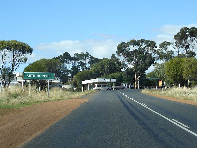 |
Entering Arthur River: Driving eastbound into Arthur River as you approach the Albany Hwy (SR30), May 2008. Image © Paul Rands |
 |
Fingerboard Assembly: Typical Western Australian fingerboards on the corner of Albany Hwy (SR30) and Coalfields Hwy (SR107) at Arthur River. May 2008. Image © Paul Rands |
1 Lake Grace Shire
Last updated: 28-Jul-2020 12:22
This site © Paul Rands. All rights reserved. Some portions © (copyright) by their respective and credited owners. Permission must be obtained before using any images from this site. For details, please email by clicking here.