|
|
|
|
|

|
Mickleham Road, Broadmeadows Deviation, Johnstone Street, Camp Road, Mahoneys Road, Keon Parade, Dalton Road, Wood Street, Settlement Road, Plenty Road, Grimshaw Street, The Circuit, Para Road, Sherbourne Road & Bridge Street (Metropolitan Route 48) |
Statistics:
Route Numbering:


General Information:
Metropolitan Route 48 is a suburban arterial road servicing Melbourne's north. It is a mix of divided and undivided road servicing residential, commercial and industrial areas. The significance of the route would have diminished once the parellel running Metropolitan Ring Road (M80) opened.
Multiplexes along the route include:

| Preview: | Description: |
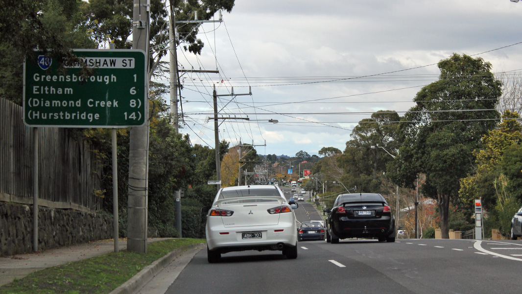 |
Reassurance Directional Sign: Distance sign on Grimshaw St (MR48) at Greensborough, June 2016. Image © Rob Tilley |
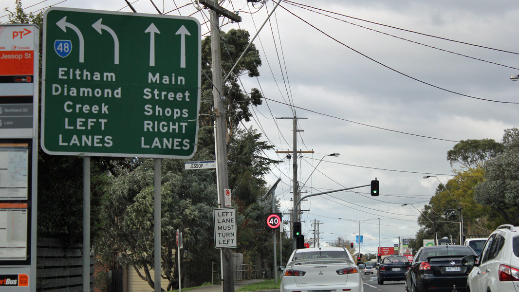 |
Lane Allocation Sign: Lane allocation sign at Greensborough approaching The Circuit (MR48) and the unnumbered section of Grimshaw St, June 2016. Image © Rob Tilley |
 |
Intersection Directional Sign: ID sign facing the unnumbered section of Grimshaw St where it meets Para Rd (MR48) at Greensborough, June 2016. Image © Rob Tilley |
 |
Reassurance Directional Sign: Distance sign on Para Rd (MR48) at Greensborough, June 2016. Image © Rob Tilley |
 |
Advance Directional Sign: AD sign on Para Rd (MR48) approaching the unnumbered section of Para Rd and Sherbourne Rd (MR48 at Greensborough, June 2016. Image © Rob Tilley |
 |
Intersection Directional Sign: ID sign at Eltham where Bridge St (MR48) meets Main Rd (MR44), June 2016. Image © Rob Tilley |
 |
Intersection Directional Sign: ID sign at Eltham where Bridge St (MR48) meets Main Rd (MR44), June 2016. Image © Rob Tilley |
1 VicRoads Road Maintenance Category - Road List Version 1, September 2012
Last updated: 17-May-2017 6:46
This site © Paul Rands. All rights reserved. Some portions © (copyright) by their respective and credited owners. Permission must be obtained before using any images from this site. For details, please email by clicking here.